
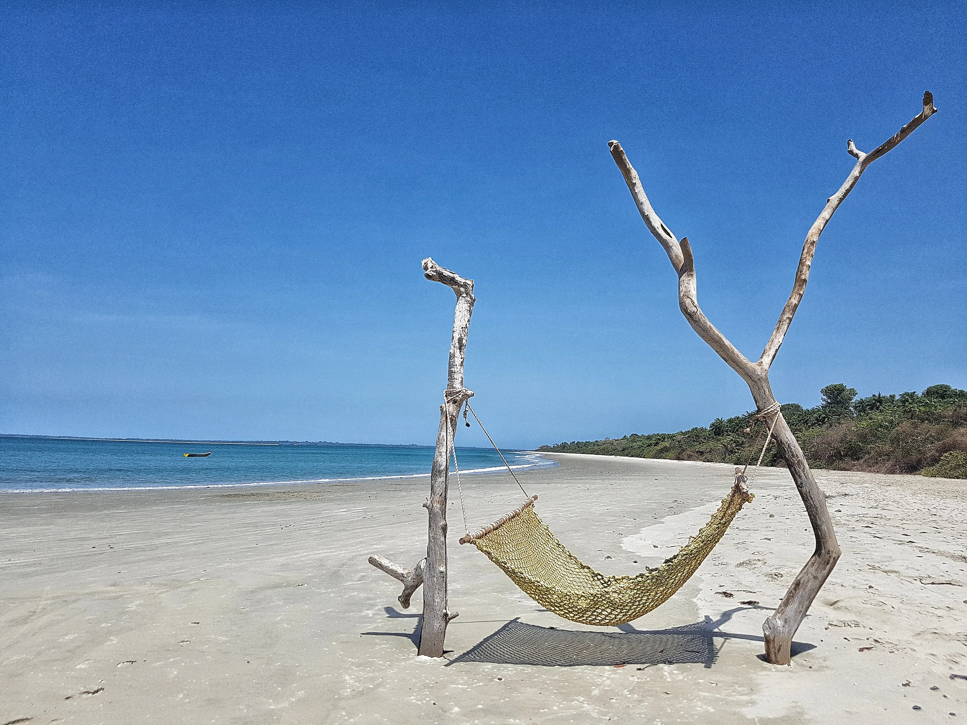
Travel to Guinea-Bissau: Bijagós islands, mangroves and Bissau
An archipelago of some eighty islands, mangroves, almost empty beaches and towns with colonial facades: Guinea-Bissau is a small country of water and forest, to discover when conditions allow. Here is some background before you look at flights to Guinea-Bissau.
Before reading further: official advice may call for caution depending on the region of the country, and the situation can change. Check the official advice of your country of departure before considering any trip; this page only presents cultural and natural landmarks.
Guinea-Bissau at a glance
Capital
Bissau
Area
About 36,000 km²
Currency
CFA franc
Languages
Portuguese and Creole
Highest point
About 260 m
Archipelago
Over 80 islands
Continent
Africa
Time zone
UTC+0
Airports covered
1
Why it fascinates
A wild archipelago, mangroves and a tropical coast
The Bijagós archipelago
About 80 islands and islets, around twenty of them inhabited, form a UNESCO biosphere reserve since 1996.
Mangroves and birds
Mudflats and mangroves host thousands of migratory waterbirds: flamingos, pelicans, waders, gulls and terns.
Quiet beaches
Pale sand, turquoise water and palm trees: the beaches of Bubaque and Bolama are among the calmest on the West African coast.
A Lusophone heritage
Portuguese, Creole and the colonial facades of Bissau and Bolama tell a shared story with the Portuguese-speaking world.
Highlights
Bubaque, Bolama, Bissau and the mangrove coast
These are the places that give Guinea-Bissau its reputation for islands, coast and heritage. They are presented as cultural information, landmarks to discover when conditions allow; this page offers no itinerary and no on-the-ground advice.
Bubaque and the Bijagós archipelago
Off the coast, the Bijagós archipelago counts about 80 islands and islets, around twenty inhabited all year. Bubaque, the most populated, is its gateway, with white sand beaches fringed by palm trees. The islands have been a UNESCO biosphere reserve since 1996, and Bijagó culture, closely tied to its sacred islands, remains alive.
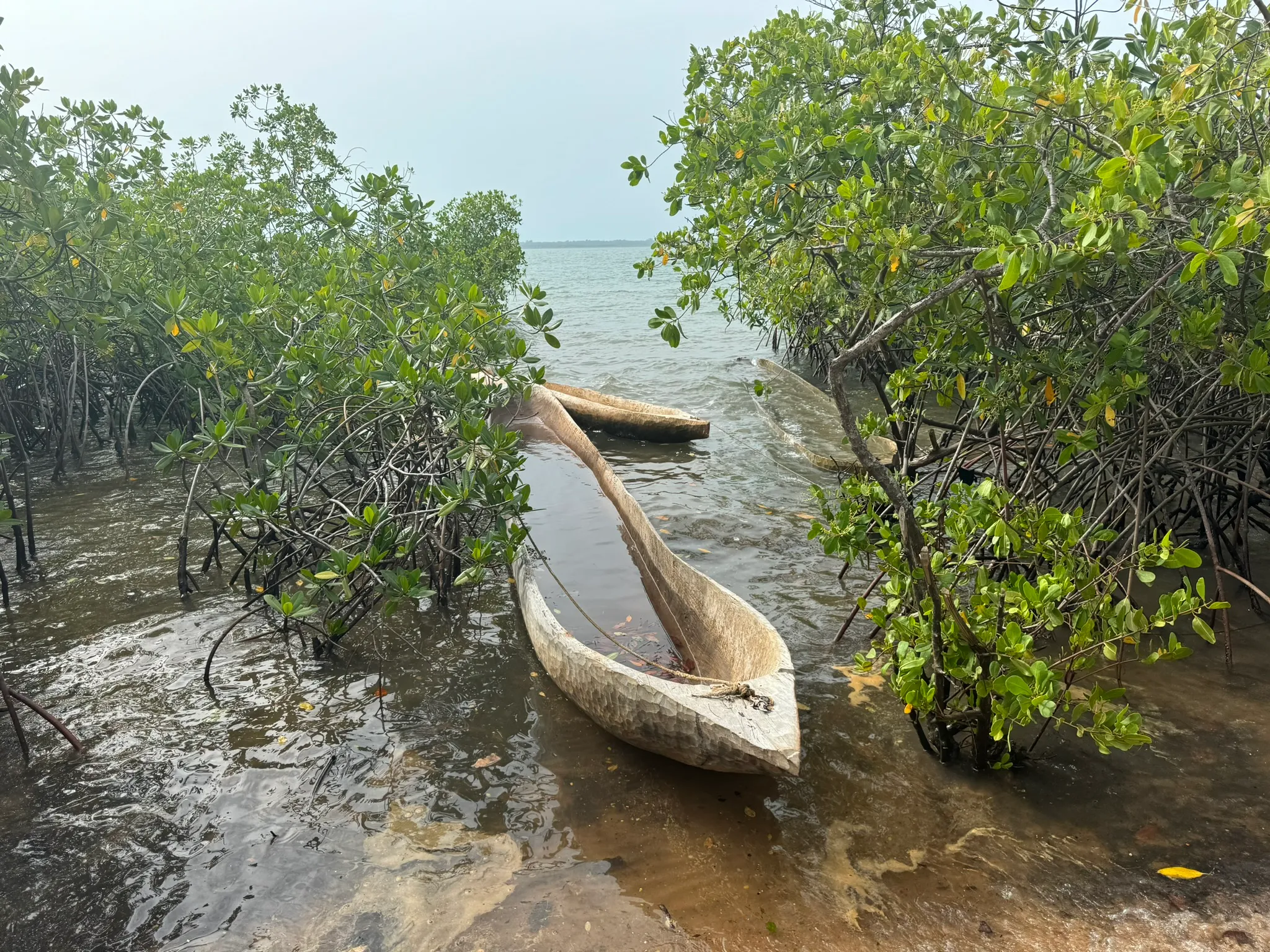
Mangroves, a world between land and sea
Tides, mudflats and mangroves draw shifting landscapes. These wetlands are a major stopover for many migratory waterbirds, including greater flamingos and pelicans, and the site is recognised as an Important Bird Area. Dugout canoes carved from a single trunk are an ancestral way of getting about here.
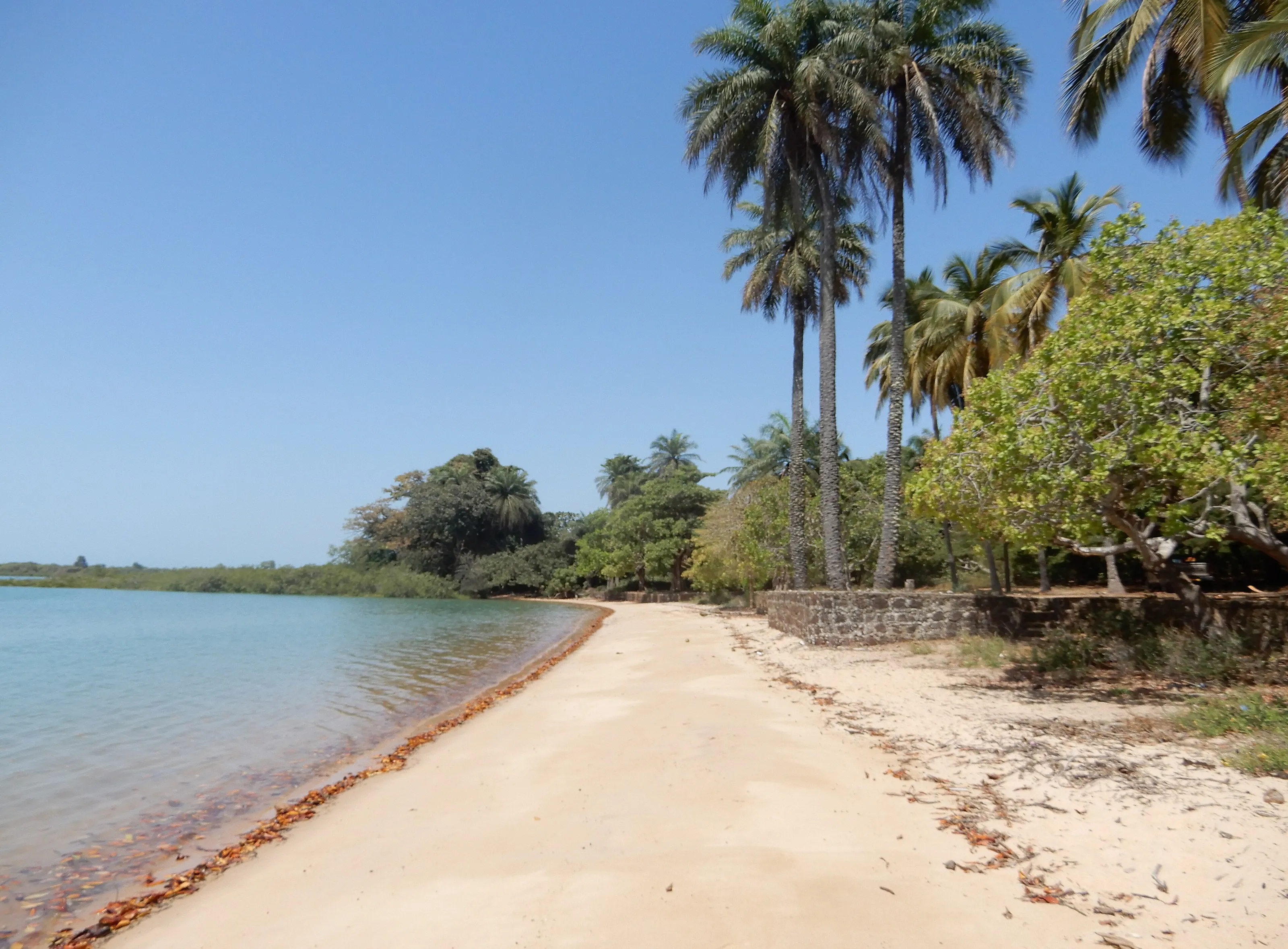
Bolama, beaches and facades from another age
On Bolama island, the small town of Bolama, seat of the region of the same name, keeps wide avenues and colonial buildings in faded colours, now mingled with vegetation. Its beaches, such as Ofir, are lined with palm and cashew trees, in almost complete calm.
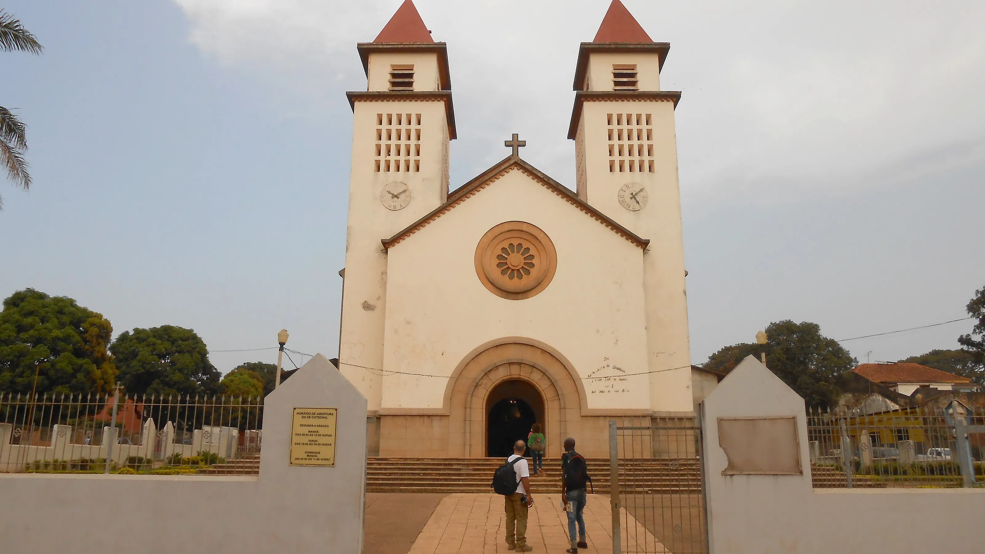
Bissau, the Lusophone capital
On the Atlantic coast, Bissau is the port and largest city, with roughly half a million people. Its white two-towered cathedral, old Portuguese-era districts, markets and colourful carnival set the tone of an African capital of Portuguese and Creole speech.
Orango, Cacheu and the coastal wildlife
South of the archipelago, Orango island is known for its saltwater hippos and sea turtles. Further north, Cacheu was long a Portuguese trading post on the coast, and the region recalls the old river ports.
Before you go
Dry season, rainy season and harmattan: the climate of Guinea-Bissau
| Period | Climate | Commonly cited note |
|---|---|---|
| December to April | Dry season, clear skies, dry harmattan winds from the Sahara. | Driest and most pleasant period |
| May to October | Monsoon-type rainy season, hot and humid; July and August are the wettest months. | Intense greenery, rougher sea |
| Bijagós archipelago | Hot tropical climate, shaped by tides and seasons. | Dry season |
| Bissau and the coast | High heat and humidity; almost no rain from November to May. | Dry season |
Official advice from some governments may call for caution depending on the region of Guinea-Bissau. These climate notes are cultural information only; check your departure country's official advice before considering any trip, and follow it. Entry requirements vary by nationality.
Getting around
A small country of coasts, rivers and islands
Guinea-Bissau covers about 36,000 km2, with a low, indented coast, estuaries and an archipelago. Travel conditions change and depend on decisions that only the official sources of your country of departure can reliably communicate.
This page offers no itinerary and no on-the-ground advice. It presents the country for what is most precious about it: its islands, mangroves and culture, to discover when conditions allow.
Culture and food
Rice, fish, cashew nuts and Creole
Rice, fish and seafood make up much of the table, often in palm-oil sauce with peanuts and chilli. The cashew nut, produced in abundance, is one of the country's agricultural symbols.
Guinea-Bissau Creole is the common language of much of the population, beside official Portuguese and many local languages such as Balanta, Mandinka and Manjak. The Bissau carnival, each year, is a great festival of masks and colour.
Travel to Guinea-Bissau
The Bissau-Guinean airport tracked by SniperAir
Osvaldo Vieira International
The airport of Bissau, the capital, about ten kilometres from the centre. Some services may be limited: check the situation before any booking.
FAQ
Frequently asked questions about flights to Guinea-Bissau
Which airport for a flight to Guinea-Bissau?
SniperAir tracks Bissau (OXB). Some services may be limited: check with airlines and the authorities before any booking. It is the country's international airport.
When is the best time to travel to Guinea-Bissau?
The dry season, from December to April, is the driest; the rainy season lasts from May to October, peaking in July and August. These are only climate notes.
Is travelling to Guinea-Bissau expensive?
The budget depends on many factors, and the flight is often a large share. We give no prices or estimates: conditions can change and fares vary widely.
Do I need a visa for Guinea-Bissau?
A visa is generally required, but conditions vary by nationality and can change. Ask the competent authorities and check the official website of your country of departure.
How long should I plan for?
The length depends entirely on conditions at the time, and SniperAir offers no itinerary. The islands take time; the answer belongs with official sources.
What should I know before going?
Official advice may call for caution depending on the region of Guinea-Bissau, and the situation can change. Check that of your country of departure before considering any trip. This page is cultural information: it does not recommend travelling.
How do I get alerted when a flight to Guinea-Bissau changes price?
SniperAir monitors flight prices and sends alerts; we do not sell or book any ticket. Create an alert profile with your departure airport if you follow this destination. See how it works.
Follow flight prices to Guinea-Bissau?
Create an alert and let SniperAir do the rest.
Create my alert