
Cheap flights to Niamey
Set your departure airport and maximum budget: SniperAir tracks prices to Niamey and alerts you the moment a deal matching your criteria appears.
Quick summary
Country
Niger
Continent
Africa
Airport
NIM
Currency
West African CFA franc (XOF)
Time zone
UTC+1
Deals already spotted to Niamey
Real flight examples detected by SniperAir, with their reference price.
Loading examples…
Why track Niamey with SniperAir
You do not need to compare prices every day
Choose your departure
Enter your departure airport and your maximum budget for a flight to Niamey (NIM).
SniperAir keeps watch
Our systems continuously compare new prices with the real price history of the route. SniperAir monitors prices and alerts you: it does not sell or book tickets.
You receive an alert
As soon as a price matches your criteria, you are notified, without having searched for anything yourself.
First, a plain statement: Niger is the subject of very restrictive official travel advice in many departure countries. That advice differs from one country to another, sometimes advises against travel to the country or to certain areas, and can even cover flights to Niamey. Do not assume the country is accessible to you: read the official advice of your departure country before considering anything, and check it again before any booking. SniperAir tracks prices and alerts you; it does not sell or book tickets and does not encourage you to travel.
This page therefore offers cultural background only. Niamey, the capital of Niger, spreads over both banks of the Niger River in the south-west of the country, according to French Wikipedia. German Wikipedia describes it as a young city, created in the twentieth century in an area of small villages and made capital in place of Zinder, definitively in 1926. Population figures vary widely between sources, so we do not publish one.
Airport and getting into town
An airport about twelve kilometres south-east
Niamey – Diori Hamani International Airport (NIM)
Diori Hamani International Airport, named after the country's first president, lies about 12 km south-east of the city according to Wikipedia (FR, DE). Wikivoyage (EN) places it in the south-eastern suburbs, along national road 1. Airlines and routes change often, and in many departure countries official advice discourages some flights or travel altogether: check the position before buying anything.
Approximate distance, from Wikipedia (FR, DE) and Wikivoyage (EN). We quote no taxi fares and no list of airlines, which change.
Wikipedia (FR, DE) states that Niamey is served by no railway line: long-distance travel is mostly by road, with coach companies to Agadez, Zinder, Maradi and neighbouring countries. The city lies on the trans-Sahelian road from Dakar to N'Djamena.
Official advice often singles out areas of the country to avoid. Do not build any road journey without reading it.
Landmarks
The river, the bridges, the dunes and the mosques
Niamey is best understood through its river and its sandy horizon. The places illustrated below are described according to our sources; the others are covered in text only.
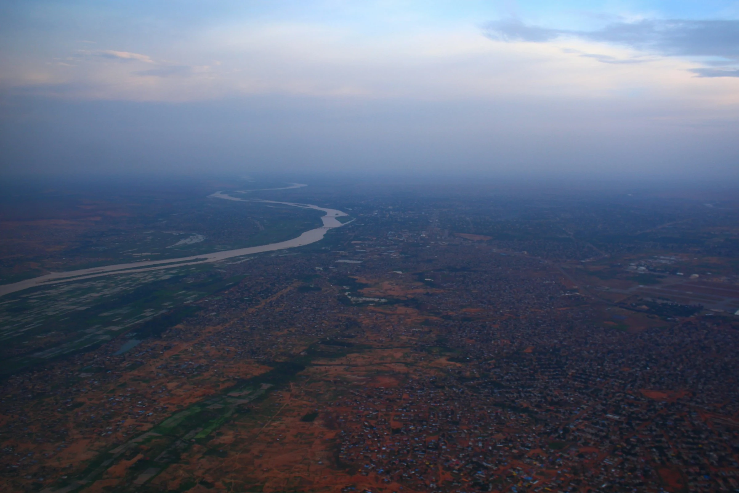
The Niger seen from a plane
According to French Wikipedia, the city is built on a plateau overlooking the left bank of the Niger and on an alluvial plain on the right bank, at an altitude of 180 to 240 m. The river is the city's main source of drinking water. From the sky, it winds through a sprawling urban fabric.
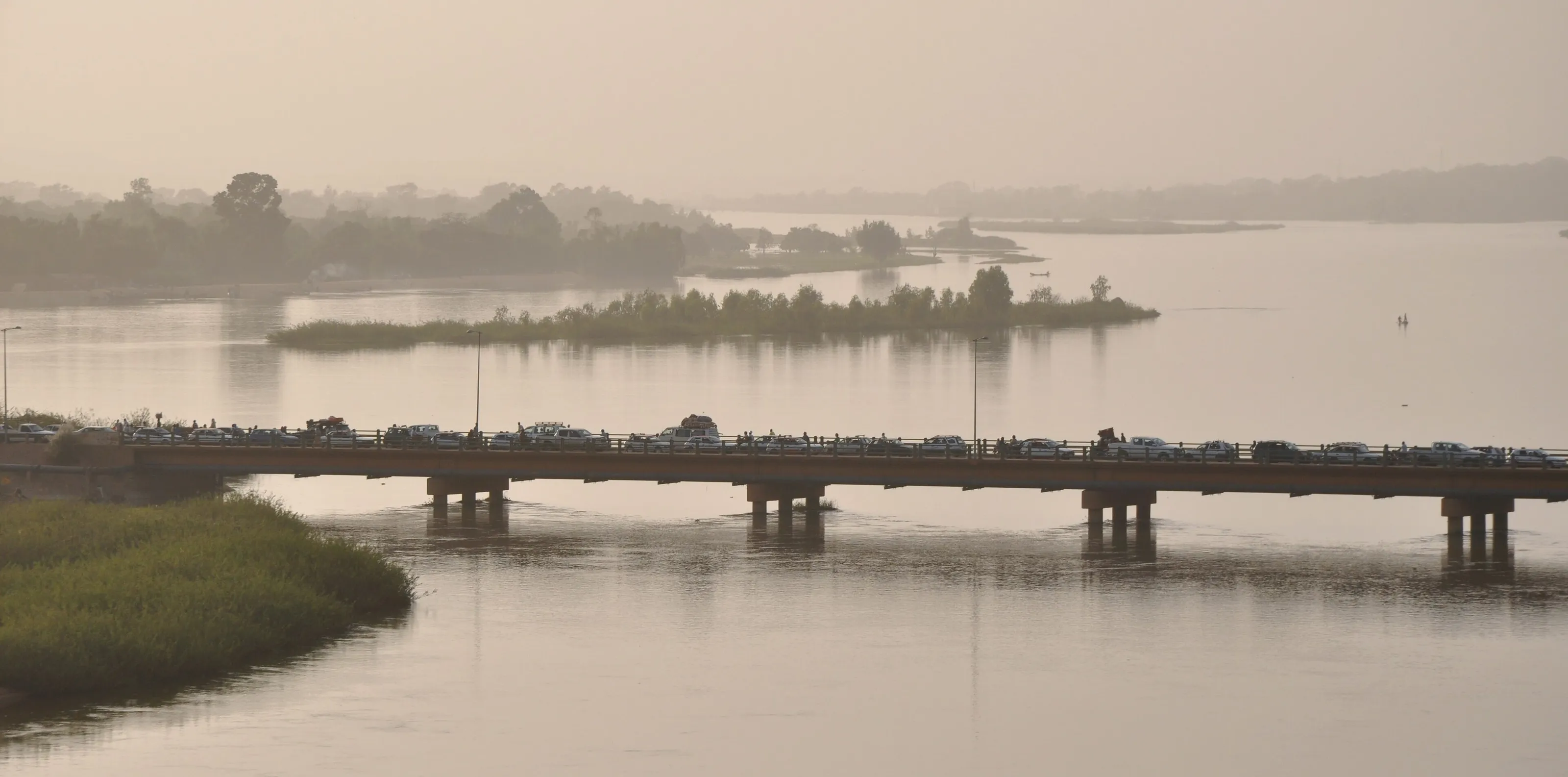
The Kennedy Bridge
Wikivoyage (EN) explains that the river divides the city, with the north bank, spreading out from the bridge, holding most of the activity while the south bank is mainly residential. In the golden haze, the bridge is packed with vehicles, with a wooded island in the water.
The dunes above the river
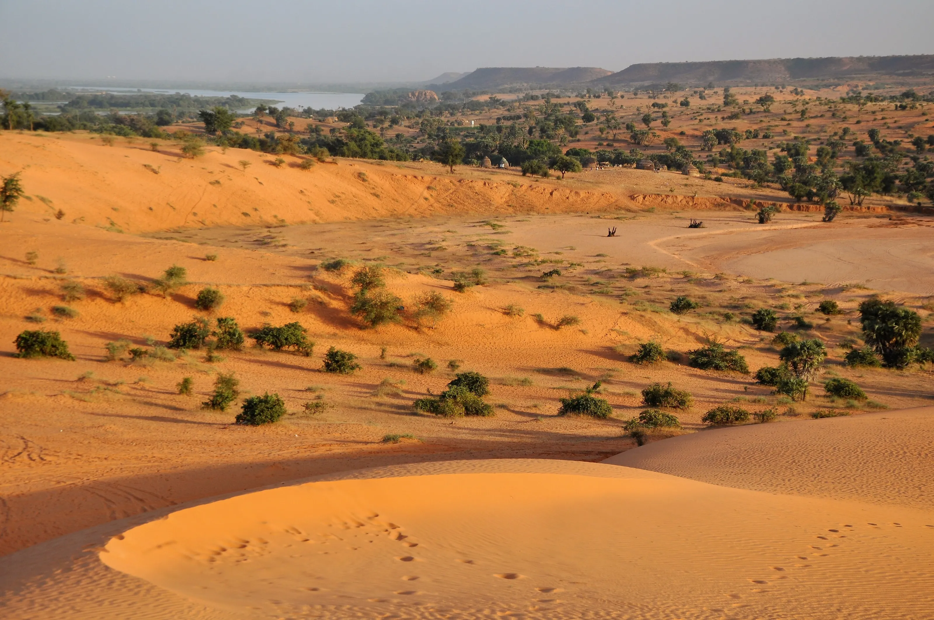
This view of orange dunes, with the Niger visible in the distance, is presented by Wikimedia Commons as taken near Niamey. Wikivoyage (EN) names the riverbanks and sand beaches on either side of the city as places where residents relax.
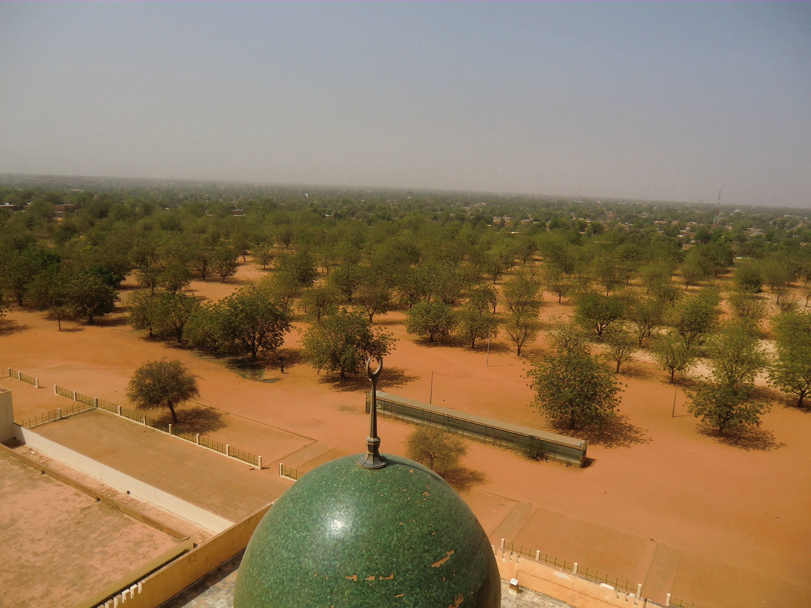
The green dome of a grand mosque
Wikivoyage (EN) mentions the grand mosque on Avenue de l'Islam, visited with a caretaker who acts as guide. This high-angle view shows a green mosaic dome above a park of trees on red ground, as described by Wikimedia Commons.
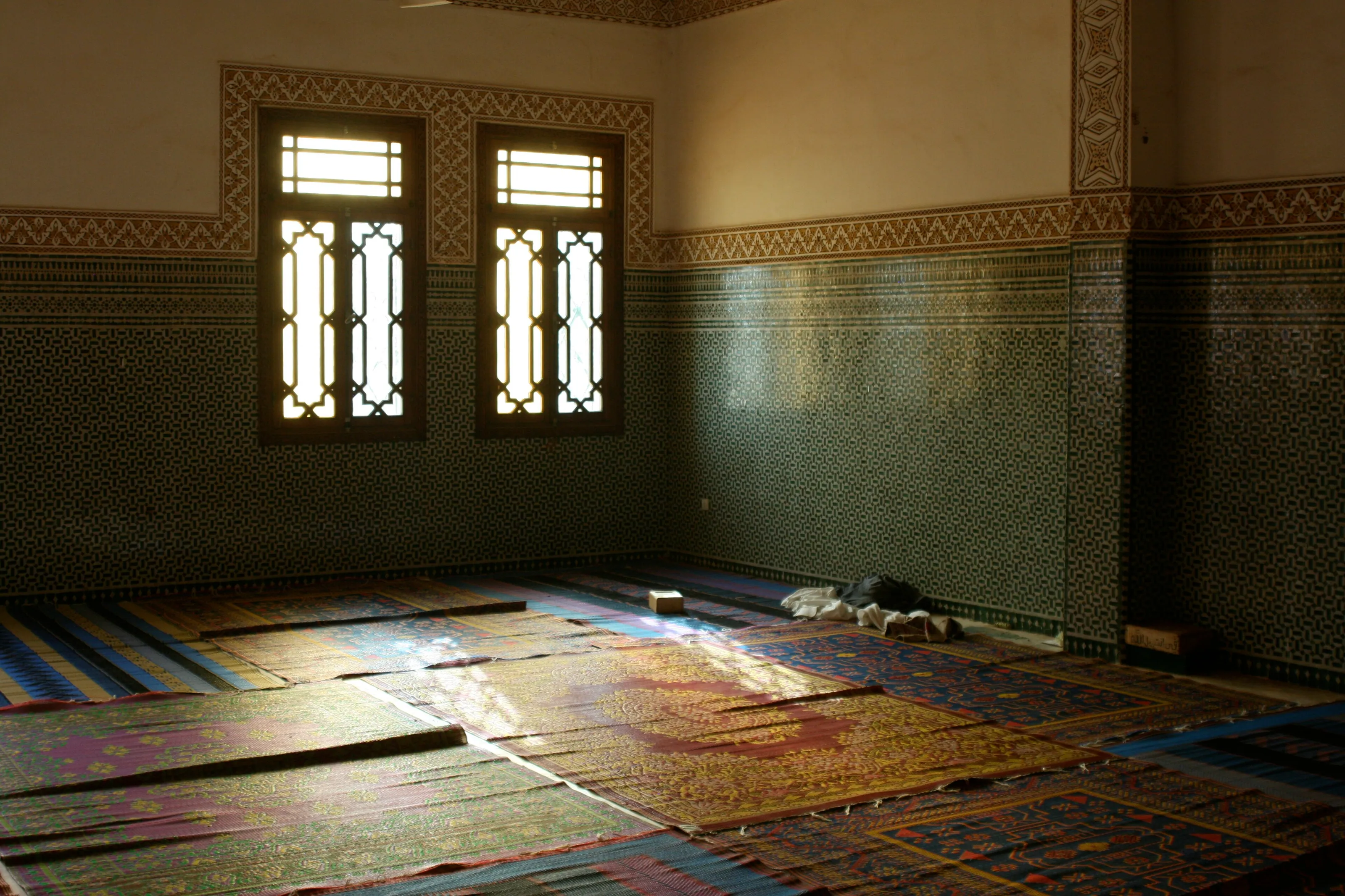
A tiled prayer hall
Dark green ceramic-tiled walls, latticed windows and coloured mats: the image, from Wikimedia Commons, shows the inside of a mosque in Niamey without further detail. Places of worship are visited under rules of their own: modest dress and prior agreement.
Other places named by Wikipedia (FR, DE, ES) and Wikivoyage (EN): the Palais des Congrès, the Mahatma Gandhi International Conference Centre and the Oumarou Ganda cultural centre, built in 1980; the grand market, built in 1950 and rebuilt after a fire; and, outside the city, the Kouré area where Wikivoyage (EN) places giraffes some forty minutes away. Excursions should only be considered after reading official advice, as areas of the country are advised against.
Museums and culture
Boubou-Hama museum, crafts and cultural centres
The Boubou-Hama National Museum
Created on 18 December 1959 according to Wikipedia (FR, DE), this museum recreates the dwellings of several groups in the country (Zarma, Fulani, Tuareg, Hausa) and holds archaeological, palaeontological and ethnographic collections. Wikipedia (DE, ES) names among its pieces the remains of the Tree of Ténéré, a former caravan landmark in the desert. A zoo and Hausa-style pavilions complete the site according to Wikivoyage (EN). Hours and fees change, so we publish none.
The Wadata craft village
Wikipedia (FR) and Wikivoyage (EN) mention the craft village in the Wadata district, where artisans make cultural products. Wikivoyage (FR) also mentions Tuareg artisans working jewellery, soapstone and leather, and the Niger artisans' cooperative.
Cultural centres and the fashion festival
German Wikipedia names the Franco-Nigerien Cultural Centre, near the museum, and the Oumarou Ganda Cultural Centre, whose amphitheatre hosts concerts, films and theatre. The International Festival of African Fashion, founded by the designer Alphadi, has been held there since the 2000s. Dates and programmes change, so ask.
Food and drink
Grilled meat, touwo and West African dishes
Street food
Wikivoyage (FR) describes grilled mutton, skewer sandwiches, touwo (millet or maize paste), dambou (millet couscous) and shinkafa da waké (beans and rice) in the street. The same source judges the beef excellent in this herding country.
Maquis and tables from elsewhere
In small local restaurants, Wikivoyage (FR) mentions mainly skewers and chips; in smarter places, dishes such as yassa, fish or rice with sauce. Wikivoyage (EN) mentions Senegalese and Ghanaian tables in the city. We name no commercial address and quote no price.
Markets
The grand market, the small fresh-produce market and the more rustic Katako market are named by Wikivoyage (FR). Wikivoyage (EN) describes the grand market as one of the largest and calmest in the region. Bargaining is customary.
Getting around
Shared taxis, roundabouts and addresses by section
Shared taxis
Wikivoyage (EN, FR) describes shared taxis, easy to hail in the street, whose price is negotiated or fixed before getting in. Trips from the airport or hotels cost more, and so do trips at night: we quote no amounts.
Wide avenues and roundabouts
German Wikipedia notes wide boulevards, unusual in West Africa, including Boulevard Mali Béro, asphalted in 2005, and Avenue François Mitterrand. Wikivoyage (EN) adds that there are few traffic lights and many roundabouts called 'Place ...'.
Finding your way
Wikivoyage (EN) says an addressing system by section and street number was introduced in the early 2000s, but residents often give directions by landmark. The simplest approach is to name a district or well-known place.
Budget and precautions
Budget and precautions
Price level
The prices quoted by our sources are old, isolated or contradictory, so we offer no range. The currency is the West African CFA franc (XOF). Wikivoyage (EN, FR) notes that bargaining is the rule in markets.
Flights and official advice
SniperAir tracks fares to NIM and compares them with the route's price history, but it does not sell or book tickets. Official advice on Niger is very restrictive in many departure countries and differs from one country to another: read your own, including what it says about flights and areas to avoid, before creating an alert and again before any purchase.
Health and formalities
Entry conditions depend on your nationality and change: check official websites. Wikivoyage (EN) mentions showing a yellow fever vaccination card on arrival. For health, ask a doctor or a vaccination centre well before any possible departure.
When to go
A semi-arid climate: harmattan, heat and summer rains
Harmattan (late November to February)
French Wikipedia describes very dry air, large swings between day and night and sometimes a dust haze. Minimums fall to around 14 to 15 °C and maximums reach 28 to 33 °C. Wikivoyage (EN) gives similar values and judges this the best period of the year.
Great heat (March to May)
When the harmattan fades, according to French Wikipedia, the heat becomes sweltering, with days of 38 °C and then 42 to 45 °C. Wikivoyage (EN) cites regular afternoons of 42 °C and rare showers.
Rainy season (June to September)
Wikivoyage (EN) and Wikipedia (ES) place the rainy season from June to September, sometimes with violent storms and flooding. French Wikipedia gives 500 to 750 mm a year; Wikivoyage (EN) about 550 mm.
October and early November
From October to late November, French Wikipedia describes a transition period that is still very hot, with minimums of 23 to 24 °C and maximums of 35 to 38 °C.
French Wikipedia classes the climate as semi-arid (Köppen BSh). We do not give full monthly averages, because the sources differ slightly. Climate says nothing about conditions on the ground: only official advice allows you to judge that.
By length of stay
What to discover in Niamey depending on the length of stay
River, museum and market
If official advice ever allows travel: one to two days for the river and the Kennedy Bridge, the Boubou-Hama museum, the Wadata craft village and the grand market.
Cultural centres and mosques
Add the cultural centres, the mosque and a moment by the river, after finding out about travel conditions.
Beyond the capital
Places named by our sources outside the city, such as Kouré or W National Park, are not suggested here as stops: official advice often singles out areas to avoid and should not be read lightly.
In pictures
Niamey in pictures
You might also like
Similar destinations
FAQ
Frequently asked questions about flights to Niamey
Does official advice allow travel to Niamey?
In many departure countries, travel advice on Niger is very restrictive and varies from one country to another; some advise against travel, certain areas or flights. Do not assume the country is accessible to you: read your own country's official advice before booking and check it again before departure.
Where is Niamey airport?
Diori Hamani International Airport (NIM) is about 12 km south-east of the city according to Wikipedia (FR, DE). We quote no taxi fares.
When is the best time of year for Niamey's climate?
Wikivoyage (EN) judges the coolest, driest period, December to January, the best; French Wikipedia describes the harmattan from late November to February. The rains run from June to September. This information does not replace official advice.
What is there to see in Niamey?
The river and the Kennedy Bridge, the Boubou-Hama museum, the Wadata craft village, the grand market and the cultural centres. Access to some places may vary, so ask about the local situation.
How do you get around Niamey?
Shared taxis are the most common option according to Wikivoyage (EN, FR); prices are negotiated or fixed before getting in. Addresses are often given by district or landmark.
Do I need a visa or vaccinations for Niger?
Entry conditions depend on your nationality and change: check official websites. For health, ask a doctor or a vaccination centre well before any possible departure.
How much does a flight to Niamey usually cost?
The price depends mainly on your departure city, the time of year and how far ahead you book. The "opportunities" section above shows real examples of prices SniperAir has already detected to this destination.
How do I get alerted when a flight to Niamey drops below my budget?
Create an alert profile with your departure airport, Niamey (NIM) as the destination and your maximum budget. You are notified automatically as soon as a matching price is detected. SniperAir monitors and alerts, it does not sell or book tickets.
Ready to head to Niamey?
Set your budget and let SniperAir monitor fares for you.
Create my alert