
Cheap flights to Abha
Set your departure airport and maximum budget: SniperAir tracks prices to Abha and alerts you the moment a deal matching your criteria appears.
Quick summary
Country
Saudi Arabia
Continent
Asia
Airport
AHB
Currency
Saudi riyal (SAR)
Time zone
UTC+3 (no daylight saving)
Deals already spotted to Abha
Real flight examples detected by SniperAir, with their reference price.
Loading examples…
Why track Abha with SniperAir
You don't need to compare prices every day
Choose your departure
Enter your departure airport and your maximum budget for a flight to Abha (AHB).
SniperAir watches
Our systems continuously compare new fares with the route's real price history. SniperAir tracks prices and alerts you: it does not sell or book tickets.
You get an alert
As soon as a fare matches your criteria, you are notified, without having searched anything yourself.
Airport and getting into town
AHB, a high-altitude airport shared with Khamis Mushait
Abha International Airport (AHB)
Wikipedia (EN) says the site, between Khamis Mushait and Abha, serves both cities; construction began in 1975 and flights began in 1977. It sits at about 2,090 m above sea level according to the same source, with a runway of more than three kilometres. According to Wikipedia (DE), flights connect it to Dammam, Jeddah, Jizan, Cairo, Riyadh, Sharurah and Taif; Wikivoyage (EN) mentions flights from Riyadh and Jeddah. We found no reliable distance to the centre and give no transfer times or fares.
Routes and schedules change, so check before you travel. Also read your home country's official advice (see Budget and precautions).
Abha is the capital of Asir Province in south-western Saudi Arabia. It stands about 2,200 m above sea level according to Wikipedia (DE, ES) and 2,270 m according to Wikipedia (EN), so sources differ by a few dozen metres. Wikipedia (DE) counts more than 334,000 people in 2022, about a third of them foreigners, and puts the Red Sea 80 km to the west and Riyadh 850 km to the north-east; a coastal road has linked it with Jeddah since 1979 according to Wikipedia (DE, EN). Saudis call the city the Bride of the Mountain, according to Wikipedia (EN).
Landmarks and sights
Rijal Almaa, Jabal Sawda and the stone villages of Asir
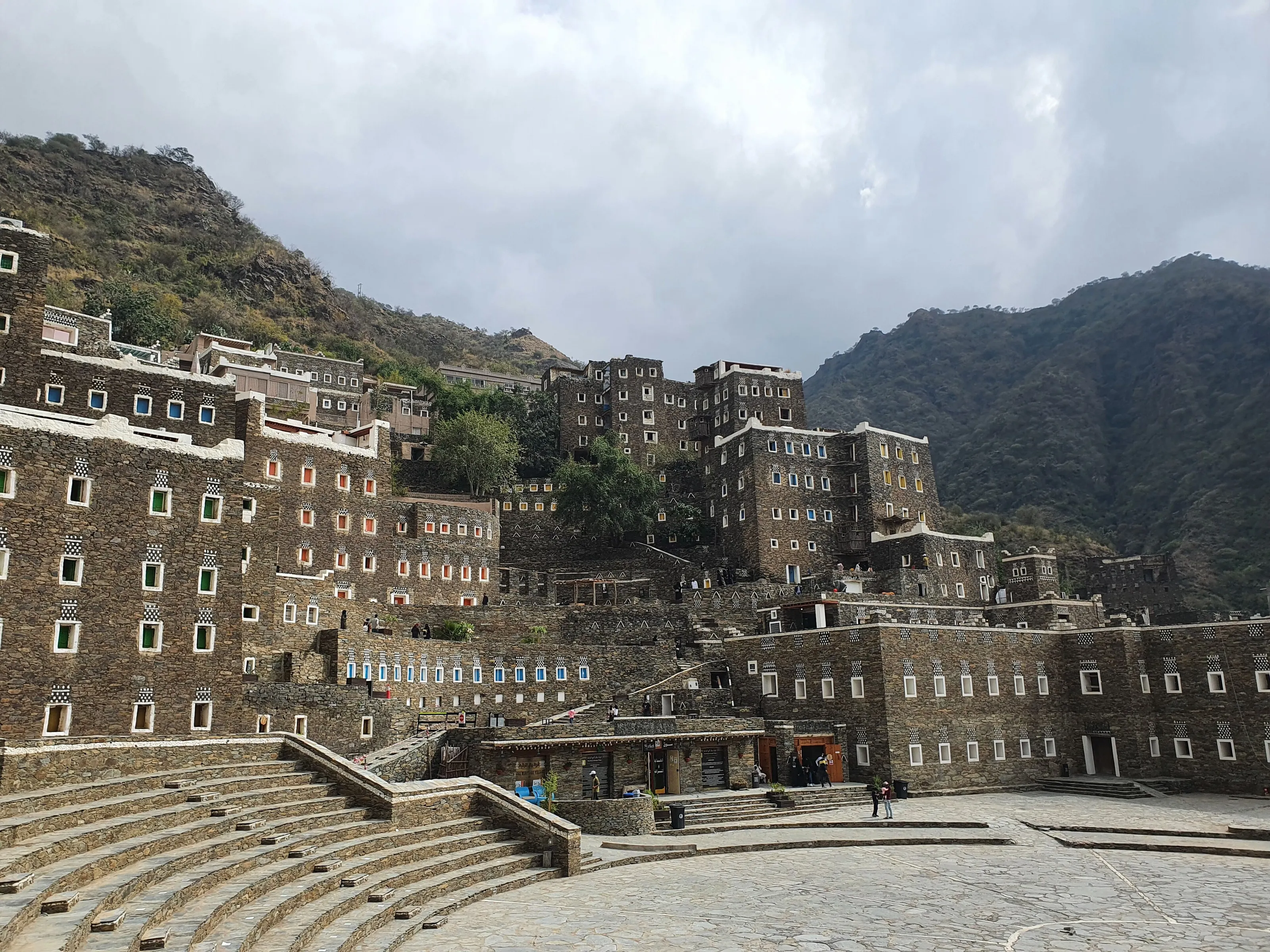
Abha is not a city of famous monuments: it is the gateway to a region of stone villages and mountain terraces, far greener than the rest of the country. The pictures below show Rijal Almaa, terraces of Asir and Tanomah; these places lie away from Abha and make day trips.
Rijal Almaa
Wikipedia (EN) places this stone village about 50 km west of Abha, while Wikipedia (FR) gives 60 km, so sources differ. It is said to be more than 900 years old, with around 60 multi-storey buildings of stone, clay and wood, some of seven or eight floors, with colourful wooden windows. A former trading post between Yemen and the Levant, it was restored from 2015 according to Wikipedia (EN).
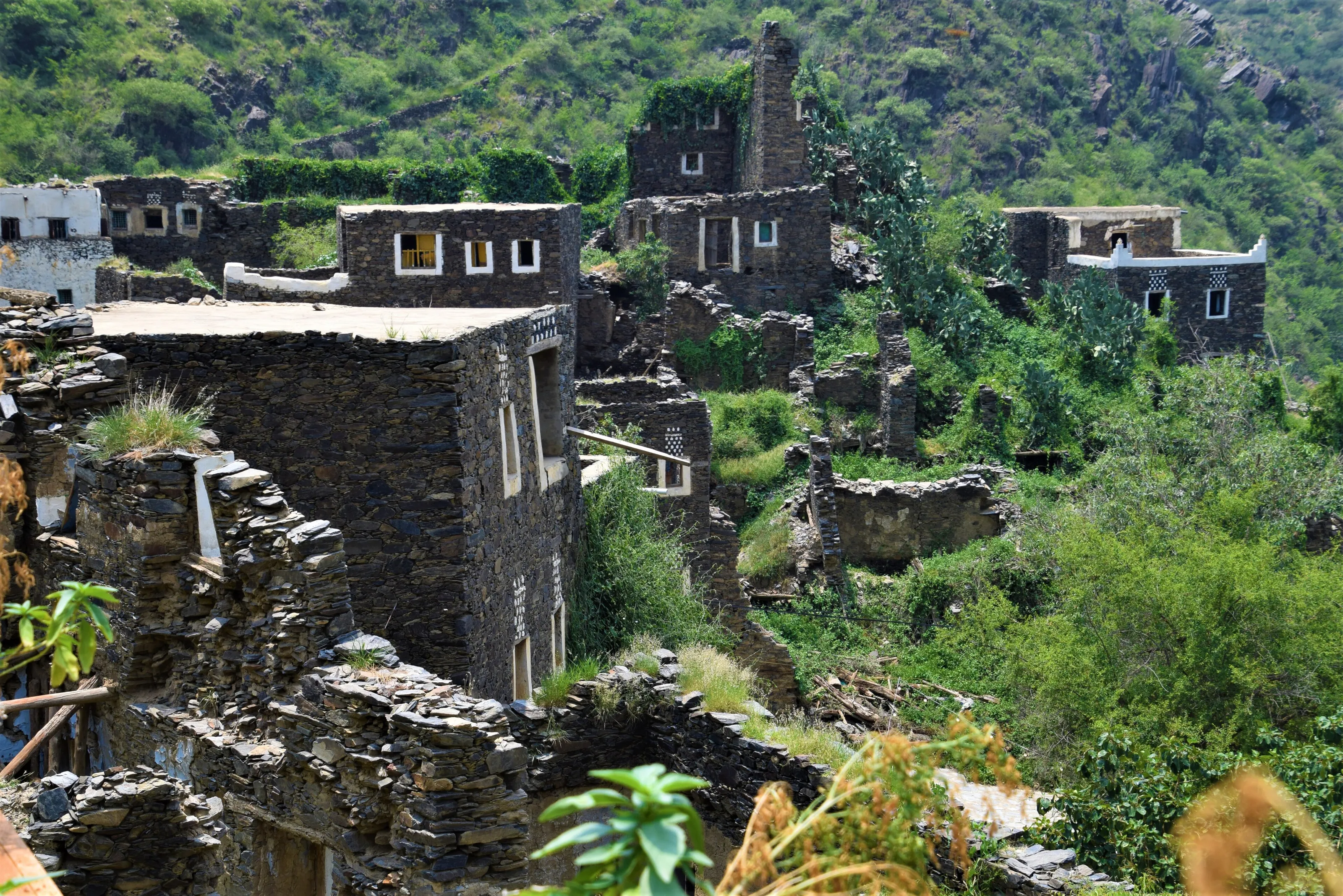
Half-ruined slate houses
In Rijal Almaa and the nearby villages, some houses of flat stone lie in ruins, overgrown with vegetation, while others keep their white window frames and chequered patterns. Wikivoyage (EN) notes that many older houses in the region are made of mud brick, with slabs of stone sticking out to shed rainwater.
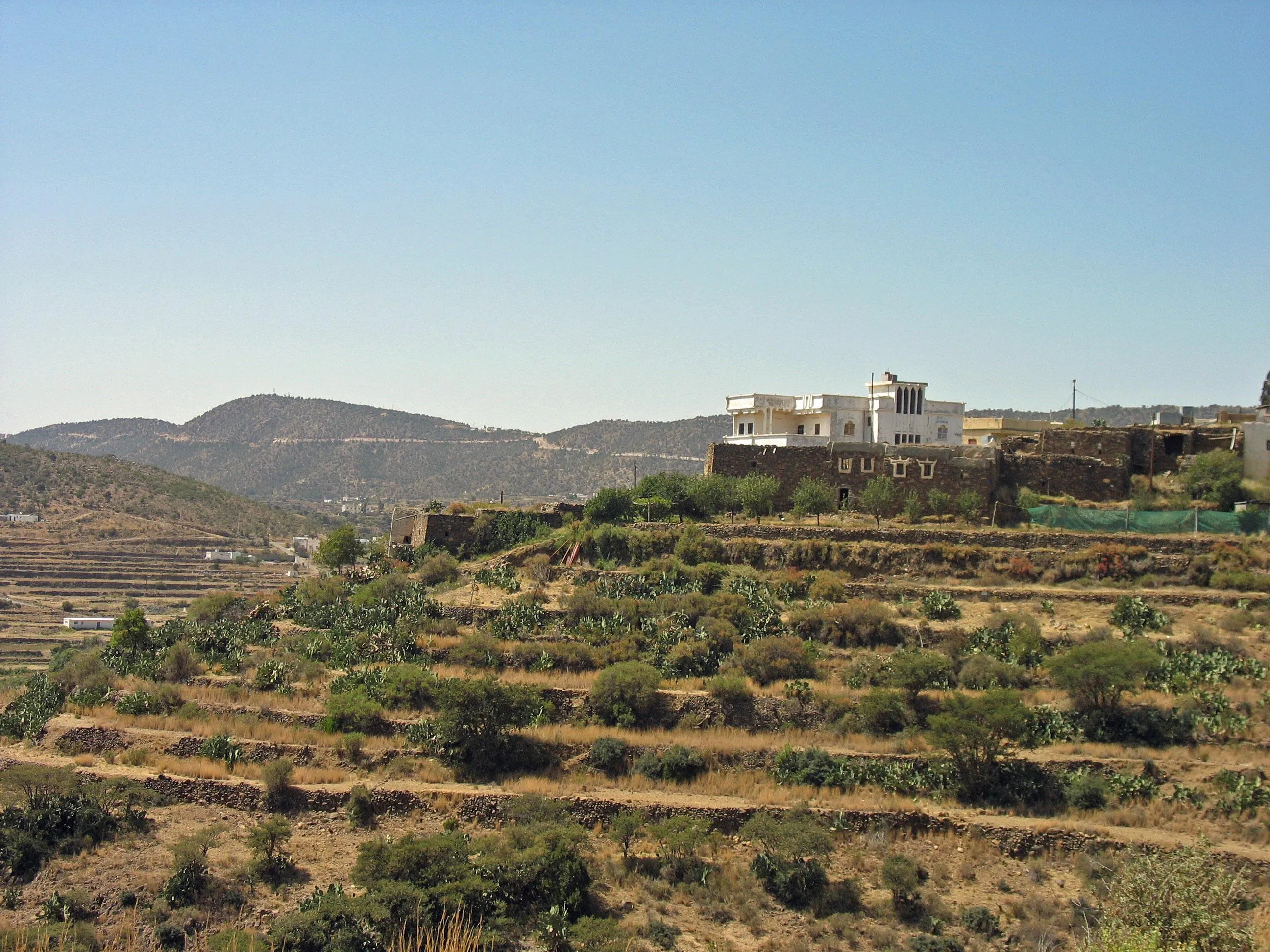
Mountain terraces
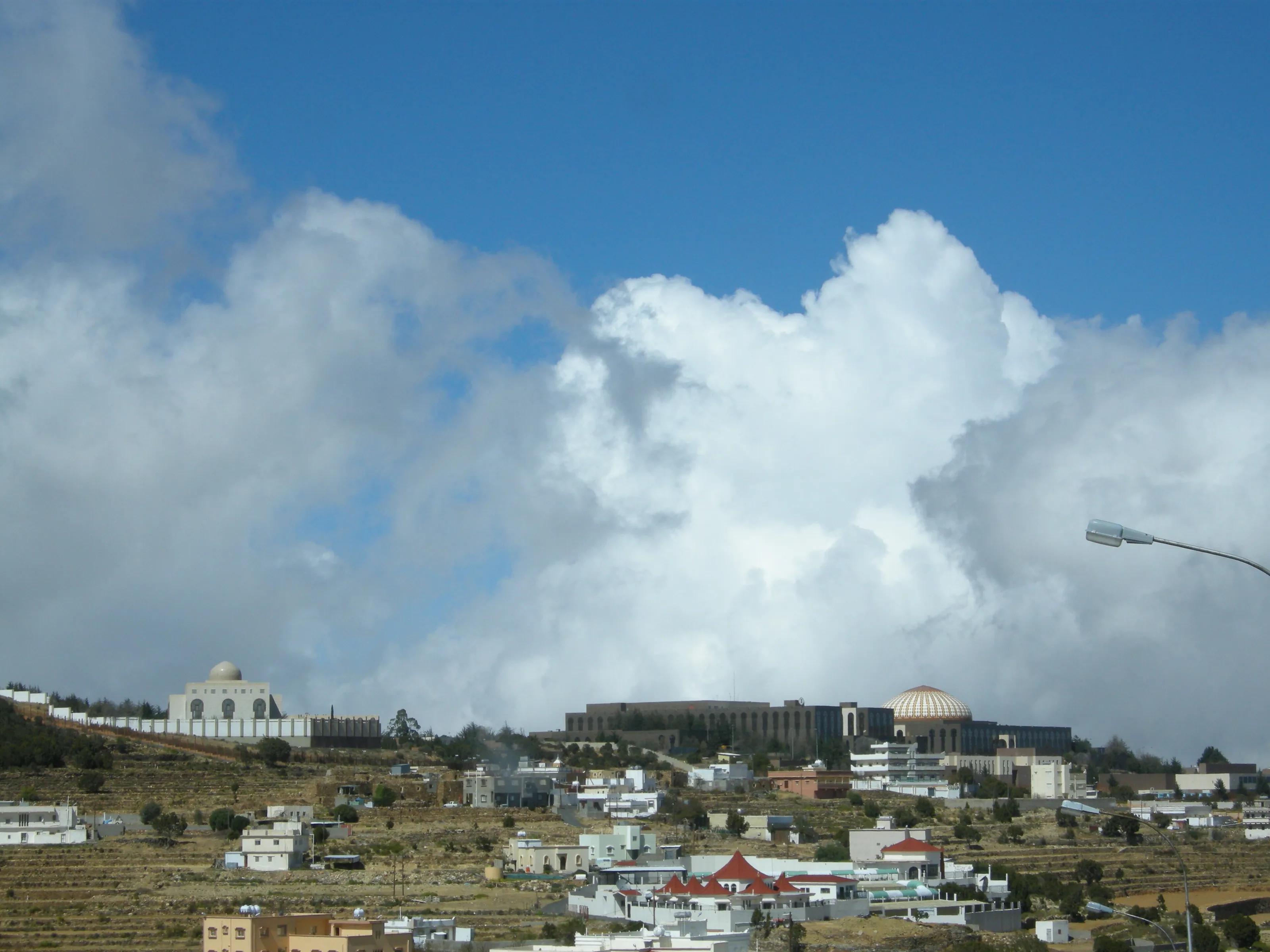
Along the road to Al Sawda, the slopes are shaped into farming terraces, with a few white buildings and a domed building on top. These stepped fields under huge highland clouds are part of Asir's identity.
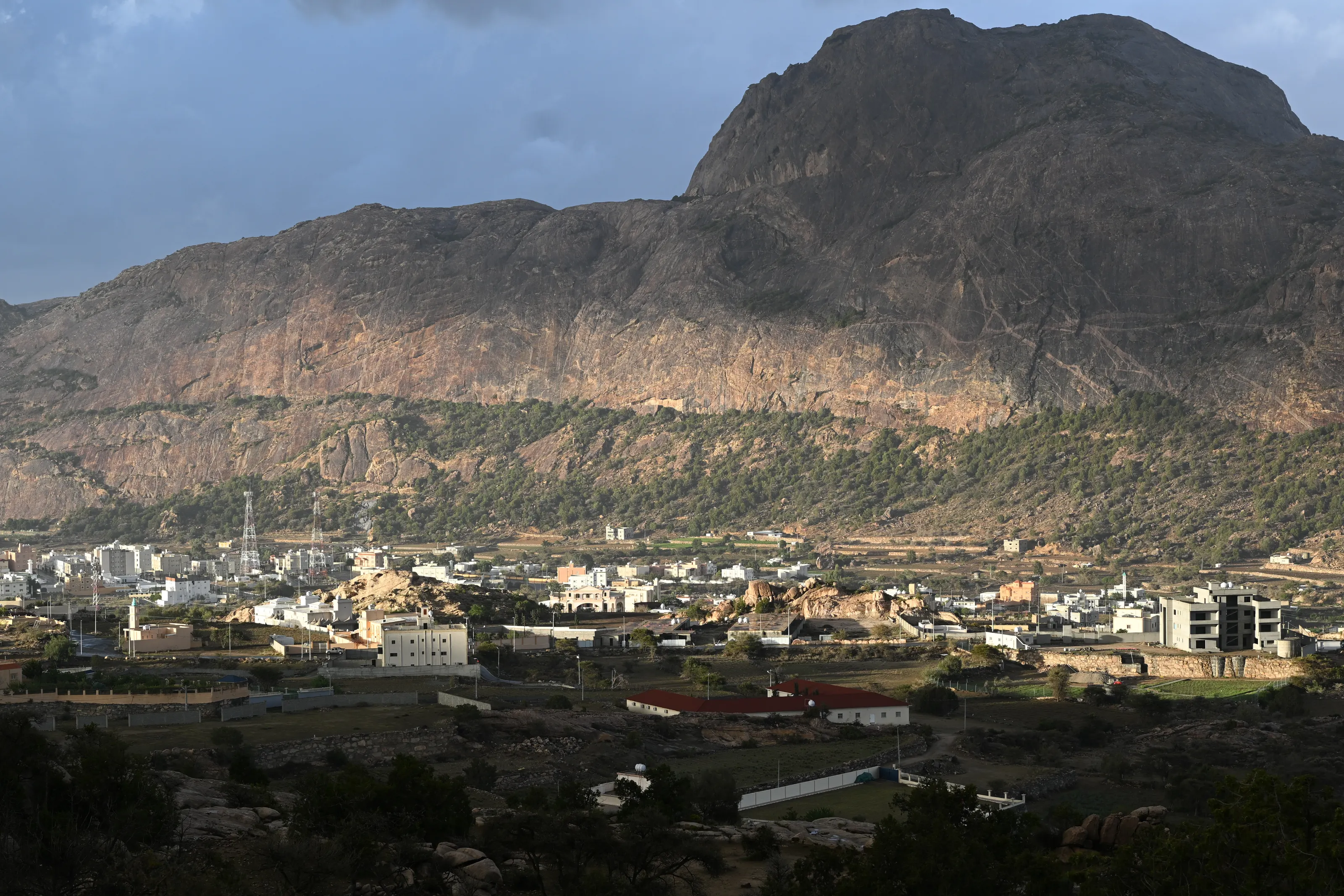
Tanomah and the Asir mountains
Wikipedia (EN) lists Tanomah among the places of the Asir region. The village spreads at the foot of a large rocky mountain with wooded flanks. We give no distance from Abha and flag it for review.
Jabal Sawda, the highest point, in words
Jabal Sawda lies about 13 km north-west of Abha according to Wikipedia (DE). Wikipedia (FR) calls it the country's highest point according to most authorities, although SRTM data gives less; Wikipedia (EN) cites an official 3,207 m, Wikipedia (FR) 3,133 m, Wikipedia (DE) 2,998.7 m, and another peak may be higher, so the height is disputed. Wikivoyage (EN) suggests the climb and the lookout at Mt Sooda; Wikipedia (EN) mentions a cable car to the top, so check that it runs.
Museums and culture
Shada Palace, hilltop forts and the village museum
Shada Palace
Wikipedia (EN) describes Shada Palace, built in 1927, as a museum of local handicrafts and household items. Opening hours change, so check before visiting; we give no ticket prices.
Rijal Almaa Heritage Museum
According to Wikipedia (EN, FR), it occupies the Al Elwan fort, more than four centuries old; it was founded by the villagers in 1985 and shows manuscripts, tools and weapons. The decorative "Al-Qatt" art, painted on interior walls by the village women, is described by Wikipedia (EN).
Hilltop forts and the Turkish fort
Wikipedia (EN) notes that Abha is made up of four quarters, the largest of which contains a fortress, and that hilltop forts are a characteristic of the city. Wikivoyage (EN) suggests a trip of about two hours to the Turkish fort, for its views down a valley towards Yemen.
Summer festival
Wikipedia (EN) recalls that the Saudi government has promoted Abha as a tourist destination, with a summer festival, sports events, exhibitions and concerts. Programmes vary from year to year.
Food and drink
Kabsa, everyday dishes and mountain cafes
Kabsa
Wikivoyage (EN) simply recommends trying kabsa, a rice-and-meat dish common across the country. We found no speciality unique to Abha in our sources and do not invent one.
Mountain cafes and restaurants
Wikipedia (EN) lists a restaurant and a fun park beside the dam lake among the notable buildings. At Habala, a village perched on the mountain, traditional buildings house restaurants and cafes in the high season according to Wikipedia (EN).
Drinks
Alcohol is banned across the country, so you drink coffee, tea and fruit juice. Market districts, such as the Khamis souk in Khamis Mushait, are also where you buy traditional clothing and silverware according to Wikivoyage (EN).
Getting around
Road, bus and cable car: getting around the Asir mountains
Road and bus
A coastal road has linked Abha and Jeddah since 1979, and you can also arrive from Taif over a very twisting mountain road according to Wikivoyage (EN). A bus station of the national bus company lies north of the centre and has several daily departures according to the same source. Drive carefully: highland roads are narrow.
Cable cars and excursions
Habala is about an hour's drive from Abha and is reached by cable car, built in the 1990s according to Wikipedia (EN). Most hotels organise tours if enough people sign up according to Wikivoyage (EN). The same source mentions a Monkey Road towards Muhayil.
Budget and precautions
Price level, local rules and official advice to check
Price level
The currency is the Saudi riyal (SAR). Abha is a favourite summer destination for Saudis, which can push accommodation prices up in July and August. We do not publish figures, because the sources are dated or conflicting.
Entry requirements
Foreign visitors must check the entry rules for Saudi Arabia, including the electronic visa, according to their nationality. These rules change: consult the kingdom's official visitor portal and your foreign ministry's information.
Local etiquette
Dress modestly, do not photograph people without their consent, stay outside places of worship unless invited, and remember that alcohol is banned. In mountain villages, ask before entering a house or photographing residents.
Safety and official advice
Abha lies in the south-west of the country, not far from the border with Yemen. Official advice varies depending on your country of departure: some governments advise against or restrict travel to regions close to the southern border. According to Wikipedia (EN), Abha airport has been targeted several times in the context of the Yemen conflict. Check your foreign ministry's advice before booking and again just before departure. SniperAir tracks flight prices to AHB but does not sell or book tickets.
When to go
A highland city that stays mild all year
Winter (December to February)
Cool at altitude, with frost possible: Wikipedia (EN) mentions recorded sub-zero temperatures and occasional snow on the higher ground. Pack warm layers for the evenings.
Spring (March to May)
The wettest period according to Wikipedia (EN), with most rain falling between February and April. Terraces and valleys are greener then.
Summer (June to August)
Temperatures seldom top 35 C according to Wikipedia (EN), which explains the influx of Saudi visitors. A small secondary rainy season falls in July and August according to the same source.
Autumn (September to November)
A transition season, often pleasant. Sources differ on the rainy seasons: Wikipedia (EN) cites February-April and July-August, while our country sheet mentions other months, so check forecasts.
Abha has a hot desert climate bordering on semi-arid (BWh to BSh), tempered by altitude according to Wikipedia (EN). The city shows temperate-climate trends apart from lower-than-usual rainfall. We publish no cross-checked monthly readings.
By length of stay
What to do in Abha depending on how long you stay
The essentials
Central Abha, Shada Palace and a viewpoint over the mountains.
Villages and mountains
Add Rijal Almaa, Jabal Sawda and Habala as day trips.
Going further
Extend to the Asir terraces, Khamis Mushait or the road towards Taif.
In pictures
Abha and the Asir villages in pictures
You might also like
Similar destinations
FAQ
Frequently asked questions about flights to Abha
How do I get from AHB airport to the centre of Abha?
The airport serves both Abha and Khamis Mushait according to Wikipedia (EN). We found no reliable distance to the centre and give no durations or fares; rent a car or use an organised transfer.
When is the best time to visit Abha?
Summer is the busiest season, because temperatures seldom top 35 C according to Wikipedia (EN); spring is wetter.
What is there to see around Abha?
Rijal Almaa, Jabal Sawda, Habala and Shada Palace according to Wikipedia (EN) and Wikivoyage (EN).
Do I need a visa to visit Abha?
It depends on your nationality. Check the kingdom's official visitor portal, including the electronic visa, and your foreign ministry's advice before booking.
Is Abha safe for a traveller?
Official advice varies by country of departure, and some governments sometimes advise against regions near the southern border. Check your foreign ministry's advice before booking and before you leave.
How high is Jabal Sawda?
About 3,000 m; the exact height is disputed: 3,207 m according to Wikipedia (EN), 3,133 m according to Wikipedia (FR), 2,998.7 m according to Wikipedia (DE).
How much does a flight to Abha usually cost?
The price depends mostly on your departure city, the season and how early you book. The opportunities section above shows real examples of fares SniperAir has already detected to this destination.
How do I get alerted when a flight to Abha drops below my budget?
Create an alert profile with your departure airport, Abha as the destination and your maximum budget. You are notified automatically as soon as a matching fare is detected.
Ready to head to Abha?
Set your budget and let SniperAir monitor fares for you.
Create my alert