
Cheap flights to Antananarivo
Set your departure airport and maximum budget: SniperAir tracks prices to Antananarivo and alerts you the moment a deal matching your criteria appears.
Quick summary
Country
Madagascar
Continent
Africa
Airport
TNR
Currency
Malagasy ariary (MGA)
Time zone
UTC+3 (EAT)
Deals already spotted to Antananarivo
Real flight examples detected by SniperAir, with their reference price.
Loading examples…
Why track Antananarivo with SniperAir
A highland capital built on hills, where fares are worth tracking
Choose your departure
Enter your departure airport and your maximum budget for a flight to Antananarivo (TNR).
SniperAir keeps watch
Our systems continuously compare new prices with the real price history of the route. SniperAir monitors prices and alerts you: it does not sell or book tickets.
You receive an alert
As soon as a price matches your criteria, you are notified, without having searched for anything yourself.
Antananarivo, known as Tana, is the capital and largest city of Madagascar, set on hills in the central highlands at about 1,280 m according to Wikivoyage (EN); other sources give between 1,260 and 1,435 m. The name means "city of the thousand", after the thousand soldiers of King Andrianjaka who is said to have founded it around 1610. Wikivoyage (EN) notes that it has more universities, nightclubs, art venues and medical services than anywhere else on the island, and calls it a photographer's dream: pastel terracotta houses with rice paddies between them. For most visitors it is the entry point to Madagascar, before they continue to Nosy Be, the coast or the national parks. Fares to TNR depend on the season and the connections, so letting SniperAir track the route and alert you is easier than comparing prices every day.
Airport and getting into town
Ivato airport, about 16 km out of town, with a newer terminal
Antananarivo – Ivato International Airport (TNR)
Ivato International Airport (TNR) lies 16 km northwest of the city centre according to Wikipedia (EN, FR), although Wikivoyage (FR) says 20 km. It has a 3,100 m runway at roughly 1,280 m above sea level (Wikipedia DE) and is the main hub of the national airline. A new terminal opened in December 2021 (Wikipedia EN). Wikipedia (DE) adds that international services were cut back in 2023 because of the national carrier's financial trouble, so check connections when you book. Wikivoyage (EN) warns of long queues for the visa and immigration in high season.
Distance: about 16 km per Wikipedia (EN, FR), 20 km per Wikivoyage (FR); the sources differ. Time per Wikivoyage (EN): half an hour early morning or late evening, more than an hour when roads are congested. We do not quote fares, which change.
Taxis have no meters, so agree the price before you get in. Hotels run shuttles, and Wikivoyage (EN) also mentions the very cheap but slow bush taxi. Entry rules and the visa depend on your nationality: check the official sites before you travel.
Landmarks
Haute-Ville, cathedral, Lake Anosy and rice paddies: a capital on hills
Tana is best discovered on foot and by taxi, climbing its stairways. The five views below are illustrated; other sites such as the Rova or Andafiavaratra Palace are described in text only.
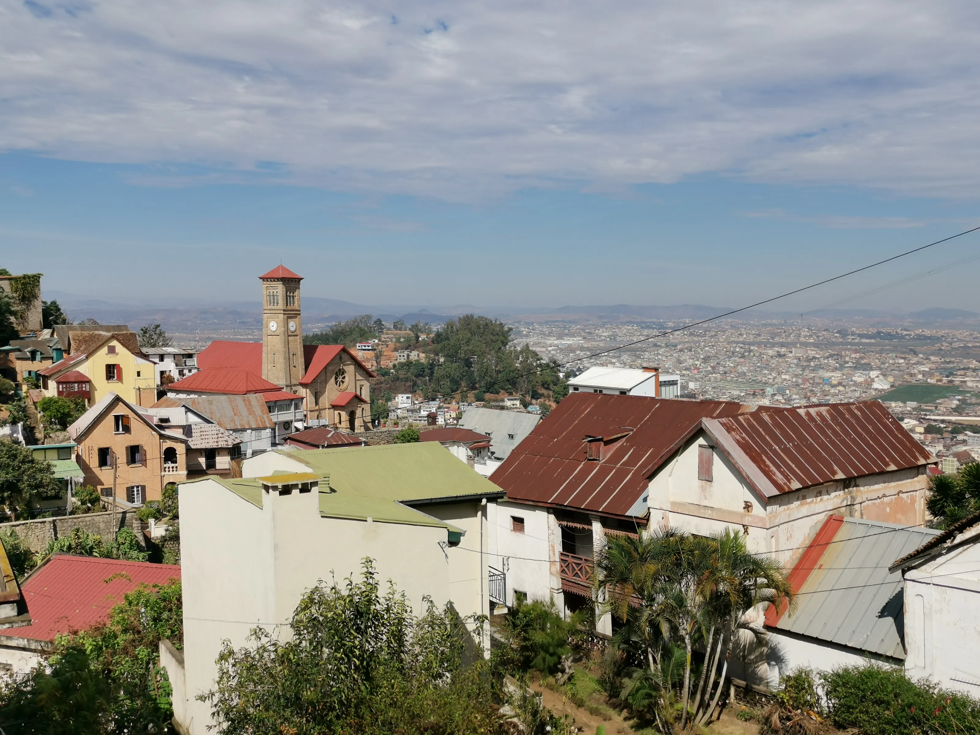
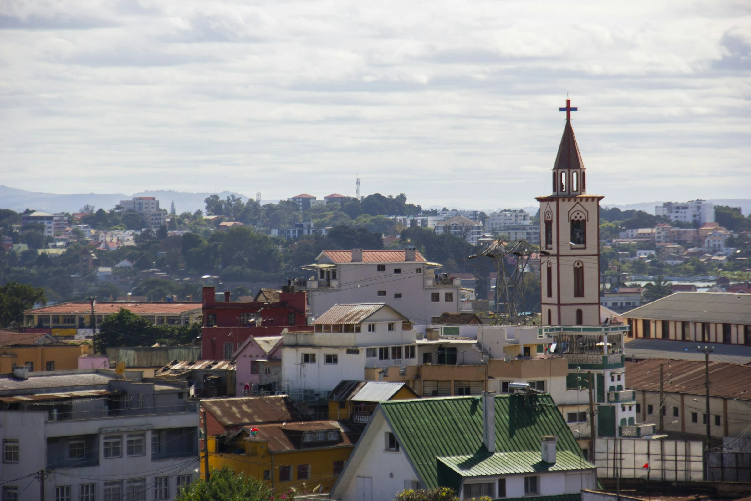
The Haute-Ville and its rooftops
The historic quarter crowns the hill with multi-storey houses, tin and tile roofs and church towers. Wikivoyage (EN) speaks of a mix of French-countryside and Indonesian architecture under mountain light.
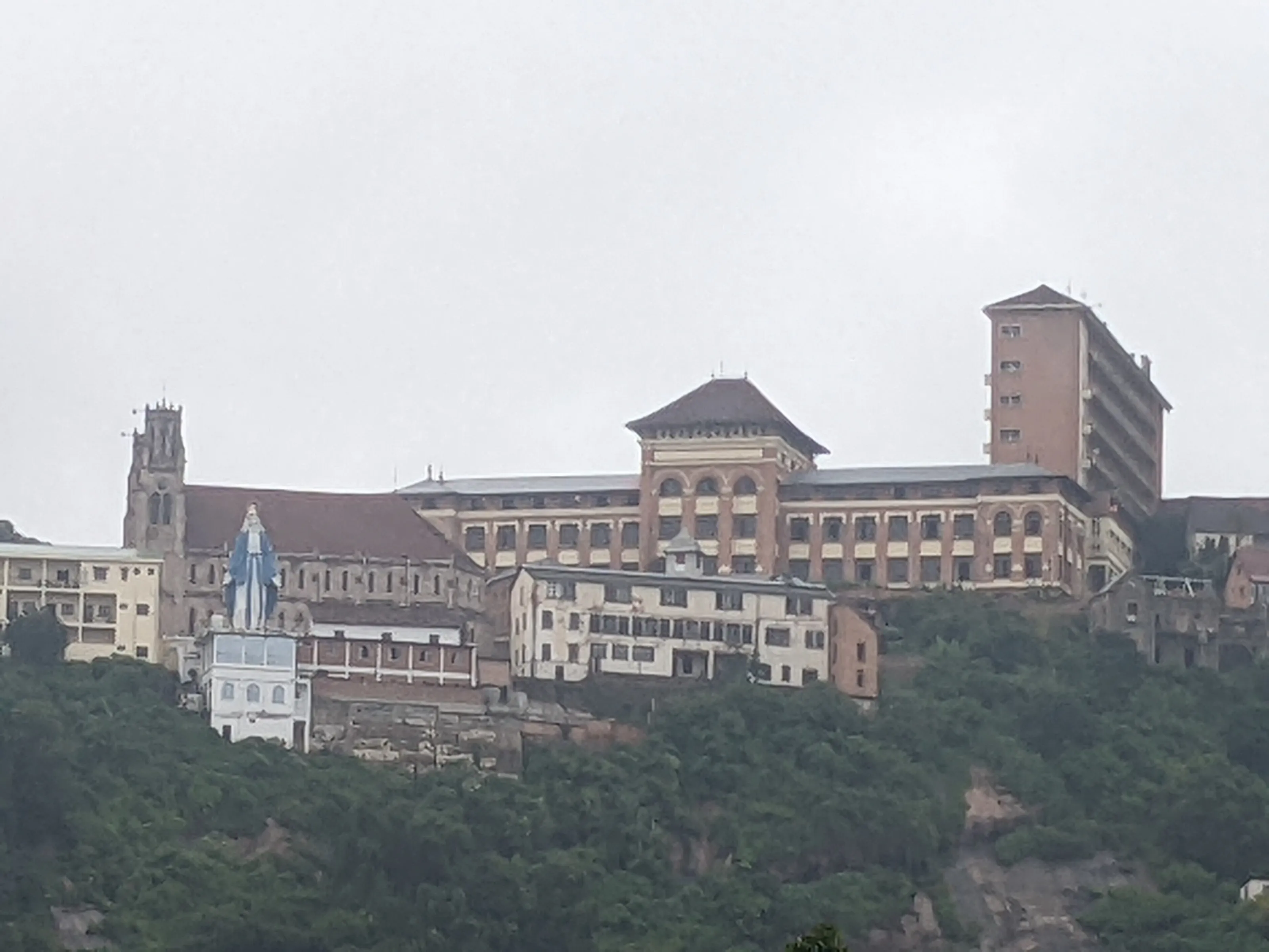
Andohalo Cathedral and the lycee
Wikivoyage (EN) places the Catholic cathedral of Andohalo, built in 1890 and topped by a large statue of Mary. It stands out against the wooded slope next to the buildings of the Andohalo school.
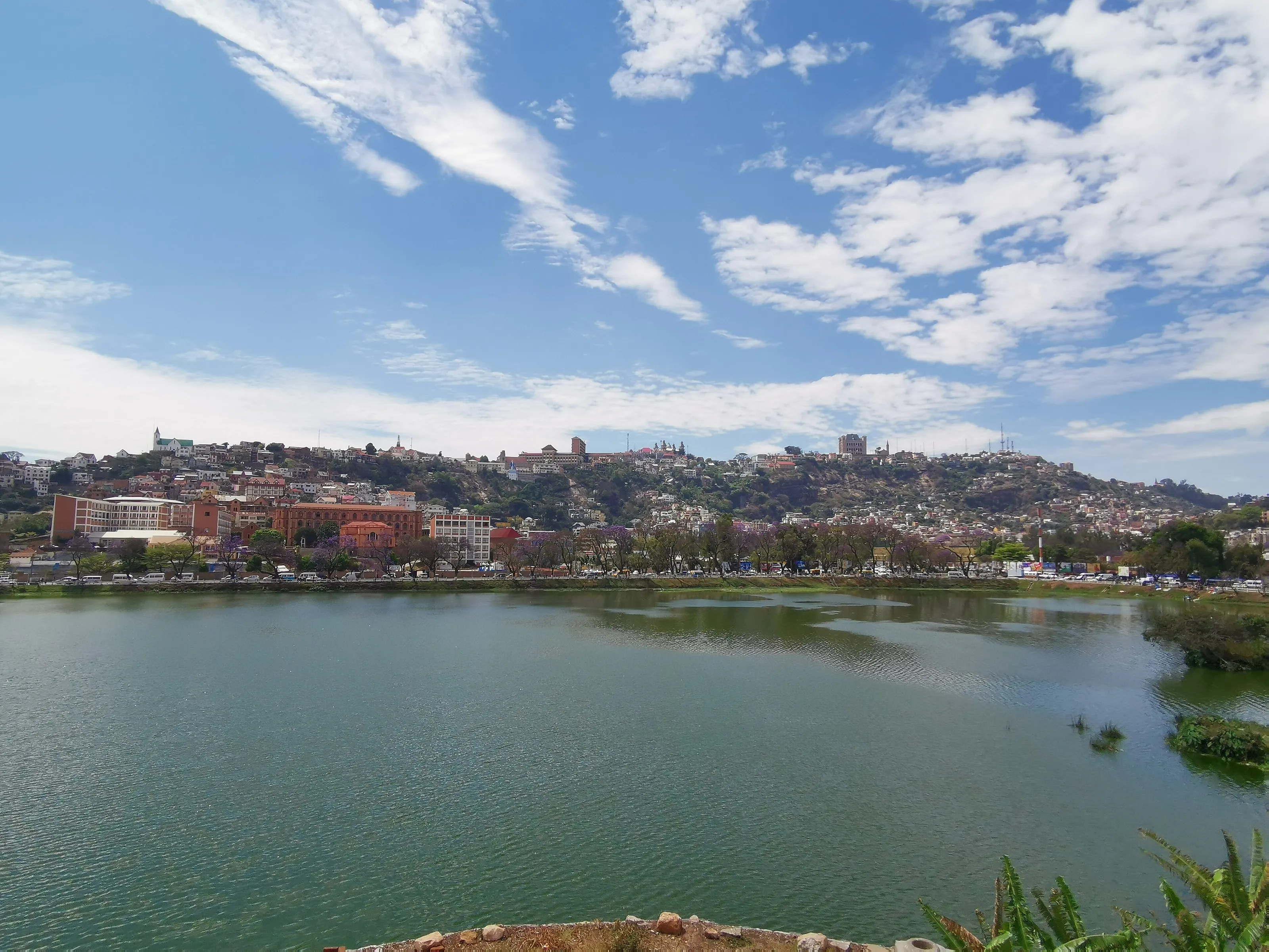
Lake Anosy
Wikivoyage (FR) names Lake Anosy as one of the emblematic places of the capital, with a war memorial on an islet reached by a causeway. Below the Haute-Ville, it works as a landmark in the landscape.
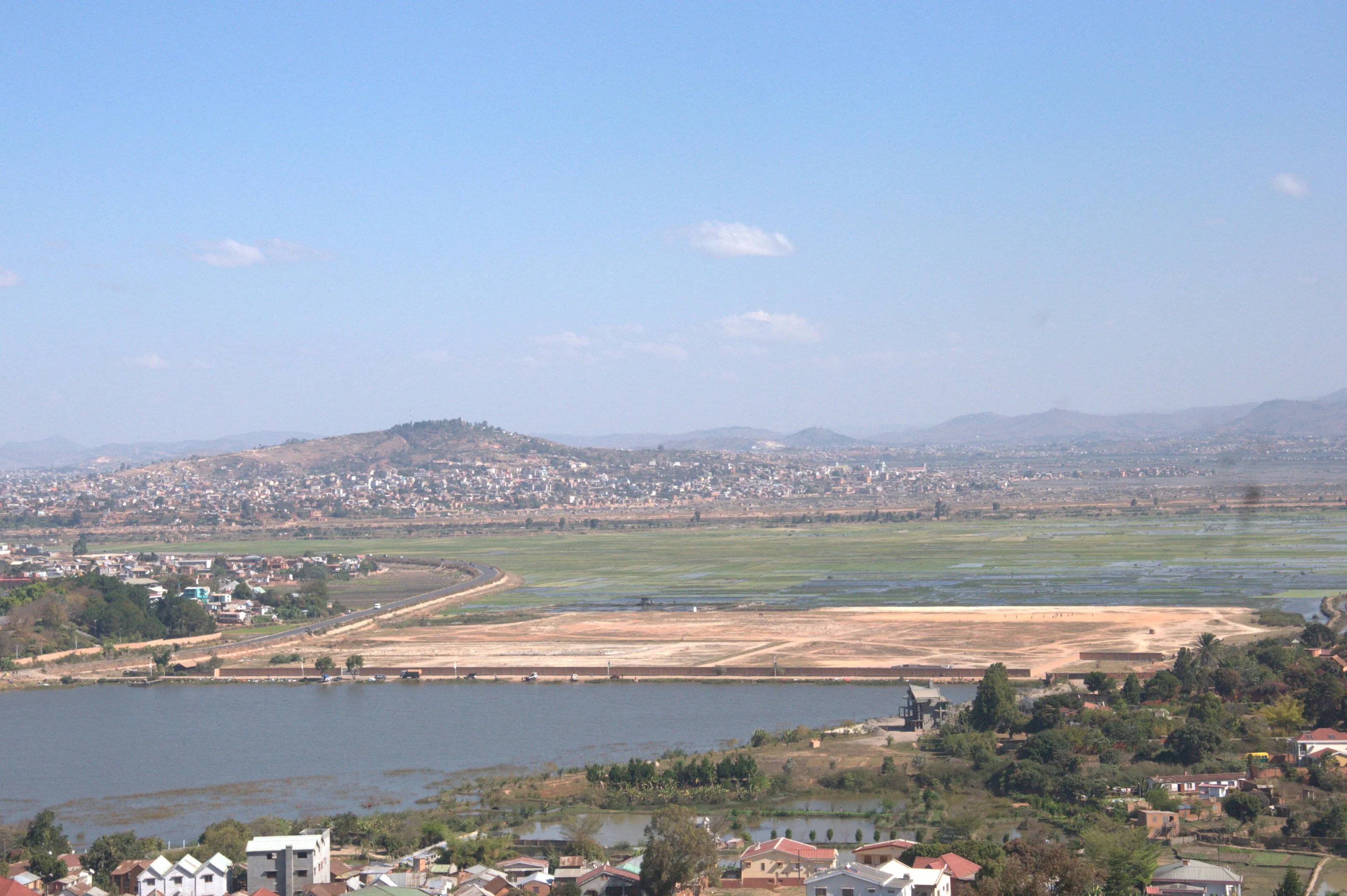
The paddies of the plain
Rice paddies still surround part of the city, forming green patches between districts, something Wikivoyage (EN, ES) lists among the capital's charms. They spread out at the foot of the hills.
Bell towers and rooftops
Between red roofs, pastel facades and church towers, the capital offers a view at every turn. Distant hills appear behind the residential districts.
The Rova, palace of the Merina rulers at the top of the hill, was gutted by fire on the night of 6 November 1995; Wikipedia (EN, ES) says restoration has continued since, with UNESCO support. Andafiavaratra Palace, the former prime minister's residence, is now a museum according to Wikivoyage (EN). Lower down, Independence Avenue and Soarano station keep the charm of colonial arcades (Wikivoyage FR).
Museums and culture
Zoo and gardens, palace museum and contemporary culture
Tsimbazaza park
The Tsimbazaza botanical and zoological garden is a conservation site for Madagascar's fauna and flora, according to Wikivoyage (FR, DE). Wikipedia (DE) mentions lemurs and other endemic species. It is a good introduction to the island's biodiversity before heading into the bush.
Andafiavaratra Palace and the art museum
The palace holds objects saved from the Rova fire, such as royal jewellery and portraits (Wikivoyage EN). The Museum of Art and Archaeology on the university campus is judged small but interesting by the same source.
Photography and pirates
Wikivoyage (FR) lists the Anjohy photography museum, created in 2018, and Wikipedia (DE) a pirate museum opened in 2008. We give neither opening hours nor prices, which change.
Food and drink
Rice, Malagasy stews and markets
Rice and what goes with it
Rice is the base of Malagasy cooking. Wikivoyage (DE) cites romazava, a beef and leafy-greens stew, and ravitoto, pork with cassava leaves. Both turn up in simple eateries and in restaurants devoted to the island's cooking.
French and world cuisine
In the centre, Wikivoyage (FR) mentions restaurants serving French, Indian, Chinese or Italian dishes, and cocktails made with Madagascar rum. Independence Avenue holds many cafes and restaurants (Wikivoyage EN).
Markets and water
Analakely market sells fruit, vegetables and crafts; Wikivoyage (EN) advises bargaining and watching your belongings. Wikivoyage (FR) says tap water is not drinkable: choose bottled or filtered water.
Getting around
Taxis without meters, taxi-be and bus stations
In town
Taxis are common, often old (Wikivoyage FR mentions Renault 4s) and without meters, so agree the price. Taxi-be, the city minibuses, are the cheapest option but hard for a visitor to follow (Wikivoyage EN).
Bus stations
Bush taxis leave from several stations organised by compass point, according to Wikivoyage (EN): the northern one serves Antsiranana and Ambanja, for Nosy Be, and the eastern one Moramanga and Andasibe.
Around the capital
Wikivoyage (FR) lists the royal hill of Ambohimanga to the north, and Wikivoyage (EN) a lemur park and a crocodile farm near the city. The train from Soarano station is barely used.
Budget and precautions
Budget, health and safety
Price level
The currency is the ariary (MGA). Simple meals and shared transport stay affordable, while accommodation and good restaurants cost more. We do not publish amounts, as we could not confirm them on two current sources.
Flights
SniperAir tracks prices to TNR and compares them with the route's real history, but it does not sell or book tickets. Consider domestic flights to Nosy Be too, whose airport is tracked separately.
Health
Ask a doctor or a vaccination centre for advice before you leave. Malaria exists in Madagascar, with a risk that varies by region and season; the capital's altitude does not remove the need to ask if you then go to the coast. Drink filtered or bottled water.
Safety
Official advice differs between countries of departure and the situation can change quickly: read your own government's advice before booking and again before you fly. Wikivoyage (EN) finds the city fine by day if you do not display valuables, and mentions stray dogs, persistent begging and snatch theft.
When to go
A highland climate: summer rain, dry cool winters
November to April
The rainy season: according to Wikivoyage (EN), almost all of the annual rain, about 1,400 mm, falls between November and April, with mild summers.
May to October
The dry season, sunny but rather cool (Wikivoyage EN); frost is rare but not unknown (Wikivoyage FR, DE). Bring a jacket for the evenings.
Wikivoyage (FR) describes a tropical highland climate with cool dry winters and mild rainy summers; Wikivoyage (DE) speaks of a "cold-tropical" climate because of the altitude. We do not give precise temperatures, as we could not cross-check them on two sources.
By length of stay
What to do in Antananarivo, by length of stay
Haute-Ville and Lake Anosy
The Haute-Ville, Andohalo Cathedral, Andafiavaratra Palace, Independence Avenue and Lake Anosy.
Markets, zoo and museums
Add Analakely market, Tsimbazaza park and the Museum of Art and Archaeology.
Hills and onward trips
The hill of Ambohimanga to the north, a lemur park, or road trips towards Andasibe; check connections and distances.
In pictures
Antananarivo in pictures
You might also like
Similar destinations
FAQ
Frequently asked questions about flights to Antananarivo
How far is Antananarivo airport from the centre?
Ivato International Airport (TNR) is about 16 km northwest of the centre according to Wikipedia (EN, FR); Wikivoyage (FR) says 20 km. Allow half an hour off-peak and over an hour in heavy traffic, per Wikivoyage (EN).
What is there to see in Antananarivo?
The Haute-Ville, Andohalo Cathedral, Lake Anosy, Andafiavaratra Palace, the Rova and Tsimbazaza park, plus the rice paddies around the city. The royal hill of Ambohimanga is a classic outing.
Is Antananarivo safe?
Wikivoyage (EN) finds it fine by day if you do not display valuables, with stray dogs, begging and snatch theft. The situation can change and official advice varies by country of departure: read your own government's advice before booking.
What health precautions should I take?
Ask a doctor or a vaccination centre before you leave: malaria depending on region and season, vaccines depending on where you travel from, filtered or bottled water, sun protection.
When is the best time to go to Antananarivo?
The dry season, May to October, is sunny but cool; the rainy season runs from November to April. Track prices in advance: they depend on the period and on air services.
How much does a flight to Antananarivo usually cost?
The price depends mainly on your departure city, the time of year and how far ahead you book. The "opportunities" section above shows real examples of prices SniperAir has already detected to this destination.
How do I get alerted when a flight to Antananarivo drops below my budget?
Create an alert profile with your departure airport, Antananarivo (TNR) as the destination and your maximum budget. You are notified automatically as soon as a matching price is detected. SniperAir monitors and alerts, it does not sell or book tickets.
Ready to head to Antananarivo?
Set your budget and let SniperAir monitor fares for you.
Create my alert