
Cheap flights to Gqeberha
Set your departure airport and maximum budget: SniperAir tracks prices to Gqeberha and alerts you the moment a deal matching your criteria appears.
Quick summary
Country
South Africa
Continent
Africa
Airport
PLZ
Currency
South African rand (ZAR)
Time zone
UTC+2 (SAST), no daylight saving
Deals already spotted to Gqeberha
Real flight examples detected by SniperAir, with their reference price.
Loading examples…
Why track Gqeberha with SniperAir
You do not need to compare prices every day
Choose your departure
Enter your departure airport and your maximum budget for a flight to Gqeberha (PLZ).
SniperAir keeps watch
Our systems continuously compare new prices with the real price history of the route. SniperAir monitors prices and alerts you: it does not sell or book tickets.
You receive an alert
As soon as a price matches your criteria, you are notified, without having searched for anything yourself.
Airport and getting into town
An airport about 3 km from the centre, known as the "ten-minute airport"
Chief Dawid Stuurman International (PLZ)
Gqeberha's airport, formerly Port Elizabeth Airport, lies about 3 km south of the centre according to Wikivoyage. Locals call it the "ten-minute airport" because most of the city is within a ten-minute drive. Taxis wait outside the terminal and the main car rental firms are on site. Domestic services connect Johannesburg, Cape Town, Durban and Bloemfontein; airlines and timetables change, so check them when you book. Travellers coming from abroad usually connect through a large South African hub.
Approximate distances, per Wikivoyage (EN, DE) and Wikipedia (EN, DE). Transport services change, so check them before you go. We do not quote fares.
Gqeberha, still often called Port Elizabeth or simply PE, is the largest city of the Eastern Cape, on Algoa Bay. The name Gqeberha has been official since 2021, but the old name is still everywhere on the ground and on many maps: search for both when comparing flights. With Kariega (Uitenhage) and Despatch it forms the Nelson Mandela Bay metro area, home to roughly 1.2 million people by most estimates.
Addo Elephant National Park is about 70 km to the north-east (Wikipedia DE: 70 km; EN: 72 km). A car is the simplest way to get there, roughly an hour on the road by our estimate. Cape Town is more than 750 km to the west, a drive most people break up along the Garden Route.
Landmarks
Donkin Reserve, beaches, the Cape Recife lighthouse and Addo elephants
Gqeberha mixes a British-era town from 1820, beaches and wild country. The places below are illustrated; the Campanile, Route 67, City Hall and the seafront are described in text only.
Donkin Reserve
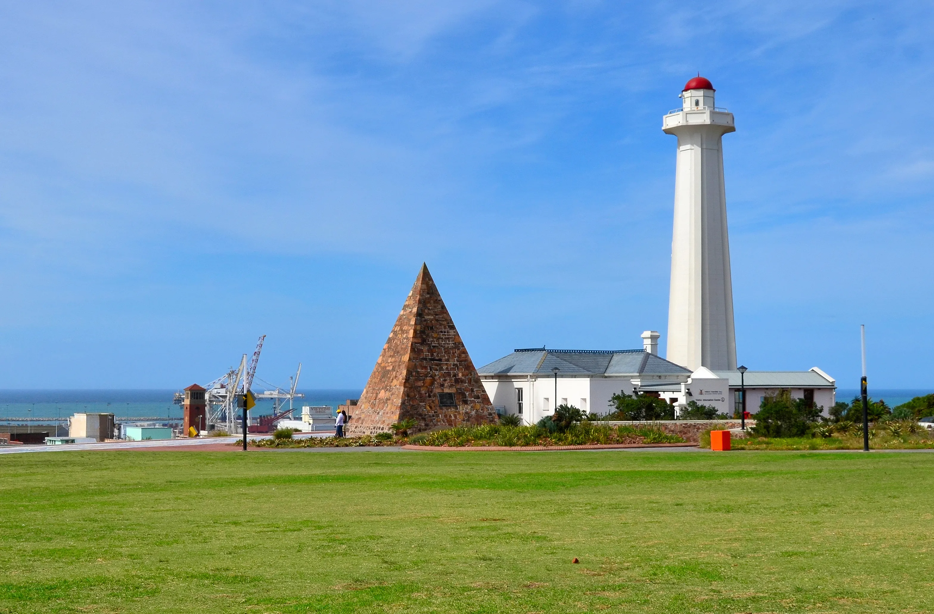
This hilltop park honours Elizabeth Donkin, wife of the acting governor who gave the city its name in 1820. It holds a stone pyramid and a lighthouse dating from 1861, and a tourist information point is based here, according to Wikivoyage. The view takes in the harbour and the bay, and the park is the starting point for the city's heritage trail.
Cape Recife and its lighthouse
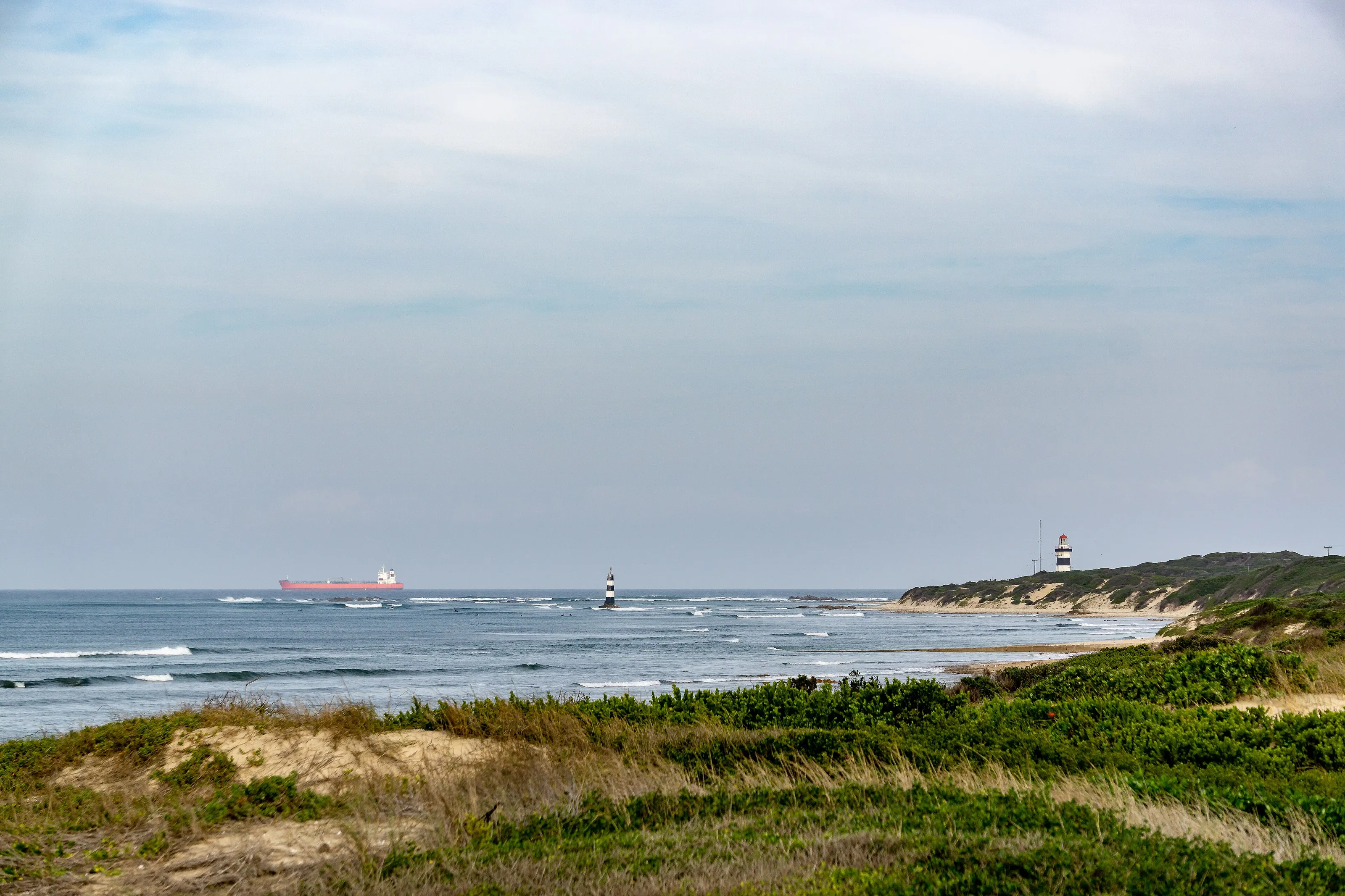
South of the city, Cape Recife marks the tip of Algoa Bay. A small striped lighthouse stands among the dunes of a nature reserve crossed by paths, between windswept beaches and rocks. It is a place for walking and watching the sea, far from the centre.
Addo, elephants close to the city
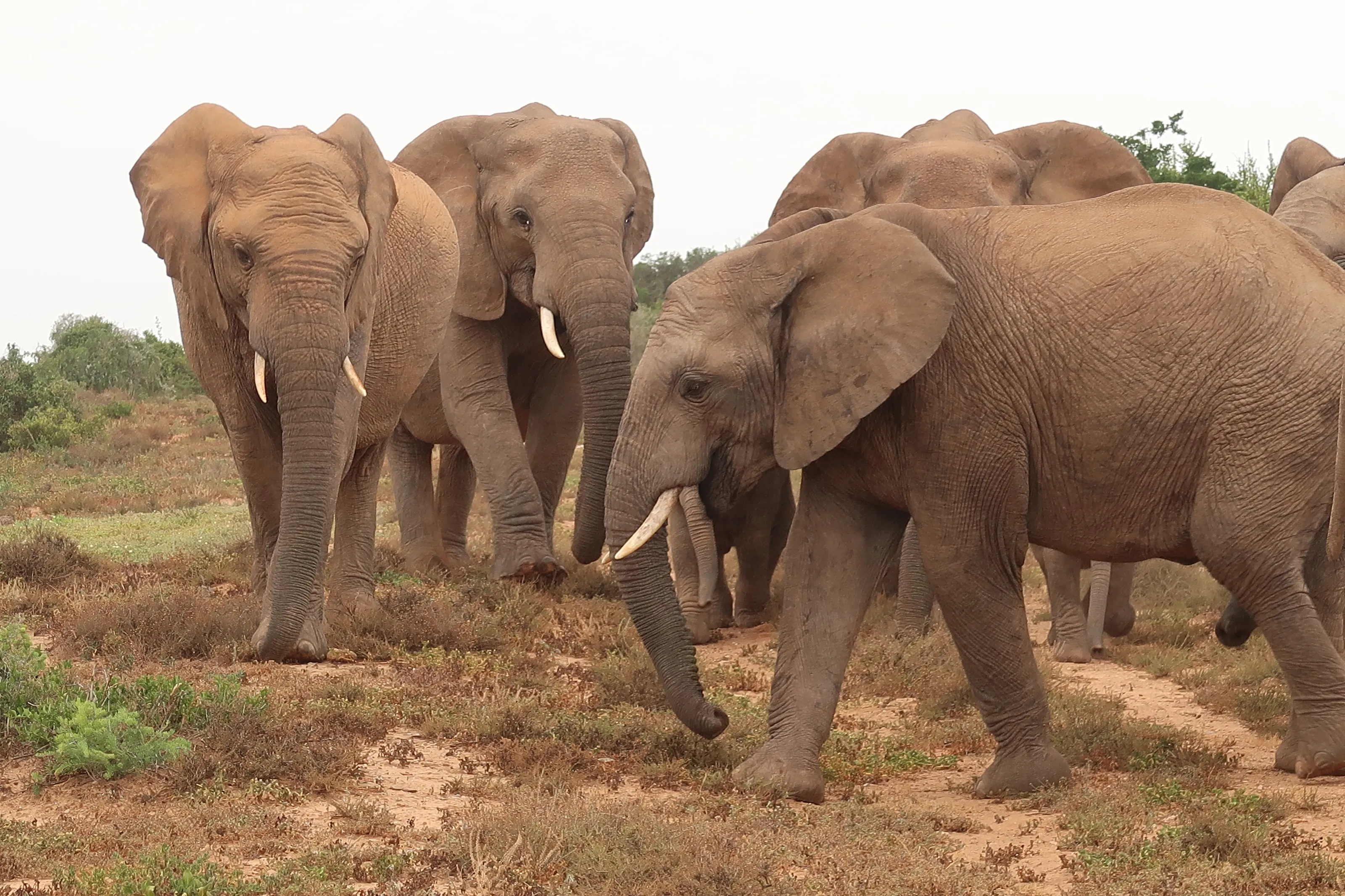
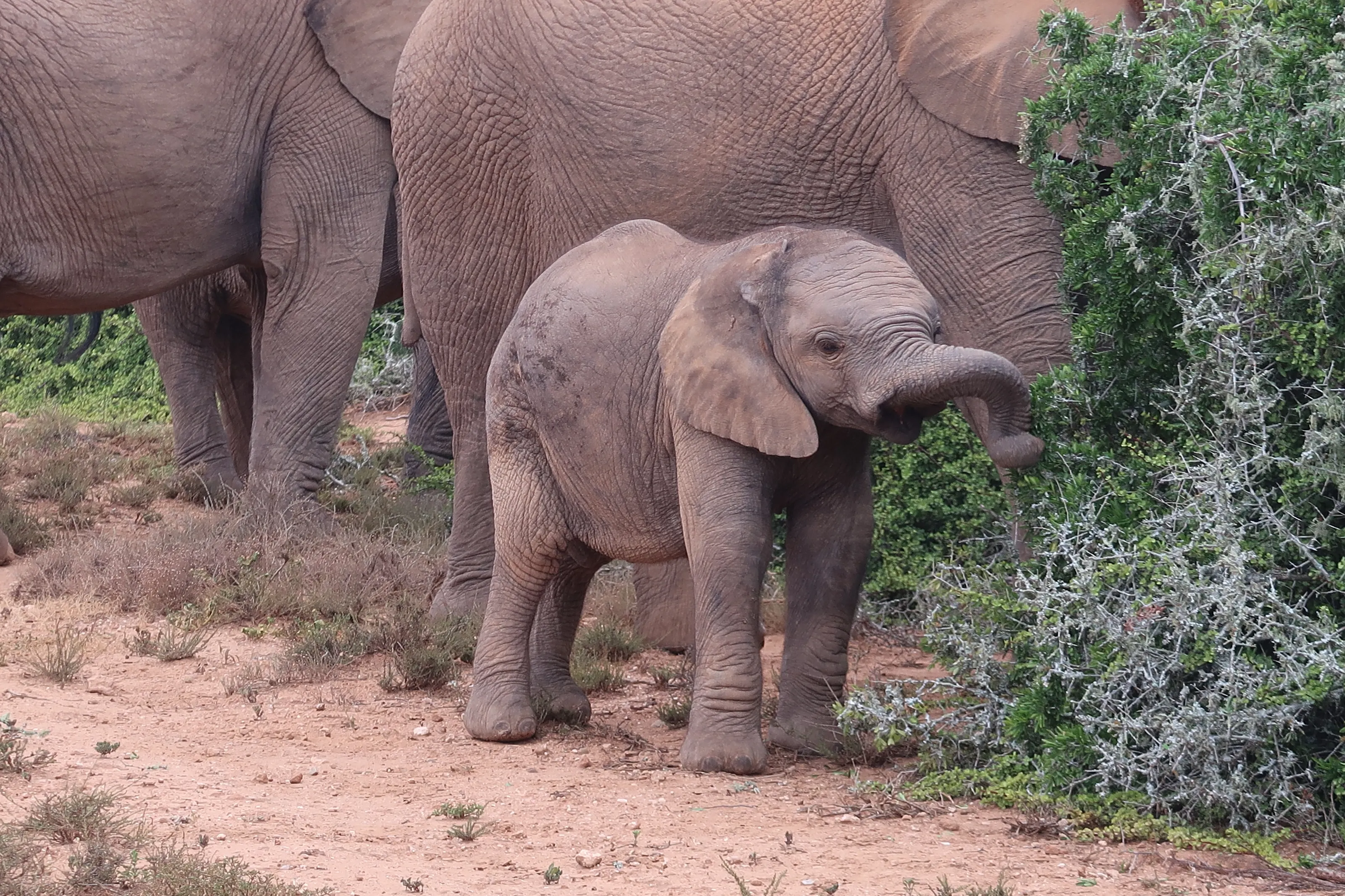
Addo Elephant National Park, about 70 km away, was set up in 1931 to protect the last eleven elephants of the region. Today they number in the hundreds (over 600 according to recent sources) and are met along tracks that you drive. The elephants are wild animals: you stay in your vehicle and follow park rules.
Elephant families beside the tracks
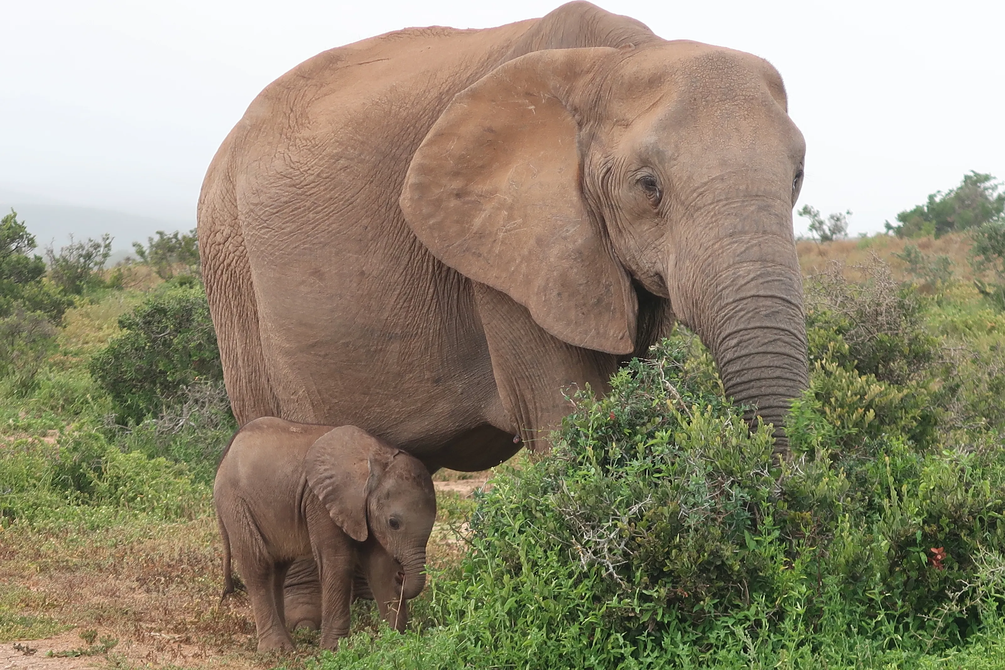
Females with calves are a common sight, browsing the bushes beside the tracks. The park, the third largest in South Africa, also shelters buffalo, black rhino, zebra and antelope, as well as a rare flightless dung beetle, and it is growing towards the coast, with islands where Cape gannets and penguins breed.
In the centre, the Campanile, a bell tower from 1923 raised in memory of the 1820 settlers, gives a viewpoint over the city, and the Route 67 walking trail starts there: 67 public artworks for the 67 years of Nelson Mandela's struggle. The 19th-century City Hall and the Feather Market Hall stand around the market square, while King's Beach, Humewood and Hobie Beach line the sand below the seafront. Opening arrangements at the lighthouse and other sites change: check before you go.
Museums and culture
Settler history, apartheid memory, art and the sea
The Nelson Mandela Metropolitan Art Museum
Set in St George's Park, this museum shows a selection of South African art, with a focus on Eastern Cape artists. The park itself, laid out in 1860, also holds a historic cricket ground and gardens.
No 7 Castle Hill and the South End Museum
The Castle Hill house is presented as the oldest surviving settler cottage in the city. The South End Museum remembers the residents who were forced out of the district under apartheid's Group Areas Act, a visit that sheds light on the city's social history.
Bayworld, aviation and military memory
Bayworld combines a museum with an oceanarium; the air force museum and Fort Frederick, the bay's first British settlement in 1799, round out the circuit. Hours and conditions change: we do not quote fares.
Food and drink
Seafood, braai and South African flavours
Fish and seafood
With about 40 km of beaches around the bay, Gqeberha lives by the water: grilled fish, calamari and prawns are eaten along the seafront, in the pavilions that look over Humewood beach. The beachfront restaurants are the easiest place to try the catch of the day.
Braai and national dishes
The braai, South Africa's barbecue, is part of social life; you will also find bobotie, biltong and dishes with roots in Cape Malay or Indian cooking. Pineapples from around Makhanda are well known in the region, according to Wikivoyage.
Markets, cafés and wine
Shopping centres and weekend markets offer local produce and crafts; beyond the city, the Garden Route and the wine country of the west provide good South African wines. We do not name commercial addresses.
Getting around
Car, buses and minibus taxis
Hire car
A car is the most practical way to link the beaches, Cape Recife and Addo; the national car rental firms all have offices, according to Wikivoyage. Traffic drives on the left. Avoid driving after dark on poorly lit roads, as the US health authorities also advise.
Buses, taxis and minibuses
A city bus network serves the town; minibus taxis, the usual way for residents to get around, run on fixed routes and take some getting used to. Use official taxis for night-time trips.
Rail and roads
Metrorail commuter trains link Kariega (Uitenhage) on weekdays; the N2 national road leads west to the Garden Route and east to Makhanda and East London.
Budget and precautions
A budget to check, common-sense caution and medical advice
Price level
The South African rand (ZAR) makes many everyday costs more manageable for a visitor paying in euros or dollars, but prices vary with the season and the exchange rate. We do not give figures because we could not confirm them from two independent sources.
Flying
The flight is the most variable cost. SniperAir tracks prices to PLZ and compares them with the route's history, but it does not sell or book tickets. Cape Town (CPT), Johannesburg (JNB) and Durban (DUR) can be tracked in parallel.
Health
According to the US CDC, South Africa's malaria areas are mainly in the north-east (Mpumalanga, Limpopo, KwaZulu-Natal); the Eastern Cape is not among them, and Wikivoyage describes the wildlife areas near Gqeberha as malaria-free. Risk varies by region and season, so see a doctor or a travel clinic before departure.
Safety
As in many South African cities, stay alert: leave nothing visible in the car, avoid walking alone at night and watch for ATM fraud. Wikipedia (FR) mentions a reputation for insecurity in the centre. Official advice differs by country of departure, so check your own government's guidance.
When to go
A mild oceanic climate, with wind
Summer (December to February)
Summers are warm but less humid than on the north-east coast; this is local school-holiday time, with lively beaches.
Autumn (March to May)
A mild season with fewer people on the beaches and conditions that are often pleasant for walking and sightseeing.
Winter (June to August)
Cool but mild winters with often clear skies: a quiet time for museums and for visiting Addo.
Spring (September to November)
Temperatures rise, flowers appear and the days lengthen: a good season before the summer rush.
Gqeberha has an oceanic climate (Köppen Cfb): mild temperatures all year, rain spread across the twelve months and frequent wind. We give no precise temperatures because we could not cross-check them; check the forecast before you travel.
By length of stay
What to do in Gqeberha by length of stay
The essentials
Donkin Reserve, the Campanile, Route 67, a beach and a sunset over the bay.
With Addo
A full day in Addo, then Cape Recife and the city museums.
Going further
Jeffreys Bay and its surf spots, or the Garden Route towards Tsitsikamma, Knysna and George.
In pictures
Gqeberha in pictures
You might also like
Similar destinations
FAQ
Frequently asked questions about flights to Gqeberha
How do I get from Gqeberha airport to the centre?
The airport (PLZ) is about 3 km from the centre and can be reached in a few minutes by car or taxi. Car rental firms are on site. Flight schedules change, so check them before you go.
Gqeberha or Port Elizabeth: which name should I search for?
They are the same city. Gqeberha has been the official name since 2021, but Port Elizabeth (or PE) is still widely used. To track a flight, use the airport code PLZ.
When is the best time to visit Gqeberha?
The climate is mild all year. Summer suits the beaches; spring and autumn bring pleasant temperatures with fewer crowds; winter is quiet and often clear.
Can you see elephants near Gqeberha?
Yes: Addo Elephant National Park is about 70 km away. They are wild animals, watched from a vehicle while following the park rules.
Do I need malaria tablets?
South Africa's malaria areas are mainly in the north-east, not in the Eastern Cape, according to the US CDC. Risk varies by region and season, so see a doctor before you travel.
Is Gqeberha safe?
As in many South African cities, caution is needed: keep valuables out of sight, limit night-time travel and be careful at ATMs. Official advice differs by country of departure, so check it before you book.
How much does a flight to Gqeberha usually cost?
The price depends mainly on your departure city, the time of year and how far ahead you book. The "opportunities" section above shows real examples of prices SniperAir has already detected to this destination.
How do I get alerted when a flight to Gqeberha drops below my budget?
Create an alert profile with your departure airport, Gqeberha as the destination and your maximum budget. You are notified automatically as soon as a matching price is detected.
Ready to head to Gqeberha?
Set your budget and let SniperAir monitor fares for you.
Create my alert