
Cheap flights to Sylt
Set your departure airport and maximum budget: SniperAir tracks prices to Sylt and alerts you the moment a deal matching your criteria appears.
Quick summary
Country
Germany
Continent
Europe
Airport
GWT
Currency
Euro (EUR)
Time zone
UTC+1 (UTC+2 during summer time)
Deals already spotted to Sylt
Real flight examples detected by SniperAir, with their reference price.
Loading examples…
Why track Sylt with SniperAir
A northern island reached by air or by train
Choose your departure
Enter your departure airport and your maximum budget for a flight to the island of Sylt (GWT), or to Hamburg if you plan to finish by train.
SniperAir keeps watch
New fares are compared with the real history of the route. SniperAir tracks prices and alerts you: it does not sell or book tickets.
Get an alert
As soon as a fare matches your criteria you are notified, without having to rerun the search yourself.
Airport and getting into town
A small airport near Westerland, and a train that crosses the causeway
Sylt (GWT)
Sylt airport is at Tinnum, about 2 km east of Westerland, the island's main town, according to Wikipedia. Wikivoyage mentions flights to German, Austrian and Swiss destinations, mostly seasonal. Because routes change from one season to the next, we name none and do not quote fares. To reach the centre or a hotel, a taxi or the island bus is simplest.
Distances are approximate, from Wikipedia and Wikivoyage; seasonal flights, trains, car trains and ferries change, so check times before you travel.
Many visitors arrive by train. According to Wikivoyage, regional trains leave Hamburg Altona every hour and take about three hours to the terminus at Westerland: the train crosses the Hindenburgdamm, a rail causeway about 11 km long built in 1927 that links the island to the mainland. Cars cross by car train from Niebüll, but parking on the island is difficult, and it is often recommended to leave the vehicle on the mainland. There is also a ferry between Havneby, on the Danish island of Rømø, and List, in the north of Sylt. Tracking fares into Hamburg and continuing by train is a simple alternative.
Dunes, cliff and lighthouses
A long western beach, shifting dunes and the Wadden Sea to the east
Sylt is the largest and northernmost of the German North Sea islands, at about 99 km². Narrow in shape, it has a long white sand beach on the west, about 40 km according to Wikivoyage, a central part of heath and meadow, and a mudflat coastline on the east, in the Wadden Sea National Park. The places below are illustrated; Keitum, Westerland and Kampen are described in text.
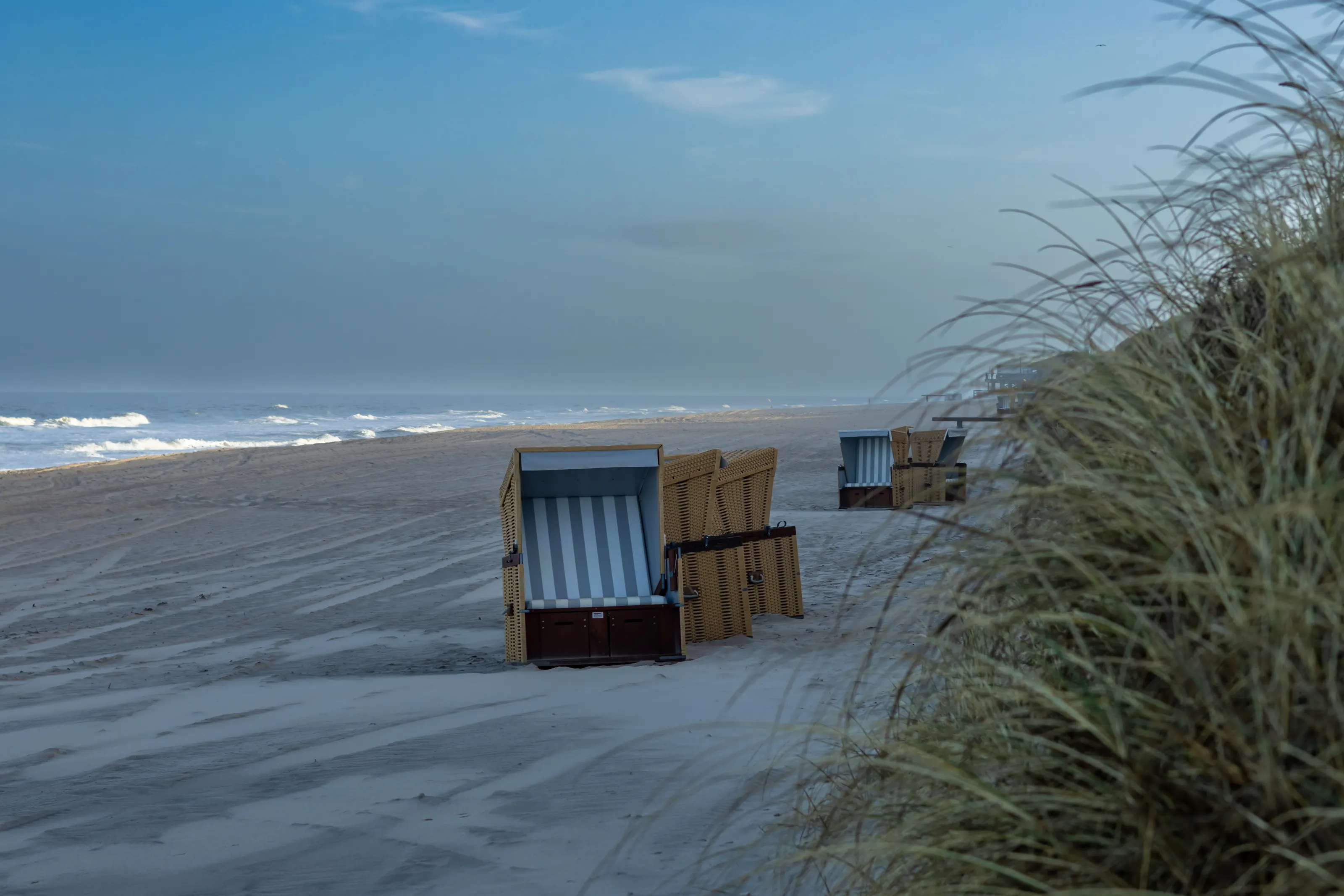
The western beach and its Strandkörbe
On the open coast the beach stretches for kilometres, facing the North Sea. The Strandkorb, a roofed wooden beach chair rented by the day, is a fixture of German beaches. The wind blows almost constantly: pack a windbreaker even in summer, and protect yourself from the sun, because UV rays get through despite the wind.
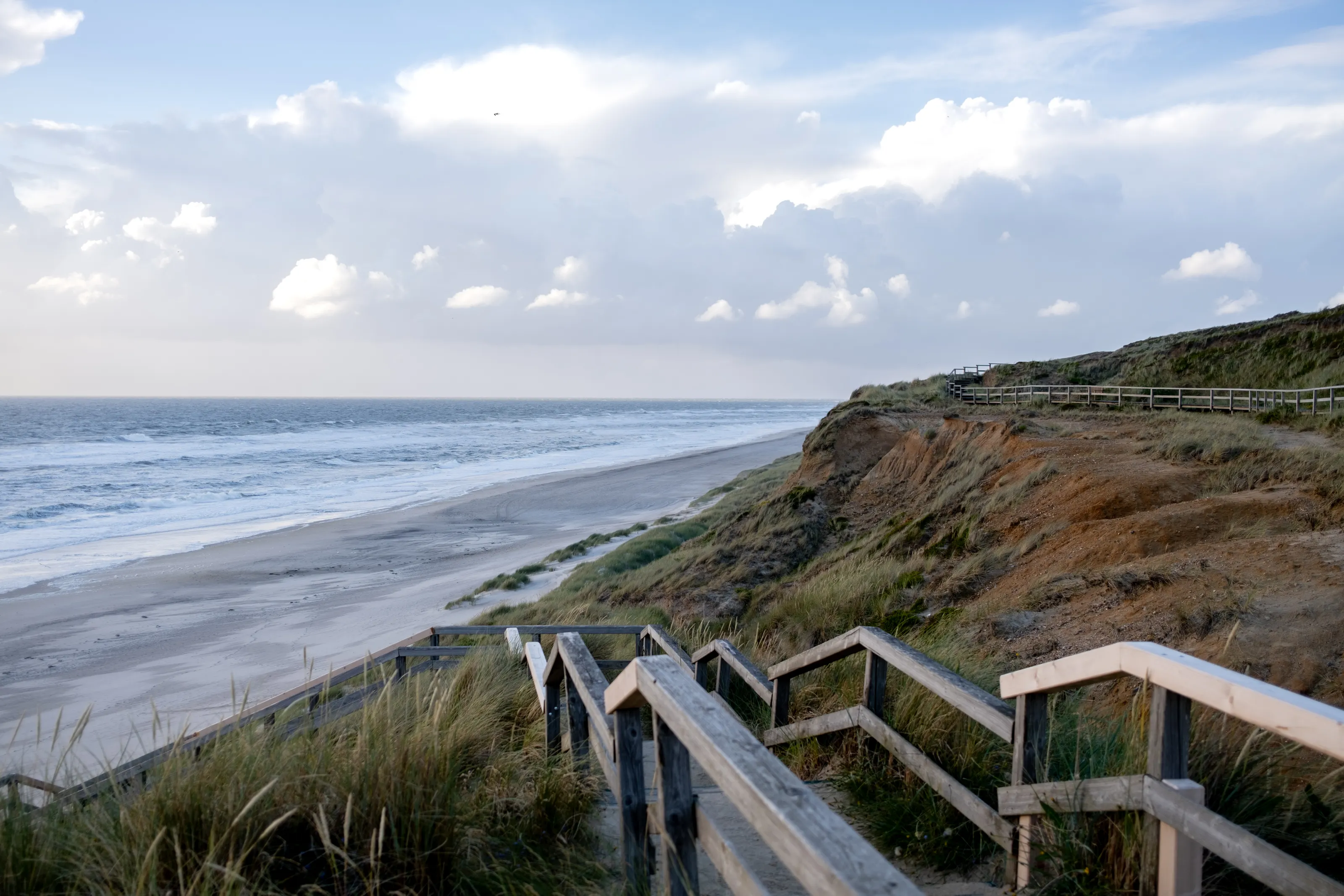
The red cliff and the Uwe dune
Between Wenningstedt and Kampen the red cliff, the Rotes Kliff, rises about 30 m above the beach, according to Wikipedia and Wikivoyage. Close by, the Uwe dune, the island's highest point at 52.5 m, can be climbed by stairs: on a clear day the view takes in the north of the island and as far as the mainland.
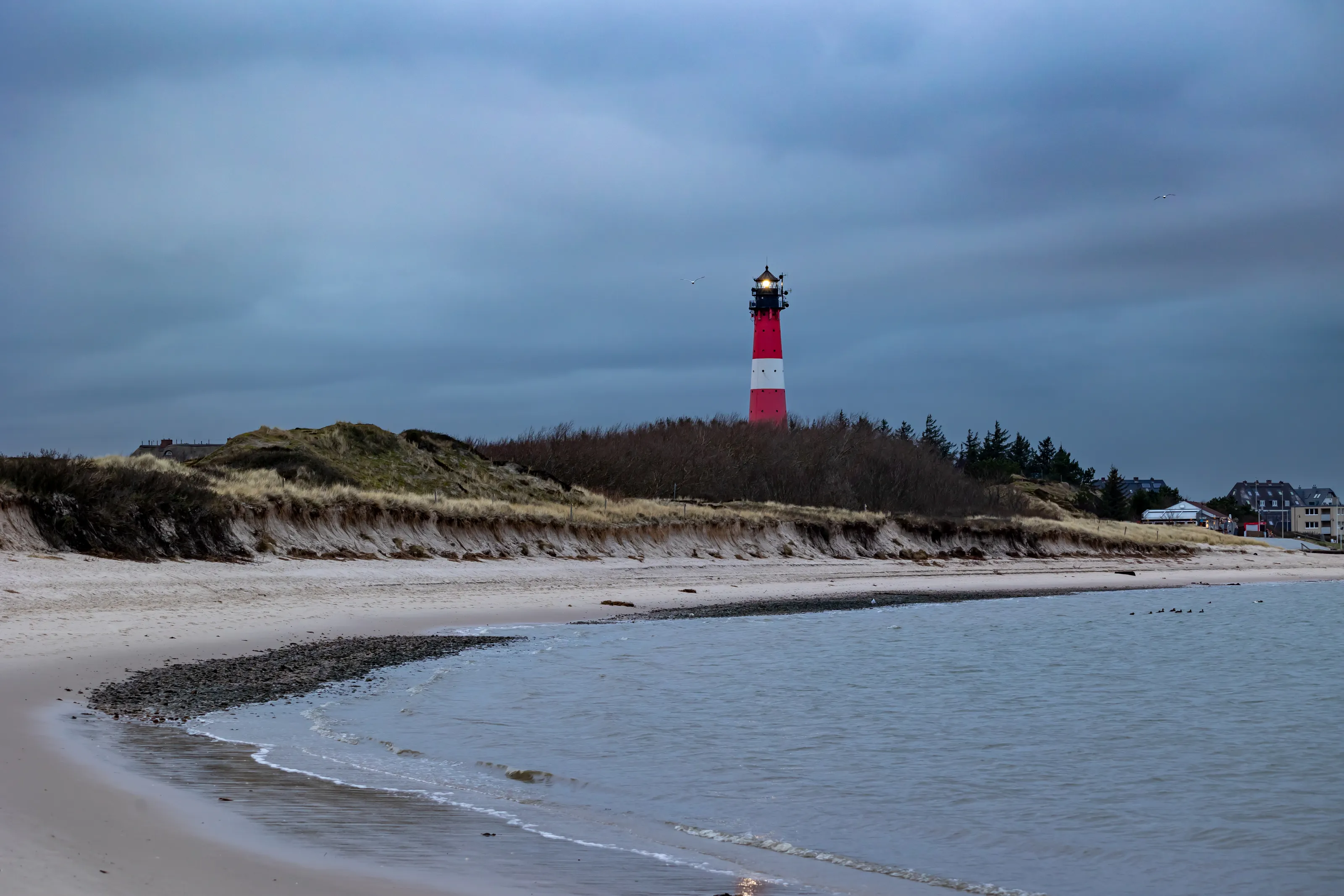
The Hörnum lighthouse and the southern tip
In the south, Hörnum occupies the tip of the island, with a harbour from which boats leave for the islands of Amrum and Föhr, according to Wikivoyage, and its red-and-white banded lighthouse. It is a good starting point for waterside walks, facing the mudflats at low tide.
Dunes and paths
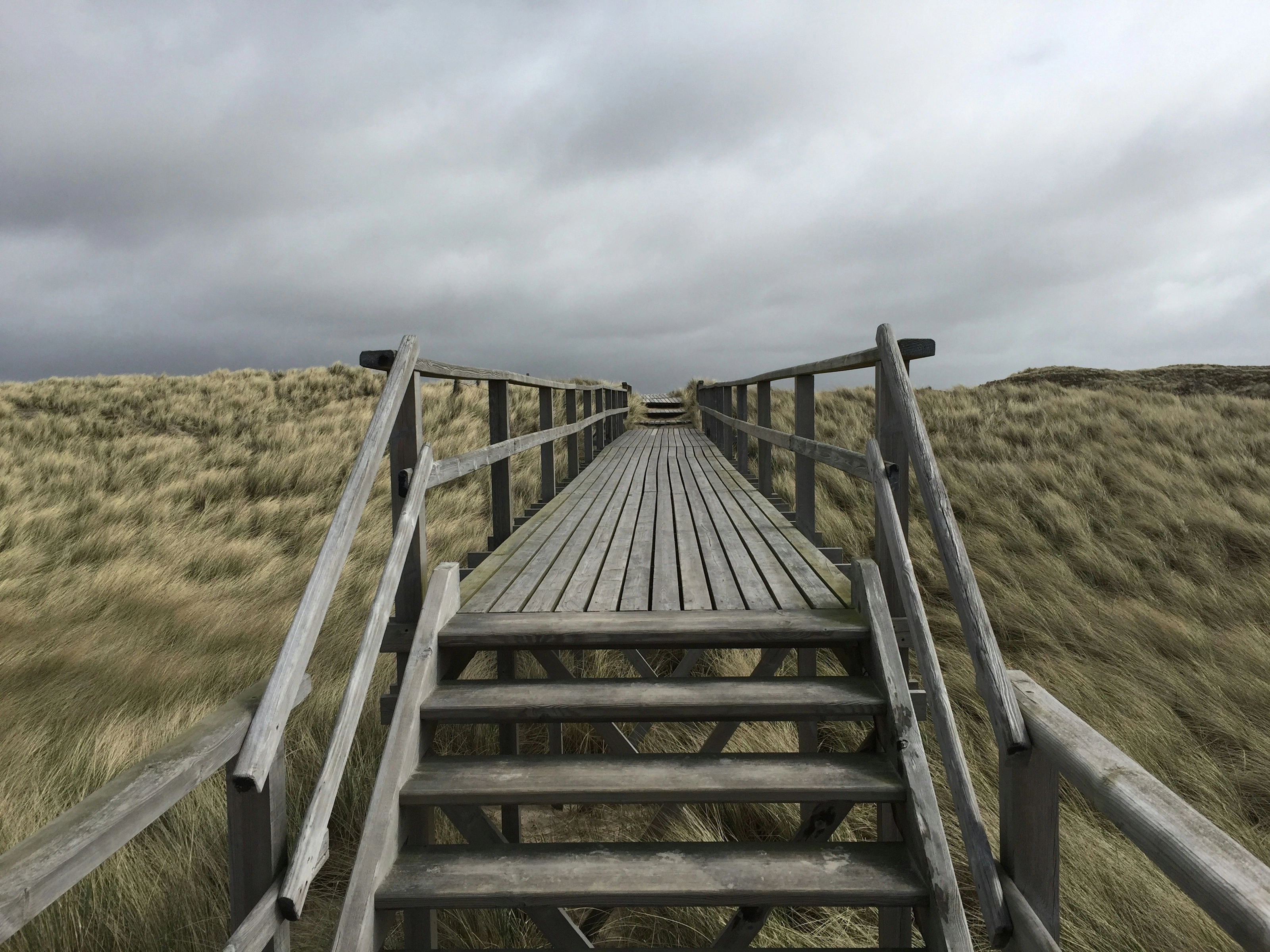
In the north and south of the island, the dunes are crossed by paths of wood and sand. Straying from them is forbidden, to protect the vegetation, according to Wikivoyage. Several lighthouses mark the coast, two of them at List in the north, according to Wikipedia.
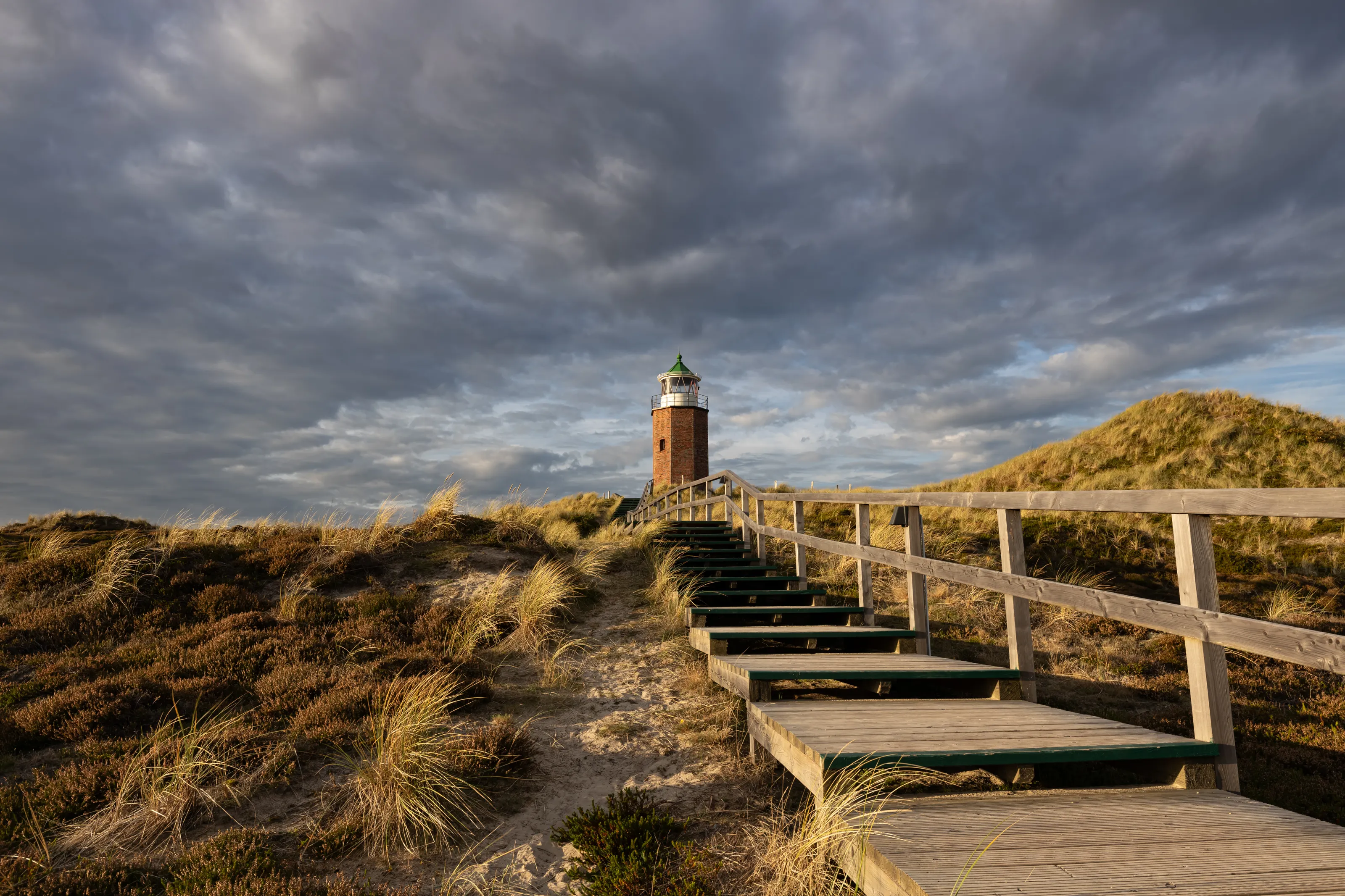
Walkways and the dunes of List
In the north, near List, are Germany's last wandering dunes, which move east at about 7 m a year according to Wikivoyage. They are protected and entering them is forbidden; you watch them from paths and walkways. Denmark is very close: a ferry links List with Havneby on the island of Rømø.
Sheep, oysters and the Wadden
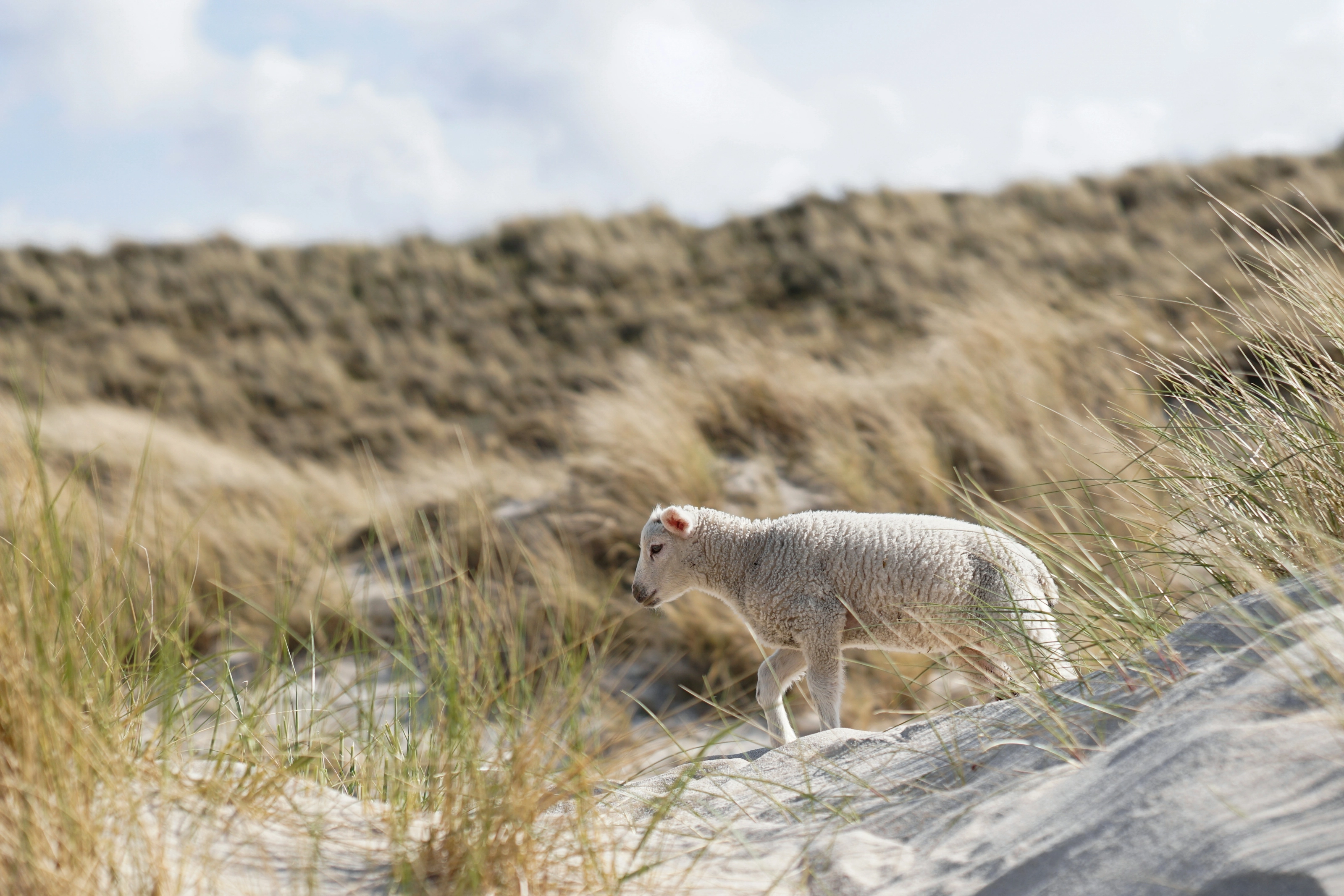
The meadows of the centre and east are grazed by sheep, and dyke lamb is among the local specialities. List has Germany's only oyster farm, according to Wikivoyage. In the east, the Wadden Sea reveals its mudflats at low tide; to venture far out, an experienced guide is essential.
Keitum, Westerland and Kampen in text
Keitum, a historic village, has the Altfriesisches Haus, a farmhouse of 1739 turned museum in 1907, and the local Sylt museum. Westerland, the main town, has the railway station, all the shops and a seafront promenade. Kampen is known as a meeting place for German high society, with bars, galleries and holiday villas. The Denghoog, in Wenningstedt-Braderup, is an accessible megalithic tomb about 5,000 years old. The Morsum cliff, in the east, offers a geological formation unique in Europe, with a walking trail.
Museums and culture
Frisian history, megaliths and nature
The local museum and the Frisian house
In Keitum the Sylter Heimatmuseum traces the island's history up to about 1850, with seafaring, costumes and daily life. Nearby, the Altfriesisches Haus, a farmhouse of 1739, shows how the old Frisians lived. Opening hours change: check the museums' websites.
Megaliths and geology
The Denghoog is the best-preserved megalithic tomb in the country, according to Wikivoyage, and you can enter it. The Morsum cliff and the sea cliffs are reminders that the island grew from a moraine of the Saale glaciation. We do not quote prices.
The Wadden and the language
Conservation stations inform visitors about the Wadden Sea and its inhabitants. The island also has its own dialect, Söl'ring, a variety of North Frisian spoken by a small share of the population, according to Wikipedia.
Food and drink
Fish, List oysters and dyke lamb
Fish and oysters
Almost every restaurant serves fish; the fish burger is a takeaway speciality, according to Wikivoyage. Sylt oysters, raised at List, and dyke lamb are the specialities most tied to the island.
An expensive island
Sylt is considered the most expensive island in Germany, with high-end restaurants and bars, especially in Kampen. You can limit spending by choosing kiosks, canteens or takeaways.
Drinks
Cafes and beach bars serve hot and cold drinks all day. We name no venues, since menus and opening hours change. Please drink in moderation.
Getting around
By bus, by bike and on foot
By bus
Several bus lines serve the whole island, and nearly all meet at Westerland station, according to Wikivoyage. Tickets are sold by the day or by duration; check lines and fares before you go.
By bike
The island is flat and crossed by cycle paths, and bikes can be rented in many places. Part of the old island railway track has become a cycle path, according to Wikivoyage.
By car
Cars arrive by car train from Niebüll. Parking is difficult and traffic heavy in high season: many travellers prefer to leave the vehicle on the mainland.
Budget and precautions
Germany's most expensive island
Price level
Sylt is Germany's most expensive seaside destination, frequented by wealthy visitors, according to Wikipedia and Wikivoyage. Accommodation and dining cost more than on the mainland, especially in summer. We do not give figures because we could not cross-check them against two independent sources.
Flights
The flight is the most variable cost. SniperAir tracks fares to GWT and compares them with the route's history, but it does not sell or book tickets. Also keep an eye on Hamburg, from where the train reaches the island.
Beach safety and entry rules
Concrete groynes, invisible at high tide, can be dangerous for bathers; they are marked with crosses. Keep to the dune paths and do not venture onto the mudflats without a guide. Germany is in the Schengen area; check entry requirements on official sites.
When to go
Summer for the beach, other seasons for wind and calm
Winter (December to February)
Windy and cool, but rarely very cold, with almost empty beaches. Wikivoyage also mentions Frisian festivals, including the Biikebrennen on 21 February.
Spring (March to May)
The first visitors return; the wind stays fresh and beaches are still calm.
Summer (June to August)
The season for swimming, Strandkörbe and walks. Crowds are at their peak, and roads and trains are busy.
Autumn (September to November)
Low light over the dunes, possible storms and nearly empty beaches, often with softer prices.
The climate is oceanic, with almost constant winds and fewer clouds and rainy days than on the mainland, about 1,750 hours of sunshine a year according to Wikivoyage. We do not give precise temperatures, as we could not cross-check them; check the forecast before you go. Pack warm clothes in every season.
By length of stay
What to do on Sylt depending on how long you stay
The essentials
A beach, the red cliff and the Uwe dune, a fish lunch and a sunset over the dunes.
The whole island
Hörnum in the south, List in the north, Keitum with its museums and village, and a bike ride.
Neighbouring islands
Amrum and Föhr by boat from Hörnum, or nearby Denmark by the ferry to the island of Rømø.
In pictures
Sylt in pictures
You might also like
Similar destinations

FAQ
Frequently asked questions about flights to Sylt
How do I get from Sylt airport to the centre?
The airport (GWT) is at Tinnum, about 2 km east of Westerland. A taxi or the island bus is the simplest option. Flights are largely seasonal, so check them before you book.
Can I get to Sylt by train?
Yes: regional trains leave Hamburg Altona every hour and take about three hours to Westerland, crossing the Hindenburgdamm, a rail causeway. Cars cross by car train from Niebüll.
When is the best time to visit Sylt?
June to September for the beach; spring and autumn for calm, light and often softer prices; winter is windy but pleasant for walks.
Is Sylt expensive?
It is Germany's most expensive island, with a wealthy clientele. We do not quote amounts because we could not cross-check them.
How long should I stay on Sylt?
Two days are enough for the beach, the red cliff and Keitum. Allow four days or more if you add Hörnum, List and bike or boat outings.
What should I eat on Sylt?
Fish, in a roll or at the table, the oysters raised at List and dyke lamb.
How much does a flight to Sylt usually cost?
The price depends mainly on your departure city, the time of year and how far ahead you book. The "opportunities" section above shows real examples of prices SniperAir has already detected to this destination.
How do I get alerted when a flight to Sylt drops below my budget?
Create an alert profile with your departure airport, Sylt as the destination and your maximum budget. You are notified automatically as soon as a matching price is detected.
Ready to head to Sylt?
Set your budget and let SniperAir monitor fares for you.
Create my alert