
Cheap flights to Fuerteventura
Set your departure airport and maximum budget: SniperAir tracks prices to Fuerteventura and alerts you the moment a deal matching your criteria appears.
Quick summary
Country
Spain
Continent
Europe
Airport
FUE
Currency
Euro (EUR)
Time zone
UTC+0 (UTC+1 during summer time)
Deals already spotted to Fuerteventura
Real flight examples detected by SniperAir, with their reference price.
Loading examples…
Why track Fuerteventura with SniperAir
You do not need to compare prices every day
Choose your departure
Enter your departure airport and your maximum budget for a flight to Fuerteventura (FUE).
SniperAir keeps watch
Our systems continuously compare new prices with the real price history of the route. SniperAir monitors prices and alerts you: it does not sell or book tickets.
You receive an alert
As soon as a price matches your criteria, you are notified, without having searched for anything yourself.
Airports and getting into town
An airport on the east coast, 5 km from the island's capital
Fuerteventura (FUE)
Fuerteventura Airport is at El Matorral, 5 km south-west of the capital, Puerto del Rosario, according to Wikipedia. It has links to more than 80 destinations and handled over 5.6 million passengers in 2016, according to the same source. It opened in 1969 and launched mass tourism on the island after the first tourist hotel of 1965. From the airport you reach the north (Corralejo) by a road running past the dunes, according to Wikivoyage (DE), and the south (Morro Jable, Jandia) across the island. There is no land link: you arrive by air, or by ferry from Lanzarote and the other islands.
Distances and frequencies are approximate, based on Wikipedia (EN, FR, ES) and Wikivoyage (DE, ES); timetables change by season, so check before you travel. We do not quote fares.
Fuerteventura is the second-largest of the Canary Islands, with 1,660 km2, about 130,000 inhabitants and a length of 100 km for 31 km of width, according to Wikipedia (EN, ES). It is the island closest to Africa, 97 km from the coast, according to Wikipedia (FR), and the whole island has been a UNESCO biosphere reserve since 2009.
The zones of the island
The north, around Corralejo, La Oliva and El Cotillo, brings together dunes, ferries and beaches; the centre has Puerto del Rosario, the capital, and Betancuria, the first capital; the south is the Jandia peninsula, with Morro Jable and Costa Calma, for long beaches and wind. Wikivoyage (DE) also lists Caleta de Fuste, in Antigua, on the central east coast. Corralejo (about 10,700 inhabitants in 2023) is the largest non-municipal locality, according to Wikipedia (EN).
Landmarks and nature
White beaches, volcanic dunes and an immense sky
Fuerteventura has the longest white sand beaches in the archipelago according to Wikipedia (EN): about 77 km of beaches in all, of which 50 km are white sand and 25 km black volcanic shingle. Cofete, Jandia, Corralejo, Ajuy and El Cotillo are among the best. The places below are illustrated.
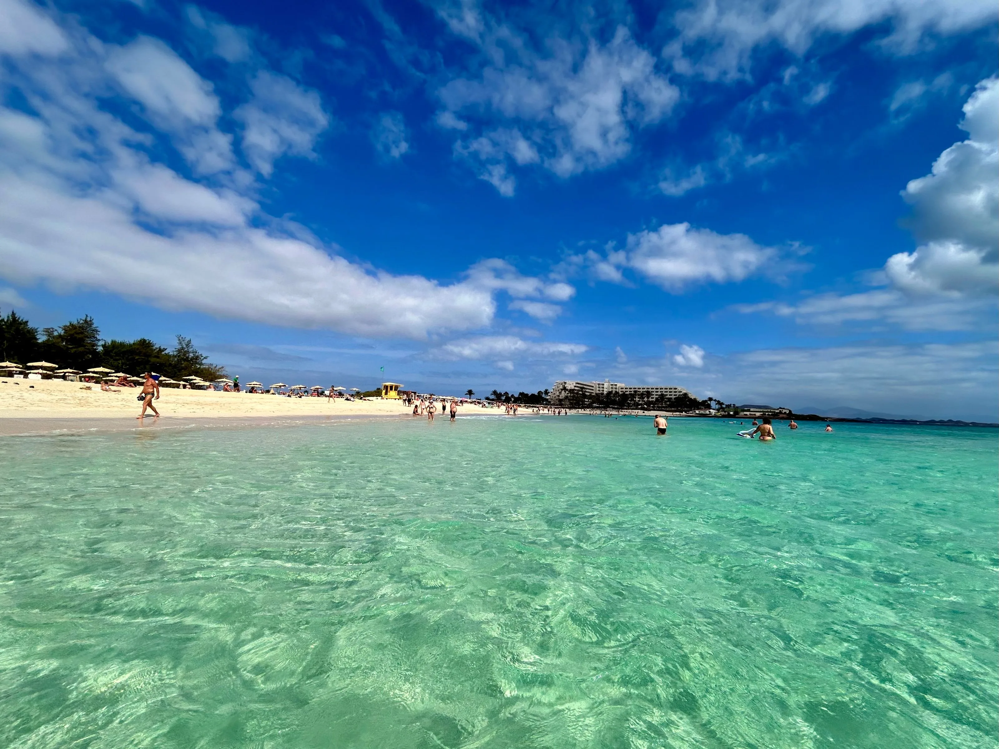
A white sand beach and turquoise water
Wikivoyage (DE) notes that you can almost choose the colour of your beach, from white to yellow to black, and even the strength of the waves: some places are very calm, others too rough for swimming. The turquoise shallows in the photo show the calm side of the island.
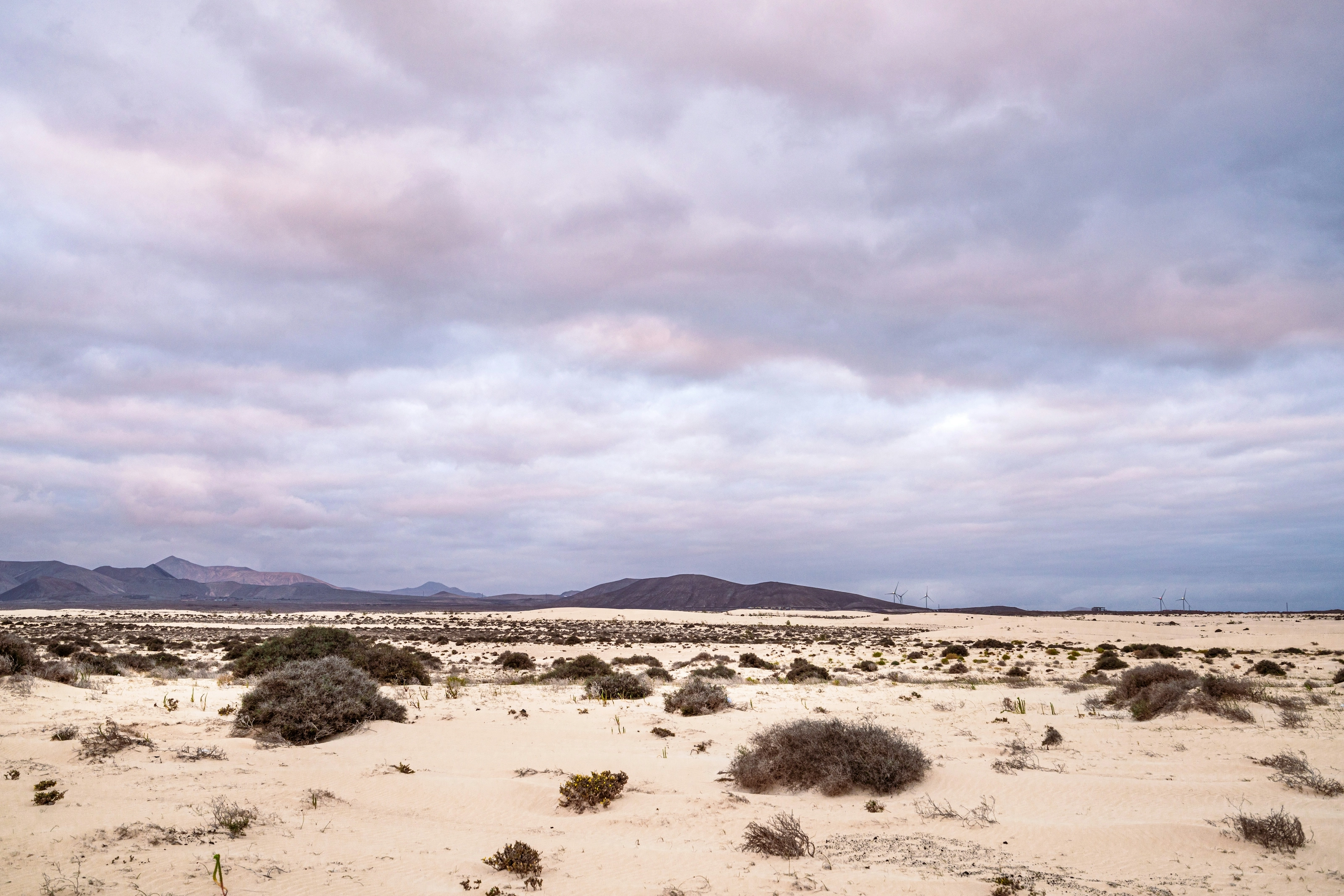
The dunes and the wind turbines
In the north, the Corralejo dunes form a natural park, according to Wikivoyage (ES); the access road runs beside the dunes, which are protected as far as the road separating them from the village, according to Wikivoyage (DE). The wind turbines on the horizon are a reminder that the north-east trade winds blow all year, according to Wikipedia (FR).
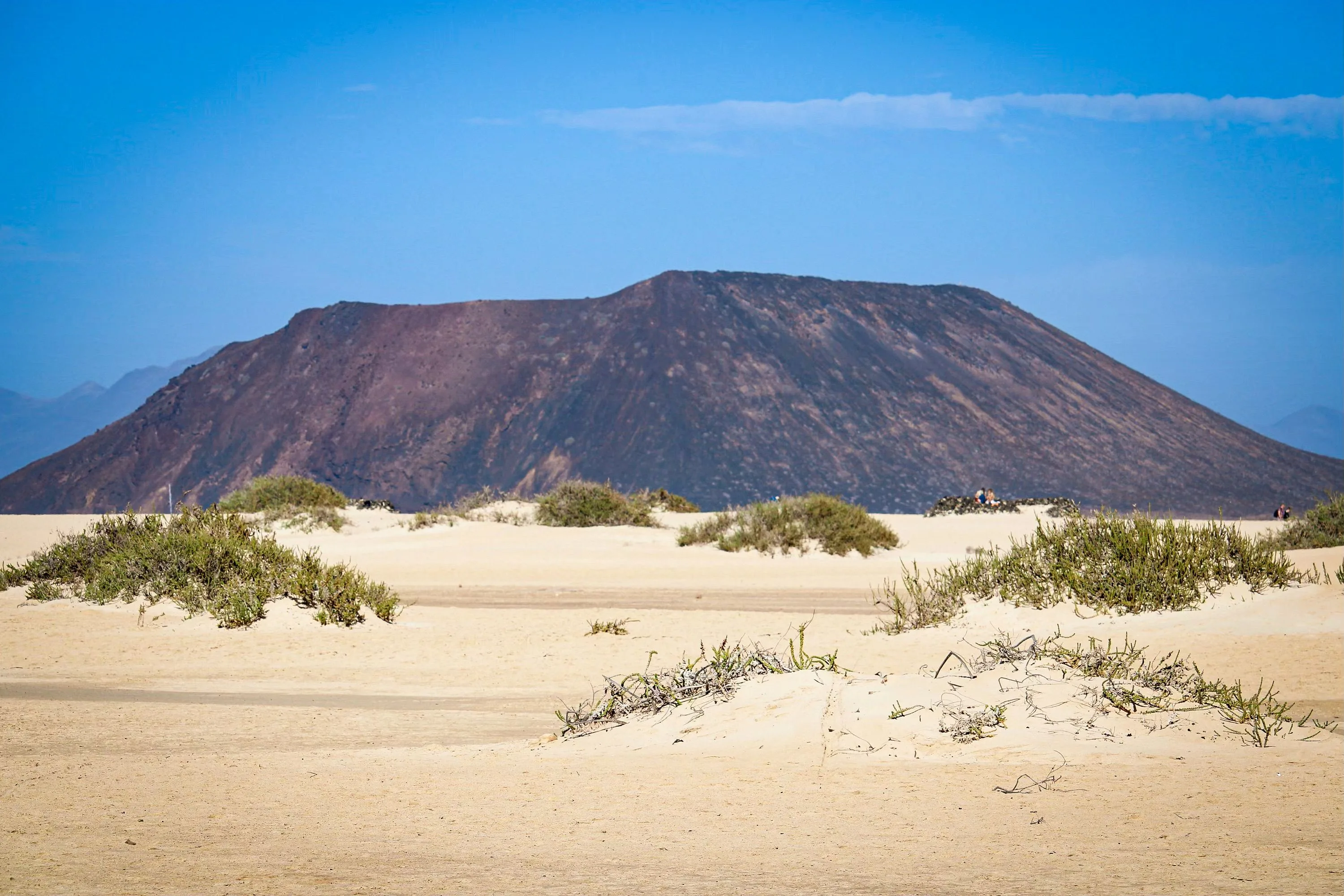
A volcanic cone beyond the dunes
The volcanoes of the north, between Lajares and Corralejo, include Calderon Hondo (278 m), the best preserved, as well as Montana Colorada and Bayuyo, according to Wikipedia (FR). The small island of Lobos, less than 2 km to the north-east, belongs to Fuerteventura and is reached by boat from Corralejo, according to Wikipedia (ES) and Wikivoyage (ES).
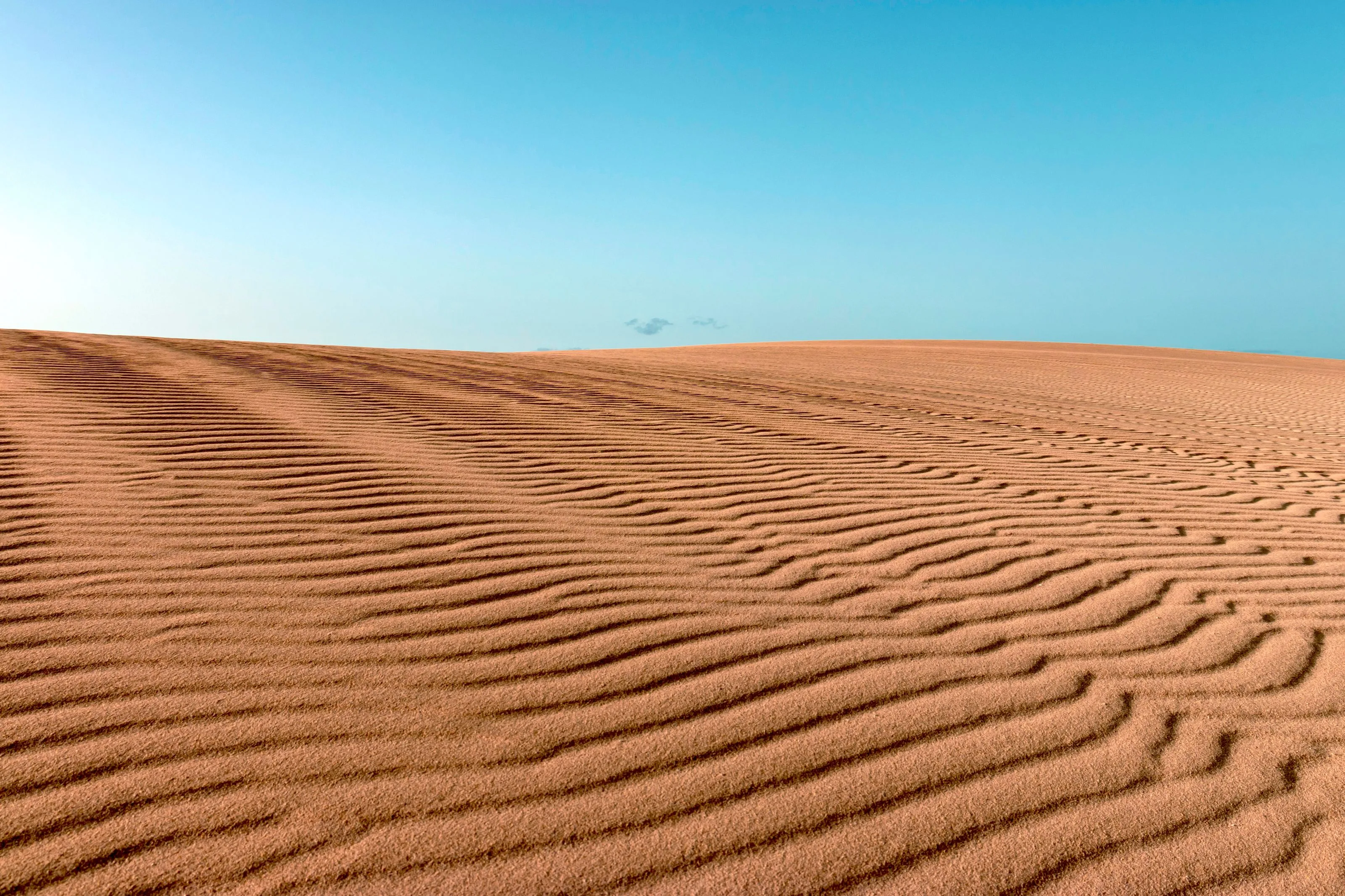
Sand ripples as far as the eye can see
The fine sand dunes invite long walks. Wikipedia (FR) explains that the landscape of dunes and desert is partly due to the chergui, a very hot Saharan wind, which also brings the calima, a haze of dust.
The north: Corralejo, Lobos and El Cotillo
Corralejo, a former fishing village turned resort, is the departure point for the catamaran to Lanzarote, which takes 12 minutes according to Wikivoyage (DE), and for boats to the islet of Lobos, whose circular walk takes more than three hours. El Cotillo, a former fishing village with a fortress, can also be visited from Corralejo.
The south: Jandia and Cofete
In Jandia, the beach at Morro Jable stretches far to the east; Costa Calma, quiet and popular with Germans, is a windsurfing and kitesurfing spot, according to Wikivoyage (DE). The Pico de la Zarza, the island's highest point, shelters these resorts from the wind. Cofete is among the best beaches listed by Wikipedia (EN).
Museums and culture
First capitals, Guanche kingdoms and fortresses
Betancuria, the first capital
Betancuria was founded in 1404 by Jean de Bethencourt and Gadifer de La Salle as the island's first settlement, then chosen as capital in 1405, according to Wikipedia (EN). Wikivoyage (DE) presents it as an excursion destination, together with the villages of Valles de Santa Ines and Vega de Rio Palmas.
Guanche kingdoms and the sacred mountain
Before the conquest the island was divided into two kingdoms, Maxorata in the north and Jandia in the south, separated by a wall across the isthmus of La Pared, some remains of which survive, according to Wikipedia (EN). The Montana Tindaya, 401 m, was a sacred place for the pre-Hispanic population, according to Wikipedia (FR).
Fortress and lighthouses
At El Cotillo the fortress served to watch for pirates, and an artist sometimes exhibits paintings there, according to Wikivoyage (DE). The La Entallada lighthouse is cited for its architecture by Wikipedia (ES). We do not list specific museums or prices: opening hours change.
Food and drink
Goat, majorero cheese, gofio and wrinkled potatoes
Typical dishes
Wikivoyage (ES) lists stewed goat meat, baked pejines, sancocho, majorero peas, gofio (toasted grain flour), hígado embarrado and papas arrugadas with mojo.
Majorero cheese
Majorero cheese is made from the milk of the native majorera goat and has a protected designation of origin, like the cheese of La Palma, according to Wikipedia (EN).
A singular kind of farming
On these poor soils, some growers raise tomatoes under net tents and keep goats, which come to be milked when the owner arrives, according to Wikivoyage (DE).
Getting around
Hire car, buses, ferries to Lanzarote and Lobos
Hire car
Wikivoyage (DE) recommends a hire car for more independence, for example for El Cotillo, where the roads are good and car parks plentiful. The island is about 100 km from north to south, so distances matter.
Bus
Buses from other parts of the island reach Corralejo around midday for day visitors, according to Wikivoyage (DE); the direct link between Puerto del Rosario and El Cotillo is less frequent. Check timetables.
Ferries
From Corralejo, a catamaran runs to Lanzarote every hour in 12 minutes (Wikivoyage DE), and boats serve Lobos. From Morro Jable, ferries go to Gran Canaria and Tenerife, and from Puerto del Rosario to Gran Canaria and the mainland, according to Wikivoyage (ES).
Budget and precautions
A windy island: take care at sea and with water use
Price level
Fuerteventura is a tourist island, with many recently developed resorts according to Wikipedia (EN). We do not quote figures, because we could not confirm them across two independent sources.
Currency and payment
The currency is the euro. Spain is in the Schengen area, so check the entry rules for your nationality.
Flights and precautions
SniperAir watches prices to FUE and compares them with the route's history, but it does not sell or book tickets. You can also watch Lanzarote (ACE) or Gran Canaria (LPA) for comparison. Wikivoyage (DE) warns that some beaches have waves too strong for swimming. Fresh water comes from desalination and tourists use about twice as much as residents, according to Wikipedia (EN), so use it sparingly.
When to go
A mild, dry climate swept by the trade winds
Winter (December to February)
Very mild, between 15 and 21 C, according to Wikipedia (FR). Most of the year's scarce rain falls in winter.
Spring (March to May)
Mild temperatures; the wind remains, which suits kitesurfers.
Summer (June to August)
Hot and sunny, from 20 to 30 C according to Wikipedia (FR). The trade winds cool the afternoons.
Autumn (September to November)
Still fine weather, with a risk of calima at any time: this sand haze can raise temperatures by more than ten degrees, according to Wikipedia (FR).
Annual rainfall is 147 mm according to Wikipedia (FR), and Wikipedia (ES) puts it below 200 mm over most of the island: Fuerteventura is one of the driest of the Canary Islands. We do not quote precise monthly averages, because the sources differ.
By length of stay
What to do in Fuerteventura depending on how long you stay
The essentials
A big beach, the Corralejo dunes and, weather permitting, a crossing to Lobos.
North and south
El Cotillo, Betancuria, then the beaches of Jandia and Cofete; a hire car is useful.
The whole island
Wind sports, walks, the volcanoes of the north and a ferry excursion to Lanzarote.
In pictures
Fuerteventura in pictures
You might also like
Similar destinations
FAQ
Frequently asked questions about flights to Fuerteventura
Where is Fuerteventura airport?
At El Matorral, 5 km south-west of the capital Puerto del Rosario, according to Wikipedia (EN). It serves more than 80 destinations.
When is the best time to visit Fuerteventura?
The climate is mild all year, with 15 to 21 C in winter and 20 to 30 C in summer, according to Wikipedia (FR). The trade winds blow constantly.
Do I need a hire car?
Wikivoyage (DE) recommends one for more independence. Buses link some places, but direct connections are less frequent.
Can I get to Lanzarote from Fuerteventura?
Yes: a catamaran leaves Corralejo every hour and takes 12 minutes, according to Wikivoyage (DE).
Can I swim everywhere?
No: Wikivoyage (DE) points to places where the waves are too strong for swimming. Ask locally before you go into the water.
What should I try to eat in Fuerteventura?
Stewed goat, majorero cheese, sancocho, gofio and papas arrugadas with mojo, according to Wikivoyage (ES).
How much does a flight to Fuerteventura usually cost?
The price depends mainly on your departure city, the time of year and how far ahead you book. The "opportunities" section above shows real examples of prices SniperAir has already detected to this destination.
How do I get alerted when a flight to Fuerteventura drops below my budget?
Create an alert profile with your departure airport, Fuerteventura as the destination and your maximum budget. You are notified automatically as soon as a matching price is detected.
Ready to head to Fuerteventura?
Set your budget and let SniperAir monitor fares for you.
Create my alert