
Cheap flights to Sacramento
Set your departure airport and maximum budget: SniperAir tracks prices to Sacramento and alerts you the moment a deal matching your criteria appears.
Quick summary
Country
United States
Continent
North America
Airport
SMF
Currency
US dollar (USD)
Time zone
UTC-8 (UTC-7 during summer time)
Deals already spotted to Sacramento
Real flight examples detected by SniperAir, with their reference price.
Loading examples…
Why track Sacramento with SniperAir
You don't need to compare prices every day
Choose your departure
Enter your departure airport and your maximum budget for a flight to Sacramento (SMF).
SniperAir keeps watch
Our systems continuously compare new fares with the route's real price history. SniperAir tracks prices and alerts you: it does not sell or book tickets.
You get an alert
As soon as a fare matches your criteria you are notified, without having searched for anything yourself.
Airport and getting into town
SMF, about 15 km northwest, with an express bus into town
Sacramento International Airport (SMF)
The airport is about 15 km northwest of the centre according to Wikipedia (FR) and Wikivoyage (FR, DE); Wikivoyage (EN) gives 10.5 miles (16.8 km) and about 15 minutes along Interstate 5. A SacRT express bus and the Yolobus line reach downtown according to Wikivoyage (EN, DE). Taxis and rental cars are quicker but dearer; we give no fares.
Distances and times are approximate, based on Wikivoyage and Wikipedia (EN, FR, DE, ES); timetables change, so check them before you travel. We give no fares.
Sacramento had 524,943 residents at the 2020 census according to Wikipedia (EN, FR, DE, ES). California's capital since 1854 according to Wikipedia (EN, FR, DE), it stands where the Sacramento and American rivers meet according to Wikipedia (EN, FR, DE). It is tied to the Gold Rush: gold was found at Coloma in 1848 and Sutter's Fort became a gateway for prospectors according to Wikipedia (EN, FR). Its nicknames are City of Trees, River City and Sactown according to Wikipedia (EN, FR, ES). Amtrak serves Sacramento Valley station according to Wikivoyage (DE), a convenient link from the San Francisco Bay area, about 120 km away according to Wikipedia (ES).
Landmarks and sights
Capitol, Old Sacramento, Tower Bridge and the rivers
Sacramento is largely walkable around Capitol Park, the historic district of Old Sacramento and the riverfront. Five places are illustrated; Sutter's Fort and the Stanford Mansion are described in text.
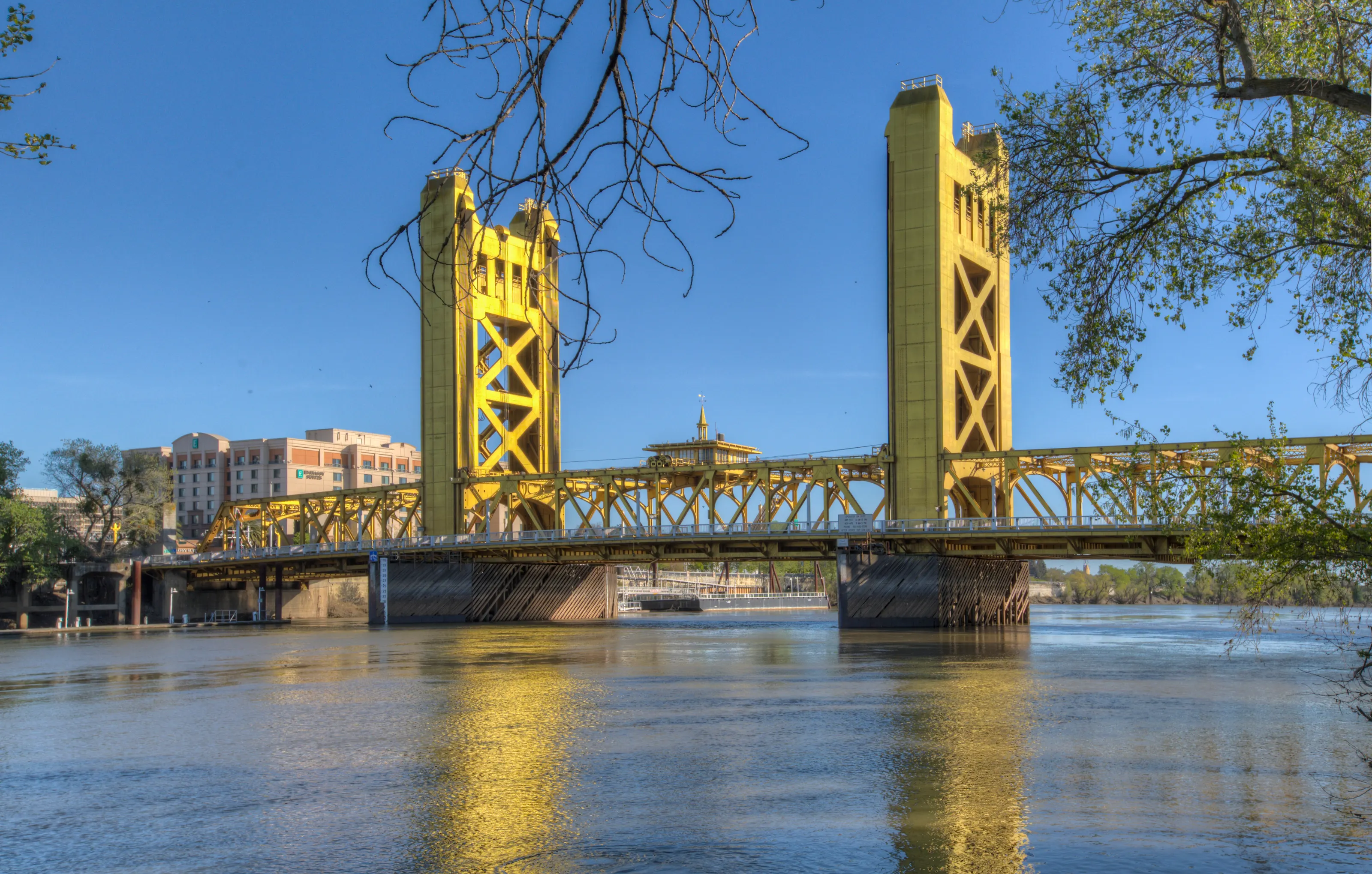
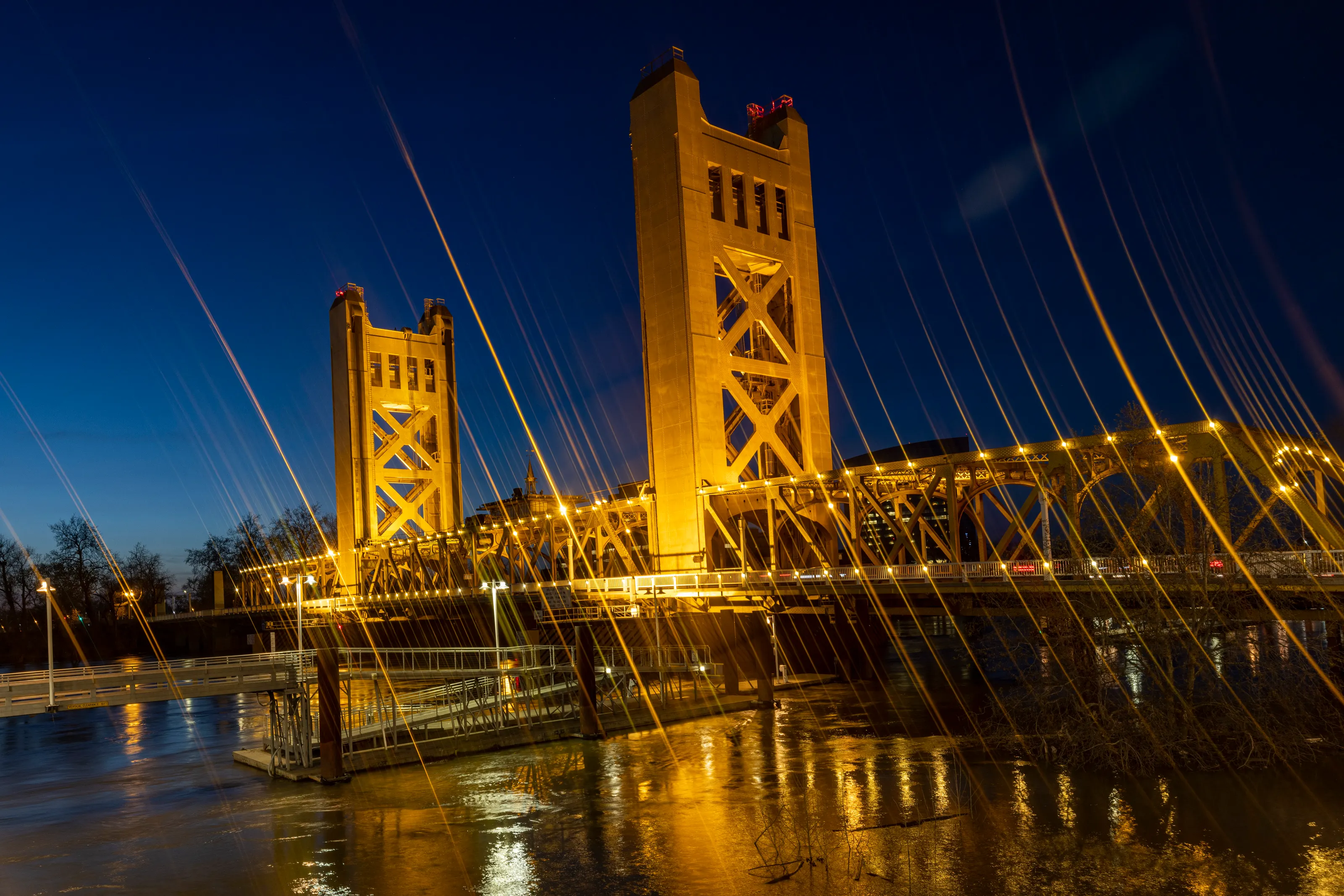
Tower Bridge
Tower Bridge, built in 1935, links Sacramento with West Sacramento according to Wikipedia (EN). Its deck lifts between two tall golden towers, and the view reaches up to the Capitol according to Wikivoyage (EN).
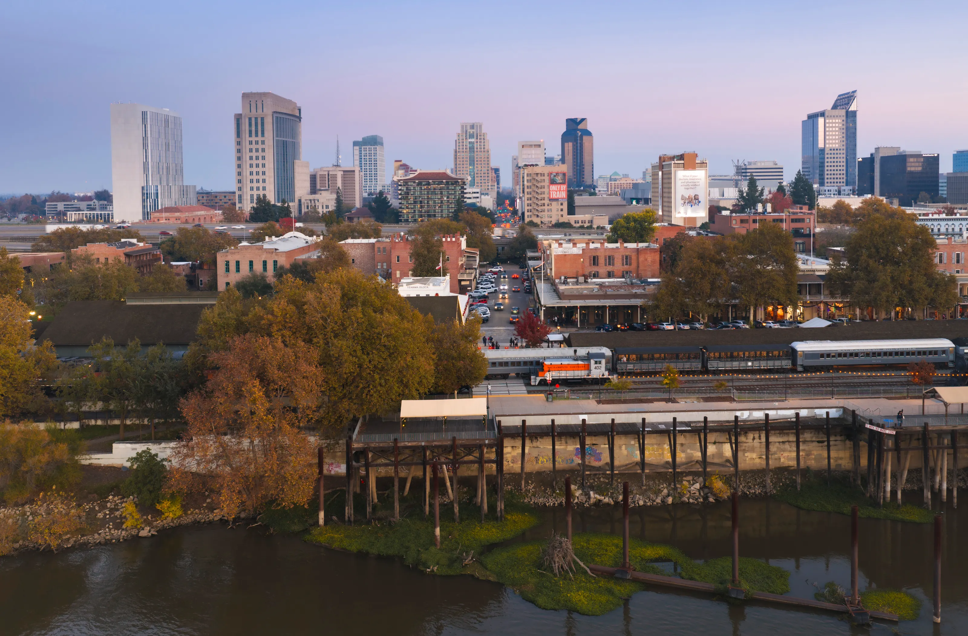
Old Sacramento and downtown at dusk
Old Sacramento, the city's oldest quarter, keeps cobbled streets and many historic buildings according to Wikipedia (EN). It was the terminus of the Pony Express mail service according to Wikipedia (FR); beyond it, the downtown towers stand out in the evening light.
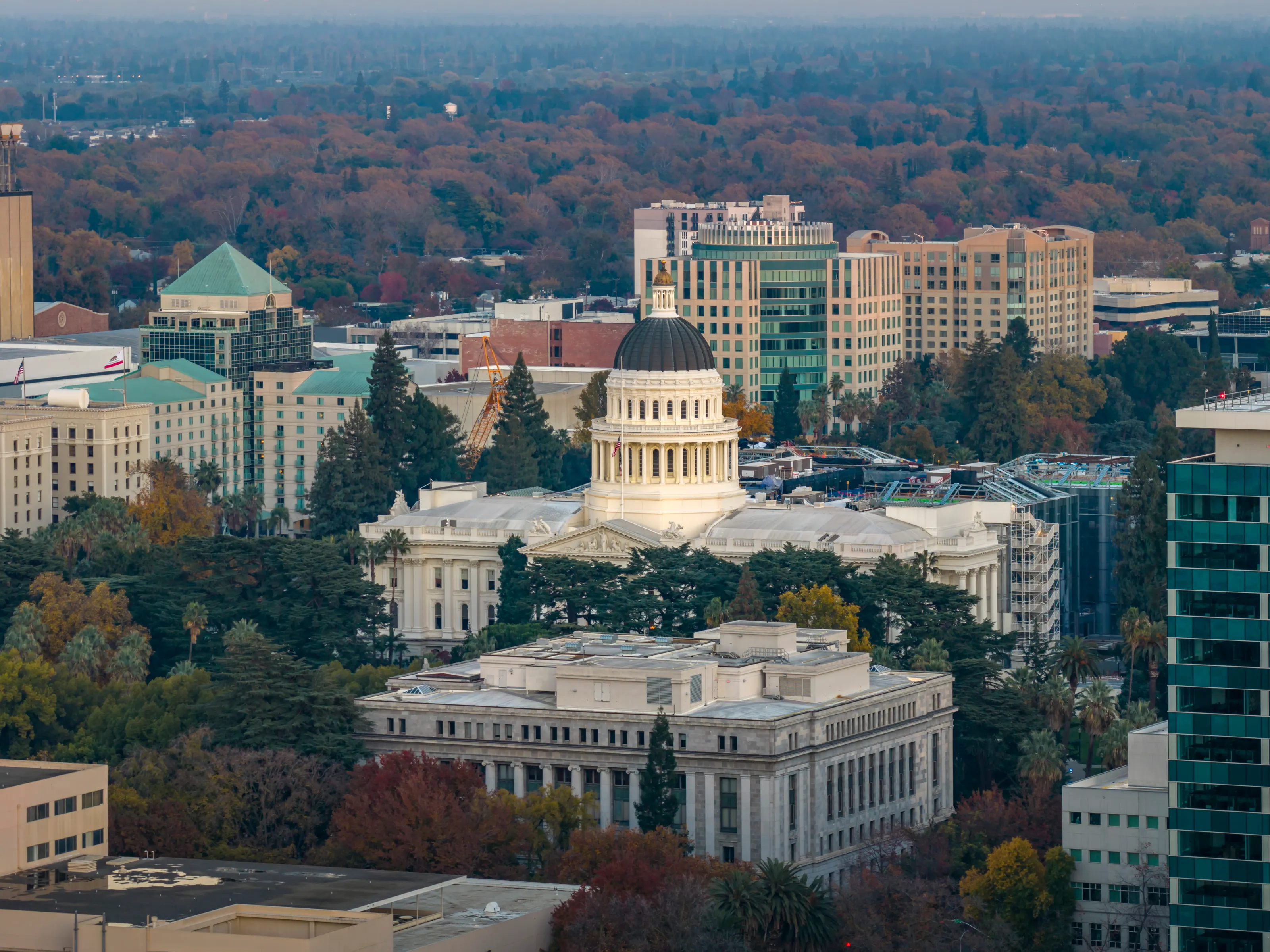
The Capitol from above
The California State Capitol, in Classical Revival style, was built in the 19th century according to Wikipedia (EN, FR, DE). It is surrounded by government buildings and Capitol Park, which is free to enter according to Wikivoyage (EN).
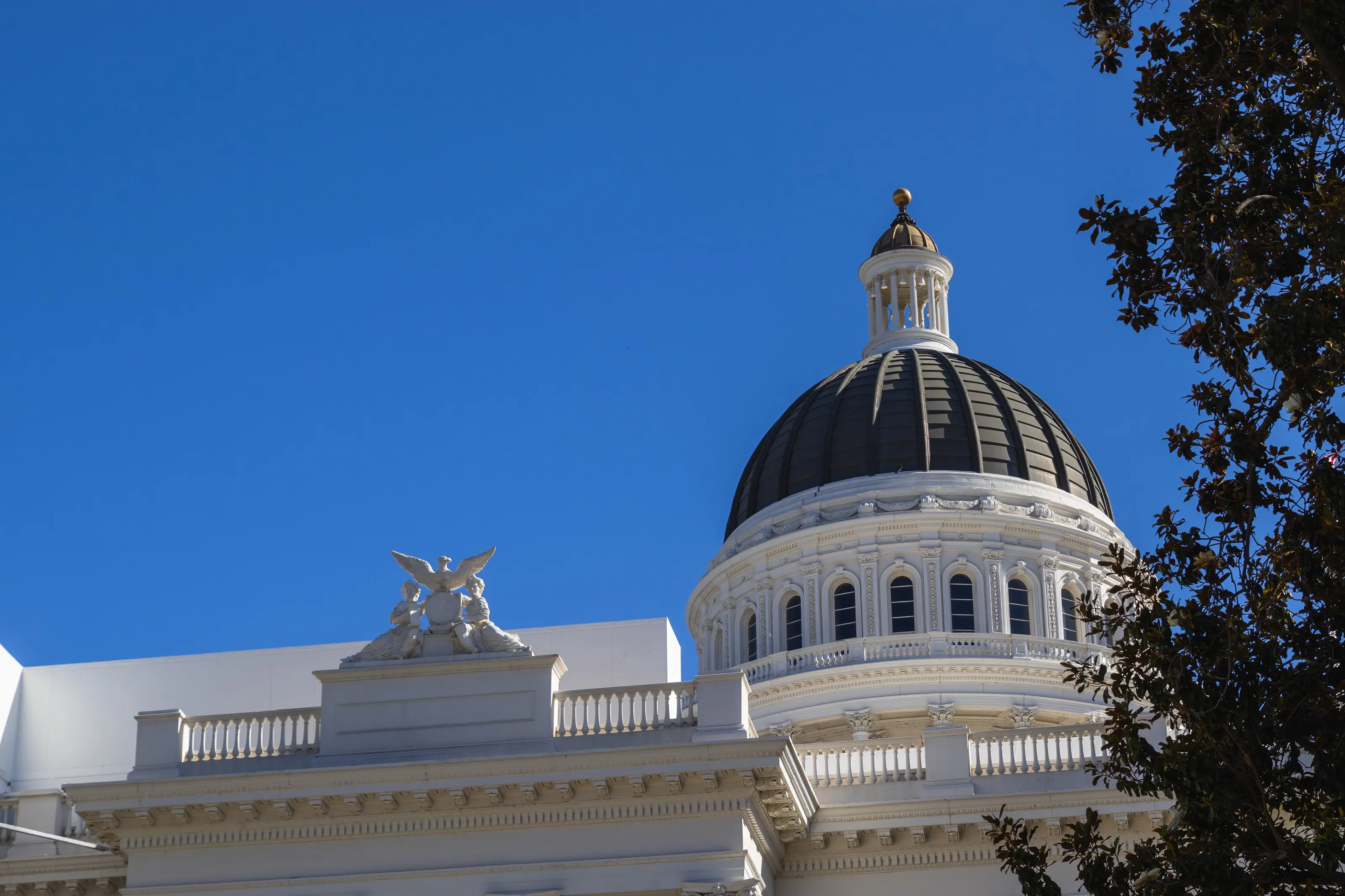
The Capitol dome
Under a blue sky, the dark dome and white colonnade of the Capitol form the city's most recognisable silhouette. The building still houses state institutions and, nearby, a museum devoted to California according to Wikipedia (FR).
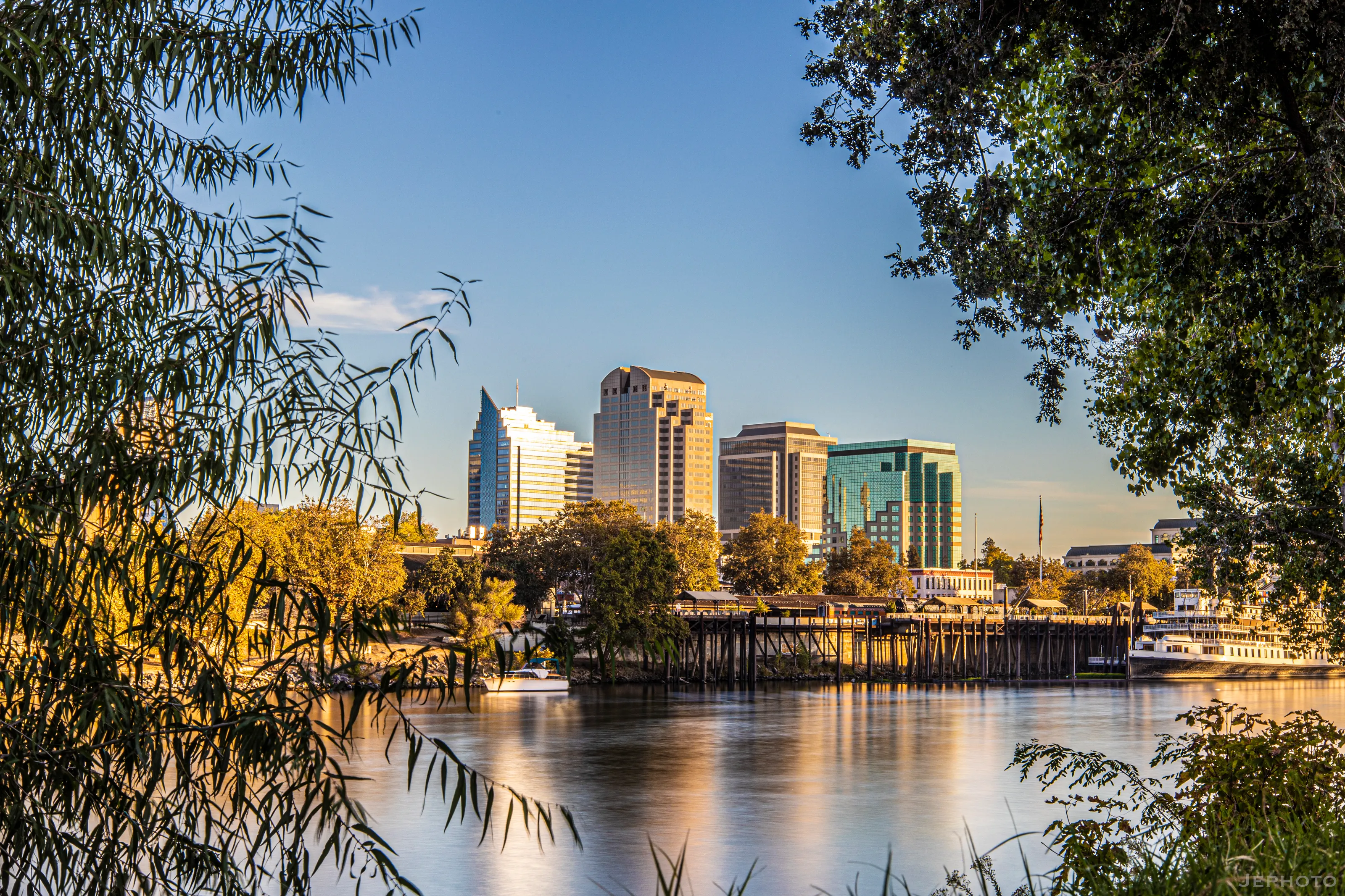
Downtown towers from the river
Sacramento spreads along the junction of two rivers, and its banks invite a stroll: the official tourism site recommends a sunset walk along the water. Office towers reflect in the river in golden light.
Sutter's Fort and the Stanford Mansion, in text
Sutter's Fort, an adobe fort built in the early 1840s by John Sutter, can still be visited according to Wikipedia (FR, ES). The Leland Stanford Mansion, a state historic park, is one of the historic sites of the centre according to Wikipedia (FR). Prices and hours change, so we give none.
Museums and culture
Railroad museum, Crocker, California history and Native cultures
California State Railroad Museum
Located in Old Sacramento, it is called one of the best railroad museums in the United States according to Wikivoyage (EN, DE). The city played a key role in the story of the first transcontinental railroad according to Wikipedia (EN, FR).
Crocker Art Museum
The Crocker Art Museum is the city's major art museum according to Wikipedia (EN, FR) and Wikivoyage (EN, DE). Other museums complete the offer: the California Museum, the California Military Museum and the Aerospace Museum of California according to Wikipedia (FR).
History and cultures
The California State Indian Museum and the Sacramento History Museum tell the story of Native peoples and of the city according to Wikivoyage (DE, FR). We give no prices: they change.
Food and drink
Farm-to-fork cooking, farmers markets and Midtown restaurants
From farm to table
Sacramento presents itself as America's farm-to-fork capital, with farm-fresh restaurants, farmers markets and home-grown breweries according to the official tourism site. The surrounding valley produces fruit, vegetables, rice and dairy according to Wikipedia (FR).
Markets
The certified farmers market offers produce, dairy, meat and crafts according to Wikivoyage (EN). Times and places vary: check before you go.
Neighbourhoods and nightlife
Midtown concentrates restaurants, bars and nightlife according to Wikivoyage (EN, DE). The historic centre and the waterfront offer tables with river views.
Getting around
Three-line light rail, buses, bikes and a car outside the centre
SacRT light rail
SacRT runs three light rail lines, Gold, Blue and Green, which share tracks downtown according to Wikivoyage (EN, DE). Wikivoyage (EN) advises buying a ticket before boarding.
Buses and bikes
The bus network is weaker away from downtown; central streets have bike lanes and a bike-share scheme according to Wikivoyage (EN).
Car and train
For most trips outside the centre a car helps according to Wikivoyage (EN). Sacramento Valley station is an Amtrak hub according to Wikivoyage (DE).
Budget and precautions
An average California price level, below coastal rates
Price level
Sacramento is generally more affordable than the big coastal California cities, with downtown hotels that vary with legislative sessions and events. The currency is the US dollar (USD). We publish no figures: sources are dated or disagree.
Flights and alerts
San Francisco (SFO), Oakland (OAK) and San Jose (SJC) are other possible gateways, but more than 100 km away. SniperAir tracks flight prices to SMF and compares them with the route's history, but it does not sell or book tickets.
Precautions
The tourist centre is lively; usual urban caution applies at night, and Wikivoyage (DE) advises avoiding some northern districts. In summer, heat calls for water and shade breaks. Foreign visitors should check US entry requirements for their nationality.
When to go
Mediterranean climate: hot dry summers, mild rainy winters
Winter (December to February)
Mild, with a December average of about 8.5 C according to Wikipedia (EN); rain and dense fog return according to Wikivoyage (EN), and snow is almost absent according to Wikipedia (FR).
Spring (March to May)
Dry sunny days return by mid-April according to Wikivoyage (EN); a pleasant season to walk along the rivers.
Summer (June to August)
Hot and dry: July highs of about 34 C according to Wikipedia (FR, DE) and Wikivoyage (EN), with peaks up to 39 C; a delta breeze blows in late afternoon according to Wikivoyage (EN).
Autumn (September to November)
Dry, sunny days until mid-October according to Wikivoyage (EN), then rain gradually returns; the trees around the Capitol take on colour.
Sacramento has a hot-summer Mediterranean climate according to Wikipedia (EN, FR), with about 460 mm of rain a year according to Wikipedia (EN, FR, ES). To walk without the heat, aim for spring and autumn; summer calls for shade breaks.
By length of stay
What to do in Sacramento by length of stay
The essentials
Visit Capitol Park, Old Sacramento and the railroad museum, then watch Tower Bridge at sunset.
Culture and discoveries
Add the Crocker Art Museum, a farm-to-fork lunch in Midtown and a walk along the river.
Going further
Take time for Sutter's Fort, a local history museum and an excursion to San Francisco, about 120 km away.
In pictures
Sacramento in pictures
You might also like
Similar destinations
FAQ
Frequently asked questions about flights to Sacramento
How do I get from SMF airport to downtown Sacramento?
The airport is about 15 km northwest, around 15 minutes along Interstate 5 according to Wikivoyage (EN). A SacRT express bus and the Yolobus line serve downtown according to Wikivoyage (EN, DE).
When is the best time to visit Sacramento?
Spring and autumn are pleasant. Summer is hot and dry, with highs of about 34 C according to Wikipedia (FR, DE); winter is mild and rainy.
What should I see in Sacramento?
The Capitol and its park, Old Sacramento, the railroad museum, the Crocker Art Museum and Tower Bridge according to Wikipedia (EN, FR) and Wikivoyage (EN, DE).
What should I eat in Sacramento?
Farm-to-fork cooking, farmers markets and local breweries according to the official tourism site; Midtown concentrates restaurants according to Wikivoyage (EN, DE).
Can I get around Sacramento without a car?
In the centre, yes: SacRT has three light rail lines and central streets have bike lanes according to Wikivoyage (EN). Outside the centre a car helps.
How long should I stay in Sacramento?
Two days cover the Capitol, Old Sacramento, the railroad museum and Tower Bridge; add a day for the Crocker and Midtown, or an excursion to San Francisco.
How much does a flight to Sacramento usually cost?
The price depends mostly on your departure city, the season and how early you book. The opportunities section above shows real examples of fares SniperAir has already detected to this destination.
How do I get alerted when a flight to Sacramento drops below my budget?
Create an alert profile with your departure airport, Sacramento as the destination and your maximum budget. You are notified automatically as soon as a matching fare is detected.
Ready to head to Sacramento?
Set your budget and let SniperAir monitor fares for you.
Create my alert