
Cheap flights to Santa Barbara
Set your departure airport and maximum budget: SniperAir tracks prices to Santa Barbara and alerts you the moment a deal matching your criteria appears.
Quick summary
Country
United States
Continent
North America
Airport
SBA
Currency
US dollar (USD)
Time zone
UTC-8 (UTC-7 during summer time)
Deals already spotted to Santa Barbara
Real flight examples detected by SniperAir, with their reference price.
Loading examples…
Why track Santa Barbara with SniperAir
You don't need to compare prices every day
Choose your departure
Enter your departure airport and your maximum budget for a flight to Santa Barbara (SBA).
SniperAir keeps watch
Our systems continuously compare new fares with the route's real price history. SniperAir tracks prices and alerts you: it does not sell or book tickets.
You get an alert
As soon as a fare matches your criteria you are notified, without having searched for anything yourself.
Airport and getting into town
SBA, a small airport in Goleta, 11 km from downtown
Santa Barbara Municipal Airport (SBA)
Santa Barbara's airport is in Goleta, about 11 km west of downtown according to Wikivoyage (EN) and Wikipedia (FR). Wikivoyage (EN) lists direct links to several western and Midwestern cities and a route 11 bus to downtown. The airport is small and flights are often pricey according to Wikipedia (FR): many travellers fly into Los Angeles (LAX), about two hours away by road, and take a shuttle such as the Santa Barbara Airbus according to Wikivoyage (DE, EN). We give no exact times or fares.
Distances and times are approximate, based on Wikivoyage and Wikipedia (EN, FR, DE, ES); timetables change, so check them before you travel. We give no fares.
Santa Barbara had 88,665 residents at the 2020 census according to Wikipedia (FR, DE, ES). It lies about 140 km northwest of Los Angeles according to Wikipedia (FR, ES), between the Santa Ynez Mountains and the Santa Barbara Channel according to Wikipedia (DE). Its Mediterranean climate and red-tiled roofs have earned it the nickname American Riviera according to Wikipedia (FR, DE). The Pacific coast here faces south rather than west, which explains the orientation of the beaches according to Wikivoyage (EN).
Landmarks and sights
Courthouse, mission, wharf and American Riviera beaches
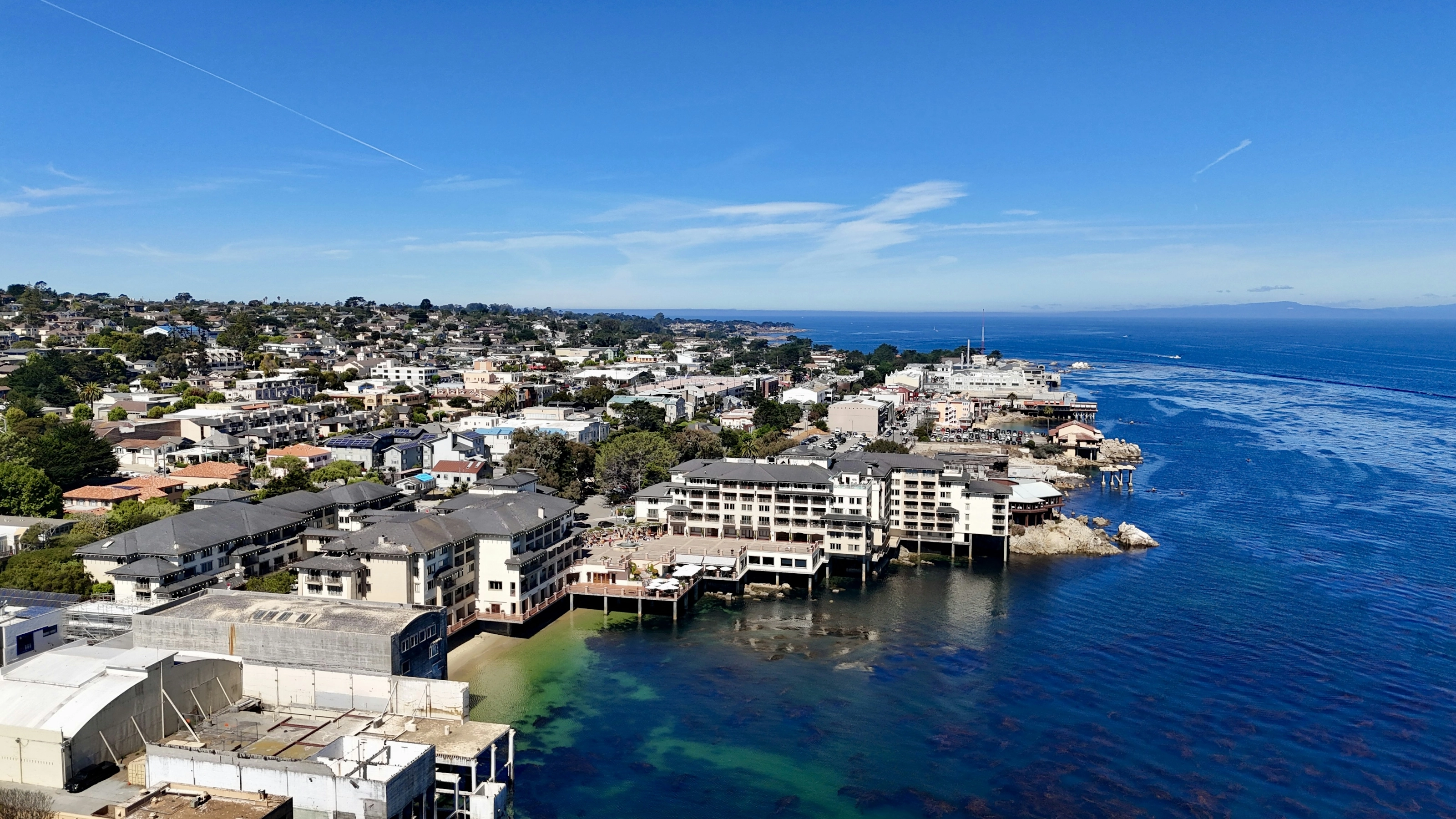
Santa Barbara is about sea, mission and Hispanic architecture. Six pictures illustrate the city; the waterfront, wine country and gardens are described in text.
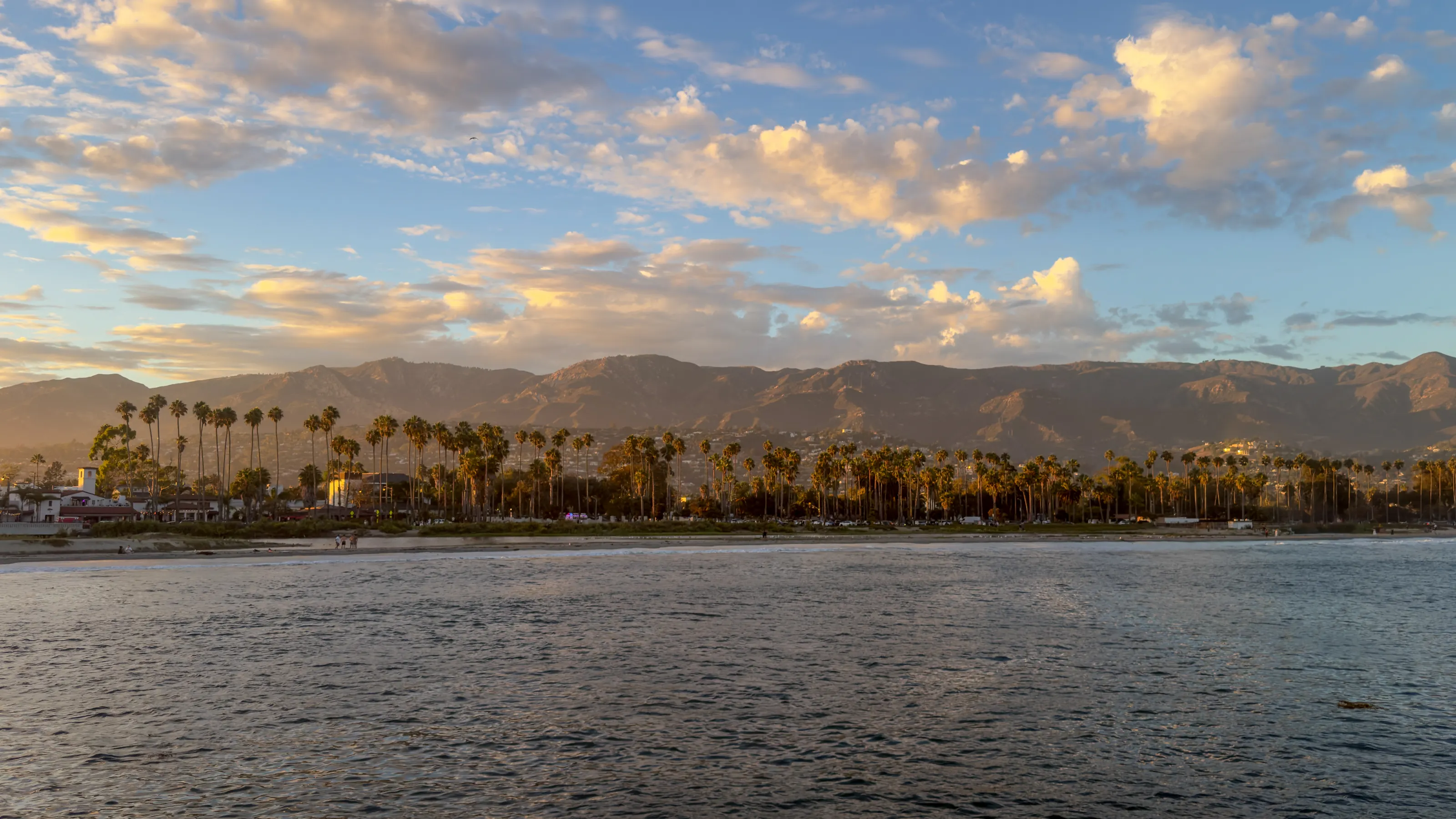
The coast at sunset
The city spreads between the Santa Barbara Channel and the Santa Ynez Mountains according to Wikipedia (DE); some peaks exceed 1,200 m according to Wikipedia (ES). The shoreline is lined with sandy beaches and palm trees according to Wikipedia (FR).
The harbour and the sea
The harbour is the departure point for boat trips according to Wikipedia (DE), notably whale watching: the channel is a migration route for grey whales according to the same source. A walkway runs along the pier and the breakwater according to Wikivoyage (EN).
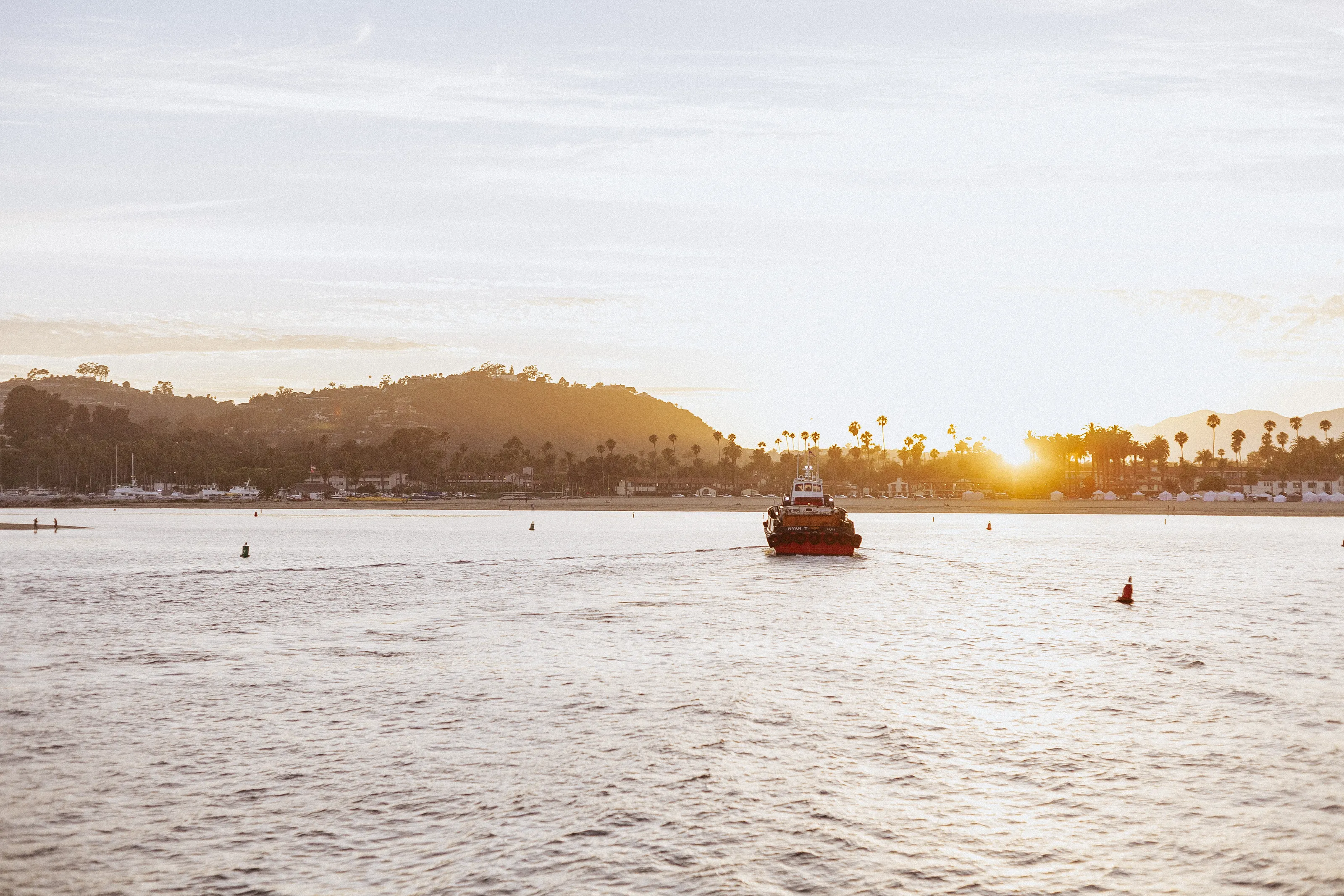
The county courthouse
The county courthouse, in Spanish-Moorish style, was completed in 1929 according to Wikipedia (DE) and Wikivoyage (EN, FR). Because the 1925 earthquake destroyed much of the city according to Wikipedia (EN, FR), the rebuilding imposed a unified style. From the El Mirador tower the view reaches the mountains and the ocean according to Wikivoyage (FR).
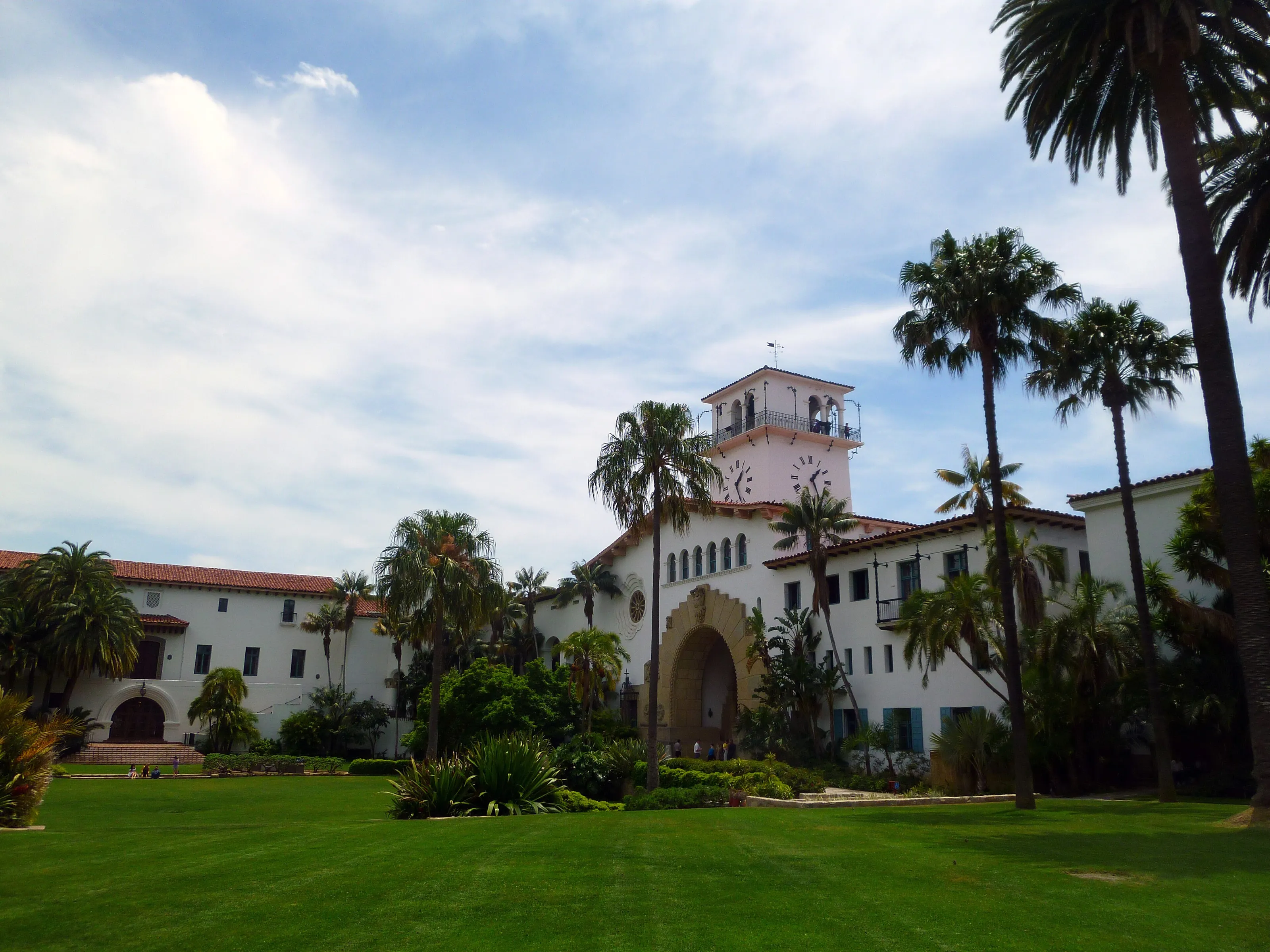
Mission Santa Barbara
Founded in 1786, Mission Santa Barbara is the tenth California mission, nicknamed the Queen of the Missions according to Wikipedia (DE) and Wikivoyage (EN). It is the only one with twin bell towers according to Wikivoyage (EN) and remains an active church according to the same source. The mission holds the archives of all the California missions according to Wikipedia (ES).
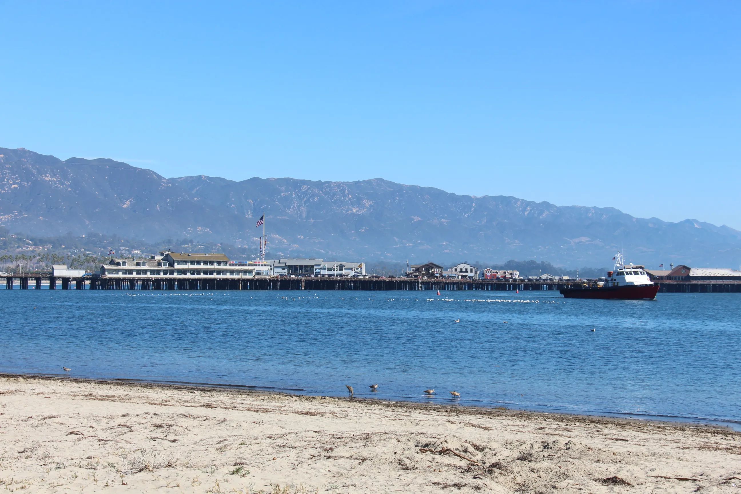
Stearns Wharf from the beach
Stearns Wharf, built in 1872, extends State Street into the ocean according to Wikipedia (EN, DE). It splits the beach into west and east according to Wikipedia (DE). Pelicans come begging there according to the same source.
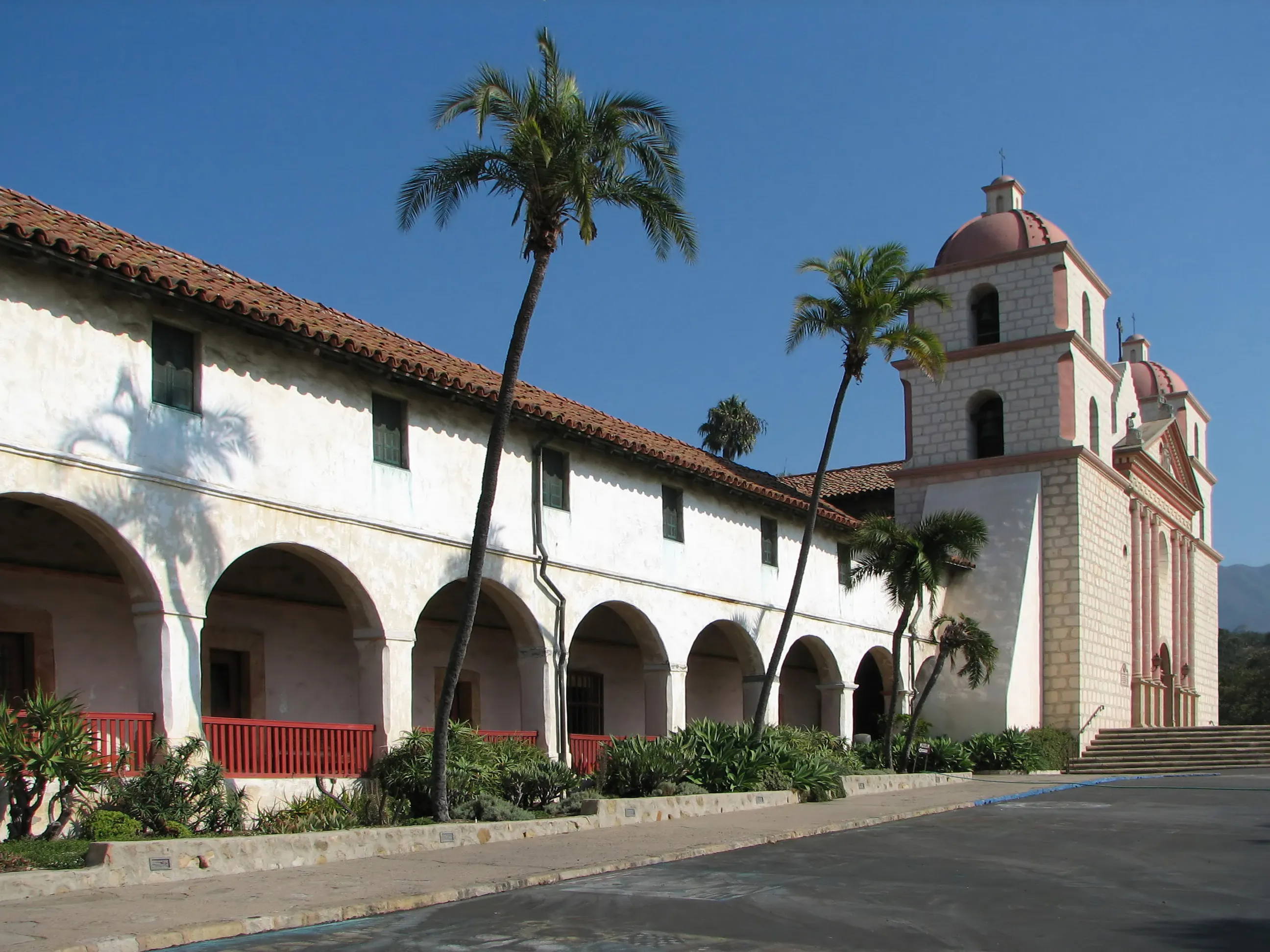
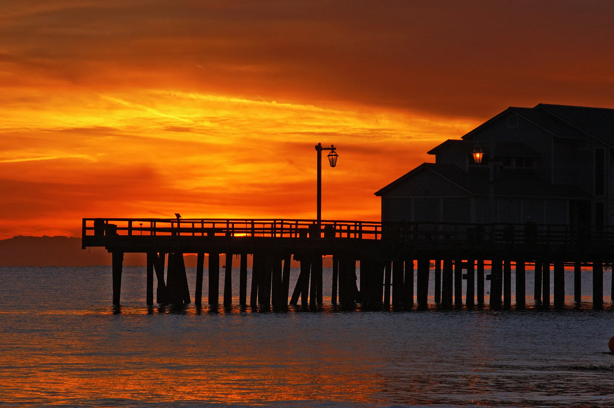
The pier at dawn
At dawn or dusk the pier stands out in silhouette against an orange sky. The waterfront bike path runs at the foot of the pier according to Wikivoyage (EN).
Funk Zone, State Street and gardens, in text
The Funk Zone, between the waterfront and Highway 101, groups wineries, breweries, art galleries and restaurants according to Wikivoyage (EN). Further up, eight blocks of State Street are reserved for pedestrians and bikes according to the same source. The botanic garden, on about twelve hectares, shows native plants and a historic dam according to Wikipedia (DE), and the zoo is known for its elephants, lions and sea lions according to the same source.
Museums and culture
Art, local history, nature and whales
Santa Barbara Museum of Art
The city's art museum has a major permanent collection according to Wikipedia (FR); Wikivoyage (EN) mentions Roman antiquities and European and modern art. Exhibitions rotate often, and we do not quote fares.
Museum of Natural History
Near the mission, the natural history museum presents the region's wildlife and prehistory, with a blue whale skeleton according to Wikivoyage (EN); Wikipedia (DE) mentions dioramas and a planetarium.
Local history and railways
The Santa Barbara Historical Museum tells of the Spanish, Mexican and American periods according to Wikipedia (DE). The Presidio, a fort founded in 1782, is now a state historic park according to the same source; a railway museum occupies a former depot of 1901.
Food and drink
California cuisine, tacos and coastal wines
California cuisine
Santa Barbara does French-inspired California cuisine well, based on local produce and fresh fish according to Wikivoyage (EN). Chefs come from far away according to the same source, and the variety is astonishing for a town this size.
Tacos and Mexican food
A large Latino population, mostly on the east side around Milpas Street, explains the profusion of taquerias and Mexican restaurants according to Wikivoyage (EN).
Wine and drinks
The Funk Zone offers wine tasting rooms and breweries according to Wikivoyage (EN); Highway 154 leads to the Los Olivos vineyards according to the same source.
Getting around
A pleasant walkable centre, buses and a car for the rest
On foot and by bike
The mild climate invites walking according to Wikivoyage (EN), especially downtown and in the Funk Zone. A bike path runs along the waterfront and much of State Street is car-free according to the same source.
Buses and shuttles
SBMTD buses serve Santa Barbara, Goleta, Montecito and Carpinteria according to Wikivoyage (EN). Shuttles run along State Street and the waterfront at regular intervals according to the same source.
Car and train
Driving is easy and parking rarely hard according to Wikivoyage (EN), except for possible mix-ups between Carrillo, Castillo and Cabrillo streets. Amtrak links Santa Barbara with Los Angeles and San Diego by the Pacific Surfliner and with the north by the Coast Starlight according to Wikipedia (FR) and Wikivoyage (EN, DE).
Budget and precautions
An expensive destination where you can still eat simply
Price level
Santa Barbara is known as a retreat for celebrities according to Wikipedia (FR), and the area is among the most expensive in the United States according to Wikipedia (DE). Wikivoyage (EN) adds a nuance: average income within the city is only slightly above the Californian average. The currency is the US dollar (USD). We do not publish figures: sources are dated or disagree.
Flights and alerts
Direct flights to SBA exist but are limited according to Wikivoyage (EN); comparing with Los Angeles (LAX) or Burbank can help. SniperAir tracks flight prices to SBA and compares them with the route's history, but it does not sell or book tickets.
Precautions
Autumn Sundowners, dry hot downslope winds, raise the wildfire risk in the foothills according to Wikipedia (EN): follow local guidance. Wikivoyage (EN) also warns that police are very strict about drunk driving. Foreign visitors should check US entry requirements for their nationality.
When to go
A very mild Mediterranean climate, with autumn winds to watch
Winter (December to February)
Mild, with highs of 17 to 21 °C on most days according to Wikipedia (EN); it is the rainy season according to Wikipedia (FR).
Spring (March to May)
Pleasant and green; whale-watching trips run from 1 May according to Wikipedia (FR).
Summer (June to August)
Warm without excess: highs of 22 to 29 °C on most days according to Wikipedia (EN), and very few days above 32 °C. The Old Spanish Days fiesta is held in August according to Wikipedia (EN).
Autumn (September to November)
Sundowners can push afternoon temperatures up and raise the wildfire risk according to Wikipedia (EN).
Santa Barbara has a warm-summer Mediterranean climate (Csb) according to Wikipedia (FR, EN); mildness is one of its main assets. Rainfall varies widely from year to year according to Wikipedia (EN); Wikipedia (DE) mentions about 450 mm on average. Snow is extremely rare in the city according to Wikipedia (EN).
By length of stay
What to do in Santa Barbara by length of stay
The essentials
The courthouse, State Street, the wharf and the beach.
Culture and discoveries
Add the mission, a museum, the Funk Zone and a bike ride on the waterfront.
Going further
Plan the Highway 154 wine country, a whale-watching boat trip or hikes in the Santa Ynez Mountains.
In pictures
Santa Barbara in pictures
You might also like
Similar destinations
FAQ
Frequently asked questions about flights to Santa Barbara
How do I get from SBA airport to downtown Santa Barbara?
The airport is in Goleta, about 11 km west of downtown, with a route 11 bus according to Wikivoyage (EN); taxis and rental cars are the alternatives. We give no times or fares.
When is the best time to visit Santa Barbara?
All year round, thanks to a very mild climate according to Wikipedia (FR, EN); summer is warm without excess and autumn Sundowners call for caution.
What is there to see in Santa Barbara?
The courthouse, Mission Santa Barbara, Stearns Wharf, the Funk Zone and the zoo according to Wikipedia (DE) and Wikivoyage (EN).
How far is Santa Barbara from Los Angeles?
About 140 km, roughly two hours by road according to Wikipedia (FR, ES) and Wikivoyage (DE).
What should I eat in Santa Barbara?
California cuisine with local produce, tacos and Mexican food according to Wikivoyage (EN).
How long should I stay in Santa Barbara?
Two to three days cover the centre, the mission and the waterfront; add a day for wine country.
How much does a flight to Santa Barbara usually cost?
The price depends mostly on your departure city, the season and how early you book. The opportunities section above shows real examples of fares SniperAir has already detected to this destination.
How do I get alerted when a flight to Santa Barbara drops below my budget?
Create an alert profile with your departure airport, Santa Barbara as the destination and your maximum budget. You are notified automatically as soon as a matching fare is detected.
Ready to head to Santa Barbara?
Set your budget and let SniperAir monitor fares for you.
Create my alert