
Cheap flights to Deer Lake
Set your departure airport and maximum budget: SniperAir tracks prices to Deer Lake and alerts you the moment a deal matching your criteria appears.
Quick summary
Country
Canada
Continent
North America
Airport
YDF
Currency
Canadian dollar (CAD)
Time zone
UTC-3:30 (UTC-2:30 during summer time)
Deals already spotted to Deer Lake
Real flight examples detected by SniperAir, with their reference price.
Loading examples…
Why track Deer Lake with SniperAir
You do not need to compare prices every day
Choose your departure
Enter your departure airport and your maximum budget for a flight to Deer Lake (YDF).
SniperAir keeps watch
Our systems continuously compare new fares with the route's real price history. SniperAir tracks prices and alerts you: it does not sell or book tickets.
You get an alert
As soon as a fare matches your criteria you are notified, without having searched for anything yourself.
Deer Lake is a small town in western Newfoundland, on the lake of the same name. It had 4,864 residents at the 2021 census according to Wikipedia (EN, ES). It sits at the junction of Route 1 (the Trans-Canada Highway) and Route 430 according to Wikipedia (FR) and is regarded as the gateway to the Great Northern Peninsula according to Wikipedia (FR, EN). SniperAir tracks flight prices to YDF and alerts you; it does not sell or book tickets.
This page is about Deer Lake and its role as the gateway to Gros Morne National Park, a UNESCO World Heritage Site since 1987 according to Wikipedia (EN, FR, DE) and the UNESCO website. Wikipedia (EN) calls it the closest major community to the park. The name comes from the caribou once seen crossing the lake, which the first Europeans called 'deer' according to Wikipedia (EN, FR).
A general reminder: official travel advice differs by country of departure and can change, so check your own government's advice before setting an alert and again before booking. Foreign visitors should also check Canadian entry requirements for their nationality. Coastal weather can change quickly, even in summer.
Airport and getting into town
YDF, the airport of western Newfoundland, and the road to Gros Morne
Deer Lake Regional Airport (YDF)
The airport lies about 5.6 km (3.5 miles) north-northeast of the town according to Wikipedia (EN). It is the second busiest airport in Newfoundland and Labrador after St. John's according to Wikipedia (EN), and the closest to Gros Morne National Park and Corner Brook according to Wikipedia (EN). Wikipedia (EN) and Wikivoyage (EN) cite links to Toronto, Halifax, Montreal and St. John's, some seasonal. Routes change, so we do not list them and publish no fares.
Distance is approximate. We publish no transfer time and no fares. None of our sources lists a direct flight from Europe to YDF: in practice you connect within Canada, for example through Toronto (YYZ), Montreal (YUL) or Halifax (YHZ).
Wikivoyage (EN) puts the airport 35 km from the southern boundary of the park and allows about an hour by road to the park; Wikipedia (FR) says roughly thirty kilometres. Routes 430 and 431 lead to the park according to Wikipedia (FR). Car rental firms operate at the airport according to Wikivoyage (EN).
You can also come by road: Wikivoyage (EN) cites the ferry between North Sydney, Nova Scotia, and Port aux Basques, then about 300 km of driving to the south of the park. For your alerts, also watch flights to Halifax (YHZ) or St. John's (YYT): the outcome can differ.
Landmarks and sights
A freshwater fjord, the Tablelands and western Newfoundland's coast
Deer Lake is best seen as the starting point for Gros Morne National Park and its landscapes. Six images illustrate the area; other places are described in text.
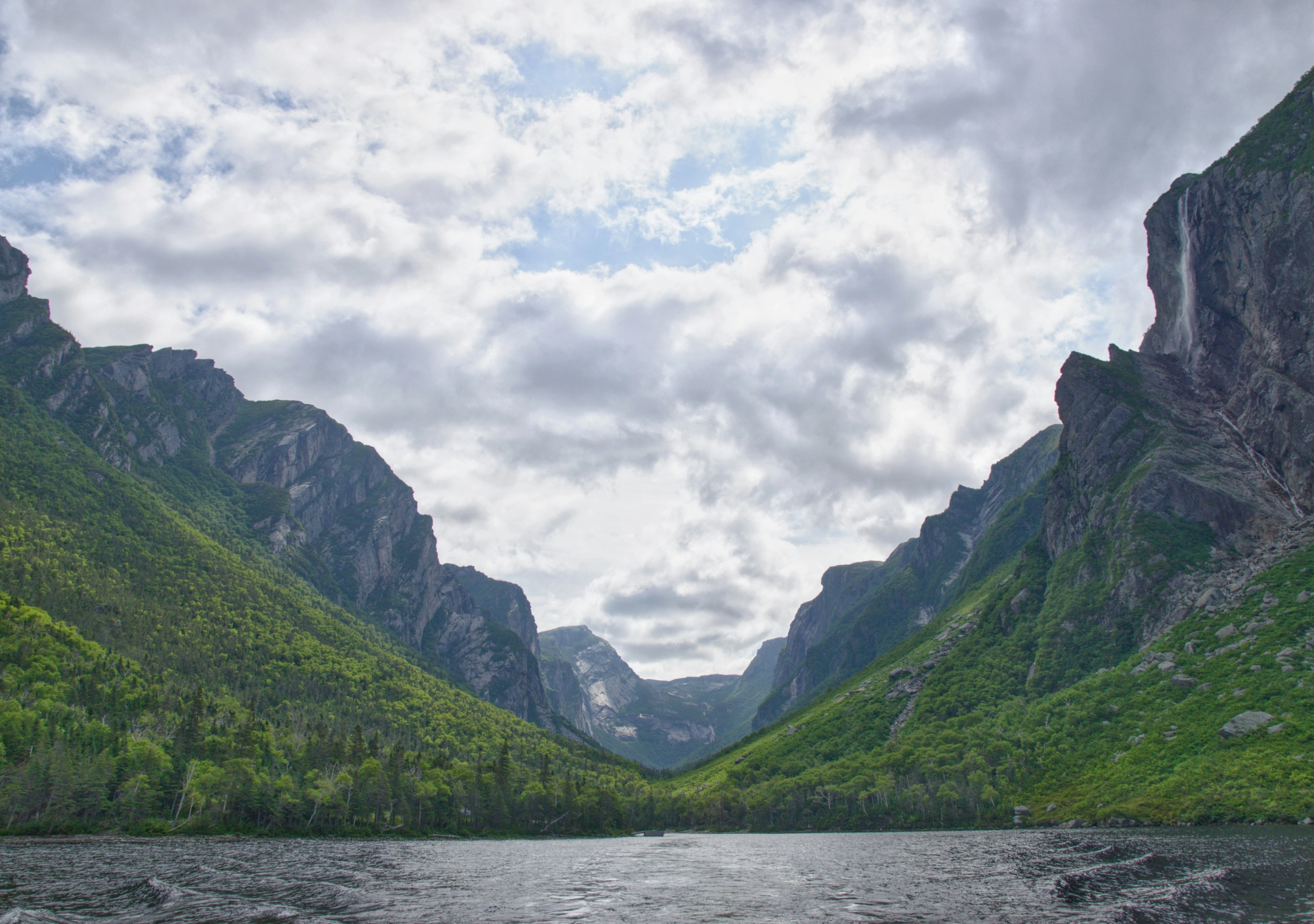
Western Brook Pond, a freshwater fjord
Parks Canada presents Western Brook Pond as a glacier-carved freshwater fjord framed by cliffs and waterfalls, best seen on a boat tour. Wikipedia (DE) describes it as a former fjord cut off from the sea after the ice melted. This view shows a fjord enclosed between two cliffs, with a thin ribbon of water on the right.
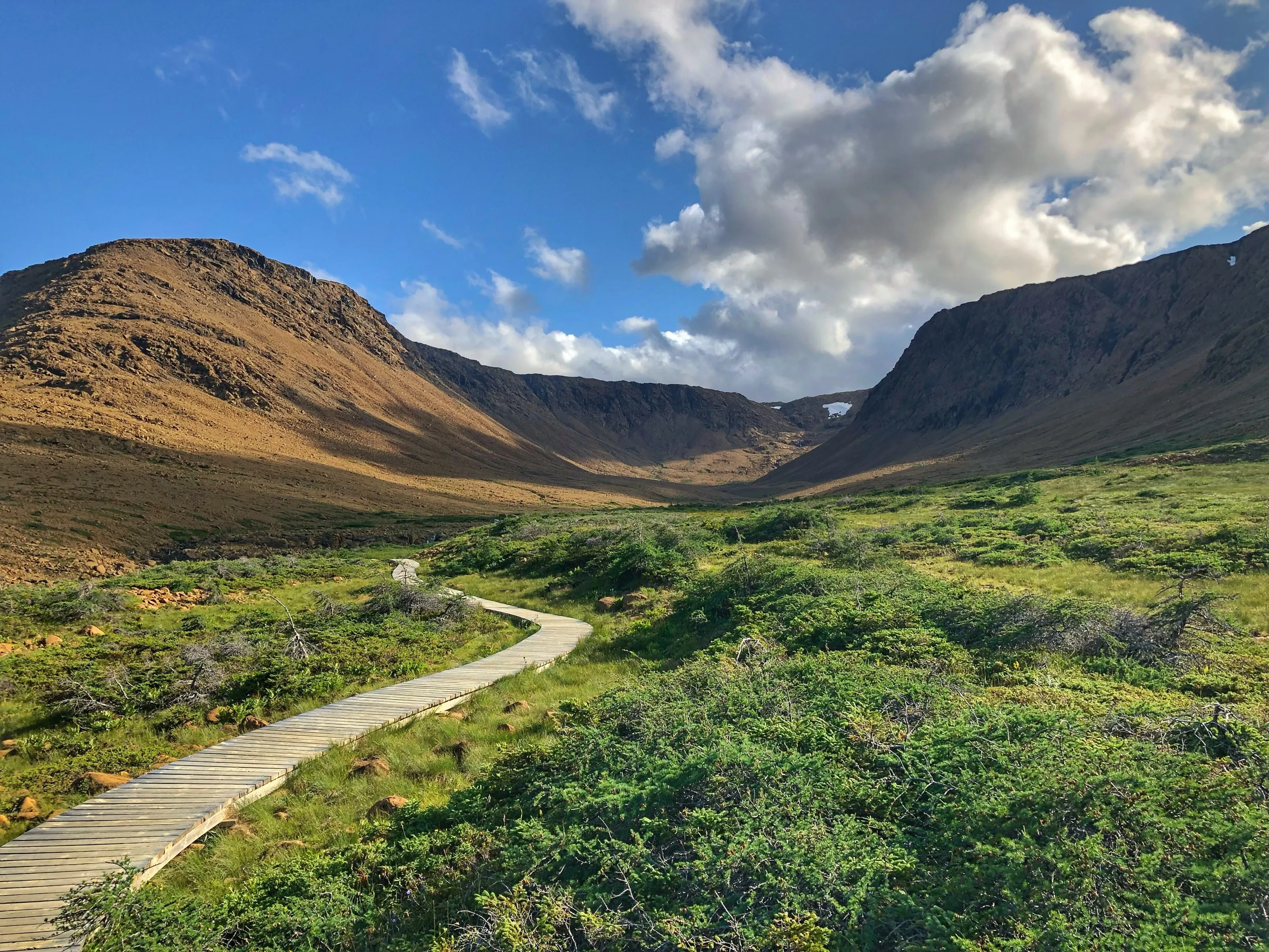
The Tablelands
The Tablelands are a rare outcrop of rock from the Earth's mantle according to Parks Canada and Wikipedia (EN, DE): their barren, ochre look contrasts with the green of the rest of the island. This view shows a wooden boardwalk in the valley. They lie between Trout River and Woody Point according to Wikipedia (EN).
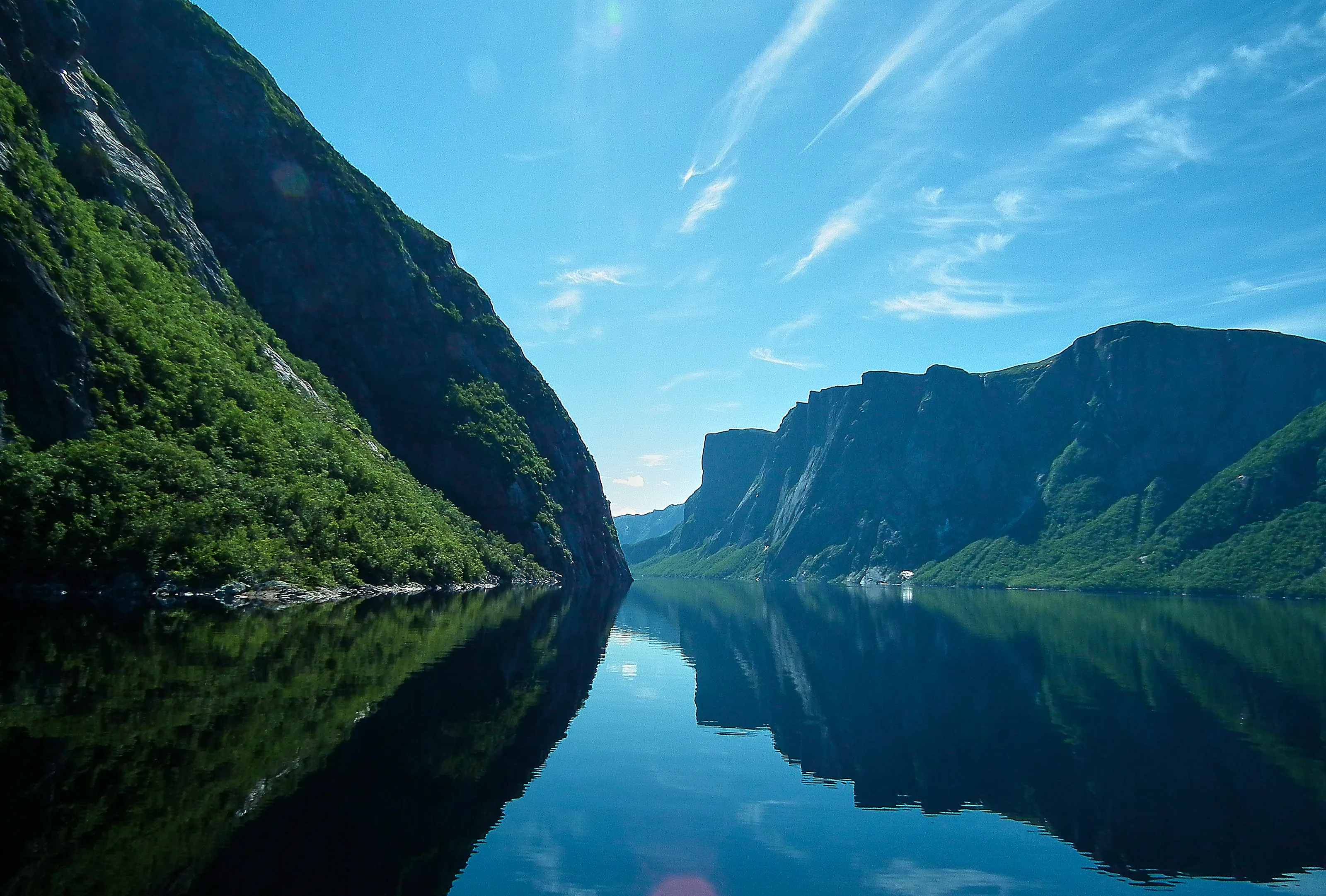
The fjord's cliffs
This view shows the very calm water of Western Brook Pond according to the image description on Wikimedia Commons, mirroring a green cliff and a large plateau. The park covers 1,805 km² according to Wikipedia (EN, FR, DE) and UNESCO (180,500 ha), and protects a rare example of continental drift.
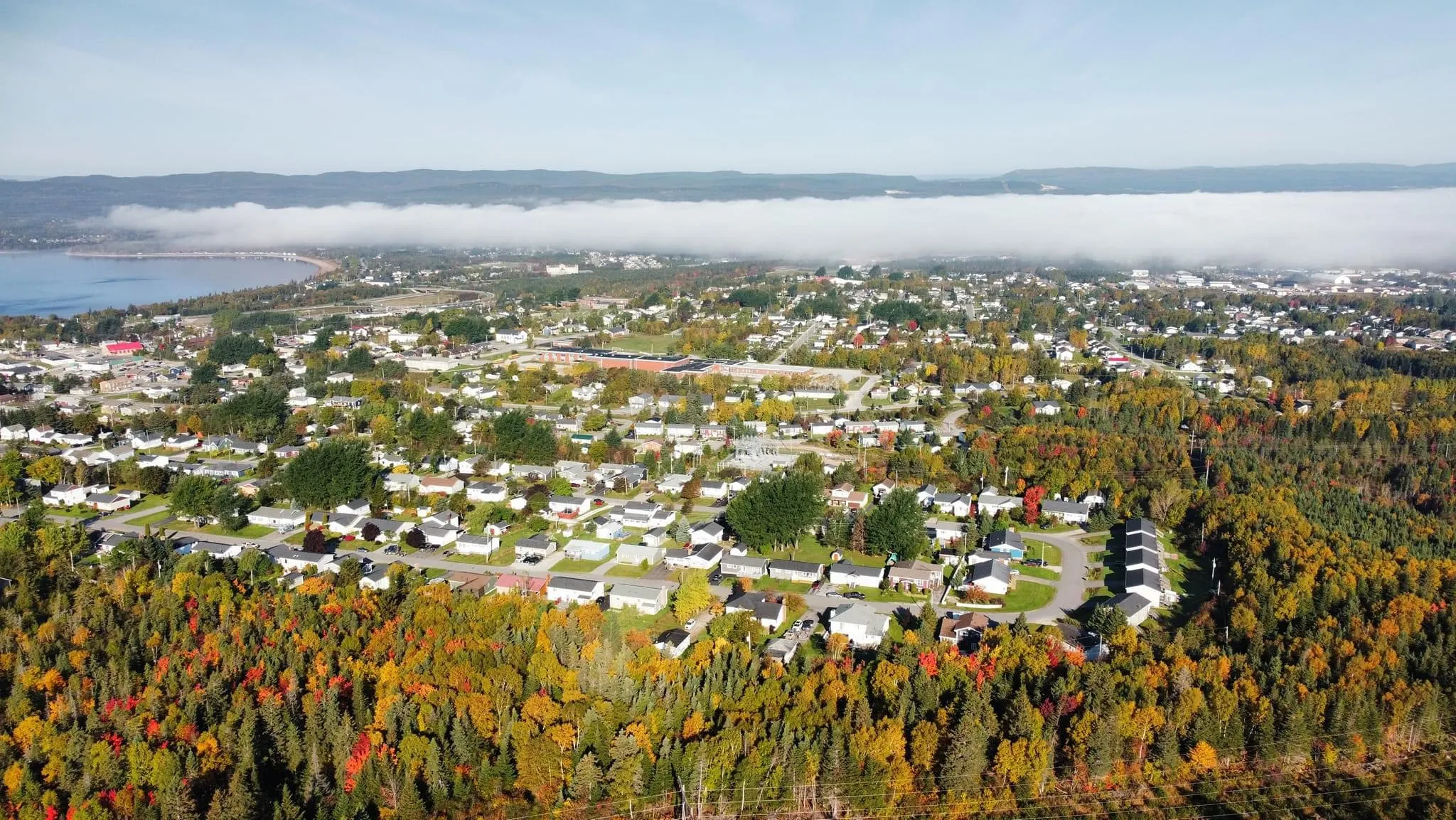
Deer Lake from above
This aerial view shows the town in autumn, surrounded by forest. The town sits at the outlet of the upper Humber River, at the north-eastern end of the lake according to Wikipedia (EN). Wikipedia (EN) also cites a wooden church and two trail systems: the Deer Lake Beach Trail and the Humber River Nature Trail.
Deer Lake itself
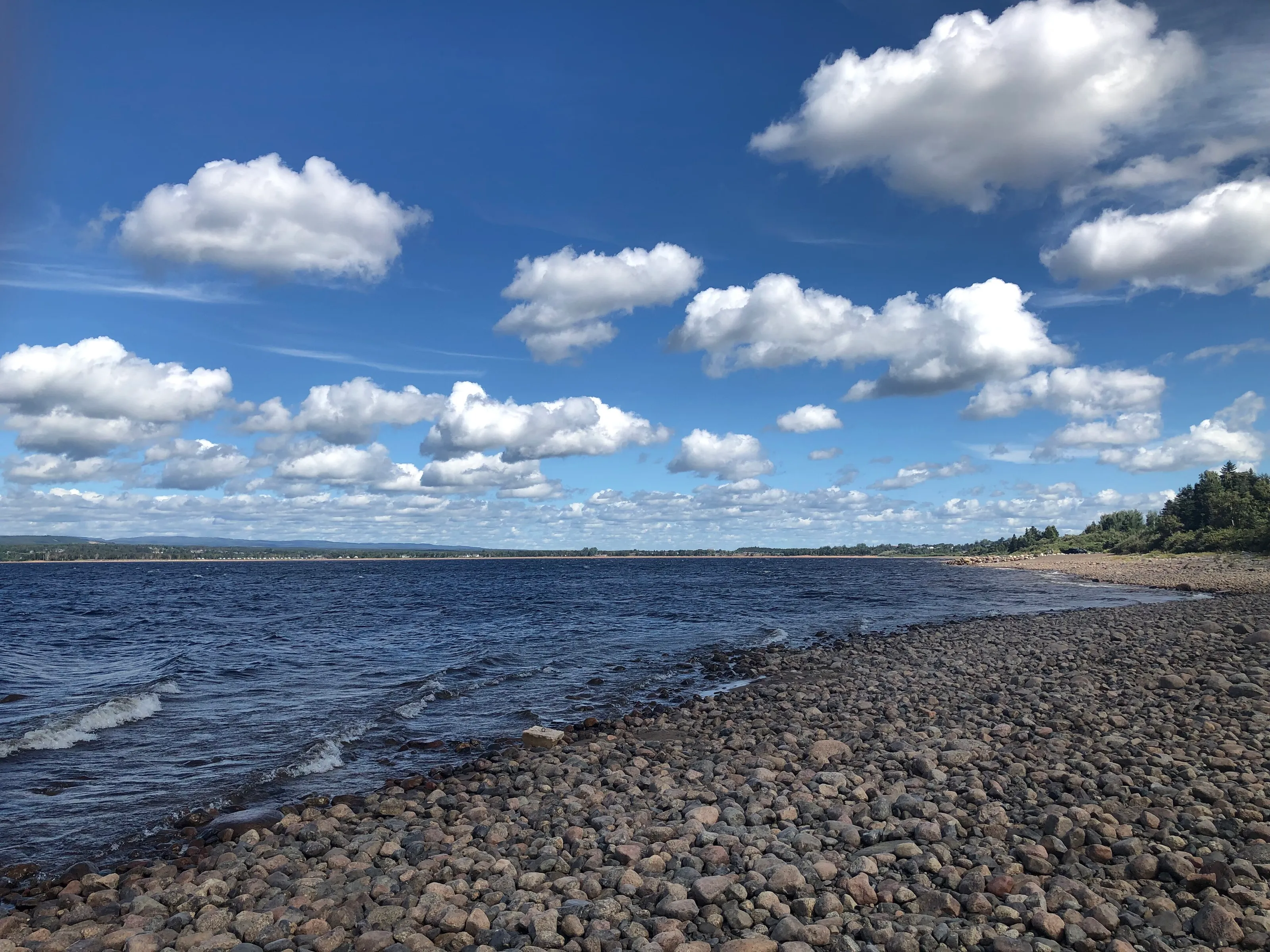
The lake gives the town its name according to Wikipedia (EN, FR). This view shows a pebble shore under big cumulus clouds. The Deer Lake Beach Trail runs along the lake according to Wikipedia (EN); swimming and water access depend on the season, so check on site.
The coast of western Newfoundland
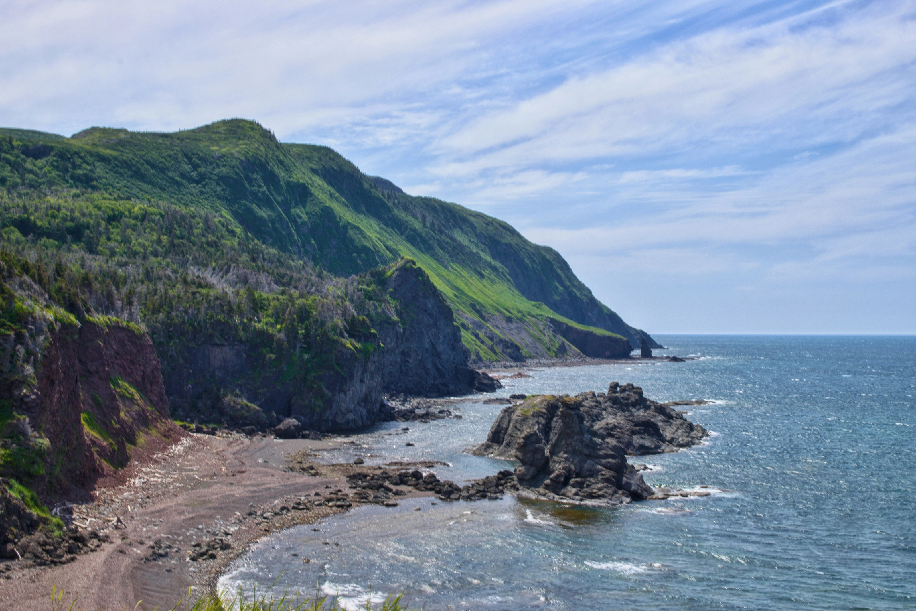
This view shows the kind of scenery found along the coast: green cliffs, a pebble beach and isolated rocks; its exact location is not specified here. Wikipedia (FR) notes that the park's coastline is cut by two deep bays, Bonne Bay and St. Pauls Inlet.
Other landmarks cited by Wikipedia (EN, FR) and Wikivoyage (EN): the villages in the park (Rocky Harbour, Norris Point, Woody Point, Trout River); Green Point, the global reference section for the Cambrian-Ordovician boundary according to Wikipedia (EN, FR); the Gros Morne Mountain hike, a summit of about 800 m; and, several hours' drive north, L'Anse aux Meadows, site of the first Viking landing in North America according to Wikivoyage (EN).
Museums and culture
Visitor centre, marine station, festivals and historic sites
Parks Canada visitor centre
The park's visitor centre is in Rocky Harbour according to Parks Canada and Wikivoyage (EN). Parks Canada also offers guided programmes and an app for exploring the Tablelands. Hours and closures vary, so we do not give them.
Bonne Bay Marine Station
In Norris Point, the marine station has an aquarium according to Wikivoyage (EN), which also mentions some heritage buildings in the village.
Festivals and local stages
Wikivoyage (EN) cites several festivals in the park, including a theatre festival, writers at Woody Point and summer concerts. Dates change every year, so check them.
Nearby historic sites
Parks Canada lists Port au Choix National Historic Site, where artefacts of four ancient Indigenous cultures can be seen; L'Anse aux Meadows, the Viking site, is cited by Wikivoyage (EN). The Deer Lake airport website promotes the chance of seeing three World Heritage Sites in one trip.
Food and drink
Seafood, cod tongues and kitchen parties
Seafood
Wikivoyage (EN) recommends seafood, with restaurants in Trout River, Woody Point and Rocky Harbour, and suggests trying cod tongues. We name no venue.
Evenings of local music
Wikivoyage (EN) mentions pubs with live music and traditional Newfoundland kitchen parties in summer, as well as a screech-in tradition offered on a Bonne Bay cruise.
Bed and breakfasts
Wikivoyage (EN) praises the welcome of Newfoundland B&Bs; in summer you need to book early. We give no prices.
In Deer Lake
The town has restaurants, supermarkets and fuel stations according to Wikipedia (EN), which makes it a good place to stock up before continuing to the park. Wikipedia (EN) cites the Strawberry Festival.
Getting around
Car, Route 430 and caution with moose
Car
Wikivoyage (EN) considers a car the most convenient way to get around: the park is huge and sights are far apart. Rental firms operate at the airport. We give no rental fares.
Moose on the road
Wikivoyage (EN) warns about collisions with moose, common in Newfoundland, especially at dawn and dusk: slow down at night.
Routes 430 and 431
Route 430 gives access to the north of Bonne Bay and Route 431 to the Tablelands according to Wikipedia (FR); Wikivoyage (EN) says main routes are maintained all year, with possible closures in bad weather.
Bike and on foot
Cycling is possible but hilly according to Wikivoyage (EN). In Deer Lake itself, trails follow the river and the lake according to Wikipedia (EN).
Budget and precautions
Price level and precautions
Price level
Wikivoyage (EN) notes that lodging fills up quickly in summer and should be booked early. We give no price range, for lack of a second independent source. The currency is the Canadian dollar (CAD).
Flights and alerts
SniperAir tracks prices to YDF and compares them with the route's history, but it does not sell or book tickets. Flights to Halifax (YHZ) or St. John's (YYT) can be tracked in parallel.
Precautions
Check your government's official travel advice. On hikes the weather can change quickly: pack layers and water, and follow Parks Canada instructions. Some mountain hikes are subject to seasonal restrictions, so check the official site.
When to go
A humid continental climate, cool and very snowy
Winter (December to February)
Deer Lake gets plenty of snow according to Wikipedia (EN). The town presents itself as a snowmobile hub. The park offers winter activities and stays open according to Wikivoyage (EN) and Parks Canada, but in low season.
Spring (March to May)
The tourist season restarts slowly: Parks Canada lists a low season from October to May. Park services ramp up from mid-May according to Wikivoyage (EN); check opening dates.
Summer (June to August)
This is the high season, May to October according to Parks Canada. Summers are moderately warm and short according to Wikipedia (EN). Book lodging early.
Autumn (September to November)
Foliage changes colour, as in the aerial view of the town. Park services run until mid-October according to Wikivoyage (EN); low season follows.
Deer Lake has a humid continental climate (Dfb), with moderately warm, short summers and winters moderated by the nearby water, and high precipitation all year according to Wikipedia (EN). We publish no numerical averages, for lack of cross-checking. To choose your dates, tracking prices to YDF early helps you compare several periods.
By length of stay
What to do around Deer Lake depending on how long you stay
Deer Lake and Tablelands
One day for Deer Lake, its trails and Route 431 towards the Tablelands and Woody Point.
Fjord and coast
Add Rocky Harbour, the Western Brook Pond cruise or approach, Norris Point and a lookout over Bonne Bay.
Mountain and north
Extend with the Gros Morne Mountain hike, even the Long Range Traverse, or Port au Choix and L'Anse aux Meadows farther north, leaving room for the weather.
In pictures
Deer Lake and its surroundings in pictures
You might also like
Similar destinations
FAQ
Frequently asked questions about flights to Deer Lake
How do I get to Deer Lake?
By air to YDF, with links to Toronto, Halifax, Montreal and St. John's according to Wikipedia (EN) and Wikivoyage (EN), or by road on Route 1 from the Port aux Basques ferry.
How far is the airport from Gros Morne National Park?
About 35 km from the southern boundary according to Wikivoyage (EN), around thirty kilometres according to Wikipedia (FR), and about an hour's drive to the park.
What is there to see around Deer Lake?
The Tablelands, Western Brook Pond, Bonne Bay, Rocky Harbour and Gros Morne Mountain, in Gros Morne National Park according to Parks Canada and Wikipedia (EN, FR).
Is Gros Morne a UNESCO site?
Yes, since 1987 according to UNESCO and Wikipedia (EN, FR, DE), for its rare example of continental drift.
Do I need a car in Deer Lake?
Yes, it is the most convenient option according to Wikivoyage (EN): the park is huge and sights are far apart. Watch for moose at night.
When should I go to Deer Lake?
The park's high season runs from May to October according to Parks Canada; winters are snowy according to Wikipedia (EN) and low season lasts from October to May.
How much does a flight to Deer Lake usually cost?
The price depends mostly on your departure city, the season and how early you book. The opportunities section above shows real examples of fares SniperAir has already detected to this destination.
How do I get alerted when a flight to Deer Lake drops below my budget?
Create an alert profile with your departure airport, Deer Lake as the destination and your maximum budget. You are notified automatically as soon as a matching fare is detected.
Ready to head to Deer Lake?
Set your budget and let SniperAir monitor fares for you.
Create my alert