
Cheap flights to Thunder Bay
Set your departure airport and maximum budget: SniperAir tracks prices to Thunder Bay and alerts you the moment a deal matching your criteria appears.
Quick summary
Country
Canada
Continent
North America
Airport
YQT
Currency
Canadian dollar (CAD)
Time zone
UTC-5 (UTC-4 during summer time)
Deals already spotted to Thunder Bay
Real flight examples detected by SniperAir, with their reference price.
Loading examples…
Why track Thunder Bay with SniperAir
You do not need to compare prices every day
Choose your departure
Enter your departure airport and your maximum budget for a flight to Thunder Bay (YQT).
SniperAir keeps watch
Our systems continuously compare new fares with the route's real price history. SniperAir tracks prices and alerts you: it does not sell or book tickets.
You get an alert
As soon as a fare matches your criteria you are notified, without having searched for anything yourself.
Thunder Bay is an Ontario city at the head of Lake Superior. It has about 109,000 residents according to Wikipedia (EN) and Wikivoyage (EN), making it the most populous municipality in Northwestern Ontario according to Wikipedia (EN, ES). It is often called the Lakehead, because it marks the end of Great Lakes navigation on the Canadian side. SniperAir tracks flight prices to YQT and alerts you; it does not sell or book tickets.
This page is about Thunder Bay and getting there, not Toronto or Winnipeg, even if you will often connect through them. Wikipedia (EN, FR, DE, ES) explains that the city was created in 1970 by merging Fort William and Port Arthur, two towns that had rivalled each other since the fur trade and railway era. The name comes from the big bay at the head of the lake, called Baie du Tonnerre on 18th-century French maps according to Wikipedia (EN, FR).
A general reminder: official travel advice differs by country of departure and can change, so check your own government's advice before setting an alert and again before booking. Foreign visitors should also check Canadian entry requirements for their nationality. Winters are long and cold, and outdoor trips need preparation.
Airport and getting into town
YQT, the airport west of downtown, and other ways in
Thunder Bay International Airport (YQT)
Wikivoyage (EN) puts the airport about 15 minutes by car west of downtown. Wikipedia (DE) says it is a port of entry staffed by border officers, but service is mostly domestic: Wikivoyage (EN) lists links to Toronto, Ottawa, Montreal, Winnipeg and communities in northern Ontario, with no direct flights to the United States. Routes change by season, so we do not list them and publish no fares.
Distance and time are approximate. We publish no taxi or bus fares. None of our sources lists a direct flight from Europe: in practice you connect within Canada, for example through Toronto (YYZ) or Montreal (YUL).
The city sits on Highways 11 and 17, both part of the Trans-Canada Highway according to Wikipedia (DE) and Wikivoyage (EN). Wikivoyage (EN) gives 7 to 8 hours by road from Winnipeg or from Sault Ste. Marie. Wikipedia (DE) and Wikivoyage (EN) say there is no passenger rail service; intercity coaches link the city with northwestern Ontario and Sault Ste. Marie according to Wikivoyage (EN).
For your alerts, also watch flights to Winnipeg (YWG) or Toronto (YYZ), then a connection or a long drive: the outcome can differ, but distances are considerable.
Landmarks and sights
Sleeping Giant, Kakabeka Falls and a fur trade fort
Thunder Bay is best explored around Lake Superior, its cliffs and its waterfalls. Four images illustrate the area; other places are described in text.
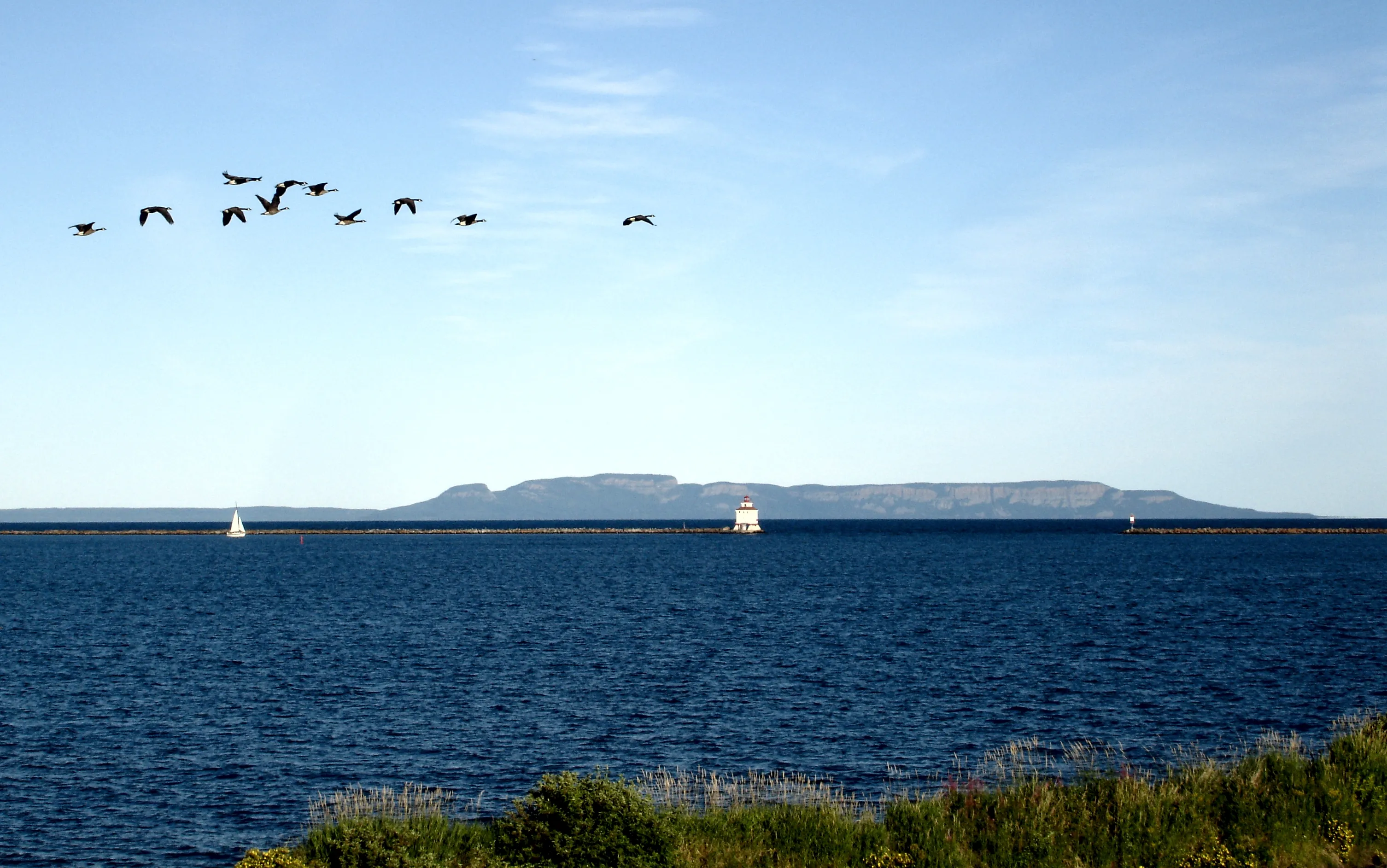
The Sleeping Giant, symbol of the city
A large mesa formation on the Sibley Peninsula that looks like a reclining giant has become the symbol of the city according to Wikipedia (EN, FR); it appears on the city's coat of arms and flag. This view shows it on the lake horizon with a small lighthouse. Wikipedia (EN) cites the marina in the Port Arthur waterfront district, Prince Arthur's Landing, as a viewpoint on the Giant.
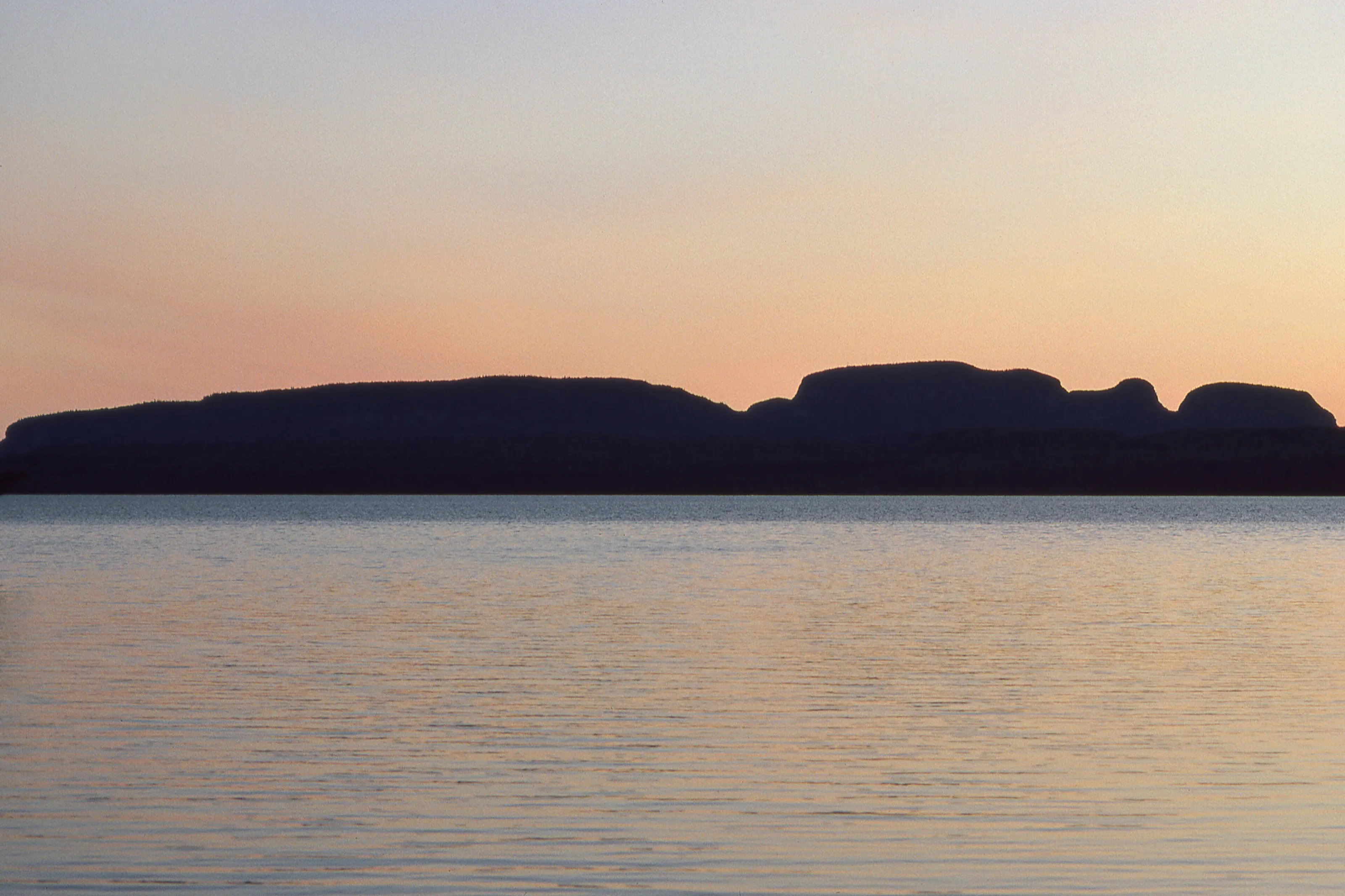
The Sleeping Giant at dusk
At dusk the plateau stands out as a dark silhouette. The peninsula holds Sleeping Giant Provincial Park, run by Ontario Parks, with trails of varying difficulty: Wikivoyage (EN) describes the Top of the Giant as a long, demanding route to a lookout above the lake. Wikivoyage (EN) also mentions Silver Islet, a former silver-mining ghost town.
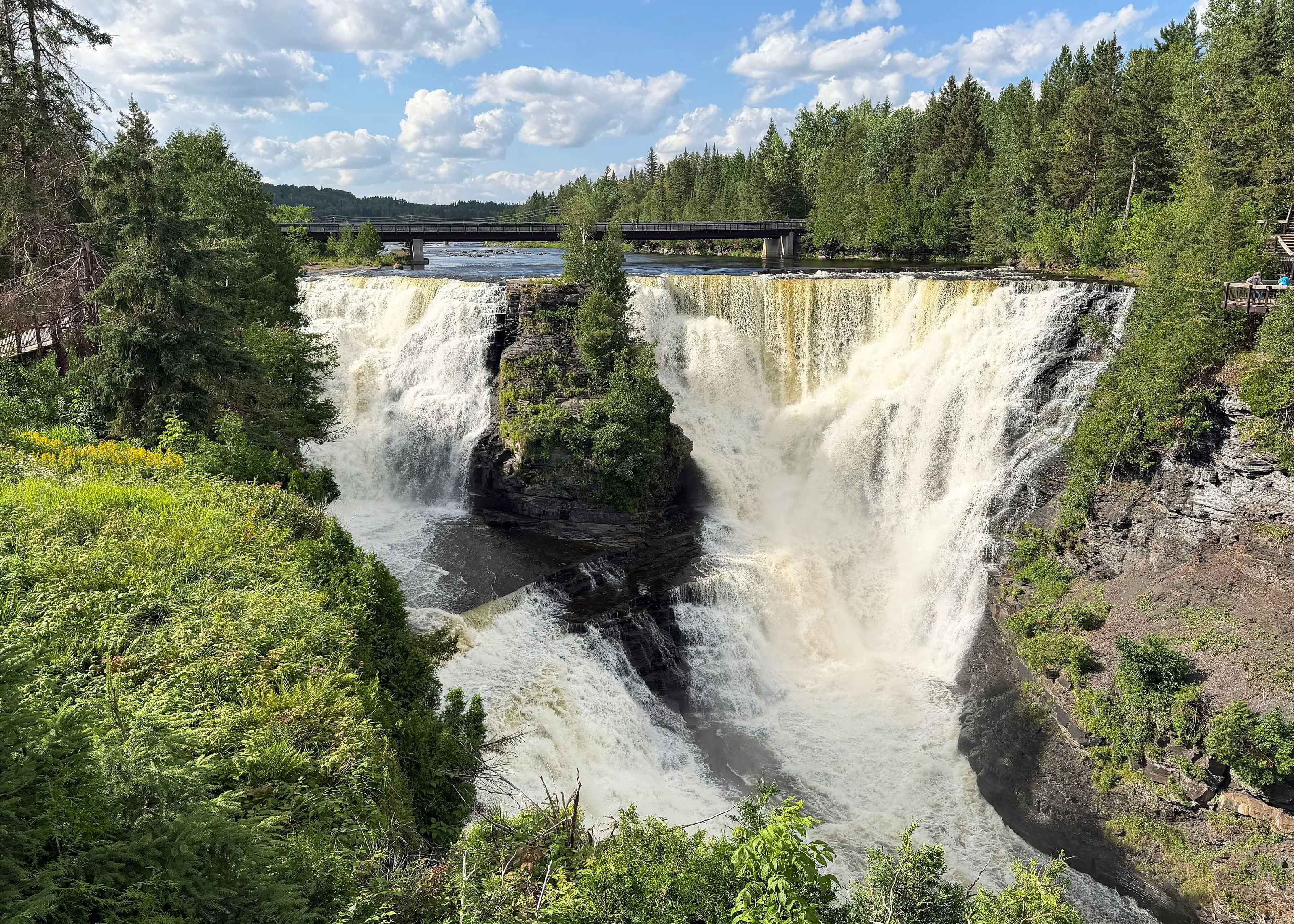
Kakabeka Falls
Kakabeka Falls, on the Kaministiquia River, drop 40 m according to Wikipedia (EN) and Ontario Parks, which makes them the second highest waterfall in Ontario according to Ontario Parks and Wikivoyage (EN). They are nicknamed the Niagara of the North according to Wikipedia (EN). They lie about 30 km west of the city; a boardwalk trail leads to viewing platforms according to Wikivoyage (EN). Entering the gorge below the falls is prohibited.
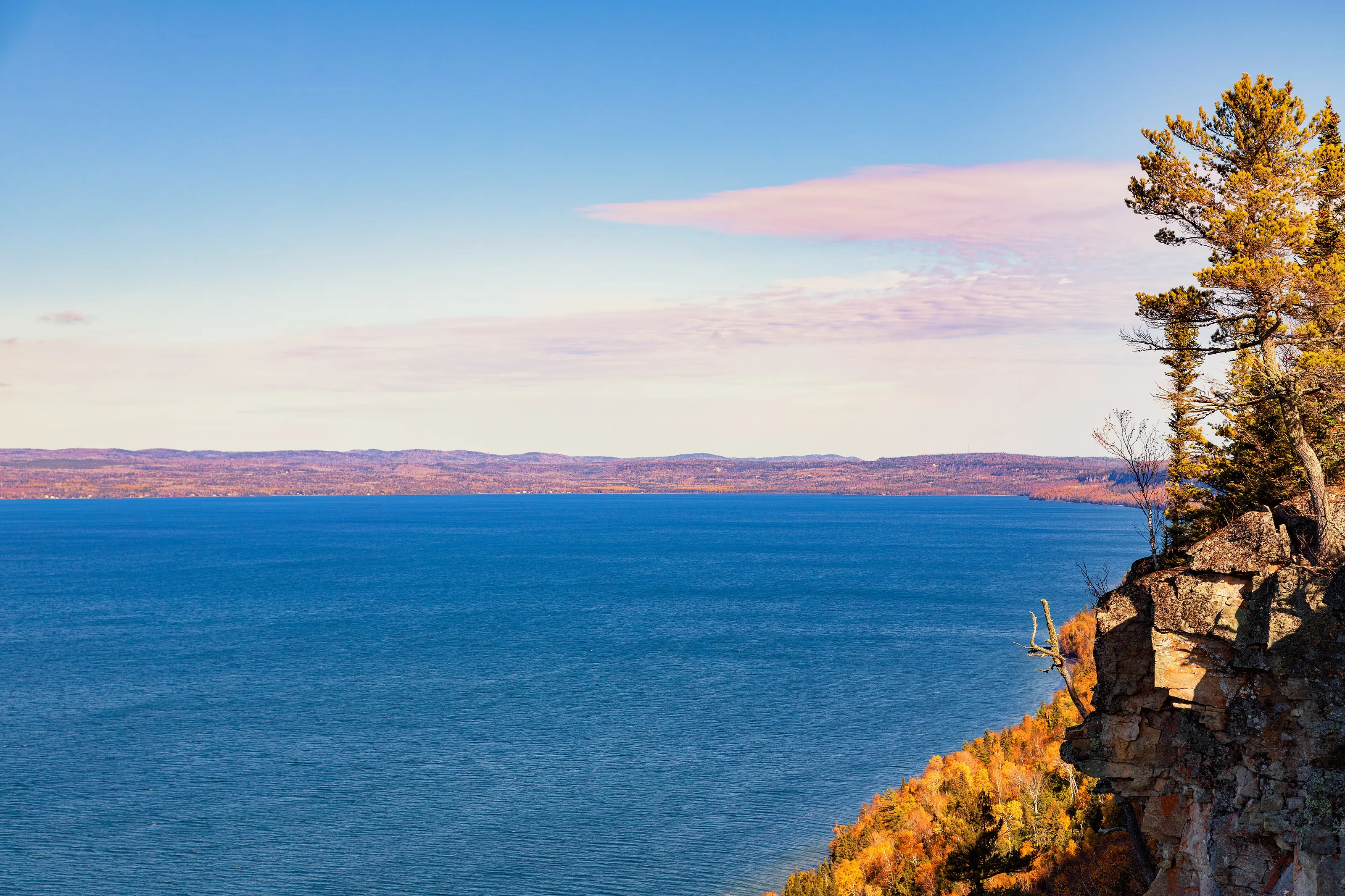
Lake Superior shore and amethyst
This view shows a rocky cliff topped by a pine in autumn colours, at Amethyst Harbour in Sleeping Giant Provincial Park according to the image description on Wikimedia Commons. Wikipedia (EN) and Wikivoyage (EN) mention several small surface amethyst mines around the city, some of which let visitors look for crystals.
Other landmarks cited by Wikipedia (EN, FR) and Wikivoyage (EN): Fort William Historical Park, a reconstruction of the North West Company post as it stood in 1815 and the city's main tourist attraction, with more than 40 buildings according to Wikivoyage (EN); the Terry Fox Memorial and Lookout, which honours the Marathon of Hope runner who had to stop near Thunder Bay; and the Port Arthur waterfront, where the retired icebreaker Alexander Henry is moored.
Museums and culture
Indigenous art, regional history and aviation
Thunder Bay Art Gallery
Founded in 1976 according to Wikipedia (EN), it specialises in First Nations artists and holds a collection of national significance according to Wikipedia (EN). Wikivoyage (EN) places it on the Confederation College campus. Hours and suggested donations change, so we do not give them.
Thunder Bay Museum
Run by the Thunder Bay Historical Museum Society, founded in 1908 according to Wikipedia (EN), it presents local and travelling exhibitions and keeps archives. Wikivoyage (EN) describes it as a three-floor museum. We publish no admission prices.
Northwestern Ontario Aviation Heritage Centre
Founded in 2007 according to Wikipedia (EN), it tells the aviation history of northwestern Ontario, especially the Can-Car factory, which built Hawker Hurricane fighters and Curtiss Helldivers in World War II according to Wikipedia (EN). Wikivoyage (EN) lists it too.
A northern cultural city
Thunder Bay was named a Cultural Capital of Canada in 2003 according to Wikipedia (EN, DE). It has the Finnish Labour Temple, Scandinavia House and a symphony orchestra founded in 1960, the only professional orchestra between Winnipeg and Toronto according to Wikipedia (EN).
Food and drink
The Persian, Finnish heritage and world cuisines
The Persian, a local pastry
The Persian is a cinnamon-bun style pastry with pink icing that is said to have originated in Thunder Bay according to Wikipedia (EN, DE) and Wikivoyage (EN). Sources disagree on the icing flavour (strawberry or raspberry), so taste it on the spot rather than hunting for a recipe.
A Finnish heritage
Wikipedia (EN) says Thunder Bay has the highest concentration of people of Finnish origin in Canada. Wikivoyage (EN) adds that saunas are common and popular, although few residents still speak Finnish.
Tables by budget
Wikivoyage (EN) mentions Greek, Thai and vegetarian restaurants, pubs, independent cafes, tea houses and a craft brewery with a taproom. We name no venue, because hours and menus change.
Districts
The Port Arthur downtown in the north brings cafes and restaurants together around the harbour; the Intercity area between the two former towns holds shopping centres and chains according to Wikivoyage (EN).
Getting around
Car, city bus and walking depending on the district
On foot
Wikivoyage (EN) notes that Thunder Bay is not a walkable city: it is very spread out, a legacy of the twin cities. Walking works within each of the two centres, Port Arthur to the north and Fort William to the south, especially outside winter.
City bus
A city bus network links the two former centres according to Wikipedia (DE) and Wikivoyage (EN). Timetables change, so check them before you go.
Car
A car is practical, even necessary, for Kakabeka Falls, Sleeping Giant Provincial Park and the canyons according to Wikivoyage (EN). We give no rental or taxi fares.
Bicycle
The city is expanding its cycling network according to Wikivoyage (EN); in summer, trails run along the lake.
Budget and precautions
Price level and precautions
Price level
Wikivoyage (EN) lists lodging from hostels and bed and breakfasts to upscale hotels. We give no price range, for lack of a second independent source. The currency is the Canadian dollar (CAD).
Flights and alerts
SniperAir tracks prices to YQT and compares them with the route's history, but it does not sell or book tickets. Flights to Winnipeg (YWG) or Toronto (YYZ) can be tracked in parallel.
Precautions
Check your government's official travel advice. As in any city, stay alert at night and in areas you do not know. On trails and by the lake the weather can change quickly: pack suitable clothing and water, and follow park rules.
When to go
A humid continental climate, sunny and shaped by the lake
Winter (December to February)
The January average is close to -14 °C according to Wikipedia (EN, ES) and Wikivoyage (EN). Winters are fairly dry and very cold. The official tourism site lists skating, skiing, ice climbing and snowmobiling; in March, the Sleeping Giant Loppet is a local tradition according to Wikivoyage (EN).
Spring (March to May)
A transition season: snowmelt, and spring fishing highlighted by the tourism office, but also a time when the region wakes up slowly. Check park opening dates.
Summer (June to August)
The July average is about 18 °C and the average high about 24 °C according to Wikipedia (EN, ES) and Wikivoyage (EN). It is the season for trails, kayaking, sailing and lakeside beaches.
Autumn (September to November)
The tourism office promotes autumn hikes and colourful scenery. First frosts arrive in October: Wikipedia (EN) notes a late-frost record on 17 October 2021.
The climate is humid continental (Dfb) according to Wikipedia (EN), influenced by Lake Superior especially in the north of the city. The city gets more than 2,100 hours of sunshine a year according to Wikipedia (EN, ES), more than any Canadian city to the east according to Wikipedia (EN) and Wikivoyage (EN). To choose your dates, tracking prices to YQT early helps you compare several periods.
By length of stay
What to do in Thunder Bay depending on how long you stay
City and lake
One day for the Port Arthur harbour, the view of the Sleeping Giant, Indigenous art and Fort William Historical Park.
Falls and park
Add Kakabeka Falls, Sleeping Giant Provincial Park, its trails and a lookout over the lake.
Canyons and canoes
Extend with Ouimet Canyon or a canoe trip around Quetico according to Wikivoyage (EN), leaving room for the weather.
In pictures
Thunder Bay in pictures
You might also like
Similar destinations
FAQ
Frequently asked questions about flights to Thunder Bay
How do I get to Thunder Bay?
By air to YQT, with mostly domestic links according to Wikipedia (DE) and Wikivoyage (EN), or by road on Highways 11 and 17, 7 to 8 hours from Winnipeg according to Wikivoyage (EN).
How far is YQT airport from downtown?
About 15 minutes by car west of the centre according to Wikivoyage (EN). We publish no transfer fares.
What is there to see in Thunder Bay?
The Sleeping Giant, Kakabeka Falls, Sleeping Giant Provincial Park, Fort William Historical Park and the Terry Fox Memorial and Lookout according to Wikipedia (EN) and Wikivoyage (EN).
Do I need a car in Thunder Bay?
It helps: the city is very spread out and the main natural sights lie outside it according to Wikivoyage (EN). A bus network links the two centres.
Is there a train to Thunder Bay?
No, there is no passenger rail service according to Wikipedia (DE) and Wikivoyage (EN).
What is a Persian?
A local pastry close to a cinnamon bun with pink icing, according to Wikipedia (EN, DE) and Wikivoyage (EN).
How much does a flight to Thunder Bay usually cost?
The price depends mostly on your departure city, the season and how early you book. The opportunities section above shows real examples of fares SniperAir has already detected to this destination.
How do I get alerted when a flight to Thunder Bay drops below my budget?
Create an alert profile with your departure airport, Thunder Bay as the destination and your maximum budget. You are notified automatically as soon as a matching fare is detected.
Ready to head to Thunder Bay?
Set your budget and let SniperAir monitor fares for you.
Create my alert