
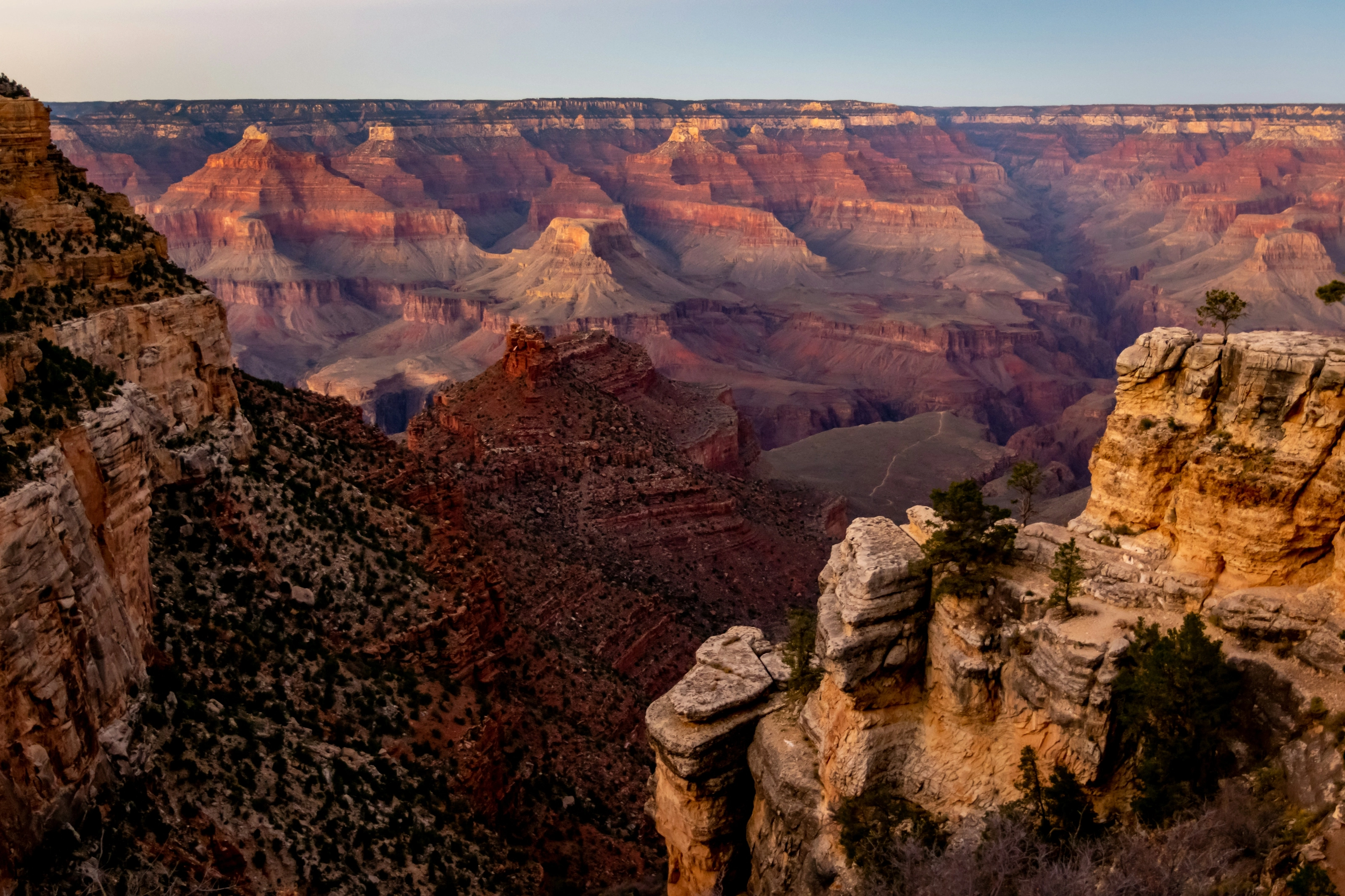
Cheap flights to the Grand Canyon
Set your departure airport and your maximum budget: SniperAir tracks prices to the Grand Canyon and alerts you the moment an opportunity matching your criteria appears.
Quick summary
Country
United States
Continent
North America
Airport
GCN
Currency
US dollar (USD)
Time zone
UTC-7
Opportunities already detected to the Grand Canyon
Real flight examples spotted by SniperAir, with their reference price.
Loading examples…
Identity
A 277-mile canyon carved by the Colorado River
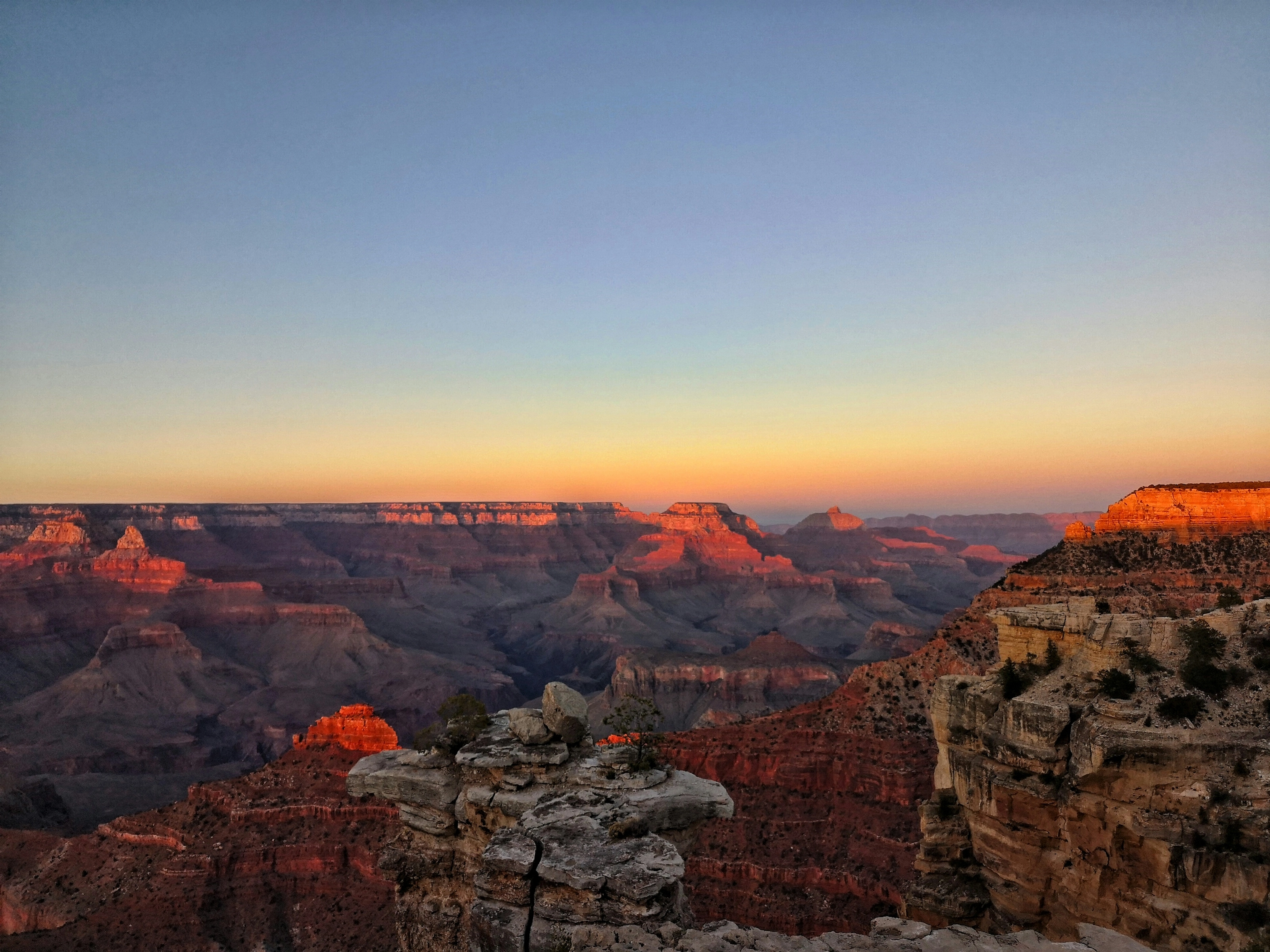
The Grand Canyon runs about 277 miles (446 km) long, from roughly 1 to 16 miles wide, and is more than 6,000 feet (1,800 m) deep in places. Rocks at the bottom, some 1.7 to 1.8 billion years old, are among the oldest exposed at the Earth's surface. The Colorado Plateau began to rise around 70 million years ago, but the river only cut the canyon as it looks today over the last five to six million years. The park was founded in 1919 and has been a UNESCO World Heritage Site since 1979.
About 90 per cent of visitors stay on the South Rim, which is open all year and reachable by road. The wilder, higher North Rim is closed in winter: the road is shut from about December 1 to May 15, and services shrink from mid-October. The two rims are only about 10 miles apart as the crow flies, but the drive between them is roughly 220 miles and four and a half to five hours.
Not to be missed
Helicopter flights and the Skywalk
Helicopter tours mostly leave from Tusayan Airport, a few minutes from the South Rim entrance, with options from roughly 20 minutes to multi-hour excursions. Compare operators and flight times before booking.
Much further west, on Hualapai land at Grand Canyon West and outside the national park, the Skywalk is a horseshoe-shaped glass bridge opened to the public in 2007. It extends about 70 feet (21 m) beyond the edge, with a drop of 500 to 800 feet (150 to 240 m) directly underneath (Wikipedia EN). It is about 130 miles (210 km) by road from Las Vegas, and a full-day trip from the South Rim, which lies far away.
Why track the Grand Canyon with SniperAir
You don't need to compare prices every day
Choose your departure
Tell us your departure airport and your maximum budget for a flight to the Grand Canyon.
SniperAir tracks it
Our systems continuously compare new prices against the route's real historical data.
You get an alert
As soon as a price matches your criteria, you're notified — without having to search yourself.
To discover
South Rim viewpoints
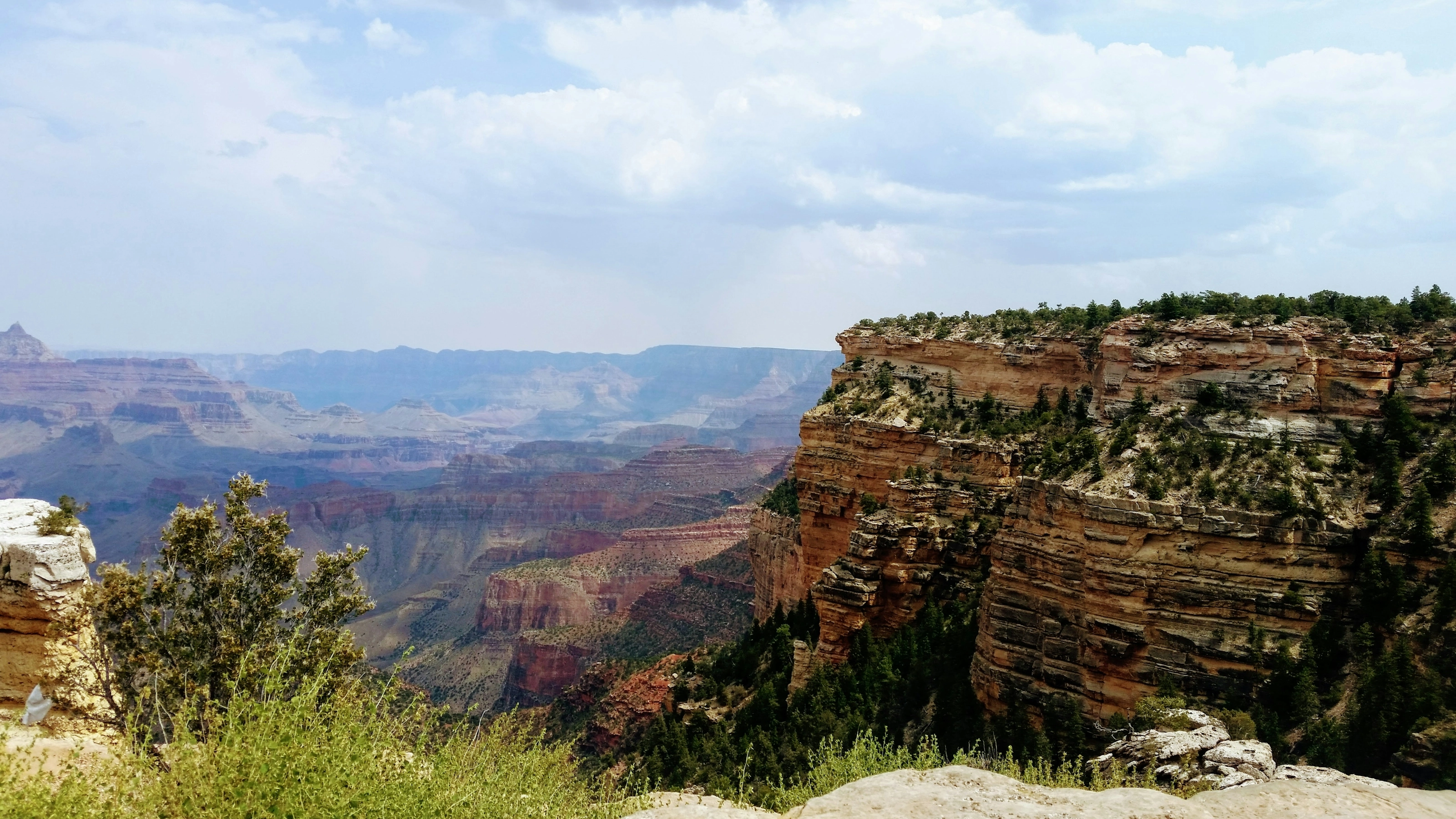
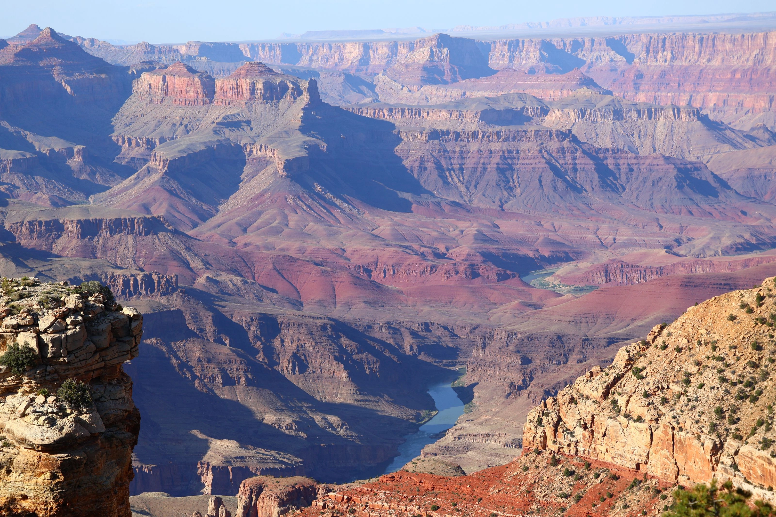
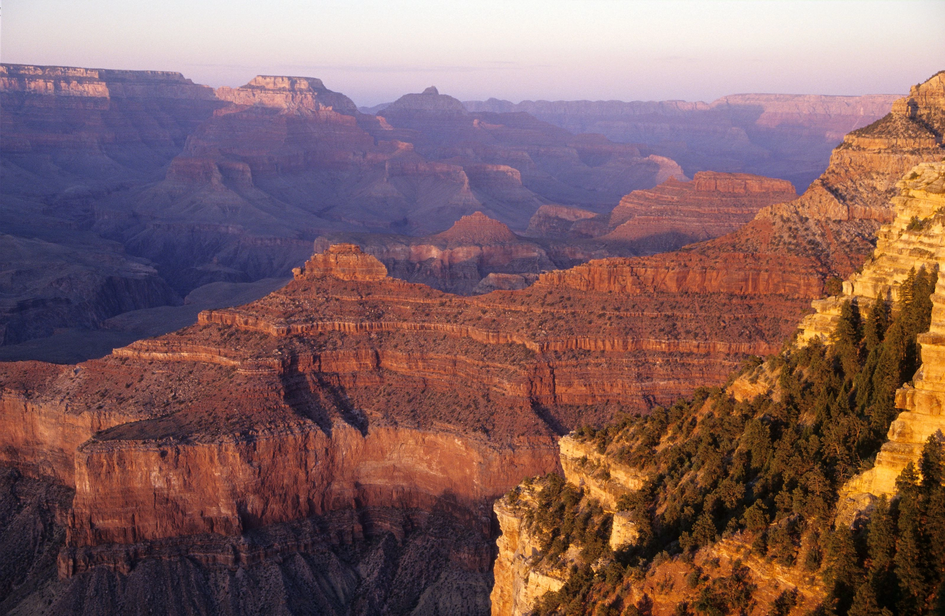
The Rim Trail runs along the South Rim for roughly 13 miles, much of it flat, linking viewpoints such as Mather Point or Hopi Point, known for its sunsets. To go down into the canyon, the Bright Angel Trail is the busiest route: 8 miles (12.9 km) to the river with an elevation change of about 4,380 feet (1,340 m) (Wikipedia EN). Rest houses with piped water line the upper part of the trail, but the two highest are shut off from around October to April to protect the pipes from freezing.
A round trip to the river in a single day is strongly discouraged by the National Park Service because of the elevation change and the heat: temperatures at the bottom can approach 120 degrees F (about 49 degrees C) in summer.
Museums and monuments
Geology, Mary Colter's architecture and Desert View
The Grand Canyon is not a museum city: its visitor sites are small buildings along the rim. The most striking is the Desert View Watchtower, a 70-foot (21 m) stone tower built in 1932 by architect Mary Colter at the east end of the South Rim drive, about 25 miles (40 km) from the village. Its floors hold murals by Fred Kabotie, and its top is the highest point on the South Rim at 7,522 feet (2,293 m) (Wikipedia EN).
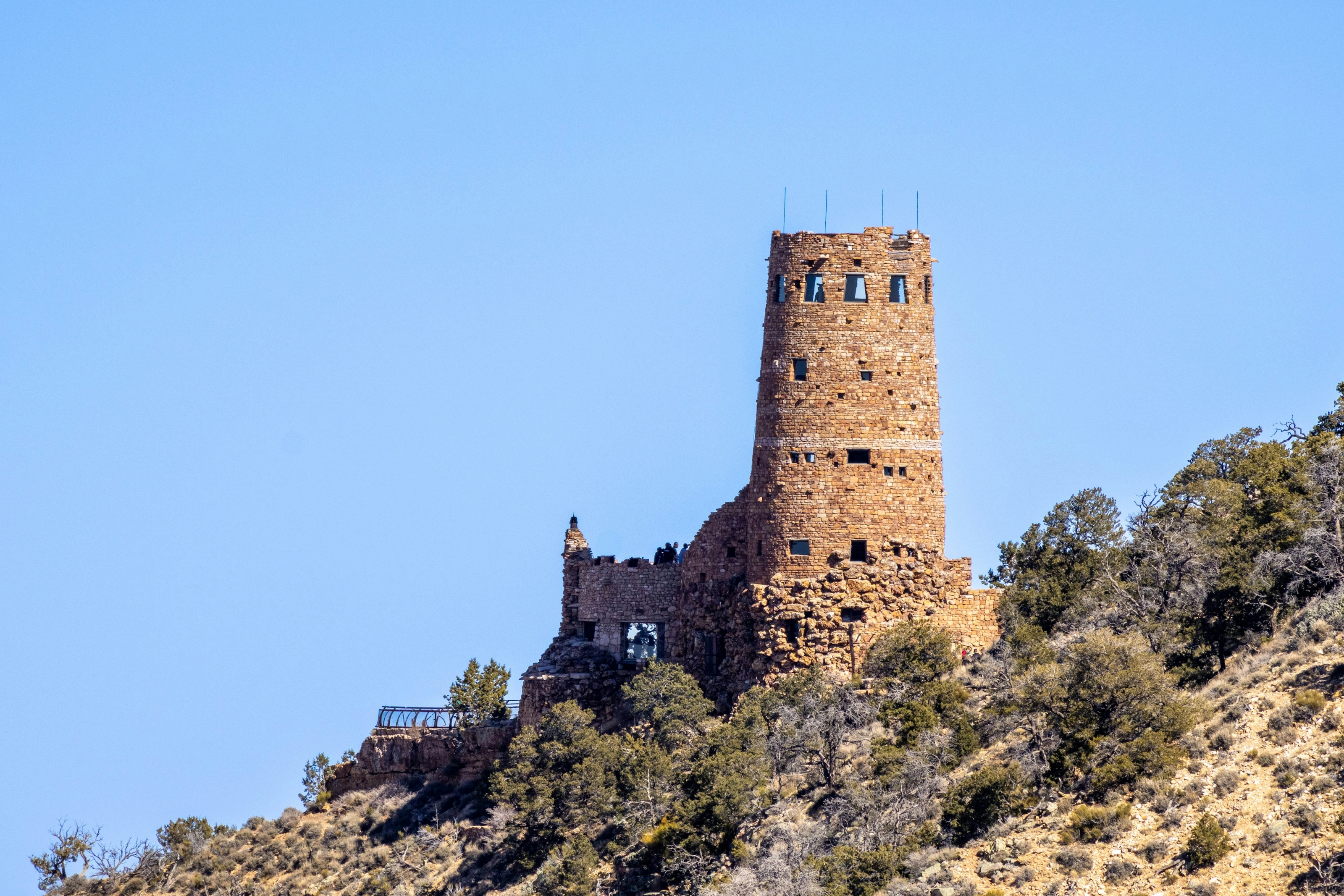
Yavapai Geology Museum. Housed in an observation station dating from 1928, about a mile (1.6 km) east of Market Plaza, it explains the canyon's geology with three-dimensional models and photographs in front of a wide view (Wikipedia EN).
Visitor Center and Kolb Studio. The South Rim visitor center offers information, exhibits and a film of about 20 minutes (Wikivoyage EN). Kolb Studio, built between 1904 and 1926, now holds a gallery, a bookshop and an information point run by the Grand Canyon Association; the Bright Angel Trail starts just to the west.
Historic buildings. El Tovar Hotel, opened in 1905 on the rim, and Hopi House, a work by Mary Colter, can be seen from the village. Check opening hours and access on the National Park Service website before you go.
Food
Cafeterias, lodges and restaurants in Tusayan
There is no local cuisine to promise here: the offer is that of the lodges and cafeterias in the South Rim village, plus a number of restaurants in Tusayan, outside the park (Wikivoyage EN). El Tovar Hotel serves breakfast, lunch and dinner, with reservations required in the evening. Bright Angel Restaurant is more casual, the Arizona Room serves dinner in season, and the Maswik and Yavapai Lodge cafeterias fill the gaps. There is also a deli inside the Market Plaza grocery store.
Good to know. Bring food and water for any hike: choices cluster around the village, not on the trails. For more variety, Flagstaff or Williams offer more choice.
Grand Canyon airport
A sightseeing airfield: scheduled flights land at Flagstaff, Phoenix or Las Vegas
Grand Canyon National Park Airport
Located in Tusayan, a few minutes from the park's south entrance, it is used mainly by private aircraft and air tour companies (Wikivoyage EN): there are no regular scheduled flights to the canyon itself. The nearest commercial airport is Flagstaff (FLG); Las Vegas and Phoenix have far more connections. Either way you then drive or take a shuttle.
| Landmark | Indicative distance or time |
|---|---|
| Flagstaff to the South Rim | about 80 miles (130 km), 1.5 to 2 hours by road |
| Williams to the canyon village | about 60 miles (95 km) by car, 2 hours 15 to 2.5 hours on the tourist train |
| Phoenix to the South Rim | about 230 miles (370 km), around 4 hours |
| Las Vegas to the South Rim | about 275 miles (440 km), 4.5 to 5 hours |
| South Rim to North Rim | about 220 miles (350 km), 4.5 to 5 hours by road |
| Las Vegas to the Skywalk | about 130 miles (210 km) by road |
Most travellers land in Las Vegas or Phoenix and rent a car. The Grand Canyon Railway links Williams with the canyon village, though the canyon is not visible from the train. SniperAir watches prices and alerts you; it does not sell or book tickets.
Getting around
Free shuttles, a car and your own feet
On the South Rim the National Park Service runs free shuttle buses on several routes, more frequent from May to September: Village, Kaibab Rim towards Yaki Point, Hermits Rest to the west, and a summer shuttle from Tusayan (Wikivoyage EN, FR). The West Rim Drive, about 8 miles (13 km) to Hermits Rest, is closed to most private cars for a large part of the year. The road east to Desert View, about 25 miles (40 km), stays open to cars all year.
Rental car. It is almost essential for arriving from Las Vegas, Phoenix or Flagstaff and for the Desert View road. Lodging in the park fills early, so many visitors sleep in Tusayan, Williams or Flagstaff.
On foot. The Rim Trail lets you move between viewpoints without a car, using the shuttle to come back.
By length of stay
What to do at the Grand Canyon depending on how long you stay
The essentials
The Rim Trail and its viewpoints, a stop at the Yavapai Geology Museum, with a sunset at Hopi Point.
Go deeper
Add part of the Bright Angel Trail, the Desert View road and its tower, or a helicopter tour.
When to go
When to visit the Grand Canyon?
Spring
Cool on the South Rim, with snow still possible in March; fewer crowds than in summer.
Summer
Peak season. The South Rim, at about 6,800 feet (2,100 m), stays mild (July highs average around 85 degrees F, about 29 degrees C) while the canyon floor is scorching. Thunderstorms can be violent in July and August.
Autumn
One of the best seasons: mild weather and lighter crowds. North Rim services shrink from mid-October.
Winter
Cold and quiet: January highs average about 44 degrees F (7 degrees C), lows about 19 degrees F (-7 degrees C), and around 43 inches (1.1 m) of snow a year on the South Rim. The North Rim is closed.
The 1991-2020 normals give about 43 inches (109 cm) of snow and about 15 inches (390 mm) of precipitation a year on the South Rim (Wikipedia EN). Best time: April to June and September to October, to avoid both heat and cold.
Budget
A mid-to-high budget, mostly for lodging
The Grand Canyon is on the pricey side because of lodging and the rental car: according to Wikivoyage EN, rooms in the park book up early and are fairly expensive, which is why many people sleep in Williams, Tusayan or Flagstaff. The park charges an entrance fee per vehicle or per person on foot, valid for seven days; fees and the annual pass change, so check the National Park Service website. Park shuttles are free, and so is walking.
Keeping costs down. Visit outside summer, sleep outside the park, picnic, and compare prices for flights and excursions before booking.
You might also like
Similar destinations
FAQ
Frequently asked questions about flights to the Grand Canyon
What is the Grand Canyon's airport?
Grand Canyon National Park Airport (GCN), in Tusayan at the park's south entrance, is used mainly for air tours. Scheduled flights land at Flagstaff, Phoenix or Las Vegas, then you continue by road.
How much does a flight to the Grand Canyon usually cost?
SniperAir has only just started tracking this route and doesn't yet have enough history for a reliable price range. Create an alert to be notified as soon as a price is detected.
How long is a flight to the Grand Canyon from Europe?
There is no direct flight to the canyon: expect a long-haul flight with at least one connection, then several hours by road from Las Vegas, Phoenix or Flagstaff.
What's the best time to book a flight to the Grand Canyon?
There's no universal rule: the best price depends on your specific route. That's exactly why SniperAir tracks prices on your behalf.
Can you hike to the canyon floor in one day?
The National Park Service strongly discourages it because of the elevation change and heat. The Bright Angel Trail suits a partial descent.
Should I choose the South Rim or North Rim?
The South Rim draws about 90 per cent of visitors: accessible and open year-round. The wilder North Rim closes in winter.
How do I get around without a car?
On the South Rim, free shuttles serve the village, Yaki Point and Hermits Rest, and the Rim Trail links viewpoints on foot.
Which museums and monuments should I visit at the Grand Canyon?
The Yavapai Geology Museum, Kolb Studio, the visitor center and the 1932 Desert View Watchtower, all on the South Rim.
What is there to eat at the Grand Canyon?
Mostly lodges, cafeterias and restaurants in the village and Tusayan, with reservations required for dinner at El Tovar.
How do I get alerted when a flight to the Grand Canyon drops below my budget?
Create an alert profile with your departure airport, the Grand Canyon as the destination and your maximum budget. SniperAir watches prices and notifies you as soon as a matching price is detected; it does not sell or book tickets.
Ready to head to the Grand Canyon?
Set your budget and let SniperAir track fares for you.
Create my alert