
Cheap flights to Hilo
Set your departure airport and maximum budget: SniperAir tracks prices to Hilo and alerts you the moment a deal matching your criteria appears.
Quick summary
Country
United States
Continent
North America
Airport
ITO
Currency
US dollar (USD)
Time zone
UTC-10 (no daylight saving time)
Deals already spotted to Hilo
Real flight examples detected by SniperAir, with their reference price.
Loading examples…
Why track Hilo with SniperAir
You don't need to compare prices every day
Choose your departure
Enter your departure airport and your maximum budget for a flight to Hilo (ITO).
SniperAir keeps watch
Our systems continuously compare new fares with the route's real price history. SniperAir tracks prices and alerts you: it does not sell or book tickets.
You get an alert
As soon as a fare matches your criteria you are notified, without having searched for anything yourself.
Airport and getting into town
ITO, Hilo airport, on the Big Island's east coast
Hilo International Airport (ITO)
Hilo International Airport serves the town and the east side of the Big Island according to Wikivoyage (EN); its terminal is small and the atmosphere relaxed according to the same source. Flights mostly come from other islands, especially Honolulu according to Wikivoyage (EN). A bus links the airport with downtown Hilo, but most visitors rent a car according to the same source. We give no exact driving times or fares.
General information based on Wikivoyage (EN) and Wikipedia (EN, FR, DE); routes and schedules change, so check before you travel. We do not quote fares.
Hilo had 44,186 residents in the 2020 census according to Wikipedia (EN, DE); it is the largest settlement on the Big Island, the seat of Hawaii County and the state's largest town outside the Honolulu area according to Wikipedia (EN). It lies around Hilo Bay, at the foot of two volcanoes: Mauna Loa, the largest active volcano on the planet, and Mauna Kea, the highest point in the Hawaiian Islands according to Wikipedia (EN).
Hilo is on the eastern, windward side of the island, the rainiest and least touristy side according to Wikivoyage (EN). It is also a convenient base for Hawaii Volcanoes National Park via Highway 11 according to Wikipedia (DE). For the west coast and its beaches, see the page on the Kona coast (KOA).
Landmarks and sights
Waterfalls, rainforest, Mauna Kea and lava lands
Around Hilo, nature takes over: waterfalls in the forest, lava fields, observatories on the summit of Mauna Kea. In town, the bayfront, Japanese gardens and farmers market complete the visit. Five images illustrate the area; the historic centre is described in text.
A waterfall in the greenery
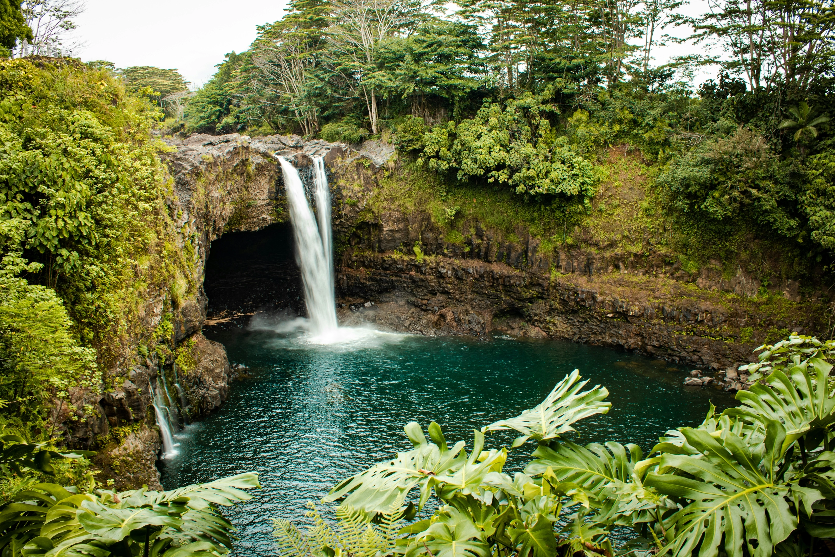
Hilo is known for its waterfalls. Rainbow Falls, near downtown, are worth a visit early in the day to see the rainbow the mist can form according to Wikivoyage (EN). Floods and slippery rocks make swimming inadvisable: follow the signs.
Akaka Falls
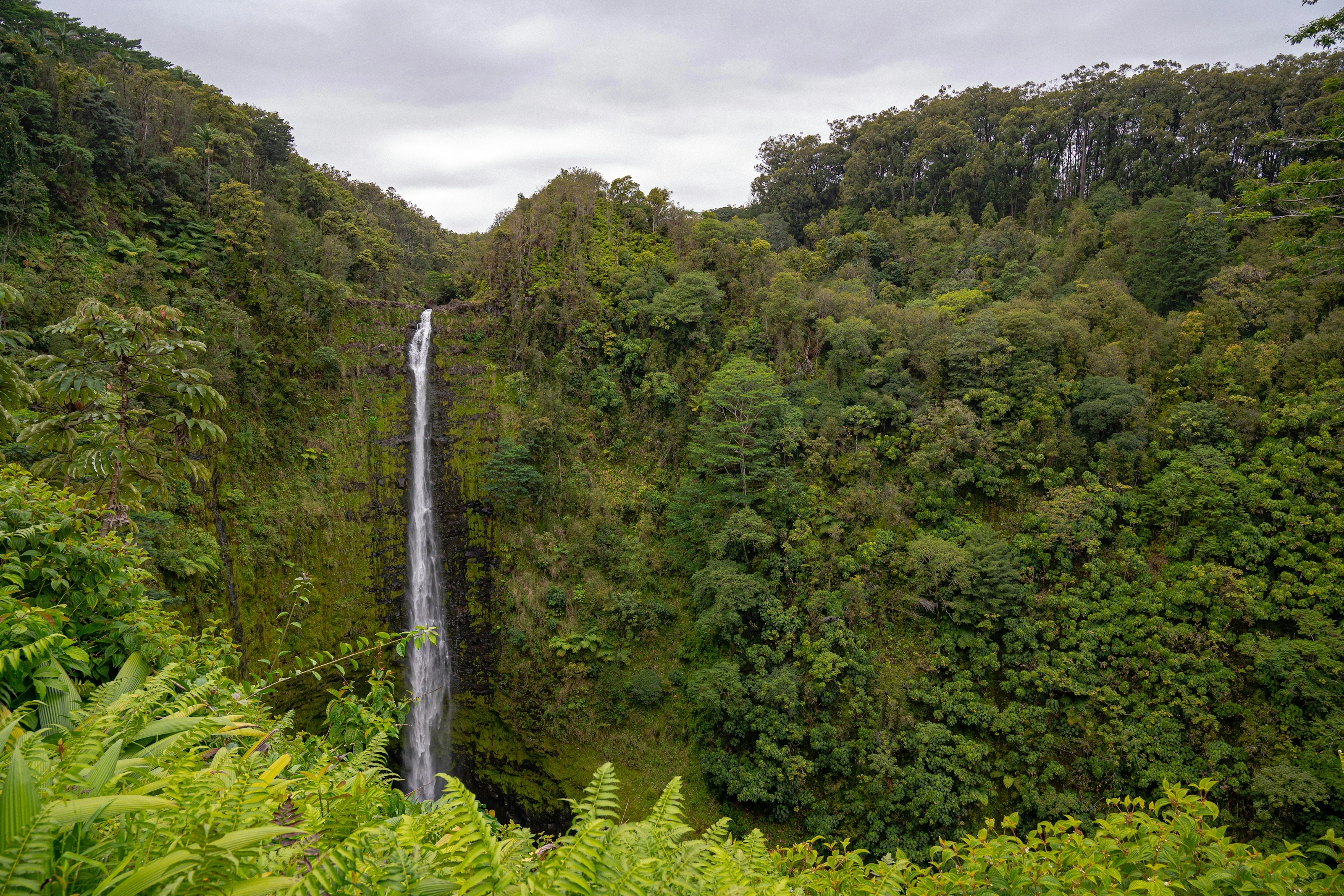
Further north, Akaka Falls drop from a sheer wall into a gorge covered in rainforest. The state park is explored on a short trail; frequent rain feeds this lush vegetation according to Wikipedia (EN).
Rainforest and morning light
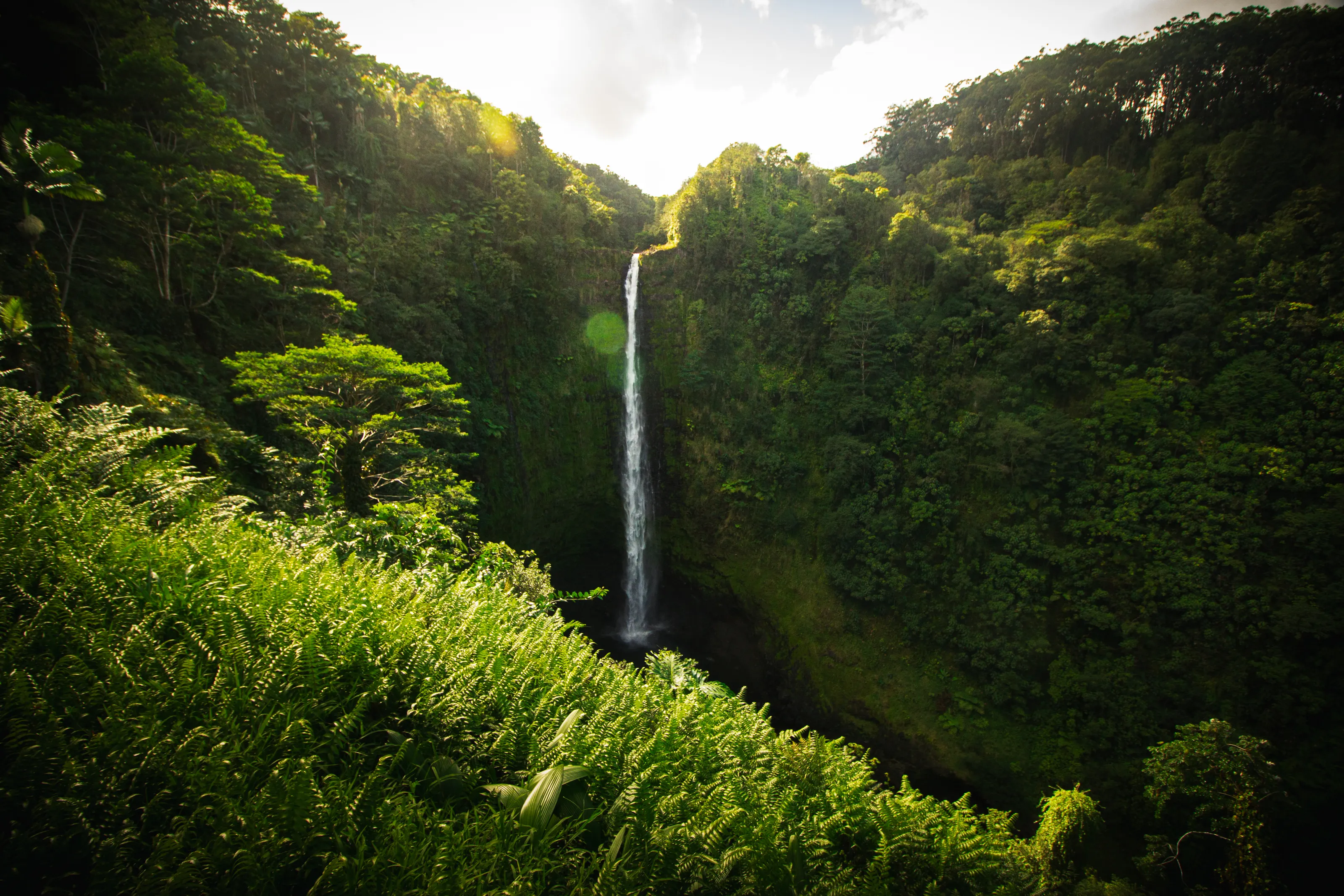
The east, windward side of the island is covered in wet forest and ferns according to Wikivoyage (EN). Light filters through the trees and the mist above the ravines: bring rain gear and shoes with good grip.
A cooled lava field
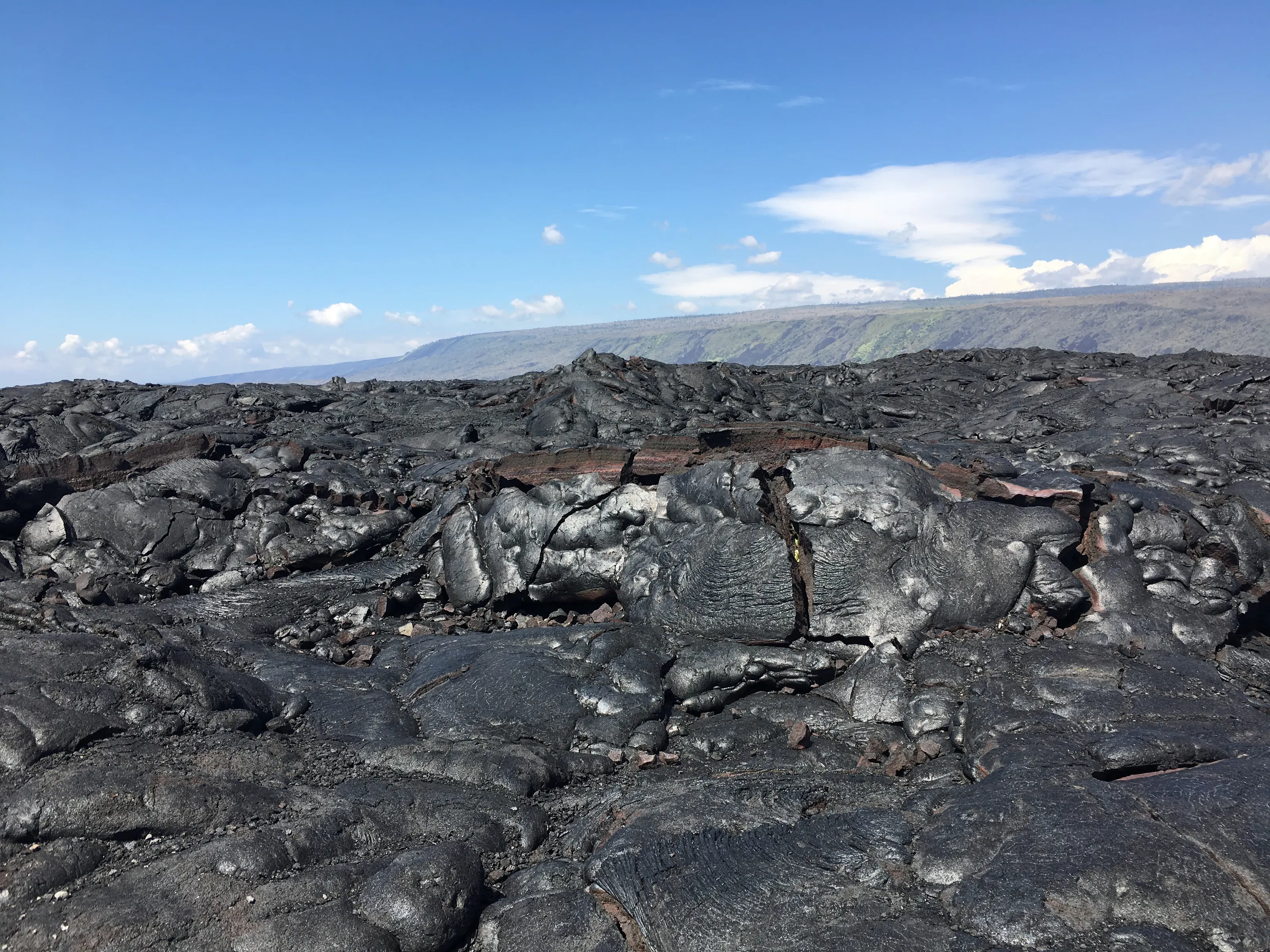
South-west of Hilo, the volcano has left fields of black lava around Volcano. Volcanic activity on the island varies: before visiting Hawaii Volcanoes National Park, check the park's official website for conditions, open trails and possible closures.
The Mauna Kea observatories
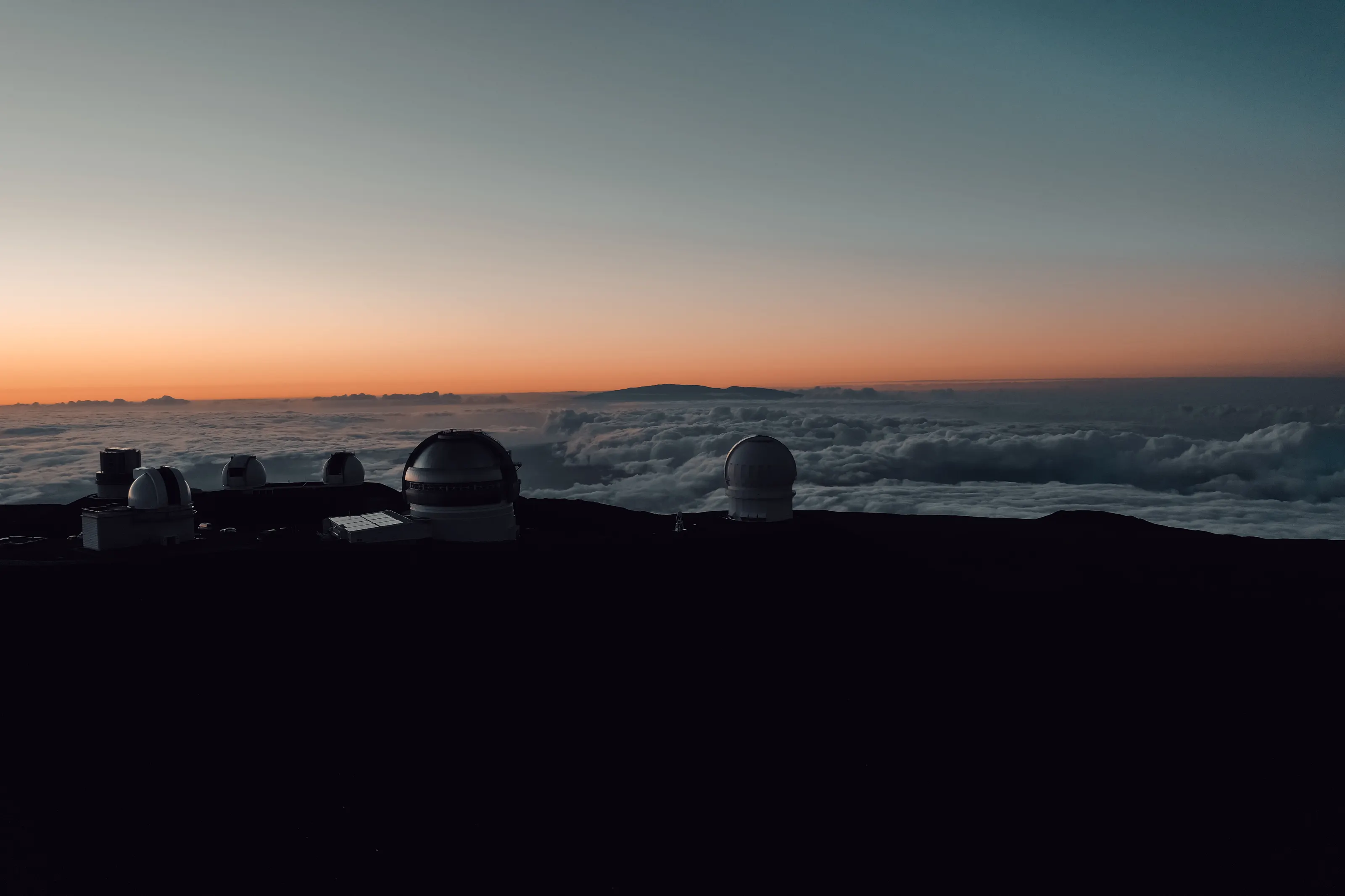
On the summit of Mauna Kea, above 4,000 m, stand some of the world's largest telescopes, including Keck, Subaru and Gemini according to Wikipedia (DE). Observatory domes rise above a sea of clouds at dusk. Access to the summit is regulated and can change: check conditions before planning a trip.
Downtown Hilo, bayfront and gardens, in text
Downtown Hilo centres on Kamehameha Avenue, where the farmers market is held several mornings a week according to Wikivoyage (EN). Liliuokalani Gardens, a Japanese garden from the early 20th century, honour the Japanese plantation immigrants according to the same source. The Palace Theater, reopened in 1998 as an arthouse cinema, brings life to downtown according to Wikipedia (EN).
Museums and culture
Tsunamis, local history and astronomy
Pacific Tsunami Museum
The museum on tsunamis recalls the 1946 and 1960 waves that hit Hilo according to Wikivoyage (EN); they caused 96 deaths in Hilo in 1946 and 61 in 1960 according to Wikipedia (EN). A sober visit, which also explains the origin of the Pacific warning system according to the same source.
Lyman House Museum
This museum occupies a restored missionary house and presents local history, art and minerals according to Wikivoyage (EN). Hours and prices change, so check them.
ʻImiloa Astronomy Center
The ʻImiloa Astronomy Center, linked to the University of Hawaii at Hilo according to Wikipedia (EN), connects modern astronomy with Hawaiian culture. We give no prices, as they change.
Food and drink
Farmers market, local plates and Japanese influences
Farmers market
Hilo's farmers market downtown is known for tropical fruit and fresh, inexpensive produce according to Wikivoyage (EN). It runs on certain mornings of the week and on Sunday: check the days.
Local plates
The plate lunch, a hearty meal of rice with meat or fish, and poke sold by weight near the harbour are easy to find according to Wikivoyage (EN). Local cooking carries the mark of workers who came from Asia for the plantations according to Wikipedia (EN).
Coffee and macadamia nuts
The area is also known for macadamia nuts, one of the world's leading producers being based in Hilo according to Wikipedia (EN), and for coffee grown on the island.
Getting around
Walkable centre, a car for nature, island buses
On foot
Many points of interest cluster at the western end of Kamehameha Avenue and can be walked according to Wikivoyage (EN). Some natural sights and beaches are more than a mile away.
By car
Almost all visitors rent a car at the airport according to Wikivoyage (EN); book ahead during events. The Hilo-Kona crossing takes about two and a quarter hours according to the same source.
Bus
The Hele-On network serves the town from a downtown hub, with few runs according to Wikivoyage (EN). It may suit a simple trip but not a busy itinerary.
Budget and precautions
Calmer and often cheaper than the resort coast
Price level
Hilo is less touristy than the west coast according to Wikivoyage (EN) and quieter, with varied lodging from hostels to bayfront hotels. The currency is the US dollar (USD). We do not publish figures: sources are dated or disagree.
Flights and alerts
Hilo is mostly reached by inter-island flights according to Wikivoyage (EN). SniperAir tracks prices of flights to Hilo (ITO) and compares them with the route's history, but it does not sell or book tickets.
Precautions
Hilo Bay is exposed to tsunamis according to Wikipedia (EN): respect sirens and official instructions. Waterfall trails are slippery. For the volcanoes, follow ranger advice and the park's official website. Foreign travellers should check US entry requirements.
When to go
A wet tropical climate with no real dry season
Winter (December to February)
February is the coolest month, around 22 degrees C on average according to Wikipedia (EN); January and February have the fewest rainy days according to Wikivoyage (EN).
Spring (March to May)
Mild with frequent showers; the Merrie Monarch hula festival takes place after Easter according to Wikipedia (EN).
Summer (June to August)
August is the warmest month, around 25 degrees C on average according to Wikipedia (EN); rain remains present.
Autumn (September to November)
Showers remain frequent all year; always pack a rain layer.
Hilo has a tropical rainforest climate according to Wikipedia (EN). More than 3,000 mm of rain falls a year at the airport according to Wikipedia (EN, DE); sources give slightly different figures, so we stay approximate. It is one of the rainiest towns in the United States according to Wikipedia (EN). Monthly averages range from about 22 degrees C in February to about 25 degrees C in August according to Wikipedia (EN). Rain increases with altitude.
By length of stay
What to do in Hilo by length of stay
The essentials
Farmers market, bayfront, Liliuokalani Gardens and a waterfall close to downtown.
Nature and knowledge
Add Akaka Falls, the Pacific Tsunami Museum and a day at Hawaii Volcanoes National Park, after checking conditions.
Going further
Plan the Hamakua coast to the north, a Mauna Kea excursion following the rules, or a crossing of the island to Kona.
In pictures
Hilo in pictures
You might also like
Similar destinations

FAQ
Frequently asked questions about flights to Hilo
How do I get from ITO airport to downtown Hilo?
A bus serves the airport from downtown, but most visitors rent a car according to Wikivoyage (EN).
When is the best time to visit Hilo?
Rain falls all year; January and February have the fewest rainy days according to Wikivoyage (EN).
What is there to see in Hilo?
The waterfalls, Liliuokalani Gardens, the farmers market, the Pacific Tsunami Museum and the volcano national park according to Wikivoyage (EN) and Wikipedia (EN, DE).
Can I visit the volcanoes from Hilo?
Yes, Hawaii Volcanoes National Park is reached by Highway 11 according to Wikipedia (DE). Activity varies: check conditions, open trails and possible closures on the park's official website.
Is Hilo exposed to tsunamis?
Yes, its bay is exposed; the town was hit in 1946 and 1960 according to Wikipedia (EN). Respect sirens and official instructions.
How long should I stay in Hilo?
Two to four days let you combine waterfalls, the market and a volcano; add a day for the Hamakua coast.
How much does a flight to Hilo usually cost?
The price depends mostly on your departure city, the season and how early you book. The opportunities section above shows real examples of fares SniperAir has already detected to this destination.
How do I get alerted when a flight to Hilo drops below my budget?
Create an alert profile with your departure airport, Hilo as the destination and your maximum budget. You are notified automatically as soon as a matching fare is detected.
Ready to head to Hilo?
Set your budget and let SniperAir monitor fares for you.
Create my alert