
Cheap flights to Alice Springs
Set your departure airport and maximum budget: SniperAir tracks prices to Alice Springs and alerts you the moment a deal matching your criteria appears.
Quick summary
Country
Australia
Continent
Oceania
Airport
ASP
Currency
Australian dollar
Time zone
UTC+9:30 (Northern Territory time, no daylight saving time)
Deals already spotted to Alice Springs
Real flight examples detected by SniperAir, with their reference price.
Loading examples…
Why track Alice Springs with SniperAir
You don't need to compare prices every day
Choose your departure
Enter your departure airport and your maximum budget for a flight to Alice Springs (ASP).
SniperAir watches
Our systems continuously compare new fares with the route's real price history. SniperAir tracks prices and alerts you: it does not sell or book tickets.
You receive an alert
As soon as a fare matches your criteria, you are notified, without having searched for anything yourself.
Airport and getting into town
An airport about 13 km south of the centre, 15 to 20 minutes away
Alice Springs (ASP)
Alice Springs Airport is about 13 km south of town. Taxis and shuttle buses reach the centre in roughly 15 to 20 minutes, and several car rental companies have desks there: a car is the most practical way to explore the region. The airport handles domestic flights, notably from Adelaide, Brisbane, Darwin, Melbourne and Sydney; there is no regular international service, so from Europe you need at least one connection in Australia. Alice Springs is also served by The Ghan train, which links Adelaide and Darwin.
Distances and times are approximate, cross-checked on Wikipedia (FR, EN, DE, ES) and Wikivoyage; they vary with traffic. Fares are not given because they change.
Alice Springs (Mparntwe for the Arrernte, its traditional owners) is the only sizeable town at the geographic centre of Australia, about 1,500 km from both Adelaide and Darwin along the Stuart Highway. Founded as a station on the Overland Telegraph Line in 1872, it has become the gateway to the Red Centre. Uluru is about 450 km away by road (4.5 to 5 hours), and the West MacDonnell gorges start about twenty kilometres out and stretch for more than 200 km. Sources give slightly different figures depending on how the town is defined, so we give no population.
Landmarks
The red gorges of the MacDonnell Ranges, starting from Alice Springs
The most photogenic places lie in the West MacDonnell Ranges, protected by Tjoritja / West MacDonnell National Park, which stretches west of town along Namatjira Drive. The places below come with photos; the Todd River, almost always dry, and the surrounding desert are described in text only.
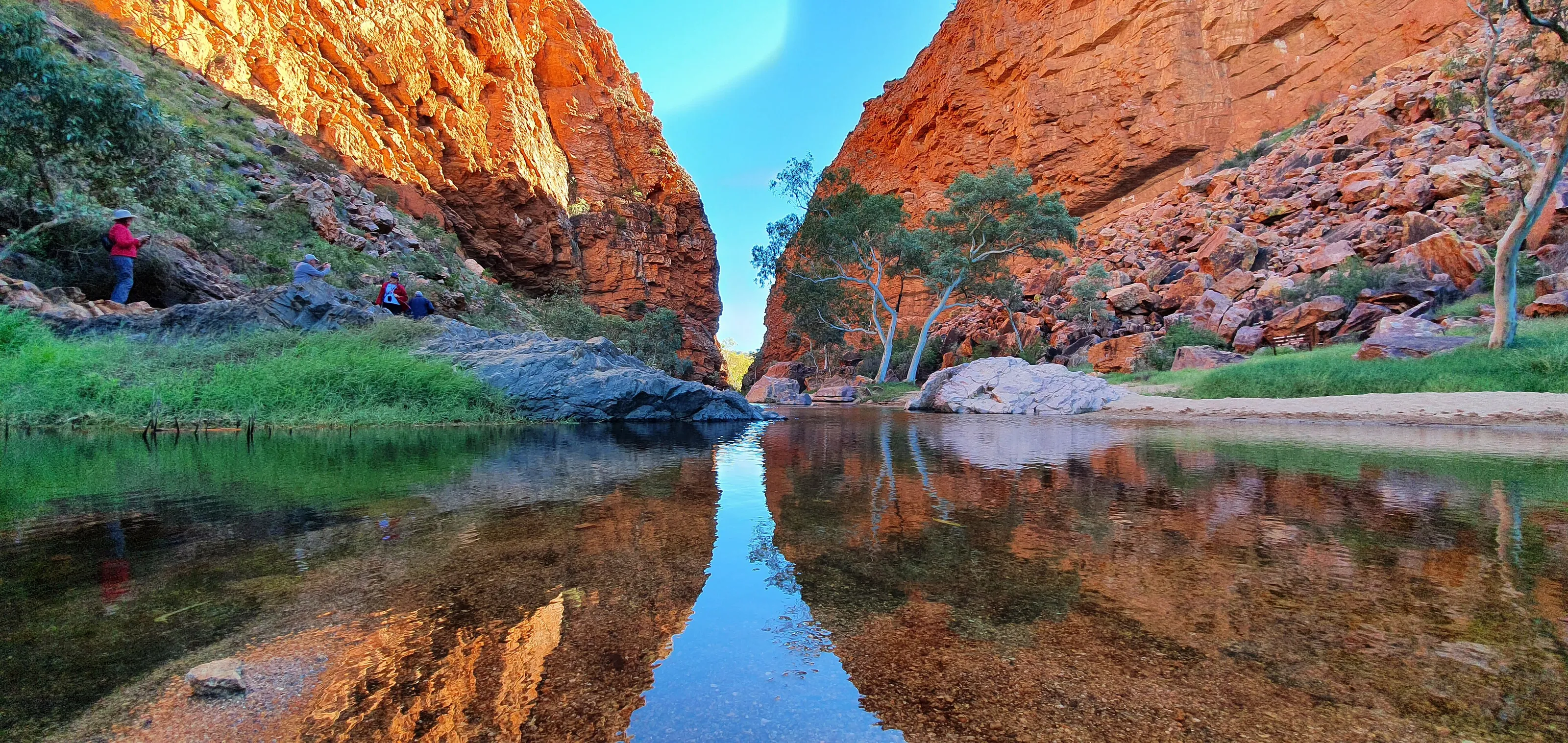
Simpsons Gap
About 18 km west of Alice Springs, Simpsons Gap (Rungutjirpa in Arrernte) is a narrow breach cut through the ridge by a watercourse. The red walls are reflected in a permanent waterhole; the place is important in Arrernte spirituality. It is easy to reach and the natural first stop of a day in the gorges.
The waterhole and wildlife
At the end of the gorge, the water draws eucalyptus trees, birds and, with luck in the early morning, black-footed rock-wallabies. The first section of the Larapinta Trail, a 223 km hiking trail, ends at this waterhole. Stay quiet and keep your distance from wild animals.
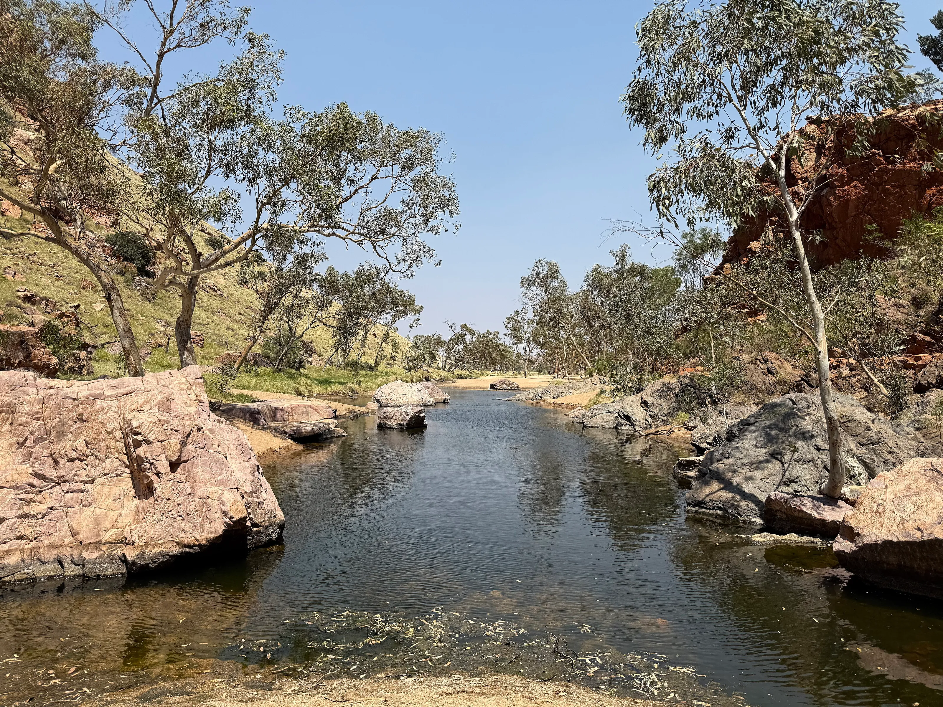
Ormiston Gorge
About 135 km west of Alice Springs, Ormiston Gorge is one of the park's finest gorges, with a large waterhole at the foot of a tall cliff and a sandy bank. It lies roughly halfway along the Larapinta Trail and overlooks the mountain ring of Ormiston Pound. Allow at least half a day from town, and take water and sunscreen.
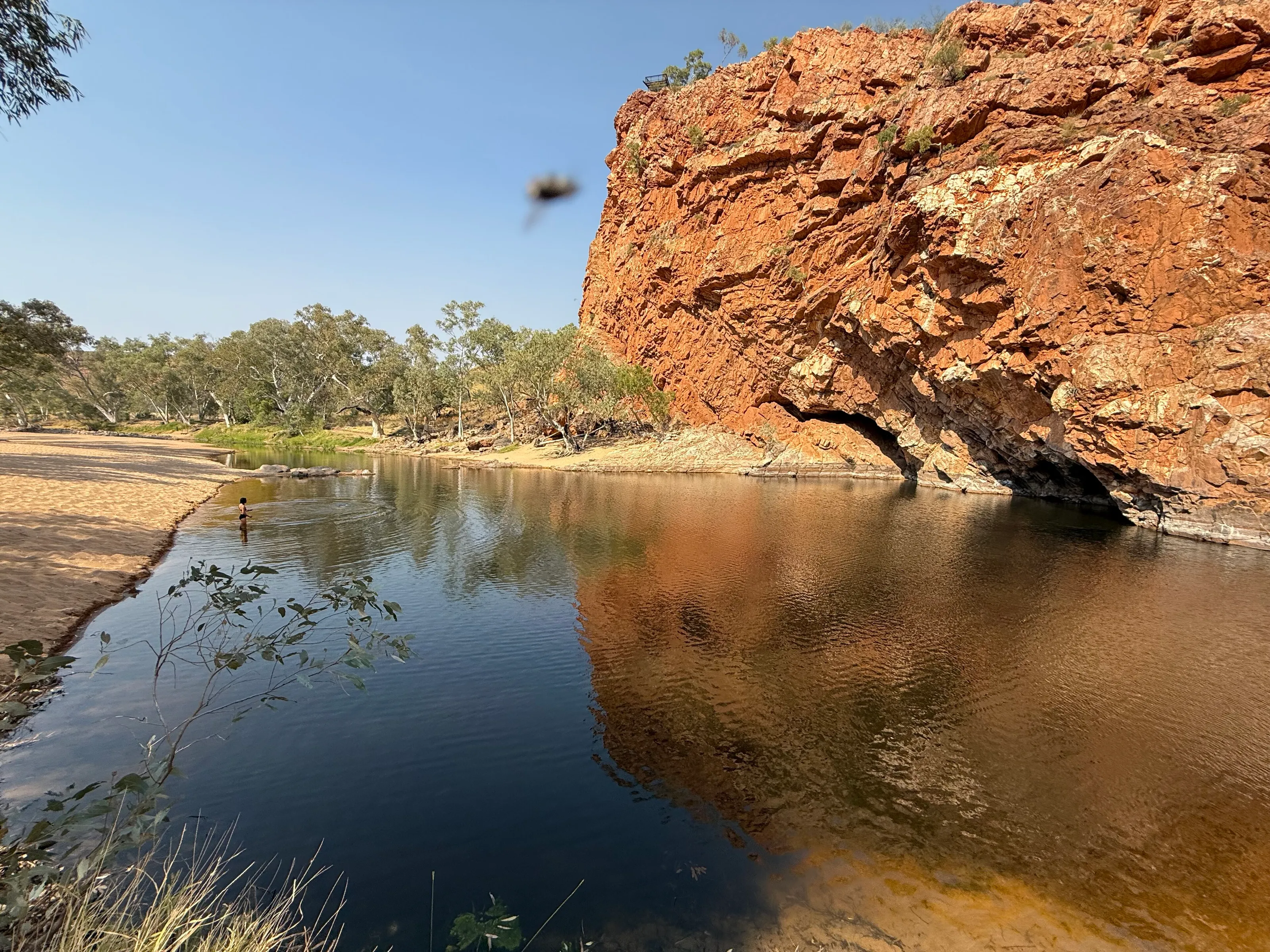
Standley Chasm
Standley Chasm (Angkerle Atwatye, 'the gap of water') is a narrow fissure with vertical walls that the sun lights fully only around midday, when the rock glows bright orange. The site lies on land managed by an Aboriginal land trust and an entry fee applies (we give no price). It is also a trailhead for the Larapinta Trail.
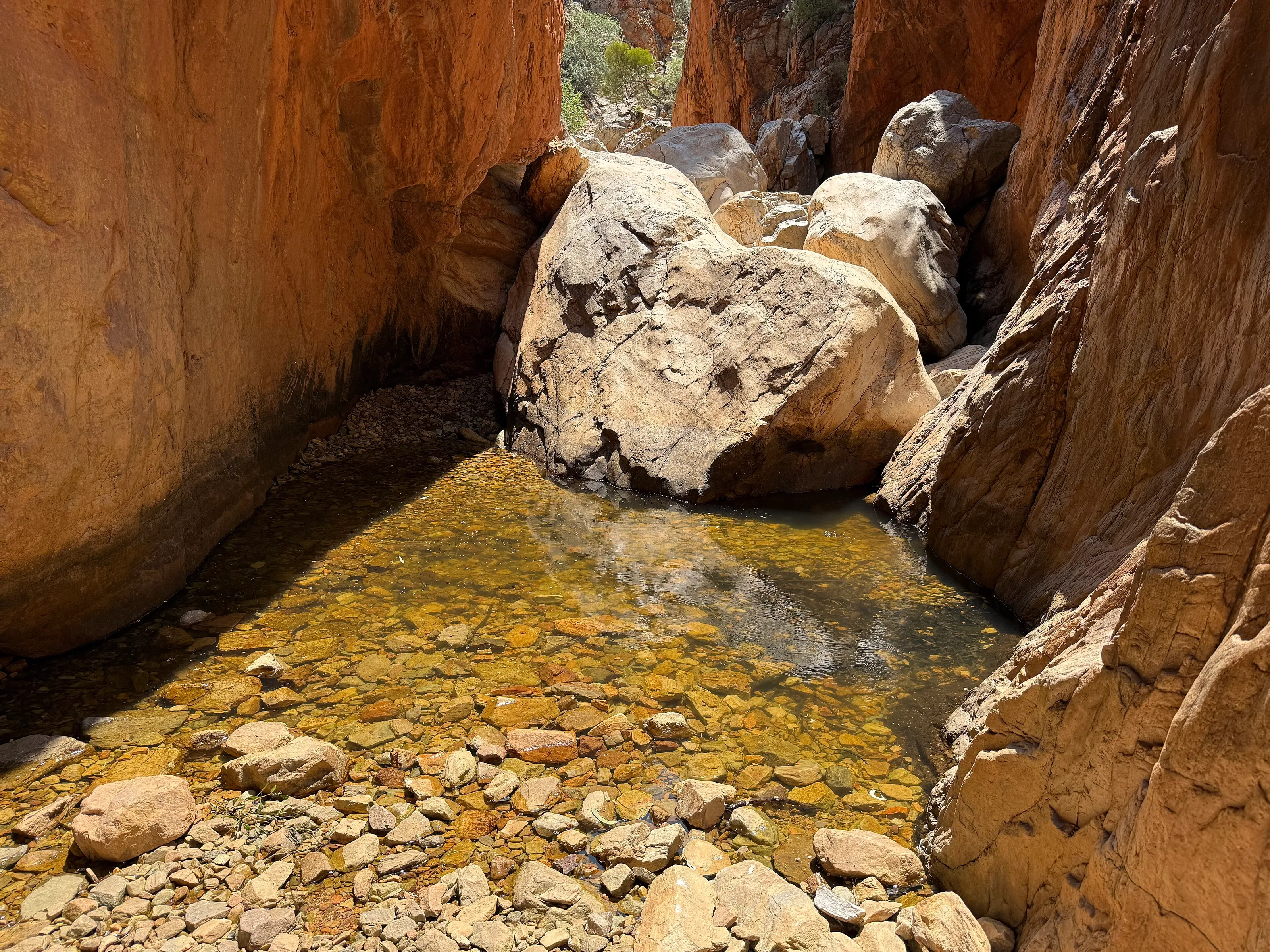
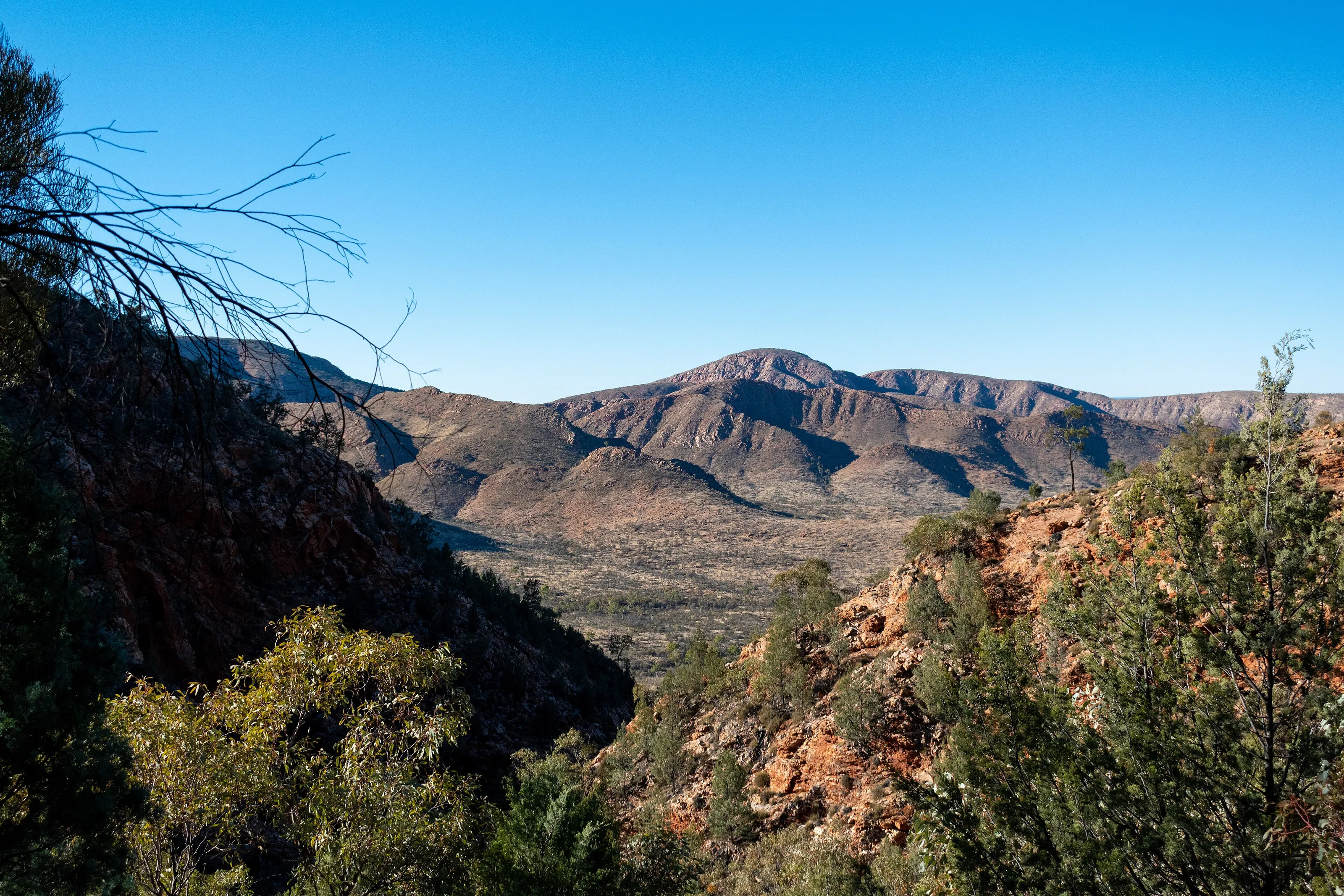
Panorama
The ridges of the West MacDonnell Ranges
Day trips and nature
Larapinta Trail, the Todd River, the desert and Uluru
The Larapinta Trail
This 223 km long-distance trail links the Alice Springs Telegraph Station to Mount Sonder, following the West MacDonnell Ranges; it is split into sections of varying length, so you can walk for a few hours or several days. Check conditions and water availability; avoid the sections in the full heat.
The Todd River and the desert
The Todd River runs through town but holds water only after heavy rain: its sandy bed, lined with eucalyptus trees, is the very image of the landscape. Around it lie several Red Centre deserts; to the south-east, the Simpson Desert has huge red dunes and sites such as Chambers Pillar and Rainbow Valley, better suited to four-wheel drives and organised tours.
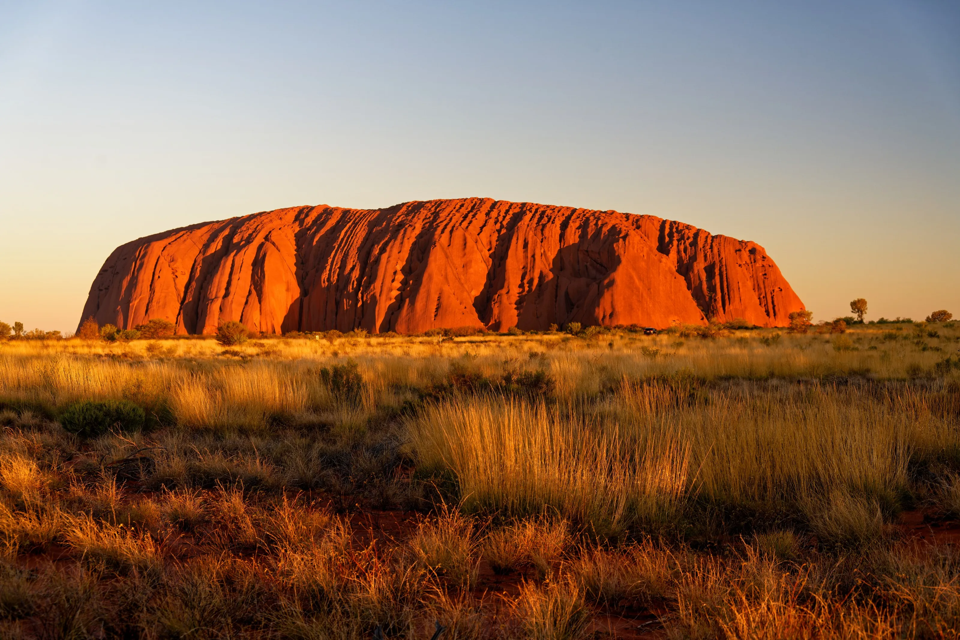
Towards Uluru and Kings Canyon
From Alice Springs you reach Uluru and Kata Tjuta about 450 km away, a drive of 4.5 to 5 hours along the Stuart and Lasseter Highways; many travellers make the round trip in two days, with a night on site. Watarrka National Park, with Kings Canyon, is another classic stop on Red Centre circuits.
Museums and culture
Desert, telegraph, flying doctors and Aboriginal art
Araluen Cultural Precinct
This cultural hub brings together the Museum of Central Australia (natural history and culture of the region, with the Strehlow Research Centre) and the Araluen Arts Centre, which presents art, live performance and touring exhibitions, including works by the Aboriginal painter Albert Namatjira. Check exhibitions and opening hours before you go.
Alice Springs Desert Park
About ten kilometres west of the centre, this park introduces the flora and fauna of Central Australia's deserts, with talks, presentations on Aboriginal use of plants and a nocturnal house for animals that are active at night. Allow several hours and avoid the middle of the day in summer.
The Telegraph Station and the town's history
The old Telegraph Station, a few kilometres north of the centre, is where the town began: historic buildings, trails and the waterhole that gave Alice Springs its name. Other places tell the local story: the old gaol and the Women's Museum of Australia, the Residency, and the Old Ghan Heritage Railway and Museum, devoted to The Ghan train.
The Royal Flying Doctor Service and the School of the Air
Alice Springs is a base of the Royal Flying Doctor Service, the outback's air medical service, and home to the School of the Air, the distance-learning school that teaches children living in remote places. Visits let you see how they work: check opening times before you come.
Aboriginal art
Alice Springs is a major centre for Aboriginal art from Central Australia, with many local galleries. Favour galleries that state the origin of the work and the artist and that pay the communities fairly. We give no prices, which vary widely.
Food and drink
Australian cooking, pubs and bush produce
Cafés, pubs and markets
The centre, around Todd Mall, has most of the cafés, restaurants and pubs with classic Australian cooking: grills, fish and pub meals. On some Sundays markets are held there with fresh produce, crafts and gifts; check the calendar locally.
Bush produce
Some menus and shops offer Australian bush ingredients (herbs, seeds, wild fruits) and meat from animals such as kangaroo. The Desert Park explains the traditional use of plants by Aboriginal people, which helps in understanding these flavours.
Alcohol: strict rules
Alcohol rules are strict in the Northern Territory: drinking in public places (parks, streets) is not allowed and sales are regulated. Learn the local rules and do not buy alcohol on behalf of other people.
Getting around
A car is essential for exploring the region
In town
The centre can be explored on foot or by bike, but summer heat discourages walking at the hot hours. A few bus lines serve the town; taxis can be scarce at peak times, so book them ahead for early-morning trips or the airport.
Rental car
For the West MacDonnell gorges and Uluru, a car is essential. The Stuart Highway, Larapinta Drive and Namatjira Drive are sealed; dirt tracks need a four-wheel drive and are sometimes excluded from rental contracts. Driving is on the left; fill up before leaving, carry water and avoid driving at dawn and dusk, when animals cross.
Coach and The Ghan train
Long-distance coaches link Alice Springs to Adelaide and Darwin, on very long journeys. The Ghan train stops at Alice Springs on its Adelaide-Darwin line; it is a luxury tourist journey, more expensive than flying: check the running days before planning.
Budget and entry
A high price level, especially for the car and tours
Price level
Alice Springs is pricier than many European destinations because of its remoteness: car rental, fuel, guided tours and accommodation weigh on the budget, especially in high season. Simple meals, markets, hiking trails and the waterholes in the gorges are budget-friendly options. We give no figures: prices vary with the season and the exchange rate.
Flights
The long-haul flight remains the most variable cost. SniperAir tracks fares to ASP and compares them with the route's history; also look at flights to Ayers Rock (AYQ) if you are visiting Uluru.
Entry and precautions
Australia generally requires an electronic travel authorisation or a visa depending on nationality: check the official Australian government websites. Also consult the official travel advice of your country of departure. On the spot, respect Aboriginal land and signage, protect yourself from the sun and carry plenty of water on excursions.
When to go
Very hot summers, cool winters with freezing nights: reversed seasons
Winter (June to August)
Mild, sunny days and cold nights with possible frost (the town is at about 545 m altitude and averages around a dozen nights below freezing a year). The best time for walking.
Spring (September to November)
Heat rises noticeably; days remain pleasant in September and then become very hot. Walk the trails early in the morning.
Summer (December to February)
Very hot: average high of about 36 °C, with peaks above 43 °C and warm nights. Most outdoor activities are done in the first hours of the day.
Autumn (March to May)
The heat gradually recedes; April and May bring pleasant temperatures for both driving and walking.
Beware of the reversed seasons: Australia lies in the southern hemisphere, so the austral summer runs from December to February and winter from June to August, the opposite of Europe. Alice Springs has a desert climate, with about 285 mm of rain a year, very erratic from one year to the next; records of over 47 °C and below -7 °C have been recorded.
As a rule, the best time runs from April to September. In summer, favour pre-dawn starts, shade and water; the car should have air conditioning.
By length of stay
What to do in Alice Springs depending on how long you stay
The town
The Desert Park, the Telegraph Station and an Aboriginal art gallery.
The gorges
Simpsons Gap and Standley Chasm, then Ormiston Gorge on Namatjira Drive.
The Red Centre
A section of the Larapinta Trail or the road to Uluru, Kata Tjuta and Kings Canyon.
In pictures
Alice Springs and the MacDonnell Ranges in pictures
You might also like
Similar destinations
FAQ
Frequently asked questions about flights to Alice Springs
How do I get from Alice Springs airport to the centre?
The airport (ASP) is about 13 km south of the centre. Taxis and shuttles usually take 15 to 20 minutes; car rental companies have desks on site.
When is the best time to visit Alice Springs?
Generally from April to September: pleasant temperatures and cool nights. The austral summer (December to February) is very hot, with average highs of about 36 °C; seasons are reversed compared with Europe.
Is Alice Springs expensive?
The price level is high compared with Europe, especially for car rental, fuel, tours and accommodation. Simple meals, markets and hikes help keep the budget down.
How long should I stay in Alice Springs?
Two to three days cover the town and the main MacDonnell gorges; add at least two days if you continue to Uluru, about 450 km away.
How do I get around Alice Springs and the area?
A rental car is essential for the gorges and Uluru; driving is on the left. In town you can walk, cycle, take a bus or a taxi. The Ghan train also stops at Alice Springs.
What should I try in Alice Springs?
Classic Australian cooking in the pubs and cafés of Todd Mall, and bush ingredients such as kangaroo. Note that alcohol is tightly regulated in the Northern Territory.
How much does a flight to Alice Springs usually cost?
The price mainly depends on your departure city, the season and how far ahead you book. The "opportunities" section above shows real examples of fares already detected by SniperAir for this destination.
How do I get alerted when a flight to Alice Springs drops below my budget?
Create an alert profile with your departure airport, Alice Springs as the destination and your maximum budget. You are notified automatically as soon as a matching fare is detected.
Ready to head to Alice Springs?
Set your budget and let SniperAir monitor fares for you.
Create my alert