
Cheap flights to Quito
Set your departure airport and maximum budget: SniperAir tracks prices to Quito and alerts you the moment a deal matching your criteria appears.
Quick summary
Country
Ecuador
Continent
South America
Airport
UIO
Currency
US dollar (USD)
Time zone
UTC-5
Deals already spotted to Quito
Real flight examples detected by SniperAir, with their reference price.
Loading examples…
Why track Quito with SniperAir
You do not need to compare prices every day
Choose your departure
Enter your departure airport and your maximum budget for a flight to Quito (UIO).
SniperAir keeps watch
Our systems continuously compare new prices with the real price history of the route. SniperAir monitors prices and alerts you: it does not sell or book tickets.
You receive an alert
As soon as a price matches your criteria, you are notified, without having searched for anything yourself.
Airport and getting into town
A modern airport roughly twenty kilometres from the centre
Quito – Mariscal Sucre (UIO)
Mariscal Sucre International Airport at Tababela opened on 20 February 2013 and replaced the old airport inside the city, according to Wikipedia (EN, FR). Sources give different distances: about 18 km east of the centre per Wikipedia (EN) and Wikivoyage (EN), 25 km per Wikipedia (FR) and 15 km per Wikivoyage (DE). Allow roughly twenty kilometres and, depending on traffic, 45 minutes to over an hour by taxi or bus. Wikivoyage (EN, DE) lists airport buses to several city terminals, and notes there are no direct flights from Germany, so check your connections.
Distances and times are approximate and vary by source and traffic. We do not quote fares.
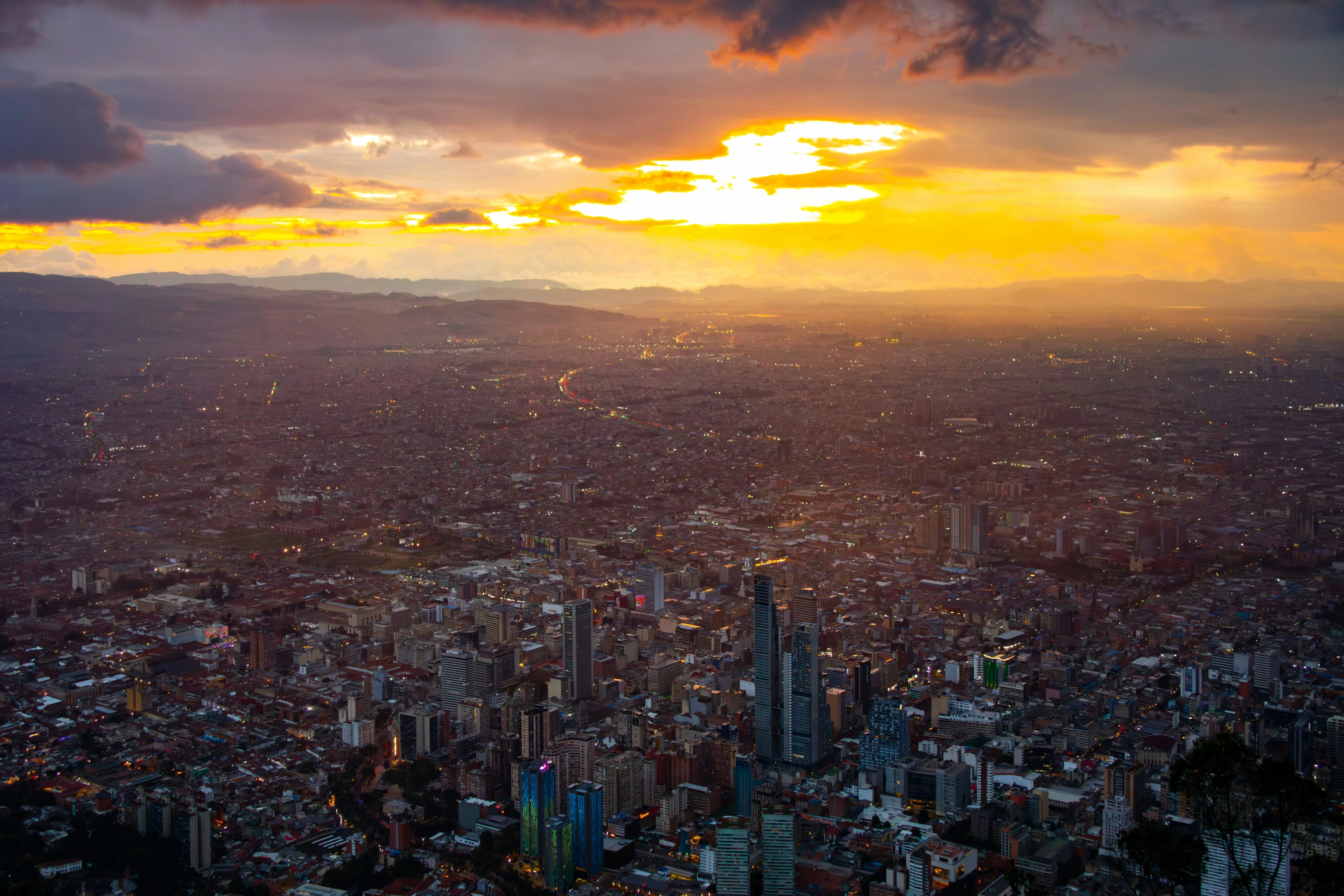
Quito, Ecuador's capital, was refounded at its present site on 6 December 1534 by Sebastian de Benalcazar, says Wikipedia (EN), and sits in an Andean basin. The built-up area is long and narrow, about 45 km by no more than 5 km according to Wikivoyage (DE). Population figures differ between pages and depending on whether you count the city or the metro area, so we leave them out. What matters for a trip is the altitude: 2,850 m according to several sources, which makes it one of the highest capitals in the world.
Landmarks and sights
A UNESCO colonial centre, baroque churches and volcano views
Quito's historic centre was among the first sites on the UNESCO World Heritage list, in 1978 (Wikipedia EN, FR, ES). Wikipedia (EN) puts it at about 320 hectares with some 130 monumental buildings; Wikivoyage (EN) counts more than 40 churches. The places below are illustrated.
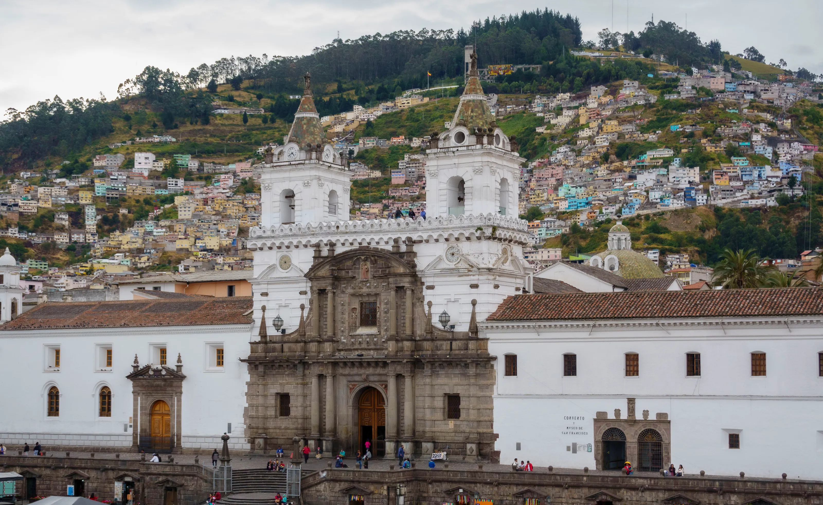
San Francisco church and convent
The complex stands on the square of the same name in the colonial centre. Wikipedia (EN) says the church was built between 1535 and 1650, and Wikivoyage (EN) mentions a museum and a tower. Behind it, the colourful houses of the hillside climb towards the sky.
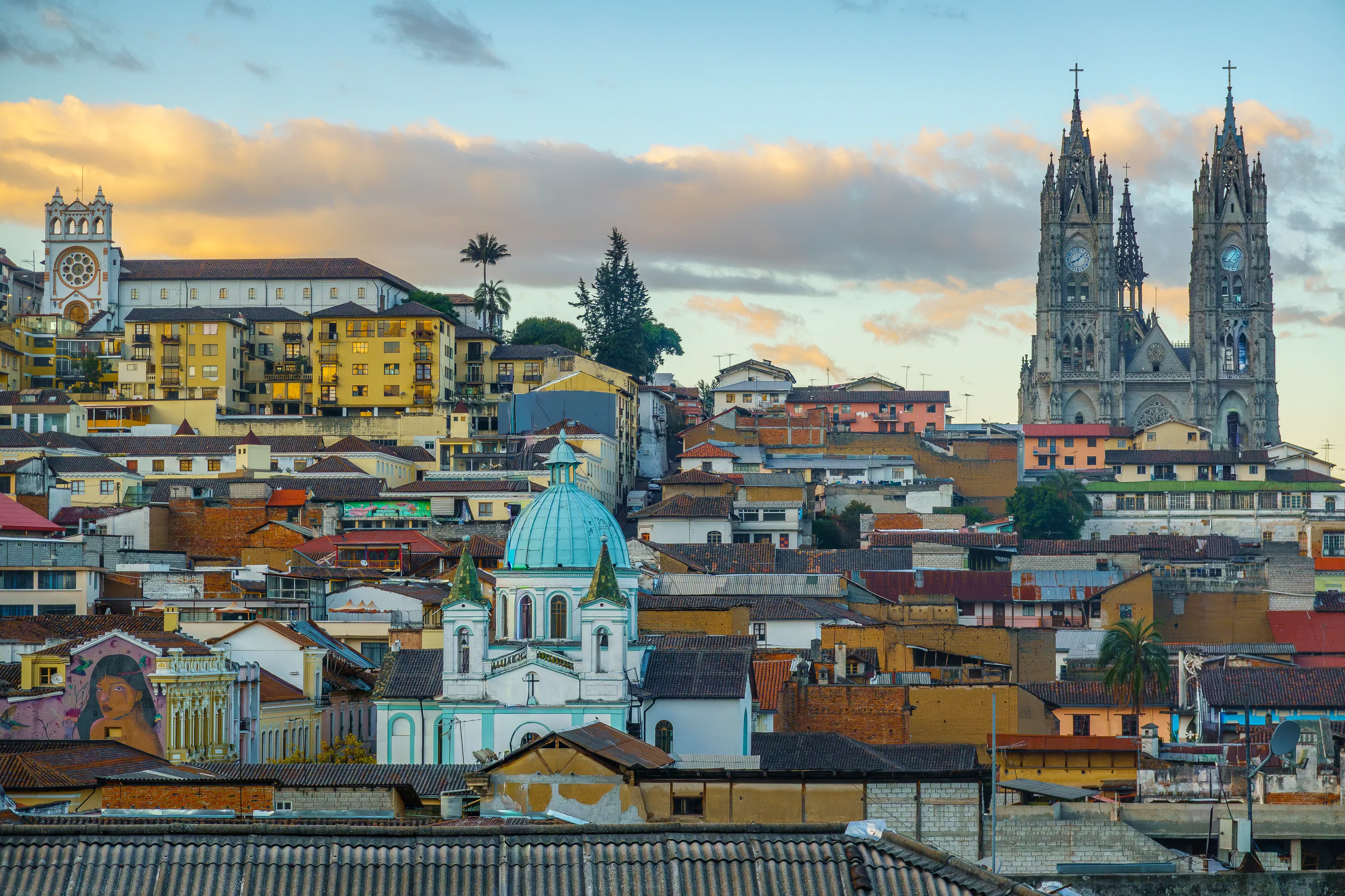
Coloured roofs and the neo-Gothic basilica
From a rooftop the centre looks like a sea of tiled roofs and yellow, ochre and green facades, with the twin spires of the Basilica del Voto Nacional in the distance, one of the most important neo-Gothic buildings in Ecuador according to Wikipedia (EN). Wikivoyage (EN) says you can climb its towers.
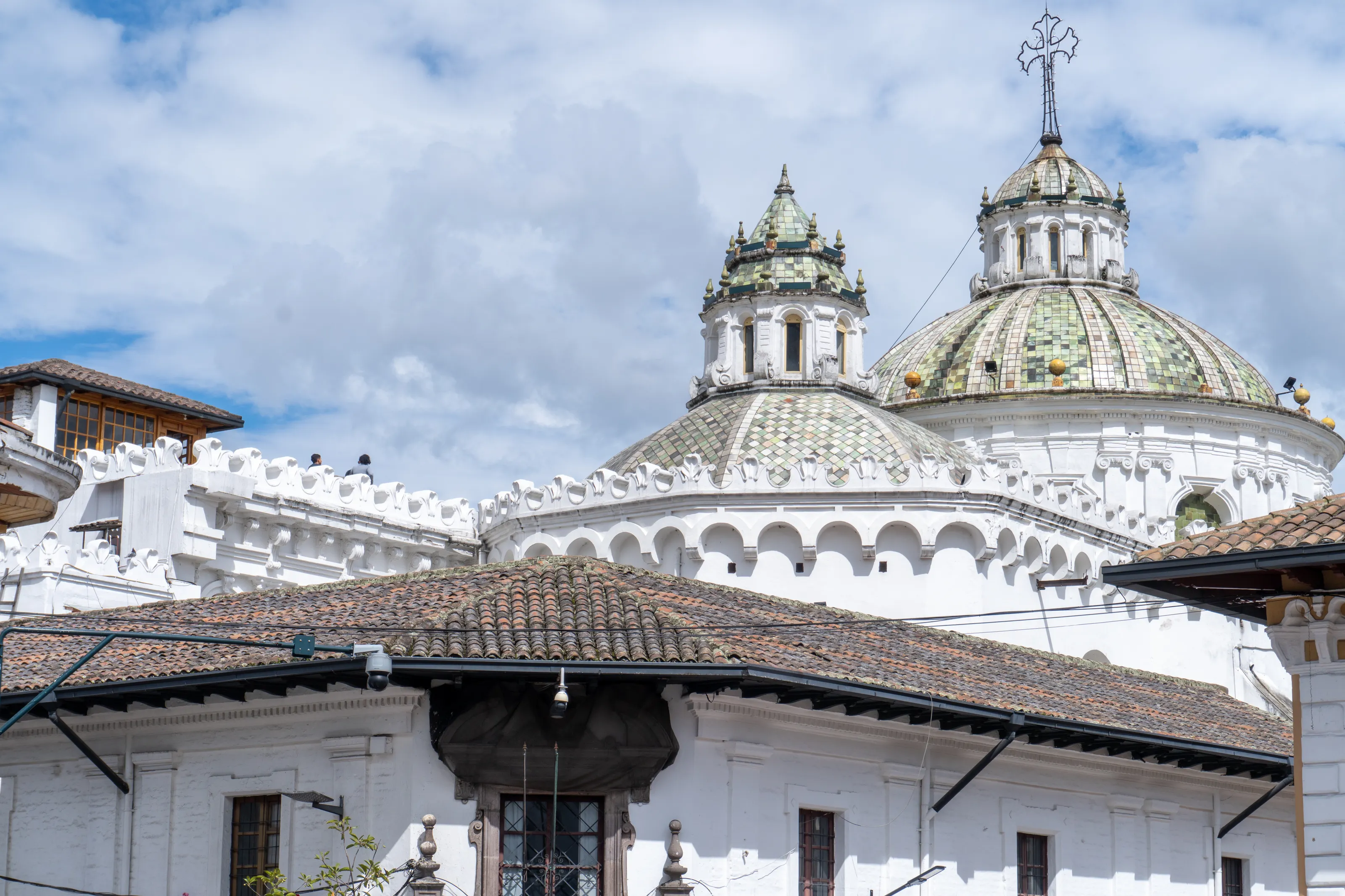
Domes and churches of the old town
Domes and bell towers rise above the roofs. The church of La Compania de Jesus, begun in 1605 with its facade completed in 1765 (Wikipedia EN), is a baroque showpiece; Wikivoyage (DE) calls the facade baroque and the interior richly ornate. Dress sensibly when visiting, and check whether photography is allowed.
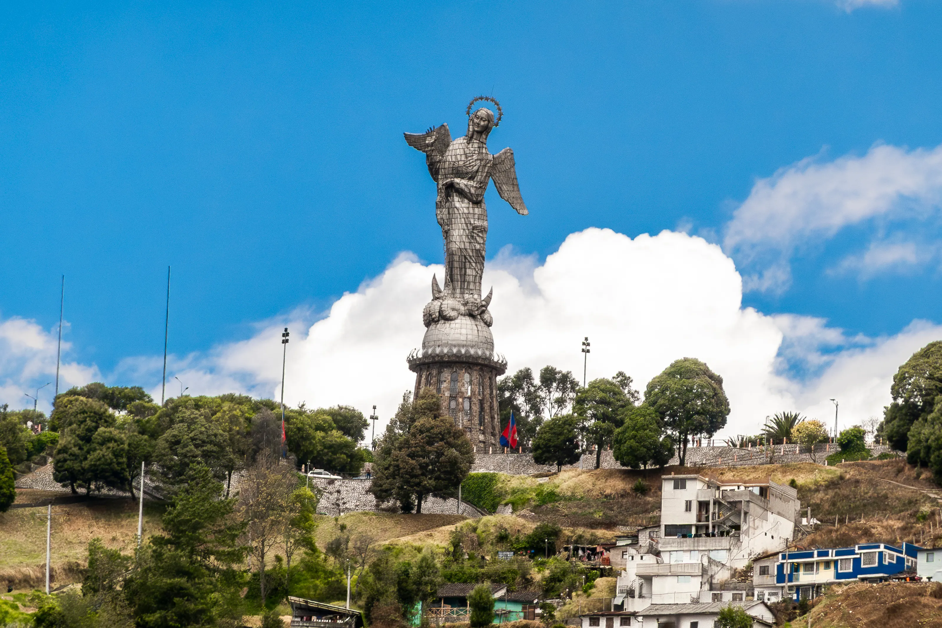
El Panecillo and the Virgin of Quito
El Panecillo is a hill south of the old town, topped by a winged Virgin of about 41 m made of aluminium (Wikipedia EN), unveiled in 1976 according to Wikipedia (ES). The view is wide, but Wikivoyage (EN, DE) says never to walk up: go by bus or taxi.
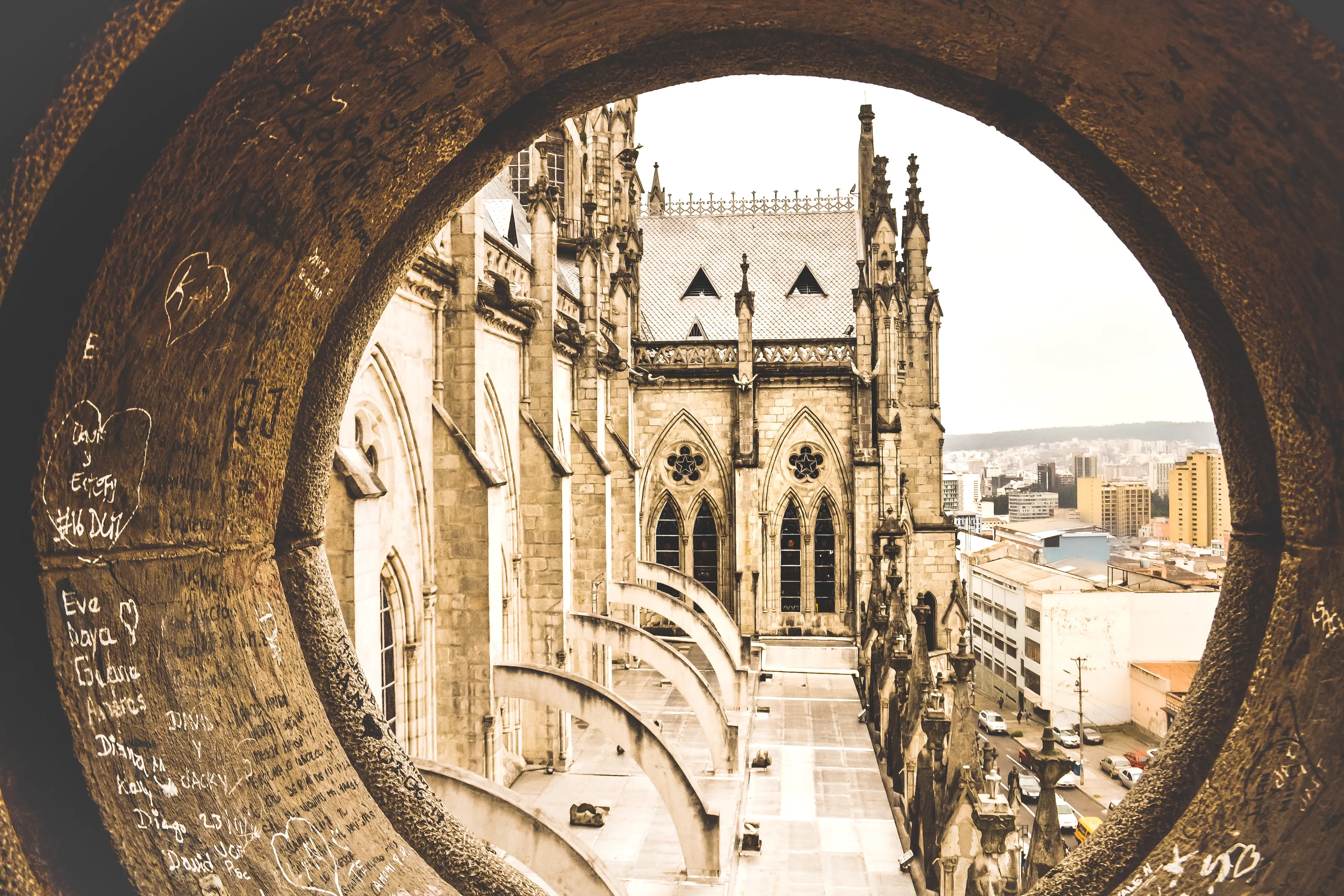
The basilica towers
Seen through a round opening, the facade of the Basilica del Voto Nacional shows its pinnacles and carved stonework. Wikivoyage (DE) warns that climbing the tower requires a head for heights.
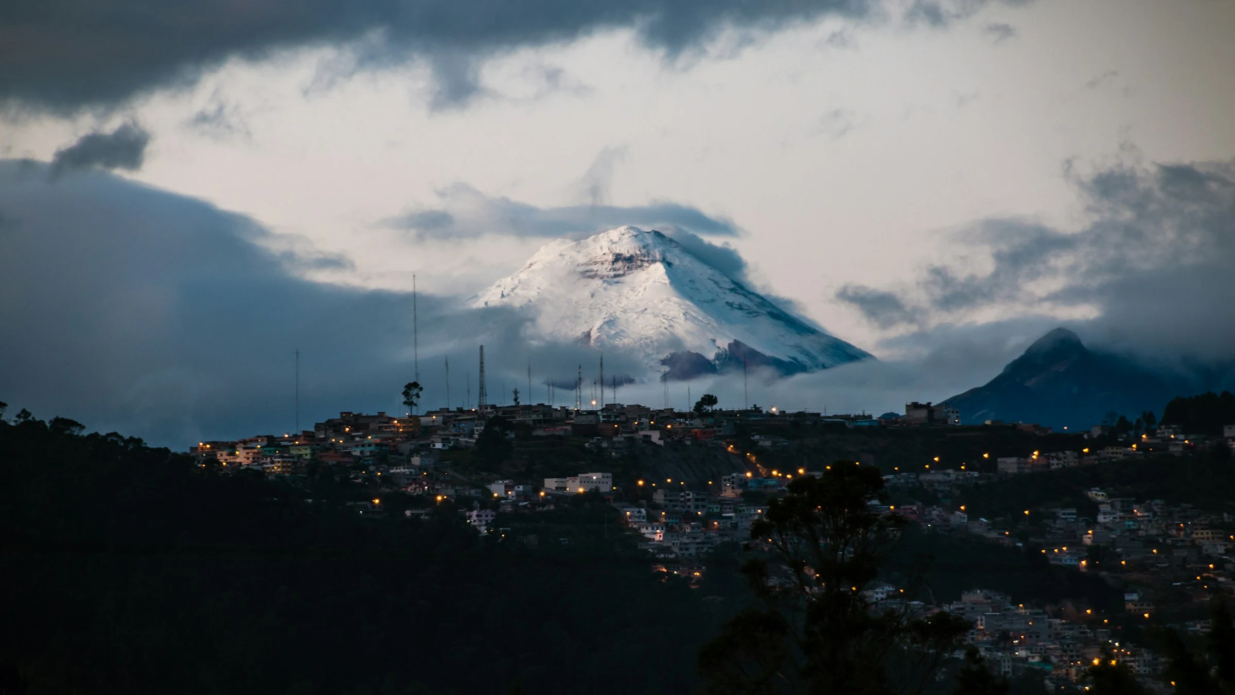
Volcanoes above the city
Quito is ringed by volcanoes: Pichincha, Cotopaxi, Cayambe and Antisana are named by Wikipedia (FR, DE). On a clear day a snow-covered peak can rise above the city's neighbourhoods, as in this dusk view; the drier months, June to August in most sources, are the best bet.
Plaza Grande, La Ronda and the cable car
Plaza Grande, overlooked by Carondelet Palace, seat of the government, is the usual starting point for a walk through the centre (Wikipedia EN, Wikivoyage ES). La Ronda is a cobbled street of shops and cafes, best in the late afternoon according to Wikivoyage (EN). The TelefériQo cable car climbs the Pichincha slopes in about 18 minutes to roughly 4,000 m, say Wikivoyage (EN, ES, DE); bring warm clothes.
Mitad del Mundo
The Mitad del Mundo monument north of the city, about 20 km away according to Wikivoyage (DE, ES), marks the equator. Wikivoyage (EN) calls it mostly touristic and says the nearby Intinan solar museum is presented as sitting on the true equator. Allow at least an hour by public transport.
Museums and culture
Pre-Columbian, colonial and modern art
Museums to understand the country
The Museo Nacional (MuNa), the Museo de la Ciudad and the Casa del Alabado, devoted to pre-Columbian art, are listed by Wikivoyage (EN, ES). Wikivoyage (DE) adds the national museum of the central bank, one of the country's most important, and the Camilo Egas museum.
Guayasamin and the Chapel of Man
Wikipedia (FR) cites the Guayasamin Museum and the Chapel of Man, devoted to one of Ecuador's best-known painters. The La Florida site museum, opened in 2010, displays objects from ancient tombs according to Wikipedia (EN).
Everyday culture
The old town is car-free on Sundays (Wikivoyage DE), a good moment for a stroll. We do not quote ticket prices or hours: they change and sources disagree.
Food and drink
Highland soups, potatoes and street food
Typical dishes
Locro de papas, a thick potato soup, and llapingachos, fried potato cakes, are named by Wikivoyage (DE); breakfast often means bolon de verde, a green-plantain dumpling. Wikivoyage (EN, ES) also lists ceviche, chaulafan fried rice and plenty of chifas, Chinese-style restaurants.
Markets and the street
Wikivoyage (DE) names the Mercado Central and the Mercado Inaquito; the La Floresta night market serves grilled skewers and tripa mishqui, grilled tripe, from late afternoon (Wikivoyage EN, ES). Plaza Foch in the La Mariscal district has many restaurants.
Drinks
Street vendors called poncheros sell a punch of egg, malt, sugar and vanilla in the old town, though they are rarer now, says Wikivoyage (DE).
Getting around
Metro, trolleybus and taxis: mind the altitude and the slopes
Metro and bus rapid transit
Quito's metro opened on 1 December 2023 and links Quitumbe to El Labrador over about 23 km according to Wikipedia (EN) and Wikivoyage (DE, EN). The Trole, the green line of the bus rapid transit network, has the stops closest to Plaza Grande (Wikivoyage EN); Ecovia and Metrobus complete the network.
Taxis
Wikivoyage (DE, EN) recommends official yellow taxis with a visible number and insisting on the meter. Slopes and altitude tire you more than you expect, so mix walking and rides.
Beyond the city
Otavalo and its craft market, the Pululahua crater, Cotopaxi and Papallacta are listed as day trips by Wikivoyage (EN, ES). For some of them a guide or agency is simpler than a rental car.
Budget and precautions
Costs to check, and a trip at altitude
Price level
Public transport is very cheap according to Wikivoyage (EN) and simple meals are affordable. We give no figures because we could not confirm them from two independent open sources.
Currency
Ecuador uses the US dollar.
Flights, safety and health
SniperAir monitors prices to UIO against the route's history but does not sell or book tickets. To compare, you can also track Guayaquil (GYE). In Quito, be careful at night in the old town, watch your belongings on public transport and use official taxis, as Wikivoyage (EN, DE, ES) advises; check the official guidance of your departure country for safety and entry requirements. At 2,850 m some travellers feel altitude effects in the first days (soroche): start gently, and if you have health concerns ask a professional before you go.
When to go
Eternal spring, with a drier spell from June to August
Dry season (June to August)
Wikipedia (EN) and Wikivoyage (DE) give this as the driest stretch; Wikivoyage (ES) calls June to September the best time to see the volcanoes.
Wet season (late September to May)
Sources disagree on the exact months: September to May per Wikipedia (EN), October to mid-May per Wikivoyage (ES), with wetter spells September to November and January to April per Wikivoyage (DE).
Any day
Temperatures vary little: about 21 C in the afternoon and 7 to 10 C at night according to Wikipedia (FR) and Wikivoyage (EN). Wikivoyage (EN) jokes about all four seasons in a day, so pack layers and a rain jacket.
Sun and altitude
UV is very strong at this altitude even in cool weather (Wikipedia EN, Wikivoyage DE): sunscreen and sunglasses help.
The climate is temperate highland oceanic (Cfb) according to Wikipedia (FR, ES); the annual mean runs from 13 C to 15.6 C depending on the page, and rainfall exceeds 1,000 mm a year. We do not give monthly averages because sources differ.
By length of stay
What to do in Quito depending on how long you stay
The historic centre
Plaza Grande, San Francisco, La Compania, La Ronda and the Basilica del Voto Nacional.
Panecillo, museums and cable car
El Panecillo by taxi, one or two museums, the TelefériQo and the Mitad del Mundo.
Volcanoes and markets
Otavalo, Pululahua, Cotopaxi or Papallacta as day trips, with Quito as a base.
In pictures
Quito in pictures
You might also like
Similar destinations
FAQ
Frequently asked questions about flights to Quito
How do I get from Quito airport to the city centre?
The airport (UIO) is about twenty kilometres away, depending on the source. By taxi or bus allow 45 minutes to over an hour, depending on traffic.
Is altitude a problem in Quito?
At 2,850 m some travellers feel mild effects in the first days: start gently, stay hydrated and ask a health professional if you have any concern.
When is the best time to visit Quito?
June to August is the driest stretch. Temperatures stay steady all year, with mild days and cool evenings.
What should I see in the historic centre?
Plaza Grande, San Francisco church, La Compania, the Basilica del Voto Nacional and La Ronda, in a centre listed by UNESCO in 1978.
Can I visit the Mitad del Mundo from Quito?
Yes, the monument is about twenty kilometres north; allow at least an hour by public transport or take an organised tour.
How long should I stay in Quito?
Two days cover the historic centre; four days let you add the cable car, museums and the Mitad del Mundo.
How much does a flight to Quito usually cost?
The price depends mainly on your departure city, the time of year and how far ahead you book. The "opportunities" section above shows real examples of prices SniperAir has already detected to this destination.
How do I get alerted when a flight to Quito drops below my budget?
Create an alert profile with your departure airport, Quito as the destination and your maximum budget. You are notified automatically as soon as a matching price is detected.
Ready to head to Quito?
Set your budget and let SniperAir monitor fares for you.
Create my alert