Cheap flights to Nador
Set your departure airport and maximum budget: SniperAir tracks prices to Nador and alerts you the moment a deal matching your criteria appears.
Quick summary
Country
Morocco
Continent
Africa
Airport
NDR
Currency
Moroccan dirham (MAD)
Time zone
UTC+1 (UTC+0 during Ramadan)
Deals already spotted to Nador
Real flight examples detected by SniperAir, with their reference price.
Loading examples…
Why track Nador with SniperAir
A Rif city on the edge of the Marchica lagoon
Choose your departure
Enter your departure airport and your maximum budget for a flight to Nador (NDR).
SniperAir keeps watch
Our systems continuously compare new prices with the real price history of the route. SniperAir monitors prices and alerts you: it does not sell or book tickets.
You receive an alert
As soon as a price matches your criteria, you are notified, without having searched for anything yourself.
Nador is the capital of the province of the same name in north-eastern Morocco: it has about 160,000 inhabitants, and nearly 400,000 with its urban area according to Wikipedia (EN, FR). It sits on the Marchica lagoon (Mar Chica in Spanish), which separates it from the Mediterranean, about ten kilometres south of the Spanish enclave of Melilla. Every summer many people from the area who live in Europe return home: more than 25,000 between June and August per Wikipedia (EN). A SniperAir alert on NDR helps you follow fares that vary a lot in that period.
Airport and getting into town
An airport about twenty kilometres away, geared to cars and grand taxis
Nador-Al Aroui (NDR)
Nador-Al Aroui airport is about 24 km south-south-west of the city per Wikipedia (EN, FR); Wikivoyage (EN) says 25 km. There is no public transport to the airport according to Wikipedia (EN): in front of the terminal, grand taxis offer shared rides to most destinations. Wikivoyage (EN) says buses towards Fez and other cities stop at Jbel Arouit, about 4 km away. It also serves as a second airport for travellers to and from Melilla per Wikivoyage (EN).
Distances are approximate (Wikipedia EN and FR, Wikivoyage EN); connections change. We do not give fares.
Nador is also served by train (the Beni Ansar to Taourirt line, opened in 2009 per Wikipedia DE) and by the port of Beni Ansar, from which ferries sail to Spain and France per Wikivoyage (EN). Oujda (OUD) is the other major airport of the Oriental, about 137 km away per Wikipedia (FR).
Landmarks
A lagoon, a corniche and Cape Three Forks
Nador is a recent city, founded in the 19th century per Wikipedia (EN) or developed by the Spanish from 1908 per Wikipedia (ES): people come mainly for the lagoon, the coast and the landscapes. The places below are illustrated; Mount Gourougou and the city hill are described in text only.
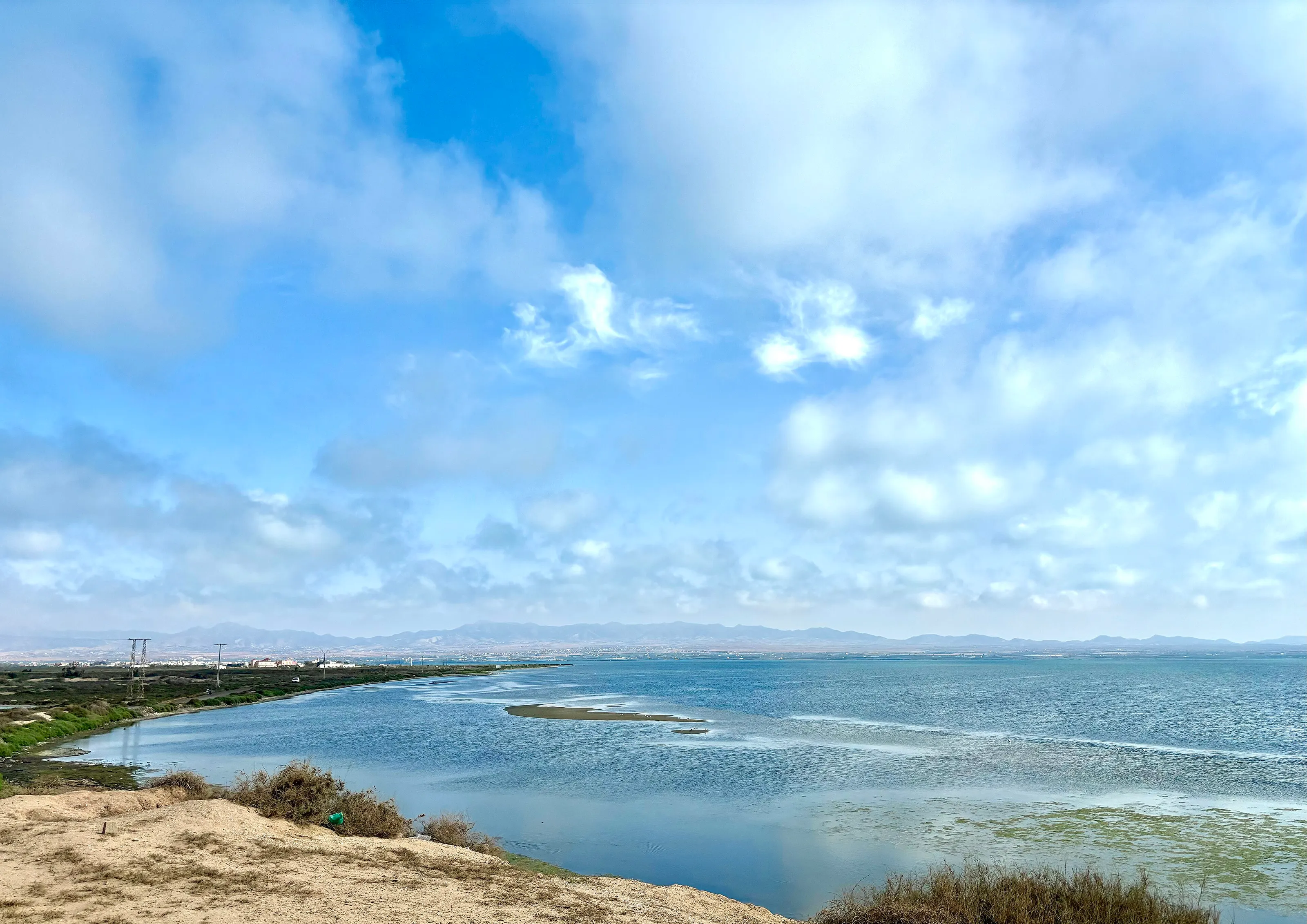
The Marchica lagoon
This salt lagoon, the largest in Morocco per Wikivoyage (EN), about 25 km long and 4,000 hectares per Wikipedia (FR), separates Nador from the Mediterranean. It attracts migratory birds per Wikipedia (EN). A tourism and clean-up development programme, Marchica Med, has been planned since 2009 according to Wikipedia (FR).
The lagoon at sunset
At low tide, the lagoon's foreshore and pools mirror the evening light. Water birds frequent the shallows, which suits birdwatchers. Conditions vary with the season: ask locally before you go.
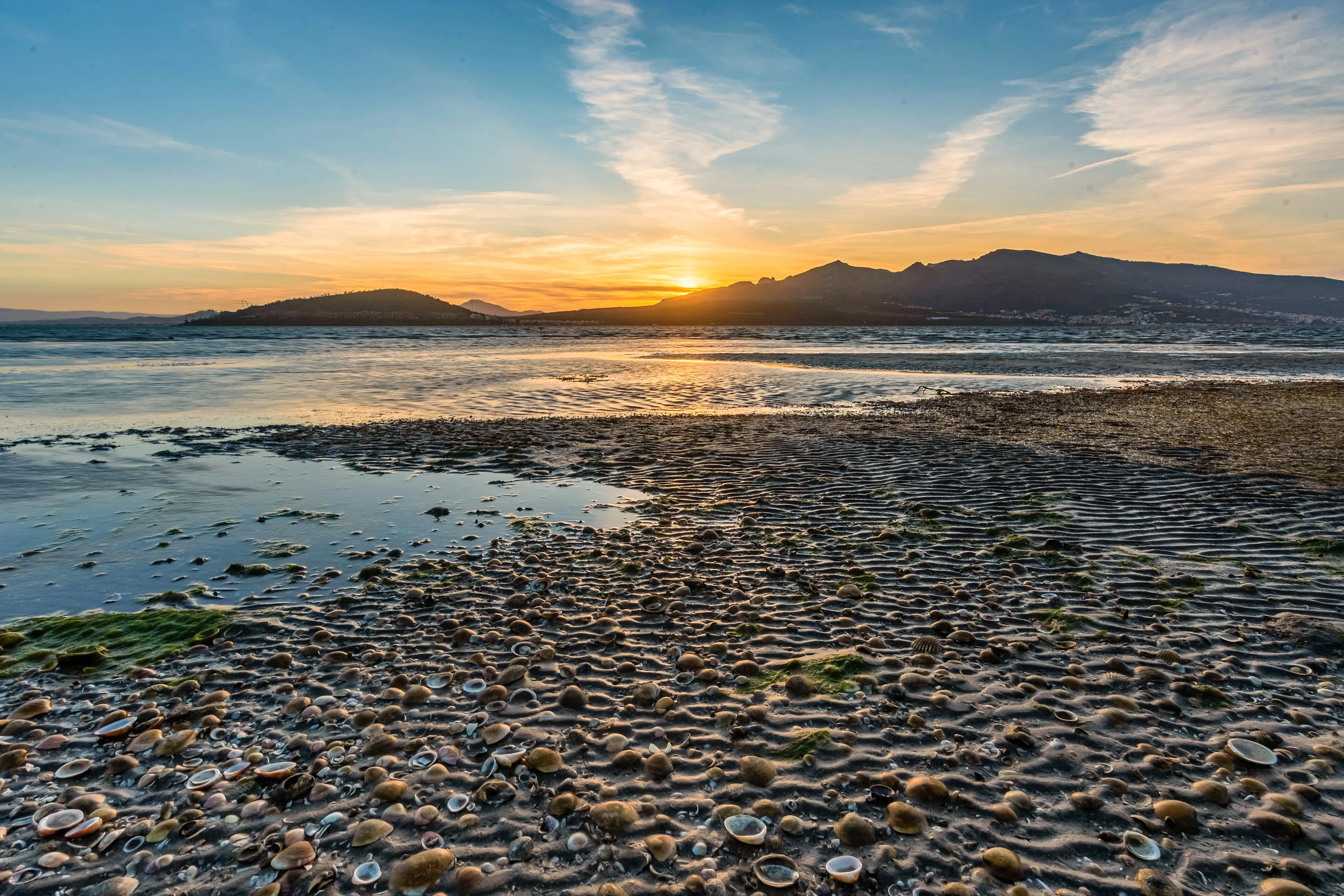
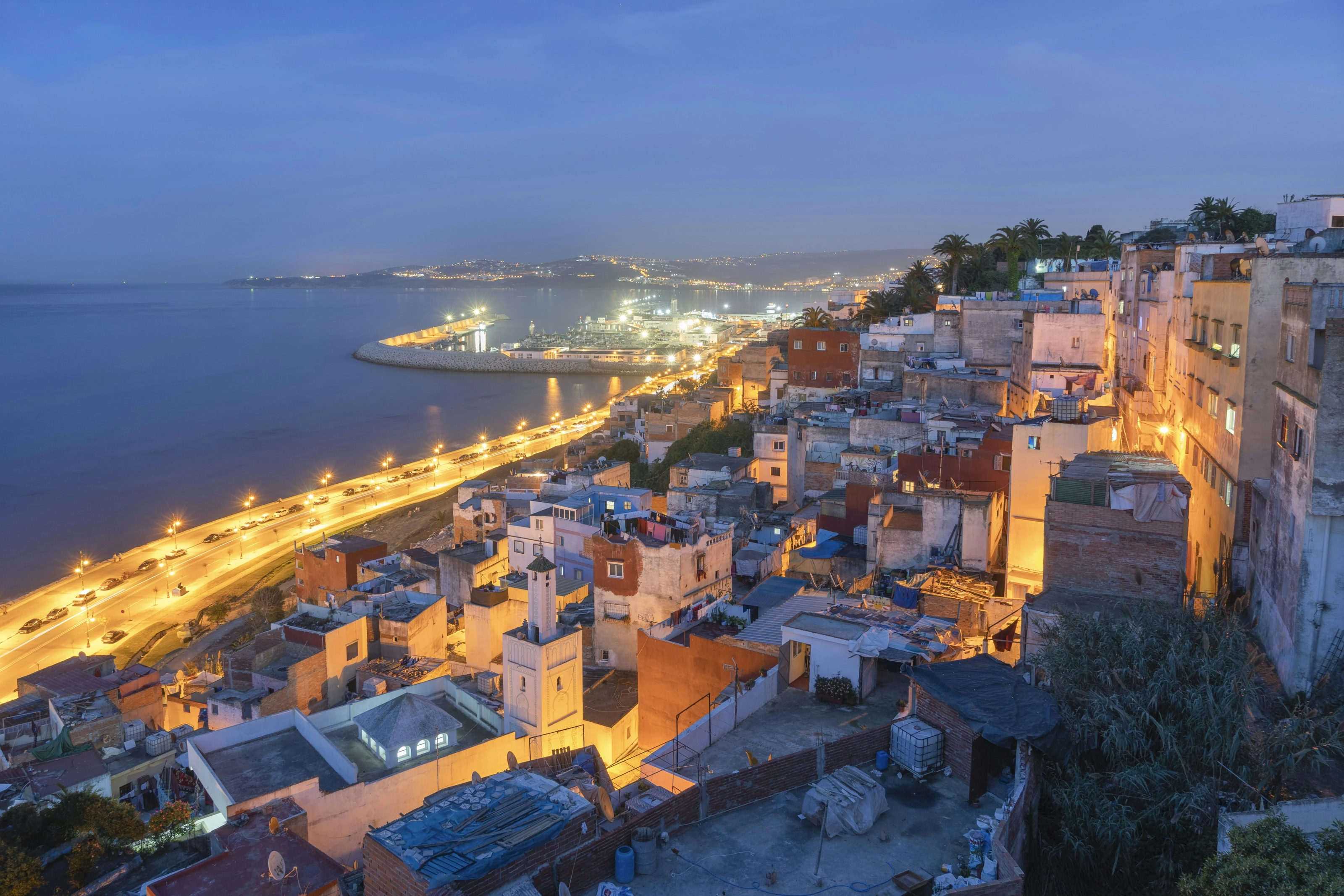
The Nador corniche
The corniche follows the lagoon for several kilometres, with seawall, promenade and palm trees. Wikivoyage (EN) presents it as a place to stroll and take photos. At blue hour the city lights reflect in the water.
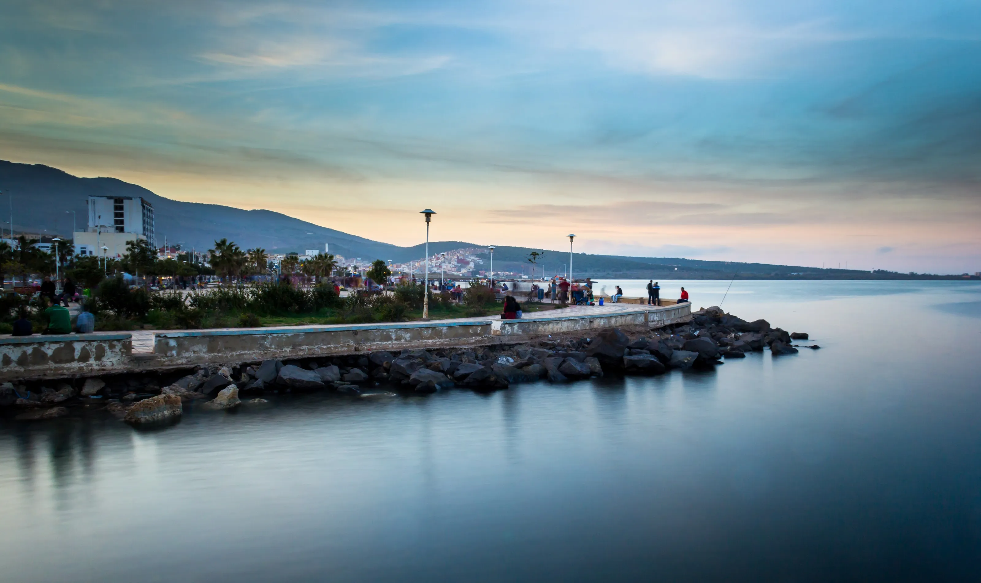
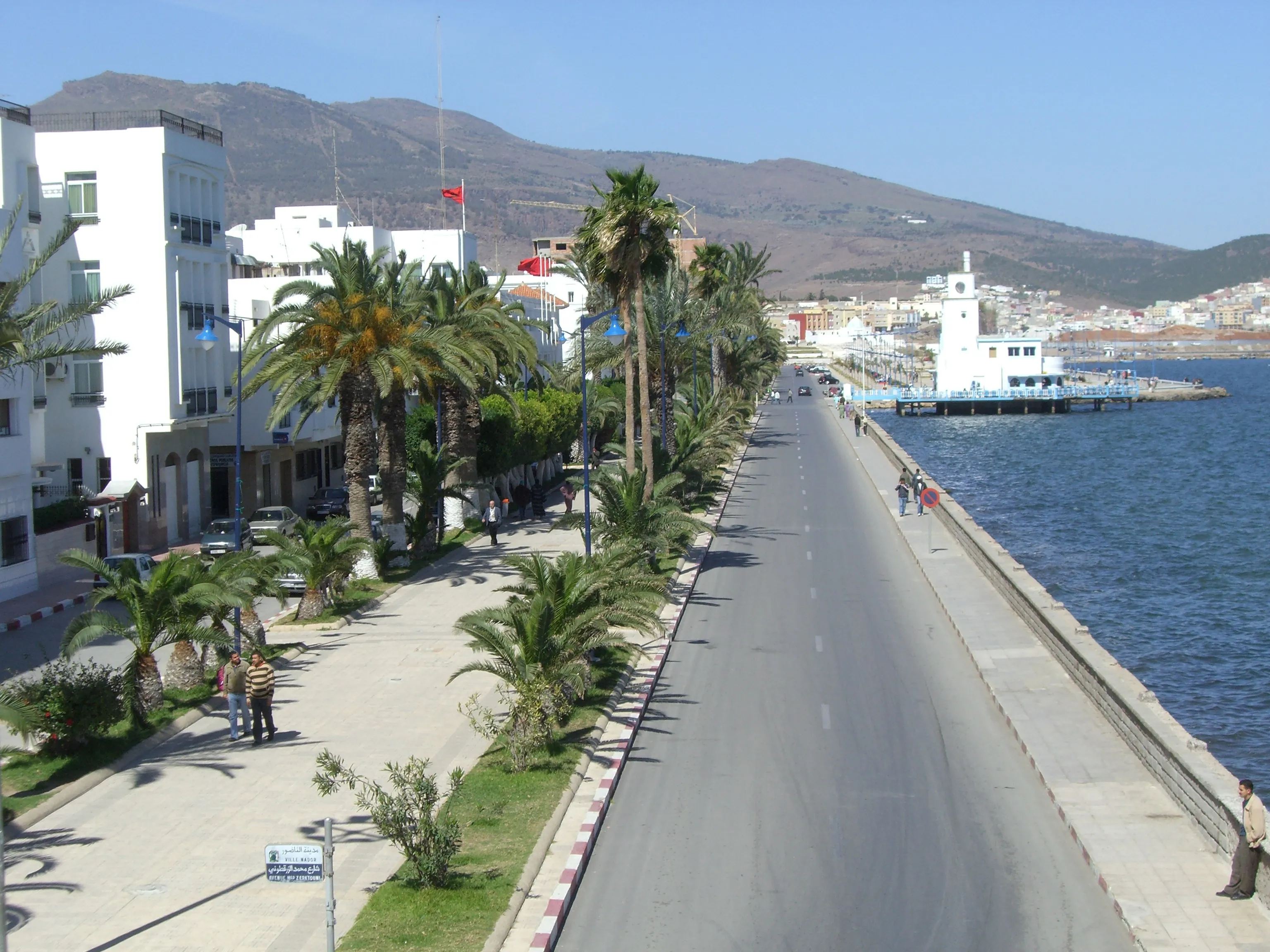
The seafront
A wide palm-lined avenue runs along the shore, with white buildings and the first foothills of the Rif behind. It is the centre of neighbourhood life, between the station, beaches and cafes. The city is growing fast along the coast.
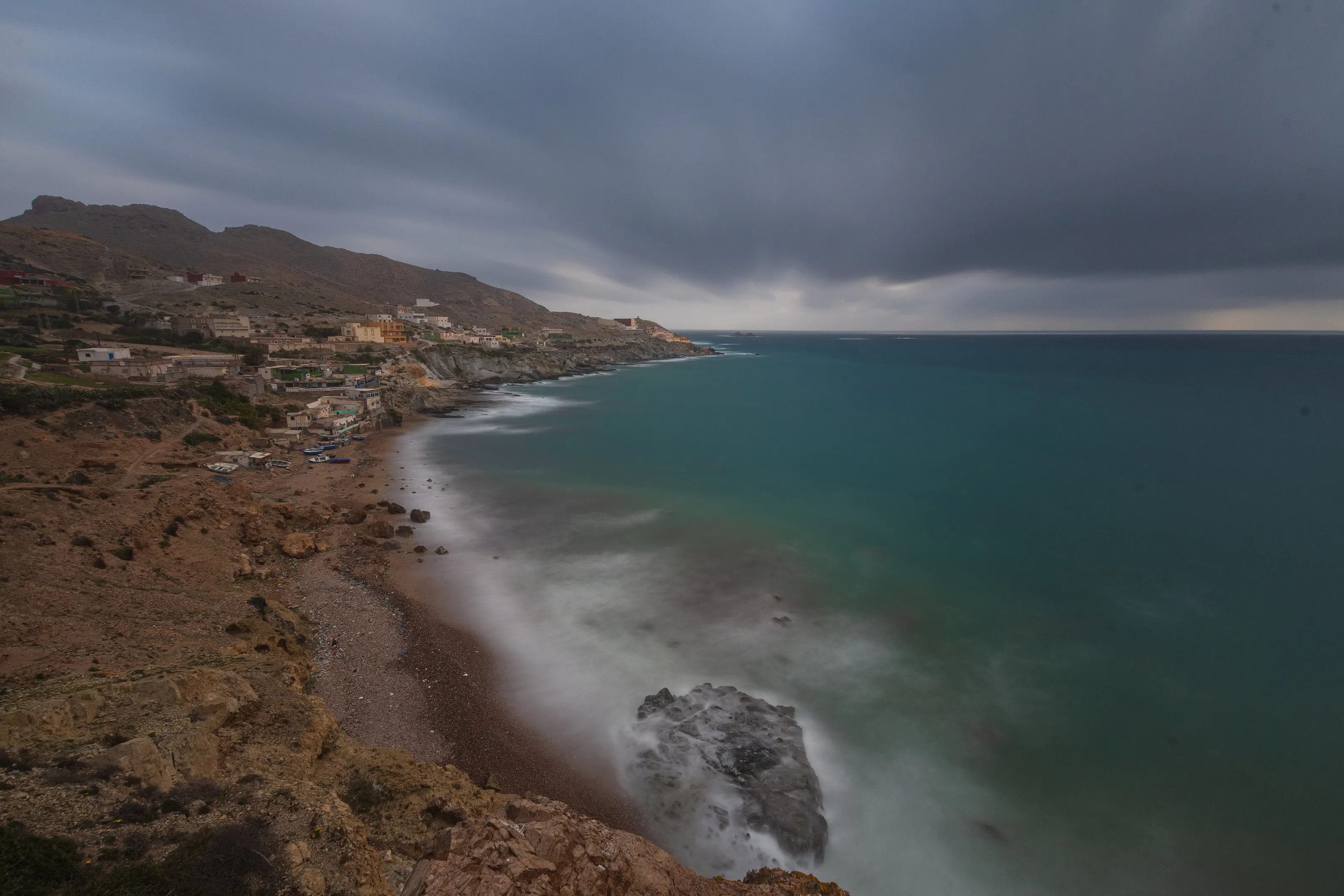
Cape Three Forks
Nador lies at the base of the Cape Three Forks (Cabo Tres Forcas) peninsula that juts into the Mediterranean, per Wikivoyage (EN). The coast alternates cliffs, coves and pebble beaches under a sometimes cloudy sky. Road quality varies: ask before you go.
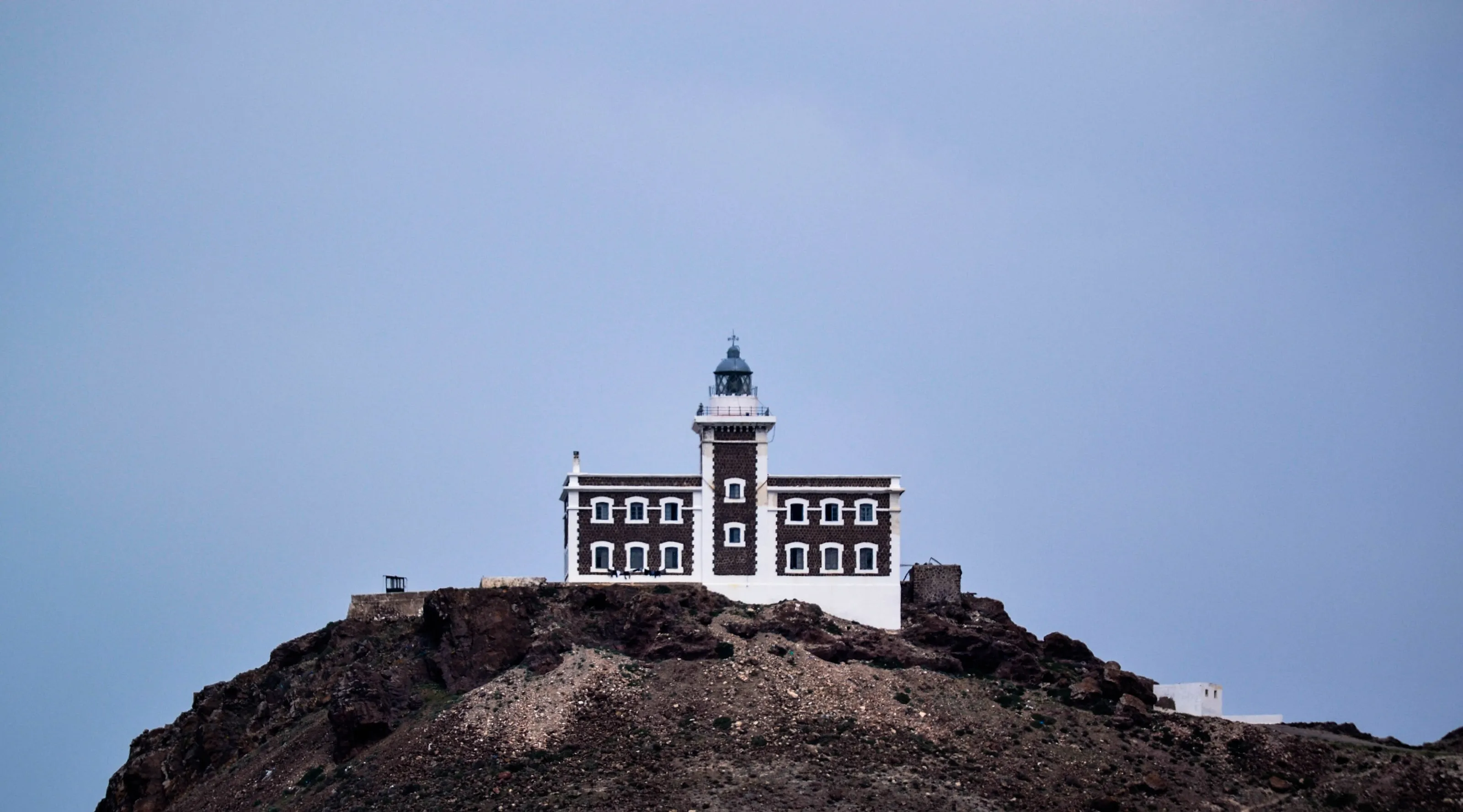
The Ras Ourek lighthouse
A white lighthouse stands on a rocky headland at Cape Three Forks, in Nador province. Access often calls for a suitable vehicle and some walking; do not go without checking the route and the weather.
Mount Gourougou and the city hill, in text
Mount Gourougou, south of the city, offers views of Nador and the Mediterranean and has wild monkeys, per Wikivoyage (EN), which also notes litter on the paths. The small hill above the city is climbed by a long staircase visible from the station, with a view over the rooftops.
Museums and culture
Few museums cited: Rif culture, heritage and landscapes
A Rif city
Nador is the largest predominantly Riffian city in Morocco per Wikipedia (EN); most residents' mother tongue is Rifian (Tarifit) according to Wikipedia (ES, DE). Moroccan Arabic, French and Spanish are also heard.
Heritage and buildings
Wikipedia (DE) mentions the small qubba of the marabout Sidi Ali on a hill in the city. The Radio Medi 1 transmitter, with masts 380 m high, is among the tallest structures in Africa per Wikipedia (DE, EN). Our sources cite no major museum.
Marchica and nature
The lagoon, the wetlands at the Moulouya mouth and Mount Gourougou form the region's real natural heritage. Wikivoyage (EN) also lists a golf course at Atalayoun. We give no admission prices.
Food and drink
Grilled fish, lentil soup and seafood
The dishes
Wikivoyage (EN) mentions a seafood restaurant and a small street eatery serving grilled sardines, chips and lentil soup with bread, very cheap when it was written. We do not name them or give prices.
Goods from across the water
The proximity of Melilla shows in the shops: Spanish-made food and household goods are widely sold in Nador per Wikipedia (EN). Fish and farm produce from the region are available too.
Terraces and rhythms
Cafes cluster near the corniche and the centre; in summer the town gets lively after dark as the diaspora returns. Wikivoyage (EN) suggests asking locals about weekend football matches.
Getting around
Taxis, buses and trains, but mostly a car to explore
In town
The centre can be covered on foot: the corniche, the station and the centre are close to each other per Wikivoyage (EN). For the rest of the urban area, ask locally about taxis and buses.
Between cities
Several direct coaches link Nador to the country's big cities: Wikivoyage (EN) cites Fez at about 5 hours with a national operator. The train goes to Taourirt, with connections to Fez and Casablanca, twice a day per the same guide.
To explore
For Cape Three Forks, Gourougou or more distant beaches, a car or a private grand taxi is the most practical. Check road conditions, weather and access before you set out.
Budget and precautions
A budget to check, especially in summer
Price level
We give no ranges or figures, as we could not cross-check them on two independent, up-to-date sources. The currency is the Moroccan dirham. Wikivoyage (EN) lists hotels of varying standard on the lagoon and towards Gourougou.
Flights
The flight remains the most variable cost, particularly from June to August when the diaspora returns. SniperAir tracks prices to NDR and compares them with the route's history, but it does not sell or book tickets. Oujda (OUD) or Fez (FEZ) can complete the watch.
Formalities and precautions
Entry formalities depend on your nationality: check them on official sites and read your country's travel advice. Keep an eye on your belongings in busy places and find out before hiking in the mountains.
When to go
A dry Mediterranean climate with hot summers
Winter (December to February)
Wetter than summer per Wikipedia (EN); days stay mild on the coast.
Spring (March to May)
A good time for the corniche, the lagoon and the cape landscapes, before the heat.
Summer (June to September)
Dry and hot, with temperatures that can exceed 40 C per Wikipedia (FR); the town is lively with the return of the diaspora from June to August.
Autumn (October to November)
Autumns can turn very rainy after dry spells, according to Wikipedia (FR).
Nador has a hot semi-arid climate (BSh) per Wikipedia (EN): an average annual temperature of 18.7 C and about 313 mm of rain a year, with more rain in winter than in summer. Wikipedia (FR) describes dry, very hot summers, almost no rain from June to September and sometimes very rainy autumns. We give no other figures; check the forecast before you travel.
By length of stay
What to do in Nador depending on your stay
The essentials
The corniche, the Marchica lagoon, a fish meal and a viewpoint over the city.
Further afield
Cape Three Forks, Gourougou and a beach on the Mediterranean coast.
Around Nador
Oujda, Saidia or Fez by road or train, depending on your plans and routes.
In pictures
Nador in pictures
You might also like
Similar destinations
FAQ
Frequently asked questions about flights to Nador
How do I get from Nador airport to the centre?
The airport (NDR) is about 24 km south-south-west. There is no public transport; grand taxis wait in front of the terminal. Check conditions before you travel.
When is the best time to visit Nador?
Spring is pleasant for the corniche and the lagoon. Summer is dry and hot, with big crowds from June to August.
Is Nador a beach resort?
The city is separated from the sea by the Marchica lagoon, but there are beaches on the lagoon and on the Mediterranean further away.
How long should I stay in Nador?
Two days for the corniche, the lagoon and a fish meal; three to four days if you add Cape Three Forks and Gourougou.
Is Nador expensive?
We give no amounts because we could not cross-check them. The flight is the cost you can optimise with a price alert.
What should I try in Nador?
Grilled sardines, lentil soup and seafood, in the small local eateries.
How much does a flight to Nador usually cost?
The price depends mainly on your departure city, the time of year and how far ahead you book. The "opportunities" section above shows real examples of prices SniperAir has already detected to this destination.
How do I get alerted when a flight to Nador drops below my budget?
Create an alert profile with your departure airport, Nador (NDR) as the destination and your maximum budget. You are notified automatically as soon as a matching price is detected. SniperAir monitors and alerts, it does not sell or book tickets.
Ready to head to Nador?
Set your budget and let SniperAir monitor fares for you.
Create my alert