
Cheap flights to La Paz
Set your departure airport and maximum budget: SniperAir tracks prices to La Paz and alerts you the moment a deal matching your criteria appears.
Quick summary
Country
Bolivia
Continent
South America
Airport
LPB
Currency
Boliviano (BOB)
Time zone
UTC-4
Deals already spotted to La Paz
Real flight examples detected by SniperAir, with their reference price.
Loading examples…
Why track La Paz with SniperAir
You don't need to compare prices every day
Choose your departure
Enter your departure airport and your maximum budget for a flight to La Paz (LPB).
SniperAir keeps watch
Our systems continuously compare new prices with the real price history of the route. SniperAir monitors prices and alerts you: it does not sell or book tickets.
You receive an alert
As soon as a price matches your criteria, you are notified, without having searched for anything yourself.
La Paz is the seat of government of Bolivia, while Sucre remains the constitutional capital (Wikipedia EN, DE). Wikivoyage (EN) calls it the highest national capital in the world. It is built in a canyon cut by the Choqueyapu River below the peaks of the Cordillera Real, and its districts climb the slopes up to the neighbouring city of El Alto on the Altiplano. The airport, LPB, is in El Alto at very high altitude, and flights from other continents usually involve a connection, so watching prices for La Paz is a good way to pick the right moment.
Airport and getting into town
An airport on the Altiplano, high above the city
La Paz / El Alto - El Alto International Airport (LPB)
El Alto International Airport (LPB) is in the city of El Alto, 13 km west of La Paz according to Wikipedia (EN) and 14.5 km from the centre according to Wikipedia (ES). Its elevation is given as 4,061.5 m by Wikipedia (EN) and 4,058 m by Wikivoyage (EN): think of it as roughly 4,000 m. Wikipedia (EN) calls it the highest international airport in the world, while Wikipedia (ES) ranks it second behind Daocheng Yading in China. Wikivoyage (EN) advises walking slowly to immigration, using radio taxis with a roof sign, or the cheaper shared vans; it also says to allow plenty of time on the way back, as buses can fill up in rush hour. We give no journey times or fares because the sources consulted do not state times and fares change.
Distances from Wikipedia (EN, ES); journey times are not stated by the sources consulted. We do not give fares.
The city ranges from about 3,100 m in its lower residential areas to over 4,000 m in El Alto, according to Wikivoyage (EN) and Wikipedia (DE); exact figures vary by district and source. La Paz was founded in 1548 (Wikipedia FR, DE) and its full name, Nuestra Señora de La Paz, means Our Lady of Peace. We do not publish a population figure, because it differs widely depending on whether you count the city alone, El Alto or the whole metropolitan area.
Landmarks
Cable cars, Illimani and neighbourhoods on the slopes
La Paz is first discovered through its views: the bowl of the canyon, hillsides of brick houses and a snow-capped mountain on the skyline. The places below are illustrated; line names and district names are used only where the sources confirm them.
Mi Teleférico: cabins above the city
The cable car network has linked La Paz and El Alto since 30 May 2014, when the first line opened, according to Wikipedia (FR, DE, ES). Wikipedia (DE) counts ten lines and more than 30 km of network by the end of 2019, and Wikipedia (FR) describes it as the longest and highest urban cable car system in the world. Wikivoyage (EN) says riding it is an experience in itself, even if you are not trying to get anywhere.
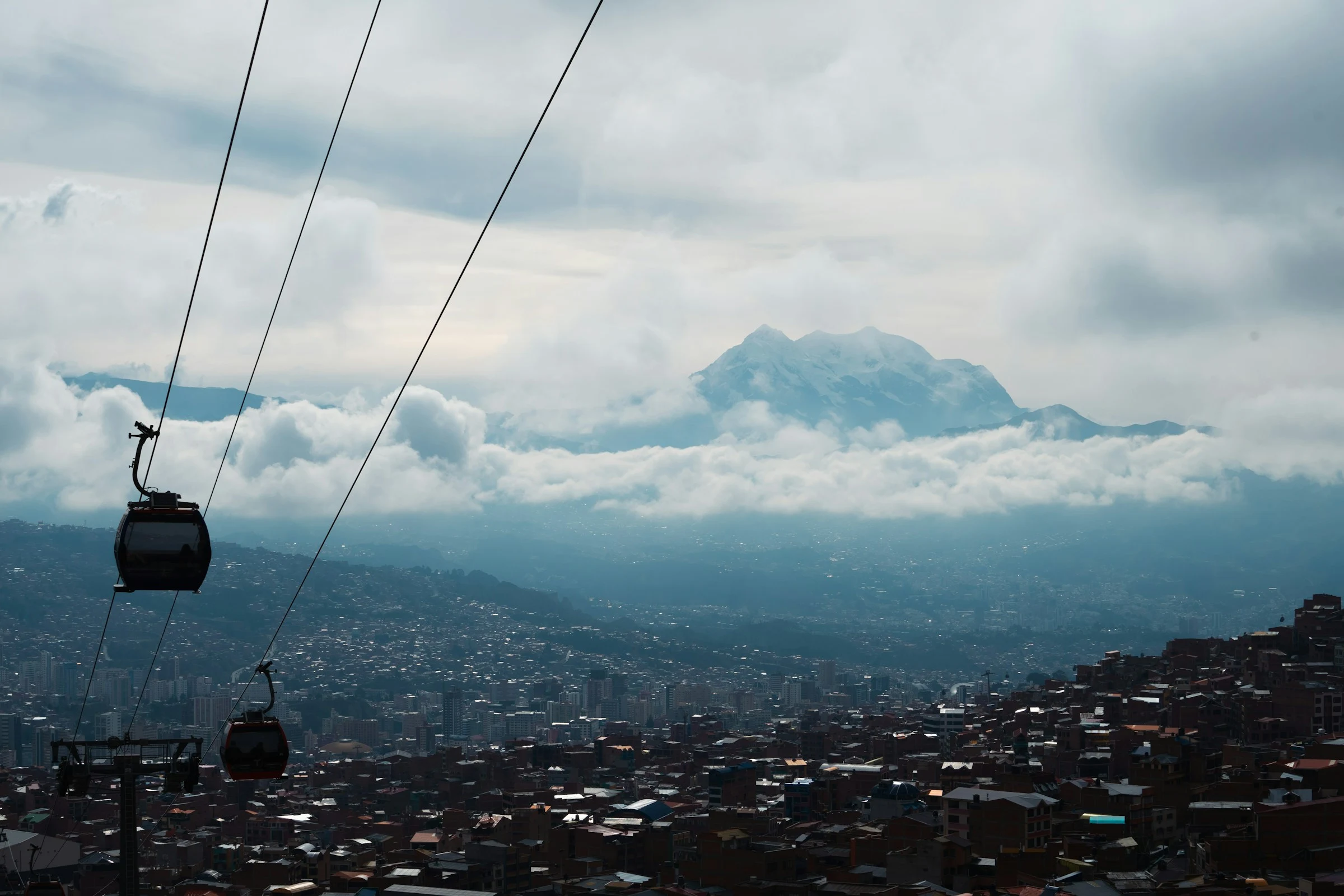
Above the brick neighbourhoods
The cabins pass over brick houses that cover the hillsides. Wikipedia (EN) explains that lower-income residents live on the surrounding slopes, while the lower and milder southern areas are more affluent. Wikivoyage (EN) suggests taking the red line up to 16 de Julio station in El Alto for a wide view of the city from above.
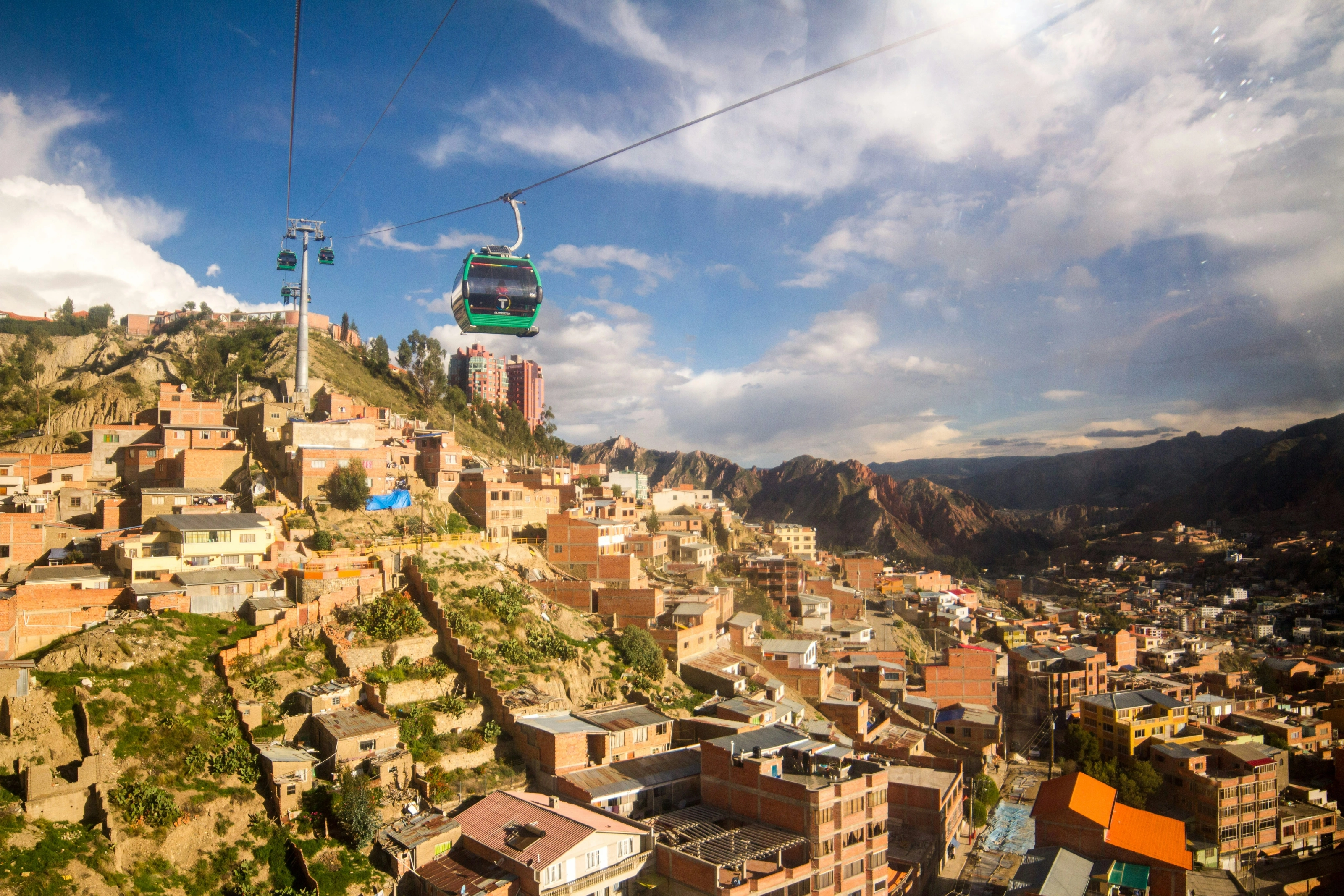
The city lit up below Illimani
As dusk falls the stepped districts light up beneath the snow-capped peak. Wikipedia (DE) puts Illimani about 40 km south-east of the city at 6,439 m, while Wikipedia (FR) gives 6,460 m. Both agree that it towers over La Paz, and it can be seen from many parts of the city on a clear day.
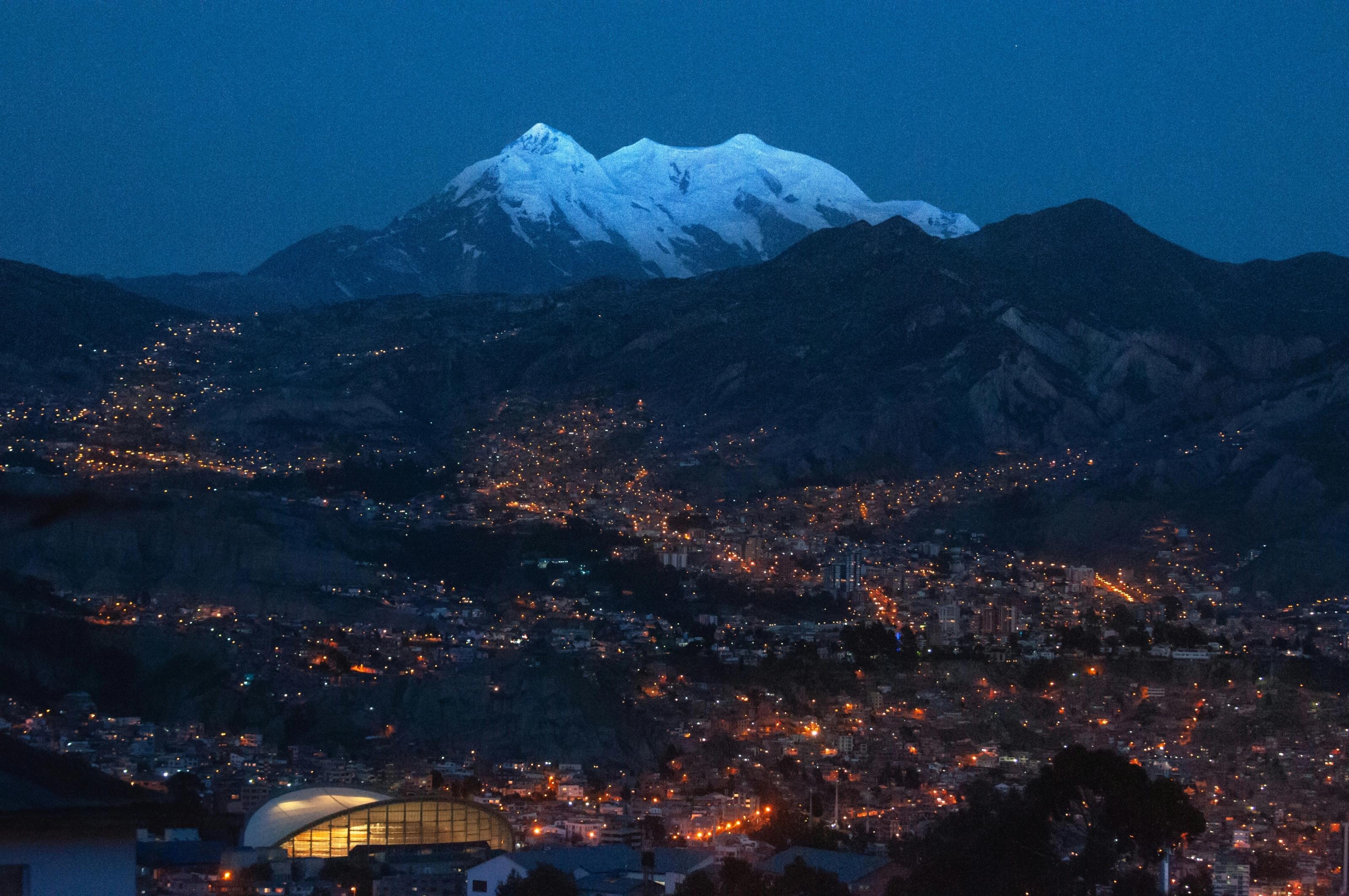
Illimani, guardian of La Paz
Wikipedia (EN) calls Illimani the "guardian" of La Paz and lists it among the Cordillera Real peaks along with Huayna Potosí and Chacaltaya. Wikivoyage (EN) names several miradores (viewpoints), among them Killi Killi, Parque Laikacota and El Montículo, where the mountain stands out in clear weather; Wikipedia (ES) counts around 21 viewpoints.
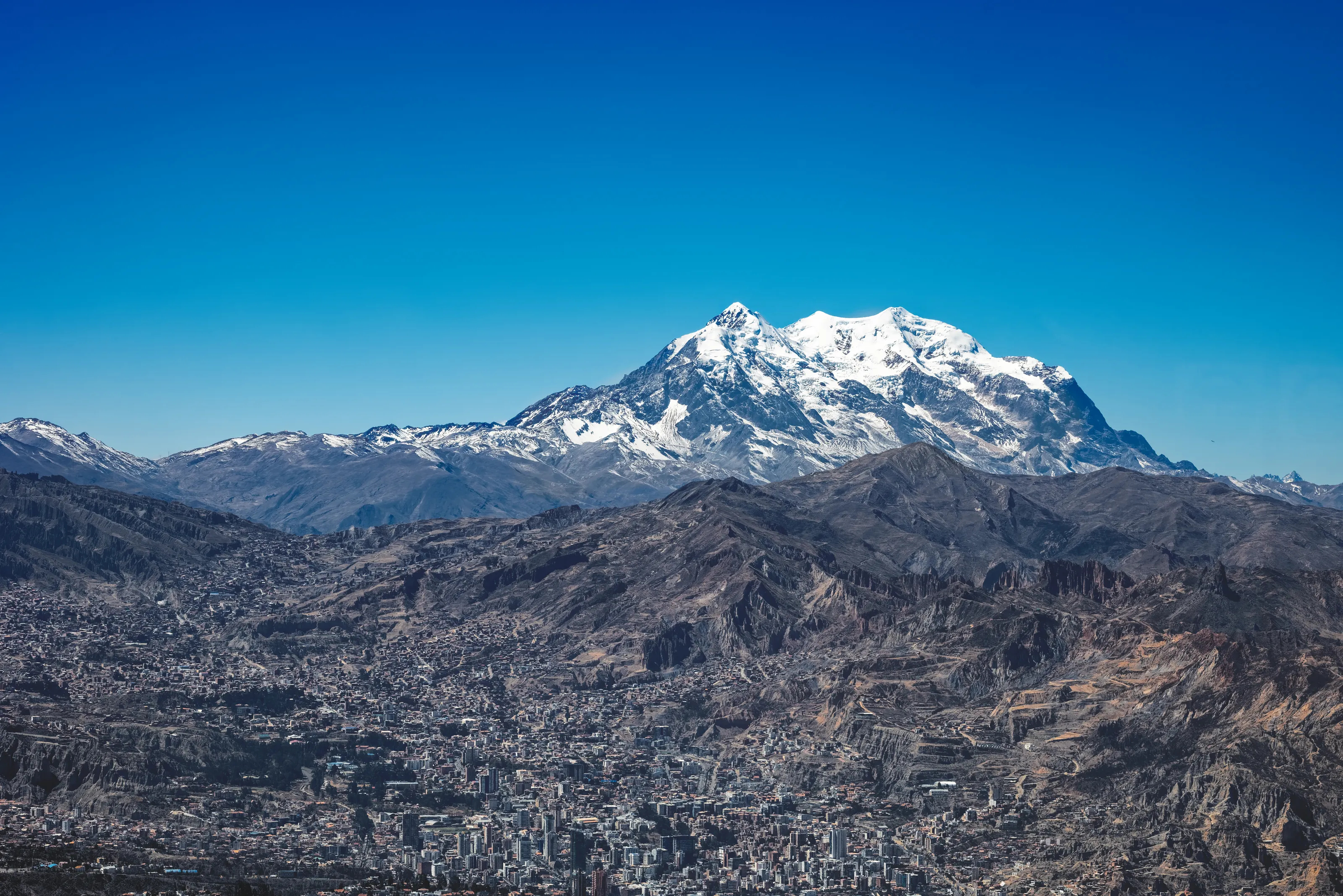
The centre in the bowl
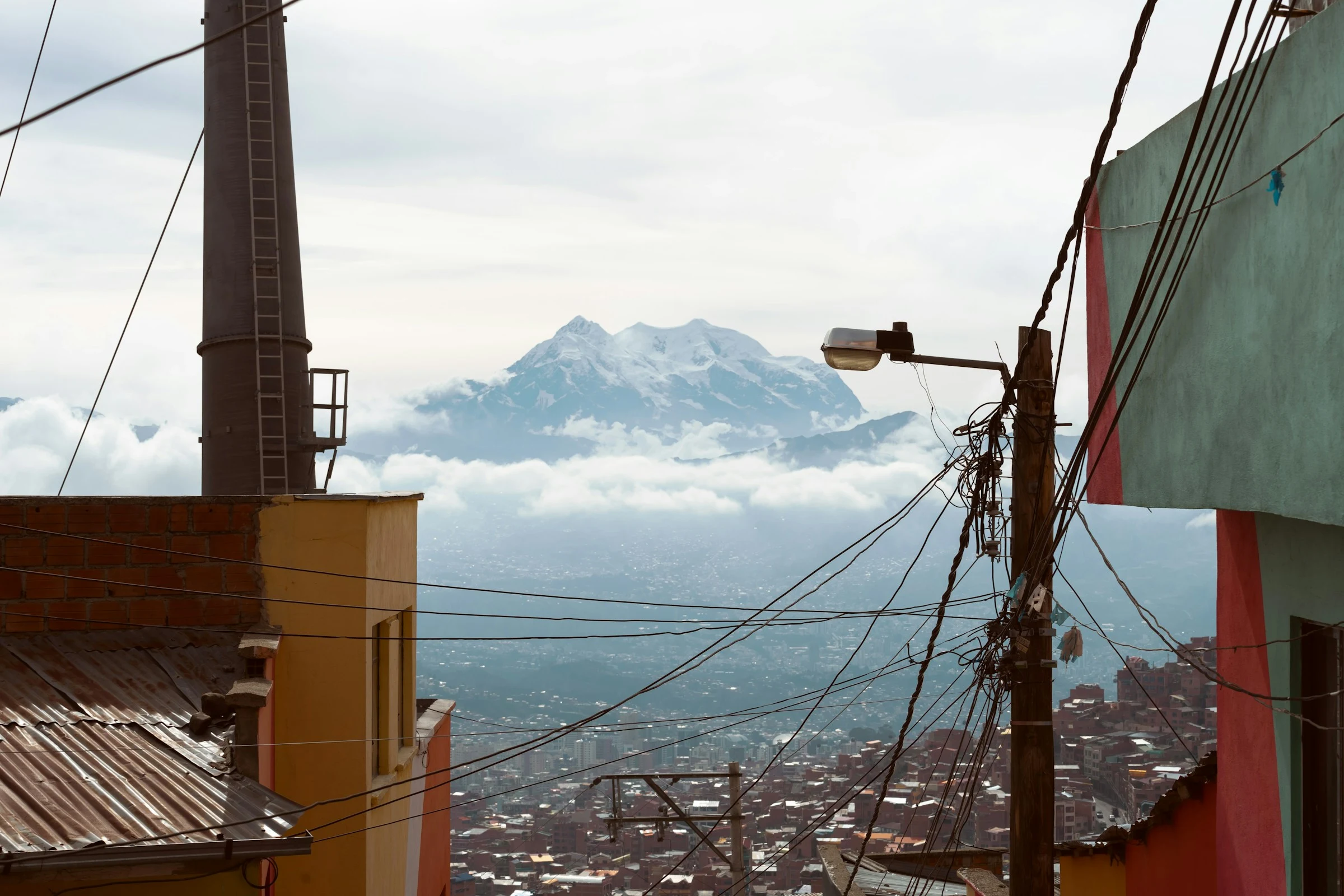
Office towers and apartment blocks fill the valley floor, ringed by bare hills. Wikipedia (EN) describes the main thoroughfare, which roughly follows the old river course and is called the Prado in its tree-lined central section. Wikipedia (DE) distinguishes a northern part with the centre and cultural institutions from a lower, warmer, residential southern zone.
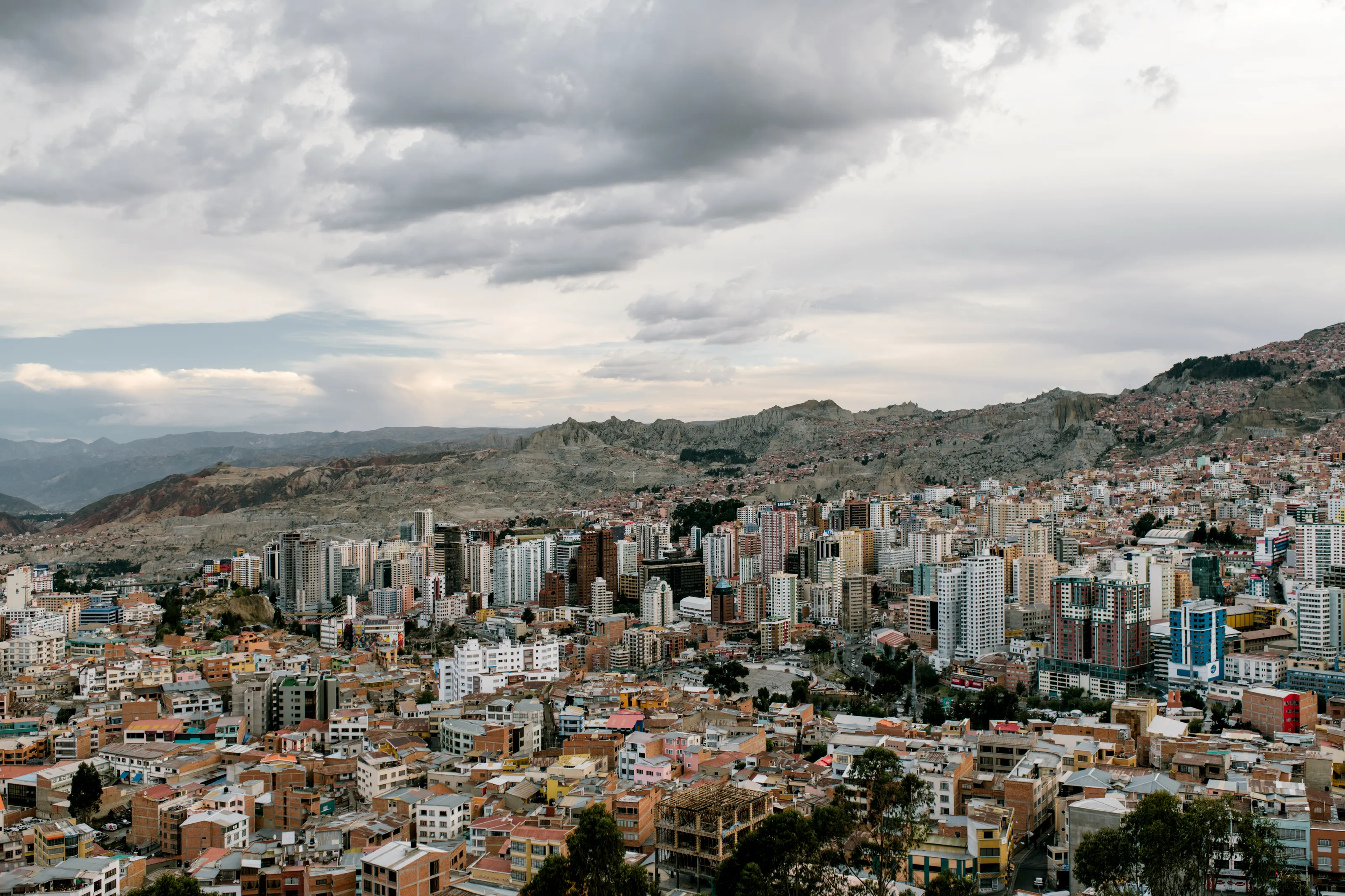
The slopes, between wires and rooftops
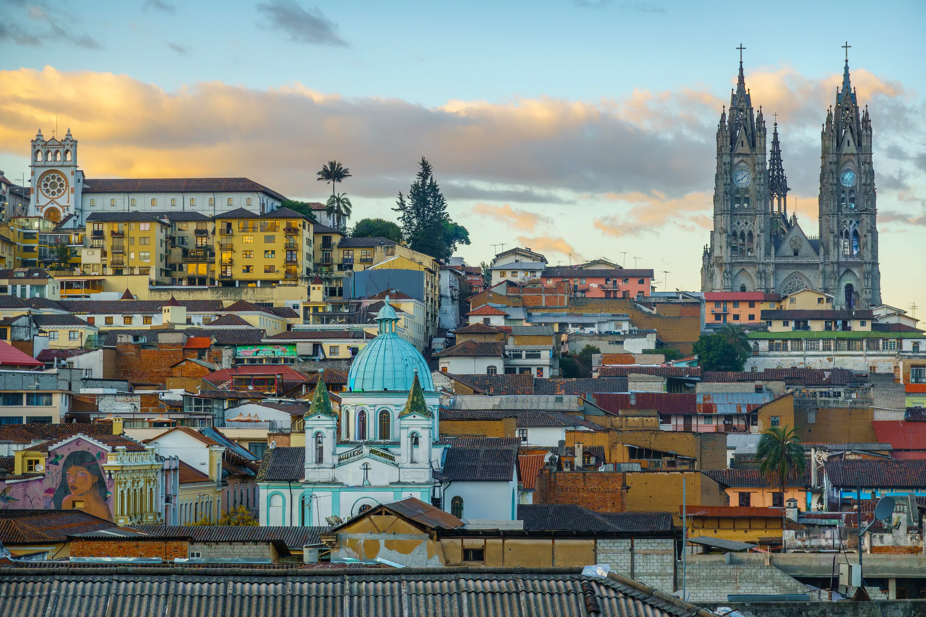
On the slopes, houses crowd together between power lines and brightly painted walls, with the snowy peak in the distance. Wikipedia (FR) explains that after the Second World War rural migration pushed people up the sides of the bowl and then onto the Altiplano, where El Alto became an independent municipality in 1985.
On foot in the centre, Wikipedia (EN, ES) and Wikivoyage (EN) name the San Francisco church, the cathedral and the government buildings on Plaza Murillo, plus Calle Jaén, one of the few streets that kept its colonial buildings. Wikivoyage (EN) also lists the Witches' Market on Calle Linares, the Valle de la Luna, a landscape of eroded rock just outside the city, and the Valle de las Ánimas. Visitors cannot enter the Palacio Quemado, the presidential palace, according to Wikivoyage (EN).
Museums and culture
Calle Jaén, art, ethnography and coca
The museums of Calle Jaén
Wikivoyage (EN) calls Calle Jaén one of the few places in the city with preserved colonial buildings, now housing several museums, among them the Musical Instrument Museum, founded by charango master Ernesto Cavour, and the Museum of Precious Metals with its pre-Columbian silver and gold. Wikipedia (ES) counts about ten museums on the street.
Art and ethnography
Wikivoyage (EN) lists the National Museum of Art, a tour through the history of Bolivian painting and sculpture, and MUSEF, the National Ethnographic and Folk Museum, which shows Bolivian cultures past and present. Wikipedia (ES) adds that the art museum occupies the former Diez de Medina palace, a colonial building of the 18th century.
Coca, festivals and music
The Coca Museum on Calle Linares is described by Wikivoyage (EN) as a small museum on the history and significance of the coca plant, popular with foreign visitors. Wikivoyage (EN) mentions the San Francisco Museum, a restored religious complex linked to the 1809 independence revolution, where you can climb the tower. Entry fees change, so we do not list them.
Food and drink
Salteñas, plato paceño and street food
Specialities
Wikivoyage (EN) names two national dishes from La Paz, pique macho and plato paceño. Wikipedia (ES) adds salteñas, papa rellena, anticuchos and the chola sandwich, and notes that Netflix included the city in its series Street Food Latin America. Wikipedia (FR) mentions chairo, a traditional soup of the Aymara people.
Markets and juices
Wikivoyage (EN) describes small lunch kitchens serving a set menu, plentiful street food, juices and avocado sandwiches, and the Mercado Uruguay with a fish alley. It advises eating lightly on the first day and being careful with salads in the first days.
Drinks and altitude
Wikivoyage (EN) says mate de coca (coca leaf tea) is a popular Andean remedy for the effects of altitude, but that studies have not corroborated its benefits. Wikipedia (FR) notes that water boils at around 87 °C at this altitude.
Getting around
Cable car, minibuses and radio taxis
The cable car
Wikipedia (ES) counts ten lines since March 2019 and a standard fare of 3 bolivianos, with a capacity of up to 17,000 passengers an hour; Wikivoyage (EN, DE) also gives 3 bolivianos per ride, which you should check on the spot. Wikivoyage (EN) explains that five lines form a full circuit lasting an hour and a half to two hours, and that the red line goes to 16 de Julio in El Alto.
Micros, minibuses and trufis
Wikivoyage (EN) describes three kinds of shared transport: regular buses (micros), minibuses and shared taxis on set routes (trufis), with the route written on the windscreen. You can hail them almost anywhere and call out to get off. Wikipedia (FR) adds the Puma Katari buses, introduced in 2014 with fixed stops.
Taxis
Wikivoyage (EN) says the easiest way to get around is by taxi: they are unmetered, so agree the fare first. It recommends radio taxis with a phone number and a sign on the roof, and says that in 2024 the ride-hailing app to use was Didi rather than Uber.
Budget and precautions
A moderate budget, and a trip at altitude
Price level
Wikivoyage (EN) lists many local prices in bolivianos, for buses, museums or the cable car, but they change every year. We give no budget range because we have not cross-checked one on two independent, current sources.
Currency
Bolivia uses the boliviano (BOB).
Altitude, health and safety
SniperAir tracks prices to LPB and compares them with the route's price history, but it does not sell or book tickets. For comparison you can also follow other Andean cities such as Cusco or Quito. Above 3,000 m, altitude sickness is common in the first days (Wikivoyage EN, DE, FR): rest, drink plenty of water and see a doctor before you travel, especially with a heart or lung condition. The sun is strong even when the air is cool (Wikipedia FR, Wikivoyage DE). Wikivoyage (EN) warns about pickpockets, a spill-and-steal trick and plain-clothes police scams; check your own country's official travel advice for safety and entry requirements.
When to go
Two seasons: summer rain and a dry, bright winter
Dry season (roughly May to September)
Wikipedia (EN) says the whole city has rainy summers and dry winters. June and July are the driest and sunniest months, with about 8 hours of sunshine a day in the highest part of the city. Wikipedia (FR) adds that temperature swings are large, from -5 to 20 °C.
Rainy season (roughly November to March)
According to Wikipedia (EN), rain falls mainly from November to March, with January the wettest month (100 to 140 mm) and a risk of destructive mudslides; Wikipedia (ES) extends the season from December to April. Wikipedia (EN) says snow flurries can occur in winter in the highest districts, usually melting before noon.
Temperatures
Wikipedia (EN) says that in the highest part of the city, above 4,000 m, average temperatures are similar to those of Bergen in Norway; central La Paz and the south, at lower altitude, are warmer. Wikivoyage (EN) says to pack warm clothing all year round.
Sun and altitude
Thin air filters little sunlight (Wikivoyage DE): sunglasses, a hat and sunscreen are useful even on cool days.
Wikipedia (EN) classifies the highest districts as cold subtropical highland (Cwc), bordering on tundra, and central La Paz as Cwb. We do not give full monthly averages because sources differ depending on the altitude of the station.
By length of stay
What to do in La Paz depending on your stay
Acclimatise and see the centre
Two to three days to adapt to the altitude by taking it easy, with Plaza Murillo, Calle Jaén, the Witches' Market, one or two museums and a cable car ride for the view.
Valle de la Luna and viewpoints
Add the Valle de la Luna, the Killi Killi or Laikacota viewpoints and a tour of the cable car lines, and perhaps El Alto's Thursday and Sunday market, according to Wikivoyage (EN).
Titicaca, Tiwanaku and the mountains
Wikivoyage (EN) suggests day trips to Tiwanaku, 72 km away, to Copacabana and Isla del Sol on Lake Titicaca, to Chacaltaya or to Sorata; the Yungas road and multi-day treks need more preparation.
In pictures
La Paz in pictures
You might also like
Similar destinations
FAQ
Frequently asked questions about flights to La Paz
Where is La Paz airport and how far is it from the centre?
El Alto International Airport (LPB) is in the neighbouring city of El Alto, about 13 to 14.5 km from the centre according to Wikipedia (EN, ES), at an elevation of about 4,000 m.
Should I worry about altitude in La Paz?
Above 3,000 m, many travellers feel effects in the first days, such as breathlessness and headaches. Take it easy, drink plenty of water and see a doctor before you travel, especially if you have any health concerns.
What is the most practical way to get around La Paz?
The Mi Teleférico cable car links La Paz and El Alto with about ten lines; minibuses, trufis and radio taxis complete the network. Prices change, so check them locally.
Is La Paz the capital of Bolivia?
It is the seat of government, but the constitutional capital is Sucre, according to Wikipedia (FR, DE).
When is the best time to visit La Paz?
Winter, roughly May to September, is dry and sunny but cold at night. Rain falls mainly from November to March. Pack warm clothing all year.
How long should I stay in La Paz?
Two to three days cover the centre and acclimatisation; add two to three days for excursions to the Valle de la Luna, Tiwanaku or Lake Titicaca.
How much does a flight to La Paz usually cost?
The price depends mainly on your departure city, the time of year and how far ahead you book. The "opportunities" section above shows real examples of prices SniperAir has already detected to this destination.
How do I get alerted when a flight to La Paz drops below my budget?
Create an alert profile with your departure airport, La Paz (LPB) as the destination and your maximum budget. You are notified automatically as soon as a matching price is detected. SniperAir monitors and alerts, it does not sell or book tickets.
Ready to head to La Paz?
Set your budget and let SniperAir monitor fares for you.
Create my alert