
Cheap flights to Cusco
Set your departure airport and maximum budget: SniperAir tracks prices to Cusco and alerts you the moment a deal matching your criteria appears.
Quick summary
Country
Peru
Continent
South America
Airport
CUZ
Currency
Peruvian sol (PEN)
Time zone
UTC-5
Deals already spotted to Cusco
Real flight examples detected by SniperAir, with their reference price.
Loading examples…
Why track Cusco with SniperAir
You do not need to compare prices every day
Choose your departure
Enter your departure airport and your maximum budget for a flight to Cusco (CUZ).
SniperAir keeps watch
Our systems continuously compare new prices with the real price history of the route. SniperAir monitors prices and alerts you: it does not sell or book tickets.
You receive an alert
As soon as a price matches your criteria, you are notified, without having searched for anything yourself.
Cusco, also spelled Cuzco or Qosqo, is a city in southeastern Peru in the heart of the Andes. It was the capital of the Inca Empire before becoming one of the great colonial cities of the country, and it remains the usual base for reaching Machu Picchu and the Sacred Valley. The airport (CUZ) is small and mostly handles domestic flights: travellers from Europe usually connect through Lima, which makes price tracking all the more useful.
Airport and getting into town
A small high-altitude airport, a few kilometres from the old town
Cusco – Alejandro Velasco Astete (CUZ)
Alejandro Velasco Astete International Airport, opened in 1967 according to Spanish Wikipedia, lies about five kilometres east of the historic centre; Wikivoyage (EN, ES) gives 16 to 20 minutes by taxi and 30 to 45 minutes by bus depending on traffic. It mainly handles domestic flights and a few international links with nearby cities according to Wikipedia (ES), so travellers from Europe should plan a connection, most often in Lima. A new airport at Chinchero, roughly thirty kilometres away, has been discussed for years as a replacement (Wikipedia EN, ES); we could not check how far the project has progressed, so check the airport shown on your ticket.
Approximate distances and times, based on Wikivoyage (EN, ES); they vary with traffic. We do not give fares.
Cusco sits at about 3,400 m (Wikipedia EN, FR; Wikivoyage EN); German Wikipedia gives 3,416 m and German Wikivoyage 3,399 m. The Spanish refounded the city on 23 March 1534 according to Wikipedia (EN, DE, ES), and it was inscribed as a UNESCO World Heritage Site in 1983. Population figures vary widely depending on whether the city alone or the urban area is counted, so we do not publish one.
Landmarks
Inca walls, baroque churches and a fortress above the city
The centre of Cusco layers two worlds: the stone foundations of the Incas and the colonial buildings erected on top of them. Wikipedia (EN) notes that the Spanish used the surviving Inca walls as the base of the new city. The places below are illustrated; sources sometimes differ on dates and distances, so we stay cautious.
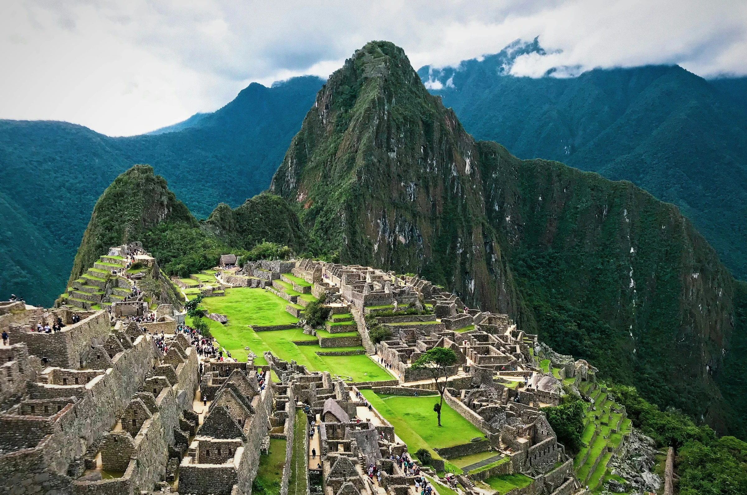
Machu Picchu: the Inca citadel above the valley
Machu Picchu is not in Cusco itself, but it is the reason for most trips. German Wikipedia places it about a hundred kilometres away by road, and French Wikipedia notes that its discovery in 1911 revived Cusco's tourism. It is reached via Aguas Calientes, the village below the site, usually by train from Poroy station, about thirteen kilometres from Cusco (Wikivoyage DE), or on foot along the Inca Trail and its alternatives. Entry rules change often, so check before you book.
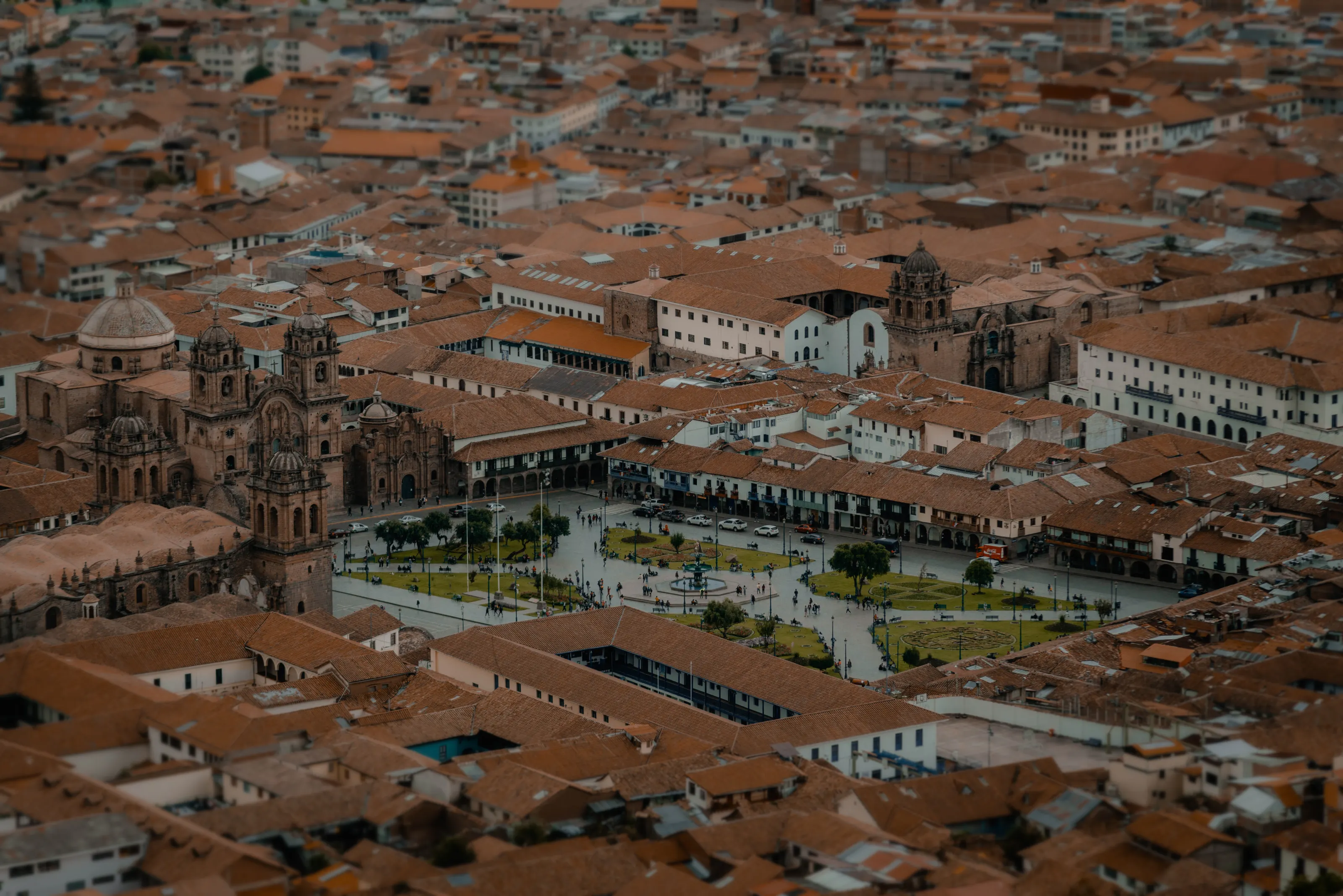
The Plaza de Armas, the historic heart
Seen from above, the great square with its gardens, arcades and the towers of the neighbouring church sits in a sea of tiled roofs. Wikipedia (ES) says the square has stayed in the same place since Inca times, when it was called Haucaypata, and that it is framed by the cathedral and the Church of the Society of Jesus; Wikipedia (FR) notes that the Spanish built the cathedral in the 16th century. It is the natural starting point for any walk around town.
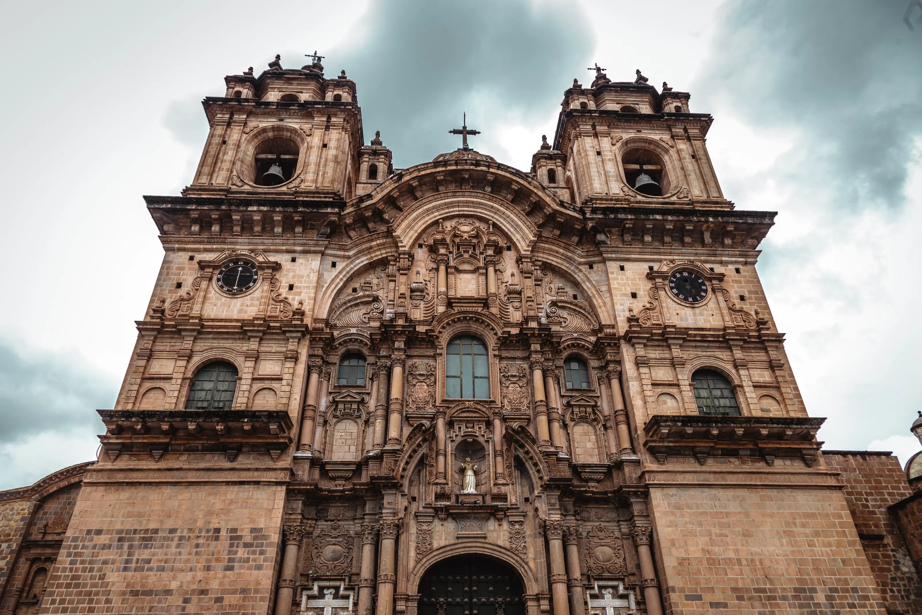
The baroque churches of the centre
The cathedral was built between 1560 and 1664 according to Wikipedia (ES), and the Church of the Society of Jesus, begun by the Jesuits in 1576, is described by the same source as one of the finest examples of colonial baroque on the continent. The stone towers and richly carved portals of the centre tell the story of the Cusco School of painting, many of whose canvases hang in the cathedral.
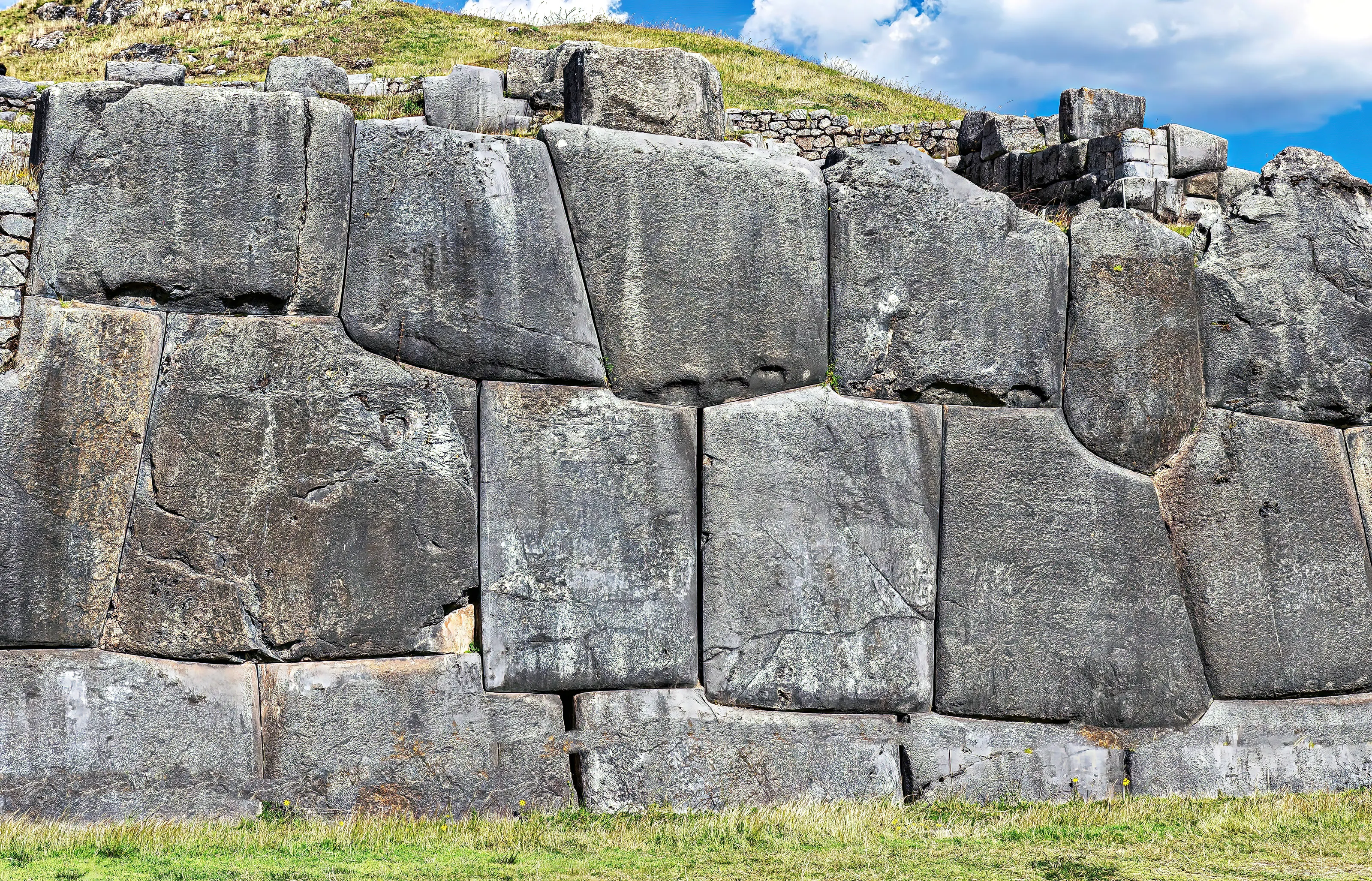
Inca walls: stone cut to the millimetre
The blocks of Sacsayhuamán, fitted together without mortar, are among the best-known images of Inca architecture. French Wikipedia cites stones up to about 6 m high and 200 tonnes; exact figures vary by source, so simply note their impressive size. In the centre, Hatun Rumiyoc street keeps the Stone of Twelve Angles, which has become one of the city's symbols (Wikipedia EN, ES; Wikivoyage EN).
Sacsayhuamán, the fortress above Cusco
The fortress overlooks the city from the northern hill; French Wikipedia puts it about two kilometres away and German Wikipedia about three, depending on the starting point. English Wikipedia traces it back to the Killke culture around the year 1100, based on radiocarbon dating. Wikivoyage (EN) suggests walking up if you can cope with the altitude, but warns about robberies in the morning and evening, so go in daylight and preferably not alone.
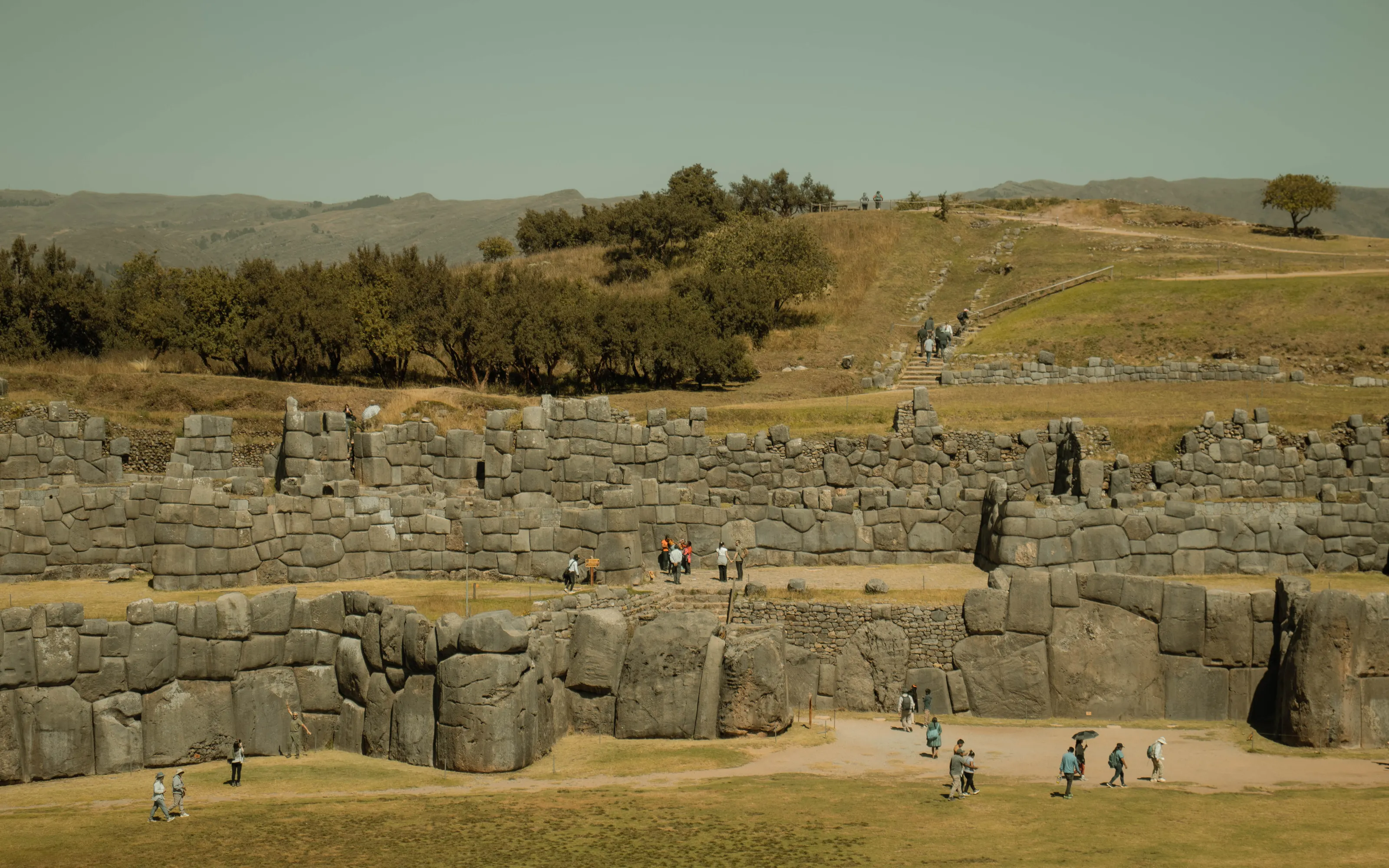
Terraces and paths at Sacsayhuamán
Beyond the great walls the site spreads into grassy terraces linked by stone steps, where llamas are sometimes seen. French Wikipedia mentions the neighbouring sites of Qenko, Puca Pucará and Tambomachay, often visited together on the same road; Wikivoyage (EN) suggests linking them by combi (minibus) or taxi.
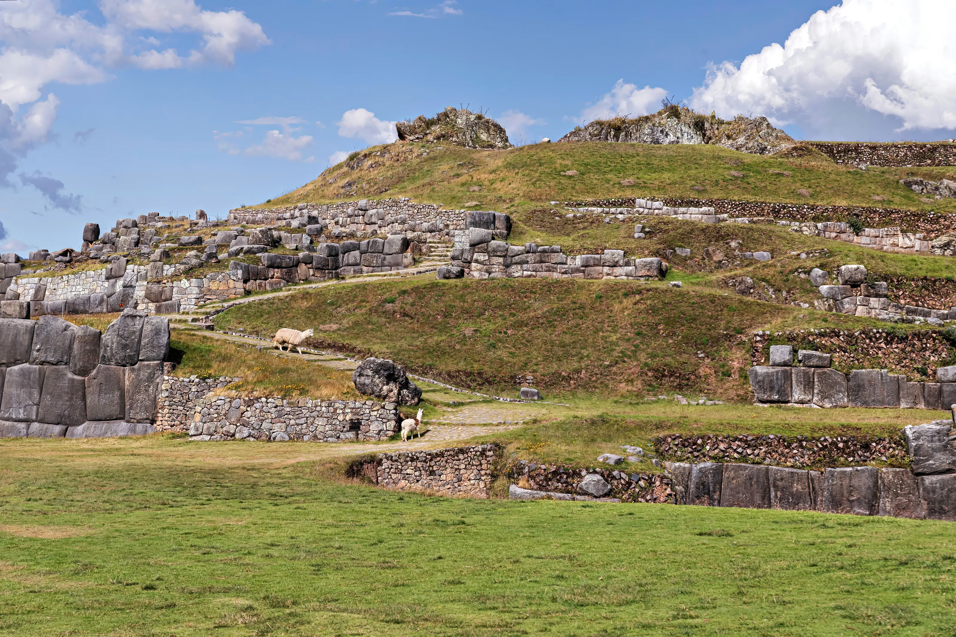
Machu Picchu in the evening light
Clouds cling to the slopes of Huayna Picchu, the mountain that rises above the citadel. Wikipedia (EN) notes that Machu Picchu has been one of the New Seven Wonders of the World since 2007. Wikivoyage (EN) says prices there can be double those in Cusco, and German Wikivoyage advises booking train seats and entry ahead of time, especially in high season.
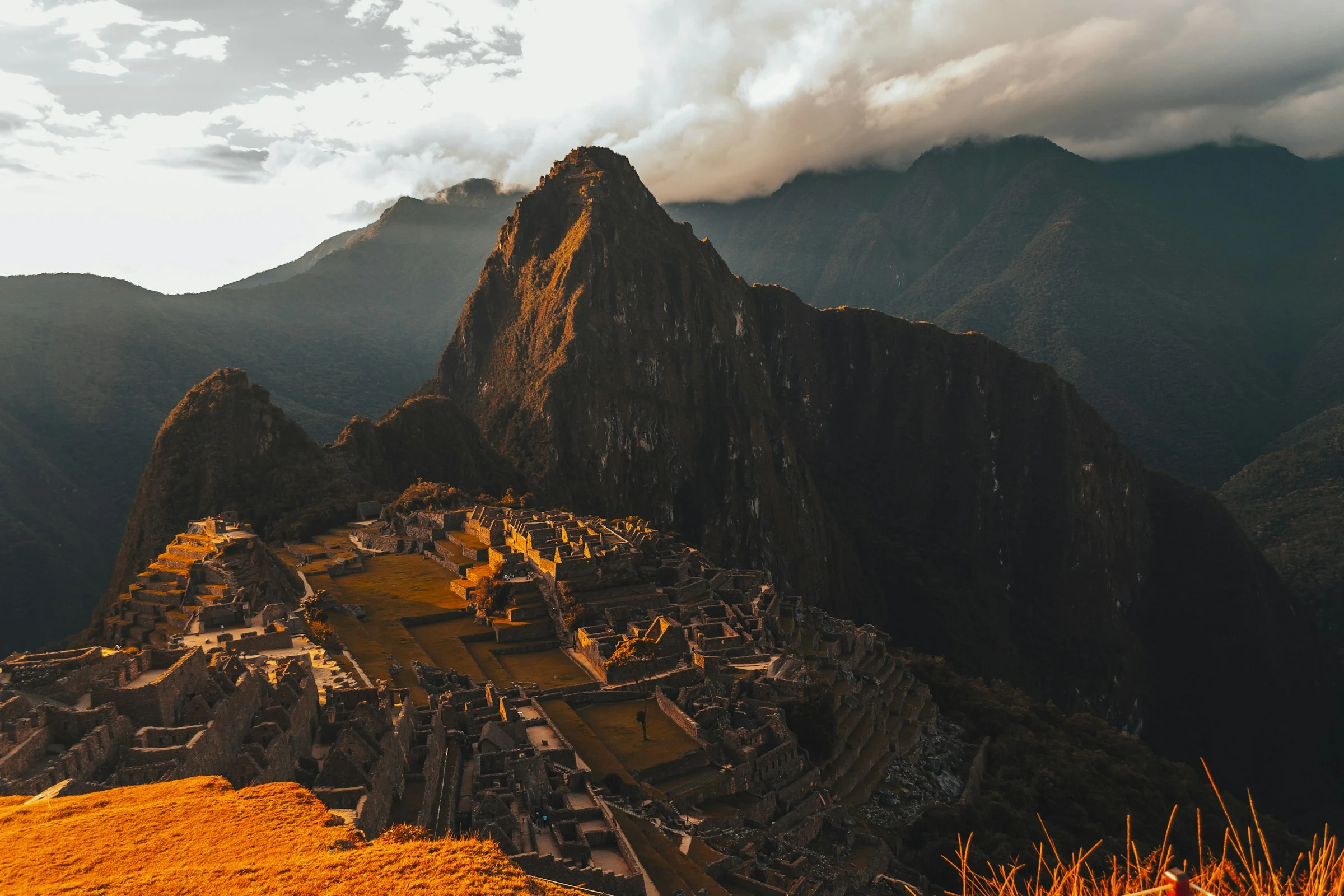
Other visits named by Wikipedia (EN, FR) and Wikivoyage (EN) include the Coricancha, the former Sun Temple beneath the convent of Santo Domingo, the San Blas district with its artisans and steep lanes, the Sacred Valley with Pisac, Ollantaytambo and Chinchero, the Maras salt pans and Moray. Each excursion can be done as a day trip from Cusco.
Museums and culture
Inca art, colonial art and Andean textiles
History and pre-Columbian art
Wikipedia (EN, FR) lists the Inka Museum, the Pre-Columbian Art Museum, the Regional Historical Museum, the Museum of Religious Art and the Machu Picchu Museum, housed in Casa Concha. Wikivoyage (EN) says the latter shows pieces from Machu Picchu returned in 2011 after an early 20th-century Yale expedition took them away.
Textiles, contemporary art and chocolate
Wikivoyage (EN) mentions a centre for traditional Cusco textiles, a municipal contemporary art museum and the Qoricancha site museum. The ChocoMuseo, listed by Wikipedia (FR) and Wikivoyage (EN), tells the story of cacao and offers workshops.
Festivals and music
Inti Raymi, the festival of the Sun, takes place each year around 24 June at the Qorikancha, on the Plaza de Armas and at Sacsayhuamán according to Wikipedia (FR, ES); Spanish Wikipedia also names the Qosqo Centre of Native Art and the Cusco Symphony Orchestra. We give no fees or opening hours: they change and sources differ.
Food and drink
Andean cooking, potatoes and chocolate
Specialities
Wikipedia (EN, ES) describes a cuisine born from pre-Inca, Inca, colonial and modern traditions. It names cuy (guinea pig), rocoto relleno (stuffed hot pepper), chiri uchu, a cold dish eaten in June during Inti Raymi and Corpus Christi, and timpu at Carnival. German Wikivoyage also recommends ceviche, served with sweet potato and corn.
Local produce
The region grew around 3,000 potato varieties according to Wikipedia (EN); corn and freeze-dried tubers such as chuño also feature in dishes. Fusion and neo-Andean restaurants have developed (EN).
Altitude and cooking
German Wikivoyage notes that water boils at around 80 °C at this altitude, so food is served less hot and pasta takes longer. Wikivoyage (EN, ES) mentions coca tea, the traditional drink offered by most hotels.
Getting around
A compact centre best explored on foot
Walking and climbing
The centre is small enough to explore on foot (Wikivoyage EN, DE), but the streets are steep and the altitude slows you down: go slowly and take breaks. German Wikipedia advises not to overload the first days.
Buses and taxis
Wikivoyage (EN) describes combis, cheap minibuses serving the city and nearby sites, and taxis for the bus station, Sacsayhuamán or the airport. Day trips to the Sacred Valley leave from several small bus stations or can be booked through agencies.
Train and road
The Machu Picchu train leaves from Poroy; two stations serve the city, Wánchaq for Puno and Poroy for Aguas Calientes (Wikivoyage DE). From Lima the road journey is very long, over twenty hours according to Wikivoyage (DE, FR), so flying remains the simplest option.
Budget and precautions
Tourist-level prices and a trip at altitude
Price level
German Wikivoyage describes Cusco as somewhat more expensive than other Peruvian cities, and Wikivoyage (EN) notes that prices around Machu Picchu rise every year and can be double. We give no figures, as we could not cross-check them against two independent sources.
Currency
Peru uses the Peruvian sol (PEN).
Flights, safety and health
SniperAir monitors prices to CUZ and compares them with the route's history, but it does not sell or book tickets. For comparison you can also track Lima (LIM). Wikivoyage (EN, DE) reports pickpocketing and advises against walking alone at night far from the Plaza de Armas; check the official advice of your home country for safety and entry requirements. At about 3,400 m many travellers feel the effects of altitude, known as soroche (headache, breathlessness), in the first days according to Wikivoyage (FR, EN, DE); start slowly, drink plenty of water and ask a doctor before departure if you have any health doubts. UV levels are very high: sunscreen and sunglasses are useful.
When to go
Two seasons: dry and sunny, then rainy
Dry season (roughly April or May to September or October)
Wikipedia (EN) runs it from April to September, Wikipedia (ES) from April to October and Wikipedia (FR) from May to September. It brings plenty of sun, days of up to about 20 °C and cold nights with frost (ES, EN). German Wikivoyage gives March to November as the best period.
Rainy season (October or November to March)
The wettest months are the southern summer: January is the rainiest according to Wikipedia (FR). Wikivoyage (EN, ES) says the Inca Trail is closed in February.
Average temperatures
Wikipedia (EN) cites 9.7 °C in July, the coolest month, and 13.3 °C in November, the warmest; Wikipedia (ES) gives about 13 °C in the dry season and 12 °C in the wet season. Dress in layers.
Sun and altitude
Wikipedia (EN) notes that in 2006 Cusco recorded the highest average UV level of any populated place. Protect skin and eyes even when it feels cool.
The climate is subtropical highland (Cwb) according to Wikipedia (EN). We do not give full monthly averages because sources differ by period and weather station.
By length of stay
What to do in Cusco depending on how long you stay
Acclimatise and see the centre
Two to three days to adjust to the altitude, according to Wikivoyage (DE), while visiting the Plaza de Armas, the cathedral, the Church of the Society of Jesus, San Blas and the Stone of Twelve Angles.
Sacsayhuamán and the Sacred Valley
Sacsayhuamán and the nearby sites, then one or two excursions to the Sacred Valley, Pisac, Ollantaytambo, Moray or Maras.
Machu Picchu and beyond
Machu Picchu with a night in Aguas Calientes, or the Inca Trail if you book far ahead; a week is enough to see the essentials according to Wikivoyage (DE).
In pictures
Cusco in pictures
You might also like
Similar destinations
FAQ
Frequently asked questions about flights to Cusco
How do I get from Cusco airport to the centre?
The airport (CUZ) is about five kilometres from the historic centre: allow 16 to 20 minutes by taxi and 30 to 45 minutes by bus depending on traffic, according to Wikivoyage.
Do I need to go through Lima to reach Cusco?
From Europe, usually yes: Cusco airport mostly handles domestic flights and a few international links with nearby cities. Check the stopovers on your ticket.
How does the altitude affect you in Cusco?
At about 3,400 m some travellers feel effects in the first days. Allow time to adjust, drink plenty of water and ask a doctor before departure if you have any health doubts.
How do I get to Machu Picchu from Cusco?
Most people take the train to Aguas Calientes and then continue to the site; the Inca Trail is another option but must be booked months ahead and is closed in February. Rules change, so check them before booking.
When is the best time to go to Cusco?
The dry season, roughly April or May to September or October, is the sunniest but also the coldest at night. Rain dominates from October or November to March.
How long should I stay in Cusco?
Two to three days cover the centre and the adjustment to altitude; add two to three days for the Sacred Valley and Machu Picchu.
How much does a flight to Cusco usually cost?
The price depends mainly on your departure city, the time of year and how far ahead you book. The "opportunities" section above shows real examples of prices SniperAir has already detected to this destination.
How do I get alerted when a flight to Cusco drops below my budget?
Create an alert profile with your departure airport, Cusco (CUZ) as the destination and your maximum budget. You are notified automatically as soon as a matching price is detected. SniperAir monitors and alerts, it does not sell or book tickets.
Ready to head to Cusco?
Set your budget and let SniperAir monitor fares for you.
Create my alert