
Cheap flights to Santiago de Chile
Set your departure airport and maximum budget: SniperAir tracks prices to Santiago de Chile and alerts you the moment a deal matching your criteria appears.
Quick summary
Country
Chile
Continent
South America
Airport
SCL
Currency
Chilean peso (CLP)
Time zone
UTC-4 (UTC-3 during daylight saving time)
Deals already spotted to Santiago de Chile
Real flight examples detected by SniperAir, with their reference price.
Loading examples…
Why track Santiago de Chile with SniperAir
You do not need to compare prices every day
Choose your departure
Enter your departure airport and your maximum budget for a flight to Santiago de Chile (SCL).
SniperAir keeps watch
Our systems continuously compare new prices with the real price history of the route. SniperAir monitors prices and alerts you: it does not sell or book tickets.
You receive an alert
As soon as a price matches your criteria, you are notified, without having searched for anything yourself.
Santiago de Chile is the capital and largest city of Chile. It spreads across the central valley between the Andes to the east and the Coastal Range to the west, mixing a neoclassical centre, hills that rise above the rooftops, parks along the Mapocho river and glass towers. It is also the main air gateway to the country and a natural base for the coast, the vineyards and the nearby ski fields.
Airport and getting into town
A large international airport on the west side of the city
Santiago – Arturo Merino Benítez (SCL)
Comodoro Arturo Merino Benítez International Airport lies in Pudahuel, on the west side, about 15 km from the city centre according to Wikipedia (EN). It is the largest airport in Chile and the country's main international gateway according to Wikivoyage (EN). Bus companies including Centropuerto and Turbus link the airport with the centre (Wikivoyage EN, ES); French Wikivoyage gives about 45 minutes to Los Héroes station. Taxis wait outside the terminal.
Approximate distance and time, based on Wikipedia (EN) and Wikivoyage (FR, EN); they vary with traffic. We do not give fares.
Santiago was founded on 12 February 1541 by Pedro de Valdivia as Santiago del Nuevo Extremo according to Wikipedia (EN, DE). The city lies at about 500 m above sea level, at the bottom of a basin ringed by mountains. Population figures vary enormously depending on whether the commune, the urban area or the region is counted, so we do not publish one.
Landmarks
Hills, a cathedral and skyscrapers below the Andes
Santiago is best explored in touches: the historic centre around the Plaza de Armas, the island hills with their views, and the business district to the east. The places below are illustrated; sources differ on some dates and figures, so we stay cautious.
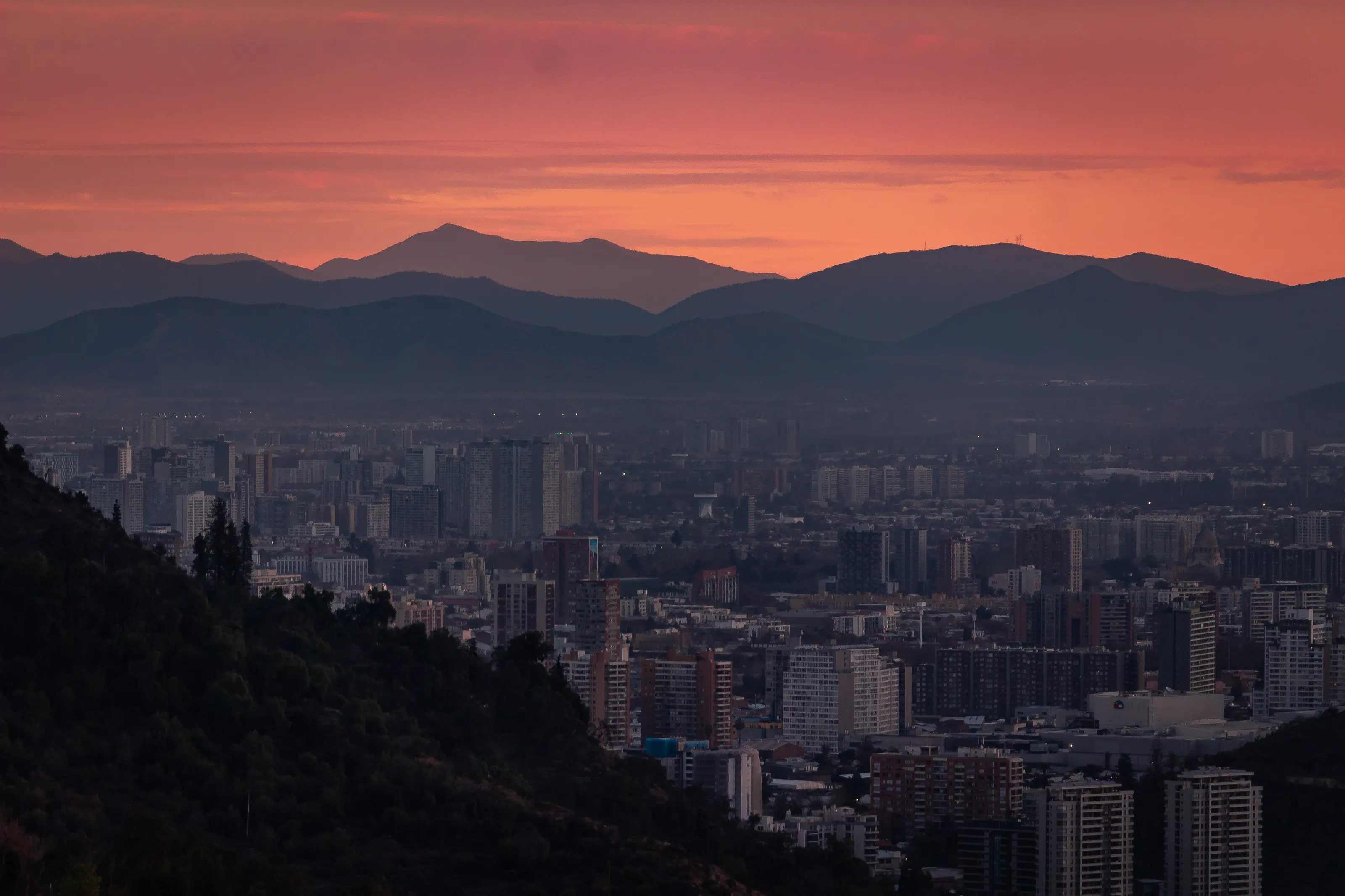
A sunset over rooftops and hills
Seen from above, the city spreads in towers and apartment blocks up to the surrounding relief. Wikipedia (EN) describes Santiago as a basin ringed by mountains, between the Andes to the east and the Coastal Range to the west, which explains both these views and the winter smog. Wikivoyage (EN) names Santa Lucía and San Cristóbal hills as the best viewpoints over the city and the Maipo Valley.
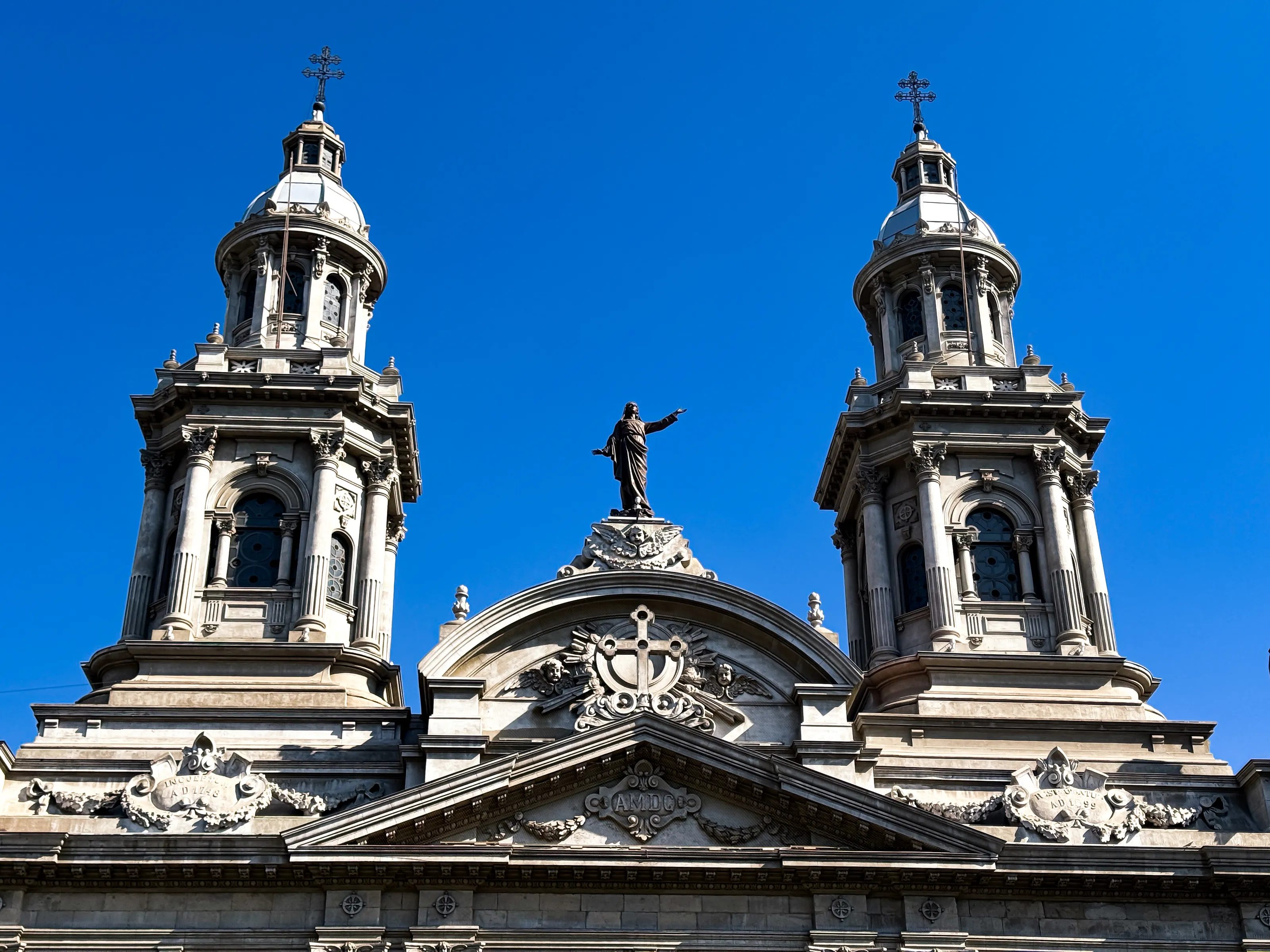
The Metropolitan Cathedral on the Plaza de Armas
The two towers and the pediment of the cathedral rise above the great square of the historic centre. Wikipedia (EN, DE) ranks it, alongside La Moneda Palace, among the key sights of the centre; sources disagree on the construction date (works between 1784 and 1805 according to one, 1745 according to another), so we do not give one. According to Wikivoyage (EN), the Plaza de Armas is the liveliest spot downtown, where street artists and musicians often perform.
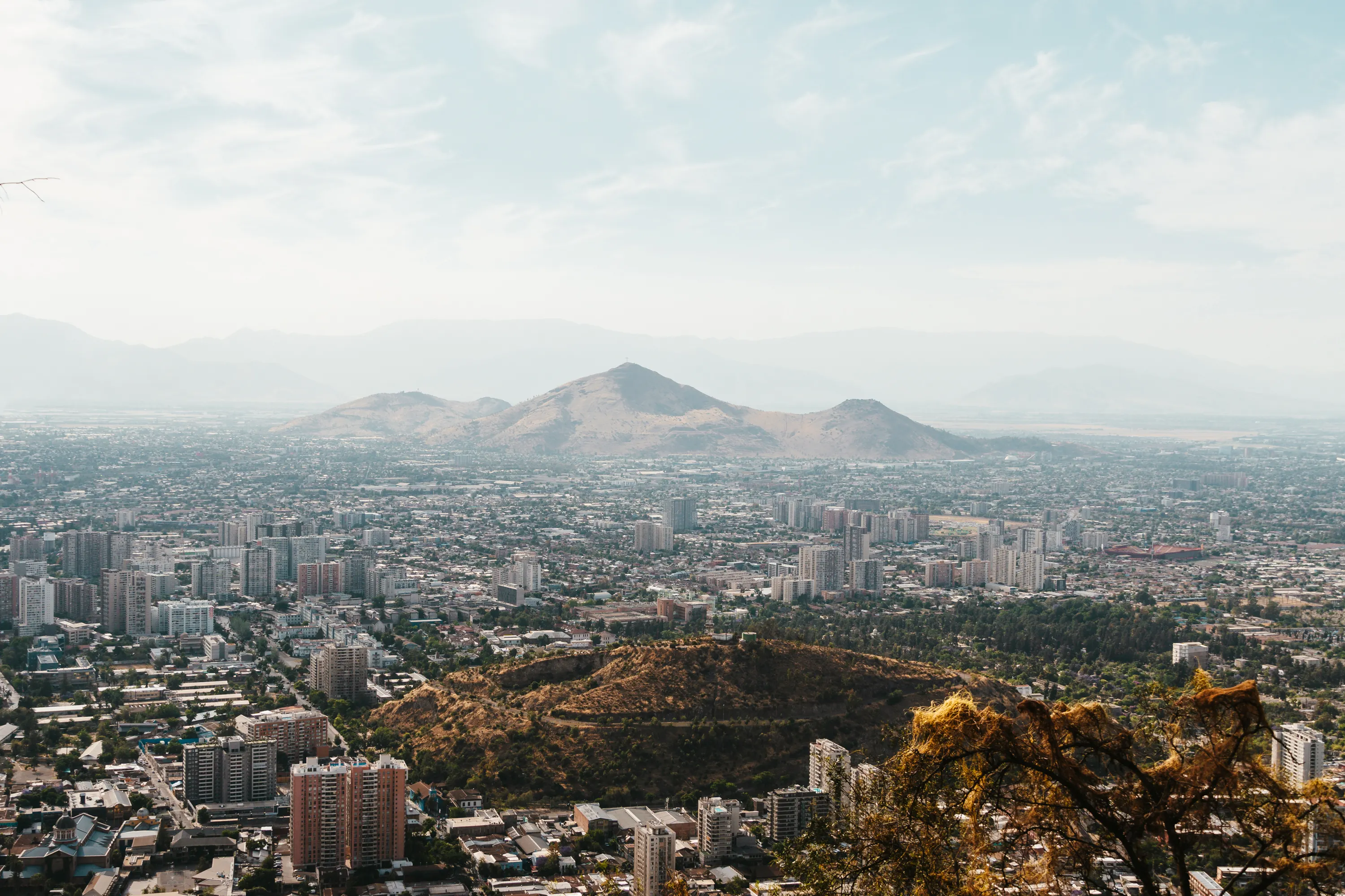
The city seen from a hilltop
From the top of one of the city's hills, you can take in the sea of buildings and the valley. Wikipedia (EN, FR) points out that these hills, such as Cerro Santa Lucía, where the city was founded, and Cerro San Cristóbal, are islands rising from the basin. Wikivoyage (EN) notes that the air is often heavier in winter, so views are much better on clear days.
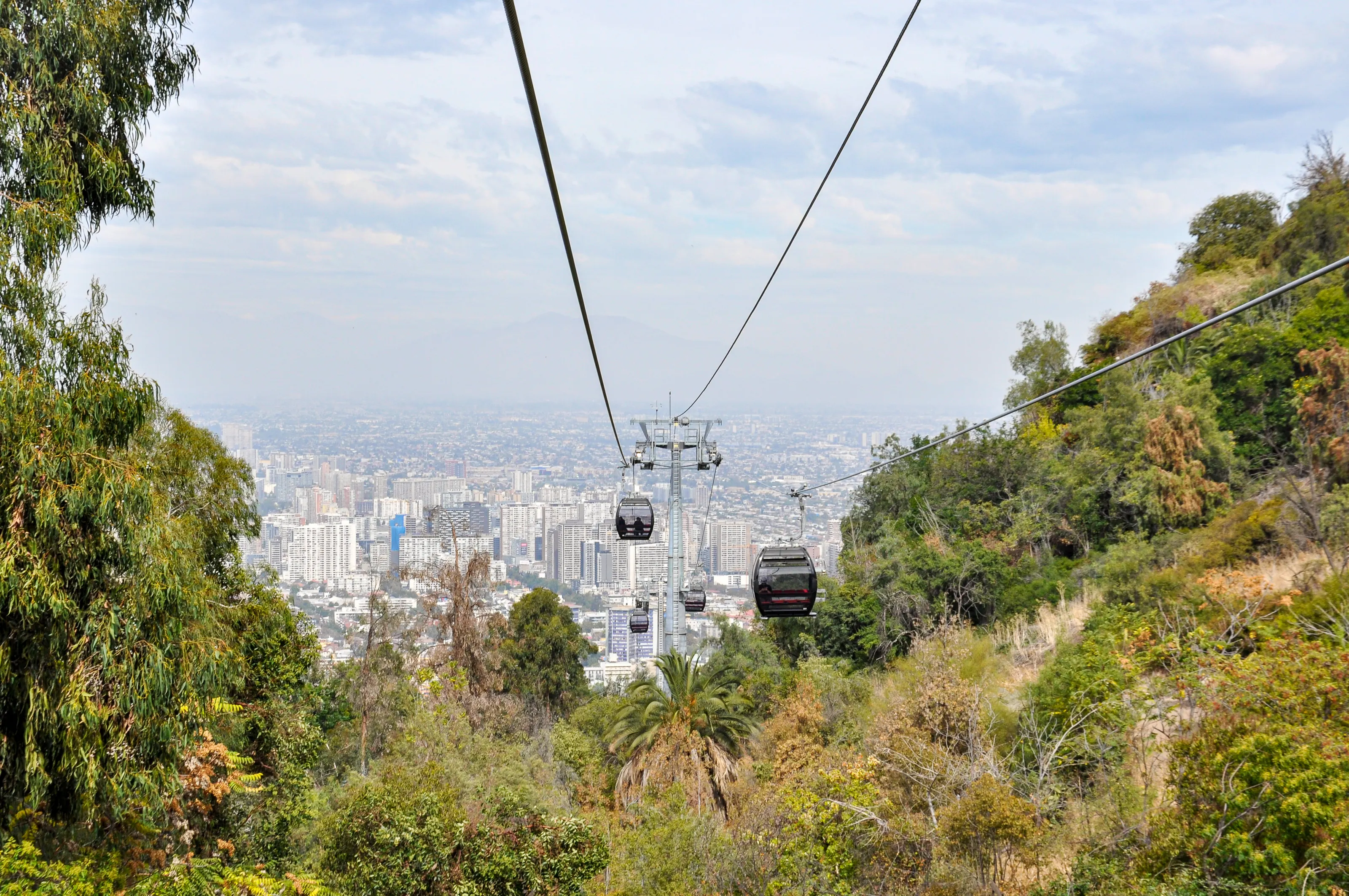
Cable cars above the Metropolitan Park
Cerro San Cristóbal is crowned by a 14 m statue of the Virgin and holds the Metropolitan Park, reached by funicular and cable car according to Wikipedia (DE) and Wikivoyage (FR, EN). French Wikivoyage says the cable car has sometimes been under repair, so check it is running on the day. The park also has a zoo, a botanical garden and picnic areas (Wikivoyage FR).
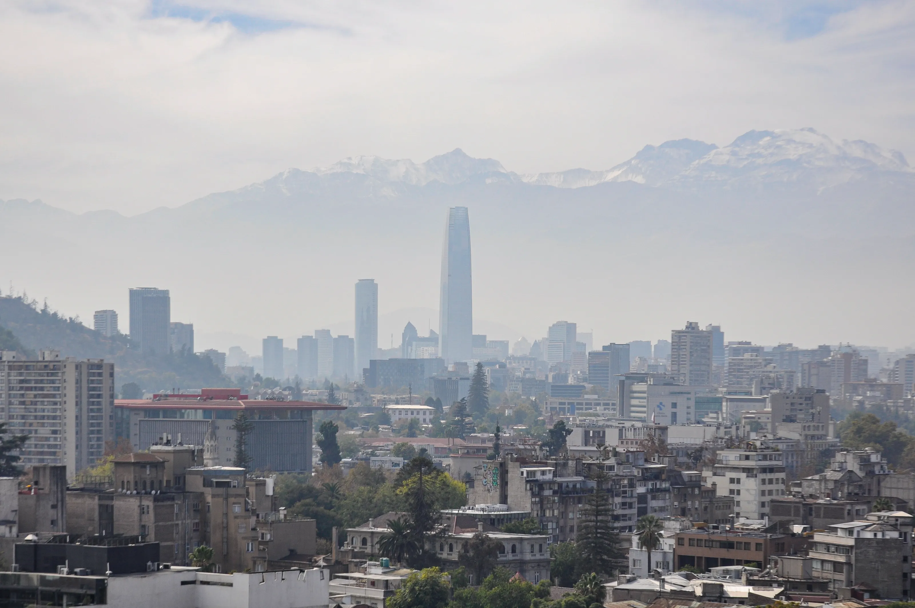
Gran Torre Santiago and the snow-covered Andes
The Gran Torre Santiago, in the Costanera Center, is about 300 m tall and is described as the tallest building in South America by Wikipedia (FR, EN) and in Latin America by Wikipedia (DE). German Wikivoyage mentions the Sky Costanera viewing deck, opened in 2015 on floors 61 and 62. The Andes, whose peaks exceed 6,000 m to the east, remain visible on clear days (Wikipedia EN).
Other visits named by Wikipedia (EN, FR, DE) and Wikivoyage (EN) include La Moneda Palace, the seat of the presidency, San Francisco Church, the oldest in the city, the Casa Colorada, Parque Forestal, the Lastarria district with its cafés, Bellavista and Pablo Neruda's house, and the Mercado Central. German Wikivoyage notes that the coast, Valparaíso and Viña del Mar, and ski resorts are within about 100 km.
Museums and culture
Pre-Columbian art, fine arts and national history
The pre-Columbian art museum
German Wikipedia presents the Chilean Museum of Pre-Columbian Art, opened in 1981 and built on the collection of Sergio Larraín García-Moreno, as one of the most important of its kind, with some pieces over 5,000 years old, mummies, pottery and textiles. English Wikipedia places it in the former Royal Customs Palace.
Fine arts and history
The National Museum of Fine Arts stands in Parque Forestal, beside the Mapocho, and the National History Museum in the Palace of the Royal Court on the Plaza de Armas (Wikipedia DE, Wikivoyage EN, FR). Wikipedia (DE) also names the Museum of Visual Arts and the Museum of Solidarity Salvador Allende.
La Chascona and cultural life
La Chascona, one of poet Pablo Neruda's houses, can be visited in Bellavista (Wikivoyage FR, EN). Wikivoyage (EN) mentions an active jazz scene and a jazz festival in January in Providencia; Wikipedia (ES) names the Santiago a Mil international festival every summer since 1994. We give no fees or opening hours: they change and sources differ.
Food and drink
Mercado Central, completos and valley wines
Typical dishes
Wikivoyage (EN) lists the completo, the Chilean hot dog, sopaipillas, cazuela (soup), pastel de choclo (corn pie), charquicán and asado, grilled meat. Picadas are small, popular places for sandwiches.
Markets and ice cream
The Mercado Central, an iron market hall from 1872, houses over 200 eateries, mostly fish and seafood (Wikivoyage DE). French Wikivoyage recommends ice cream flavoured with manjar, chirimoya or lucuma.
Drinks
Mote con huesillo, a drink of dried peaches and wheat, is sold on the street (Wikivoyage FR, EN); French Wikivoyage also names the pisco sour. The vineyards of the Maipo Valley, on the edge of the city, offer tours and tastings (Wikivoyage EN, DE).
Getting around
Metro, buses and taxis in a large metropolis
The metro
The Santiago metro, opened in 1975 (Wikipedia EN, ES), is among the most extensive in Latin America; Wikipedia (FR, ES) calls it the most extensive in South America. Lines 1, 2 and 5 cross the historic centre (Wikivoyage EN). It runs on the bip! card (Wikivoyage EN, FR) and can be crowded at rush hour. We give no line counts or fares, as they change.
Buses, taxis and bus stations
Red network buses and taxis complement the metro; Wikivoyage (EN) finds taxis relatively inexpensive and safe. Long-distance bus terminals are next to metro stations (Wikipedia EN, Wikivoyage ES) and serve Valparaíso and Viña del Mar among others.
Hills and districts
Santa Lucía and San Cristóbal hills can be reached on foot or by funicular; Bellavista and Lastarria are walkable. Traffic is heavy at some hours (Wikivoyage FR), so the metro is often more practical.
Budget and precautions
An economic capital, and a few precautions
Price level
Santiago is the country's economic capital and one of the richest cities in Latin America according to Wikipedia (FR). We give no figures, as we could not cross-check them against two independent sources.
Currency
Chile uses the Chilean peso (CLP).
Flights, safety and health
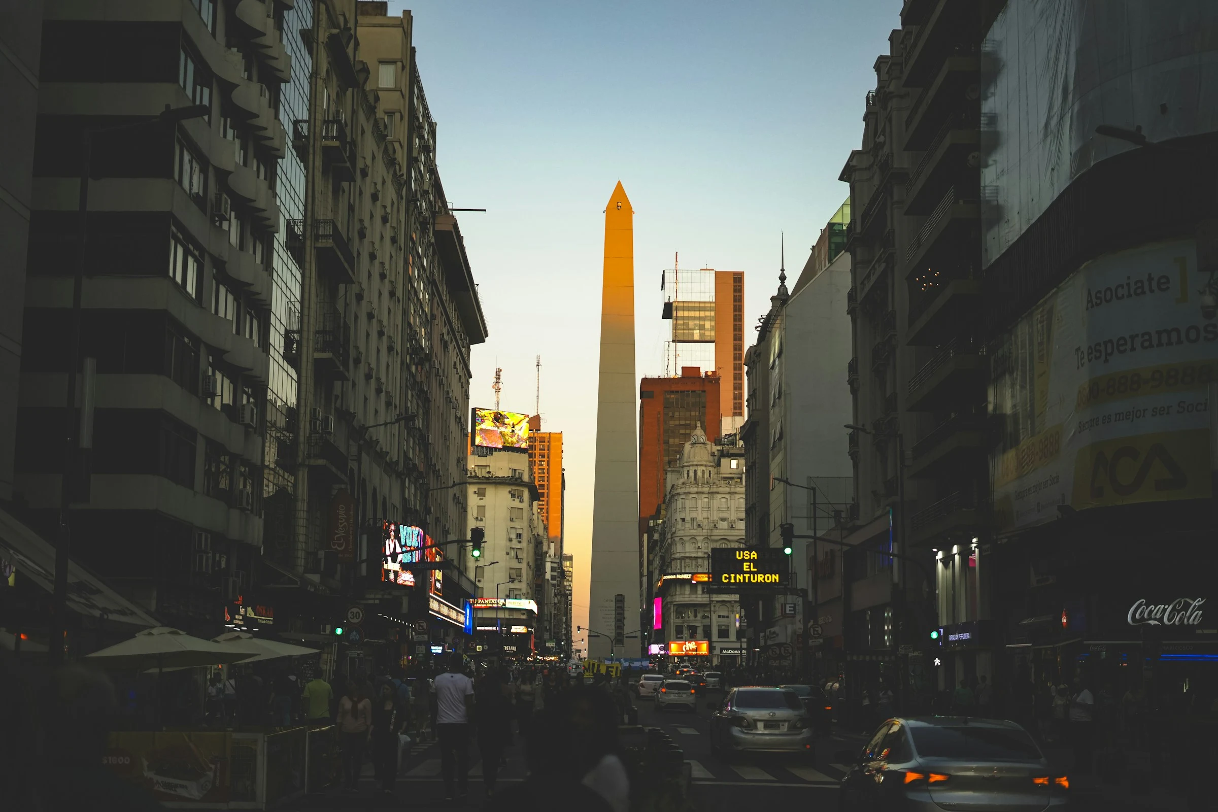
SniperAir monitors prices to SCL and compares them with the route's history, but it does not sell or book tickets. For comparison you can also track Buenos Aires. Wikivoyage (EN) judges Santiago fairly safe by South American standards but reports pickpocketing: avoid parks at night and keep belongings in front of you on the crowded metro. Chile is a seismic zone (Wikipedia EN, Wikivoyage DE) and the city is known for its winter smog, from May to September according to Wikivoyage (EN); check the official advice of your home country for safety and entry requirements.
When to go
Dry hot summers, cool wetter winters
Southern summer (December to March)
The climate is Mediterranean (Csb), with dry, hot summers: over 30 °C in the afternoon, and peaks up to 35 °C according to Wikipedia (EN) and Wikivoyage (EN, DE). Nights stay cooler. It is the sunniest season, with very little rain.
Autumn and winter (March to August)
Temperatures drop and average slightly below 10 °C; frosty mornings are possible, and snow is very rare in the city (Wikipedia EN, DE, ES). Rain falls mostly from May to August or September depending on the source.
Averages
About 20 °C in January and 8 °C in June and July according to Wikipedia (EN, ES, FR). The gap between day and night is large, so bring a jacket for the evening, even in summer (Wikivoyage EN).
Smog and nearby snow
Smog is worse in winter (Wikivoyage EN). The Andean ski areas lie less than 35 km to the north-east according to Wikipedia (ES).
Wikipedia (EN) classes the climate as cool semi-arid (BSk) with Mediterranean traits. We do not give precise monthly averages because sources vary by station.
By length of stay
What to do in Santiago depending on how long you stay
Centre and hills
The Plaza de Armas, the cathedral, La Moneda, Cerro Santa Lucía and the Mercado Central, then a panorama from Cerro San Cristóbal.
Museums, districts and the business quarter
The pre-Columbian art museum, the fine arts museum, Lastarria, Bellavista and Neruda's house, then the Gran Torre Santiago.
Vineyards, coast and mountains
The Maipo Valley vineyards, Valparaíso and Viña del Mar, or a day in the Andes; these outings are about 100 km away according to Wikivoyage (DE).
In pictures
Santiago, Chile in pictures
You might also like
Similar destinations
FAQ
Frequently asked questions about flights to Santiago de Chile
How do I get from Santiago airport to the centre?
The airport (SCL) is in Pudahuel, about 15 km from the centre. Buses and taxis run to the centre; allow around 45 minutes by bus to Los Héroes station according to Wikivoyage.
When is the best time to visit Santiago, Chile?
The southern summer, December to March, is dry and hot; spring and autumn are milder. Rain falls mostly in winter, and smog is stronger from May to September.
What should I see in Santiago?
The Plaza de Armas and its cathedral, La Moneda, Cerro Santa Lucía, Cerro San Cristóbal, the Mercado Central, the museums and the Lastarria and Bellavista districts.
Can you see the Andes from Santiago?
Yes, the range rises to the east of the city. On clear days, especially after rain, the snow-covered peaks are clearly visible from hills and high floors.
Can I go skiing from Santiago?
Wikipedia (ES) lists several ski areas less than 35 km north-east of the city. The season depends on snow cover, so check dates before you book.
How long should I stay in Santiago?
Two days cover the centre and one hill; four to five days add the museums, the districts and an excursion to the vineyards or the coast.
How much does a flight to Santiago de Chile usually cost?
The price depends mainly on your departure city, the time of year and how far ahead you book. The "opportunities" section above shows real examples of prices SniperAir has already detected to this destination.
How do I get alerted when a flight to Santiago de Chile drops below my budget?
Create an alert profile with your departure airport, Santiago de Chile (SCL) as the destination and your maximum budget. You are notified automatically as soon as a matching price is detected. SniperAir monitors and alerts, it does not sell or book tickets.
Ready to head to Santiago de Chile?
Set your budget and let SniperAir monitor fares for you.
Create my alert